new HRSA's UDS mapper replica
Build with Experience builder ( jimu package = React + bootstrap 4 + arcgis js api v4.27 )
Warning: due to experience builder's limitation, new UDS mapper can not do some major function that was in original one. New one is only partially replace the original one. The limitation is not set by developer, it is set by experience builder. For example all the following feature that found in original one are not be able to build in experience builder. The reason is you can't bind mouse click event in experience builder, but you can only bind mouse event to a tool button in experience builder.
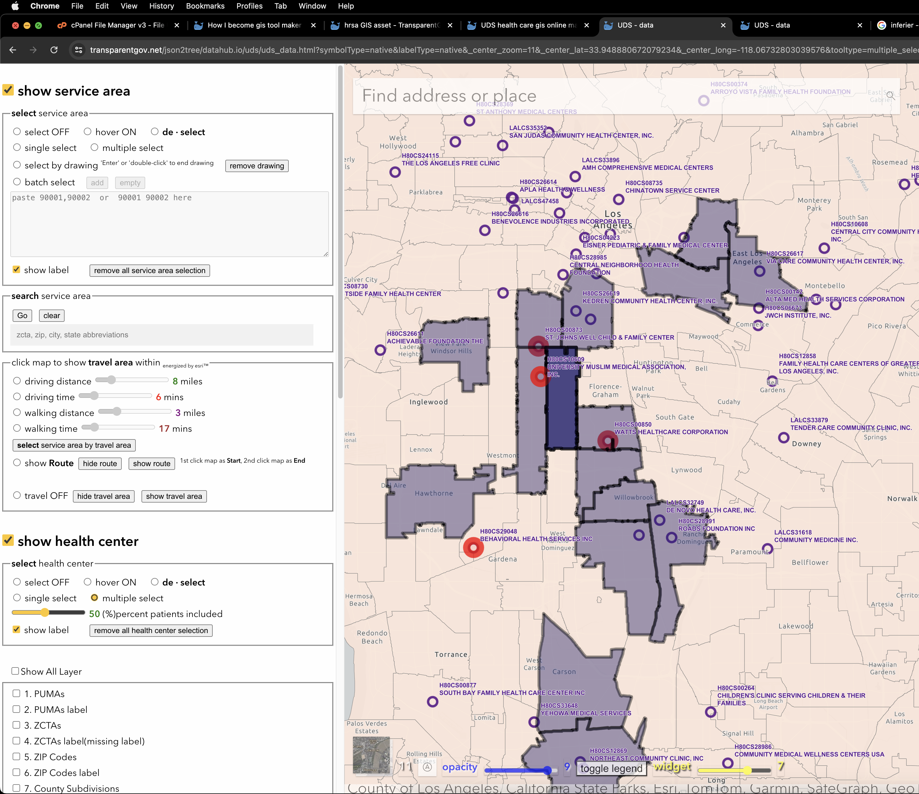
1. select multiple service area,
2. continuing single select,
3. de-select ( remove ) service area by click on map (more intuitive way to remove service area).
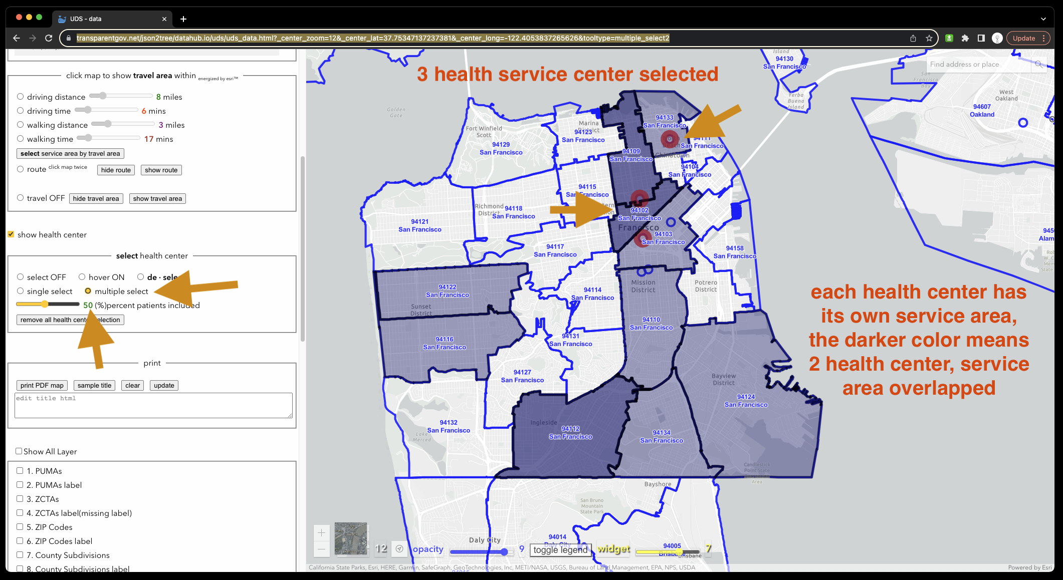
4. Select single service center,
5. select multiple service center,
6. show the service area covered by selected service center
7. show the overlapped service area if you select more than one service center nearby
8. show the most overlapped service area if you select more than 2 service center nearby, for example, some area covered by 3 nearby service center.
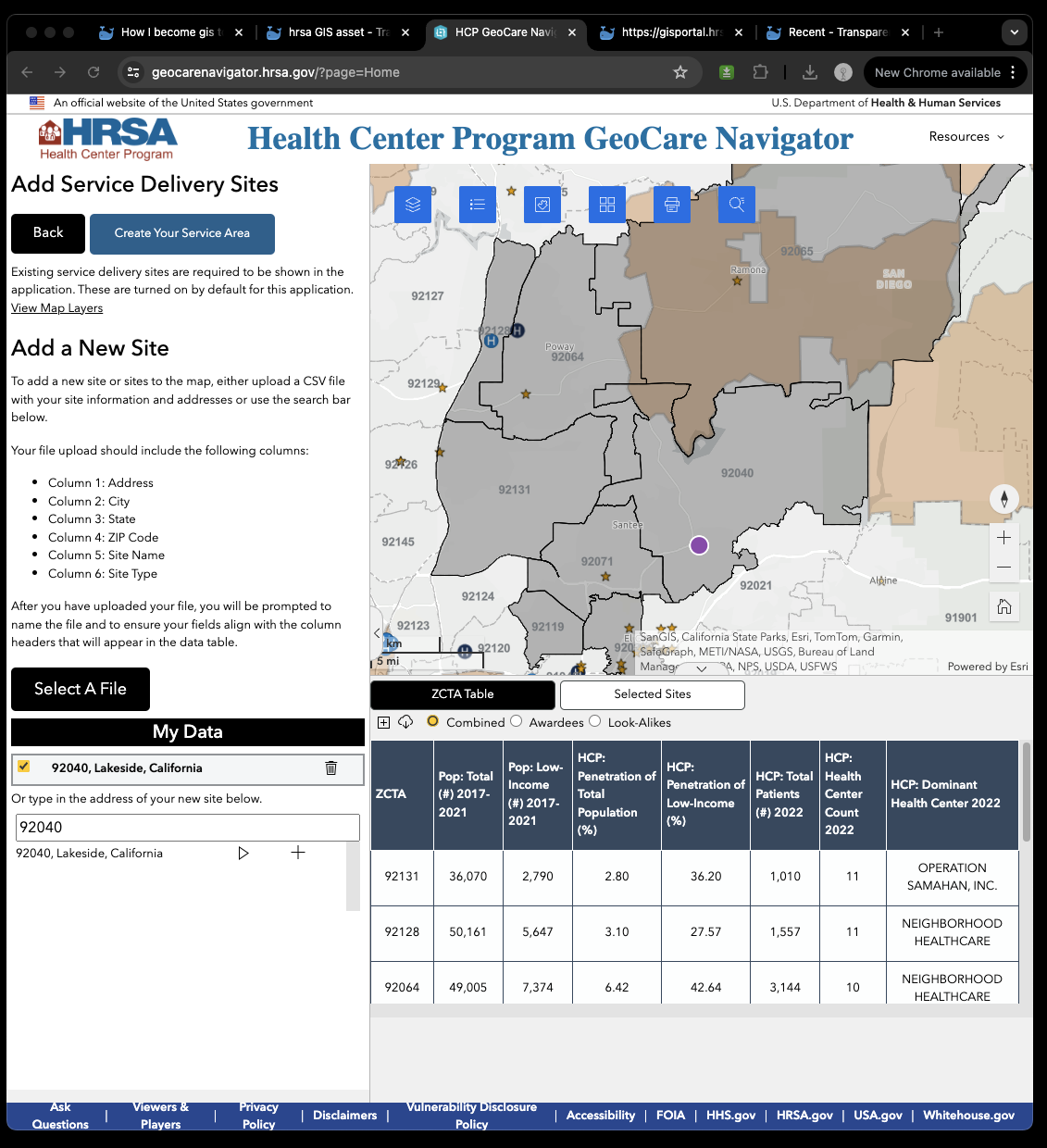
https://geocarenavigator.hrsa.gov/?page=Home
Original uds mapper v3.x
still using Arcgis Javascript API v3.x.
ArcGIS API 3.x for JavaScript will be retired on July 1, 2024.
https://maps.udsmapper.org/map
Why UDS is unique in the world ? Becaue UDS allows users to visualize where Health Center Program patients live, showing what areas are well served and what areas may need additional resources. The UDS also contains social determinants of health and population health outcomes data that may highlight potential need for health services.
Original UDS launched in 2010, still using Arcgis Javascript API v3.x, ArcGIS API 3.x for JavaScript will be retired on July 1, 2024. (click to see ESRI announcement) I am re-developing UDS mapper with Arcgis Javascript API v4.x.
Luckly all those missing major function from 1 to 8 was captured by me if I don't use experience builder.
You can find all those missing function in the following links with arcgis js api v4.28
A. browser-client-side rendering v4.x
https://transparentgov.net/json2tree/datahub.io/uds/uds_data.html
A.2 native(ArcPro build-in) color and label https://transparentgov.net/json2tree/datahub.io/uds/uds_data.html?symbolType=native&labelType=native
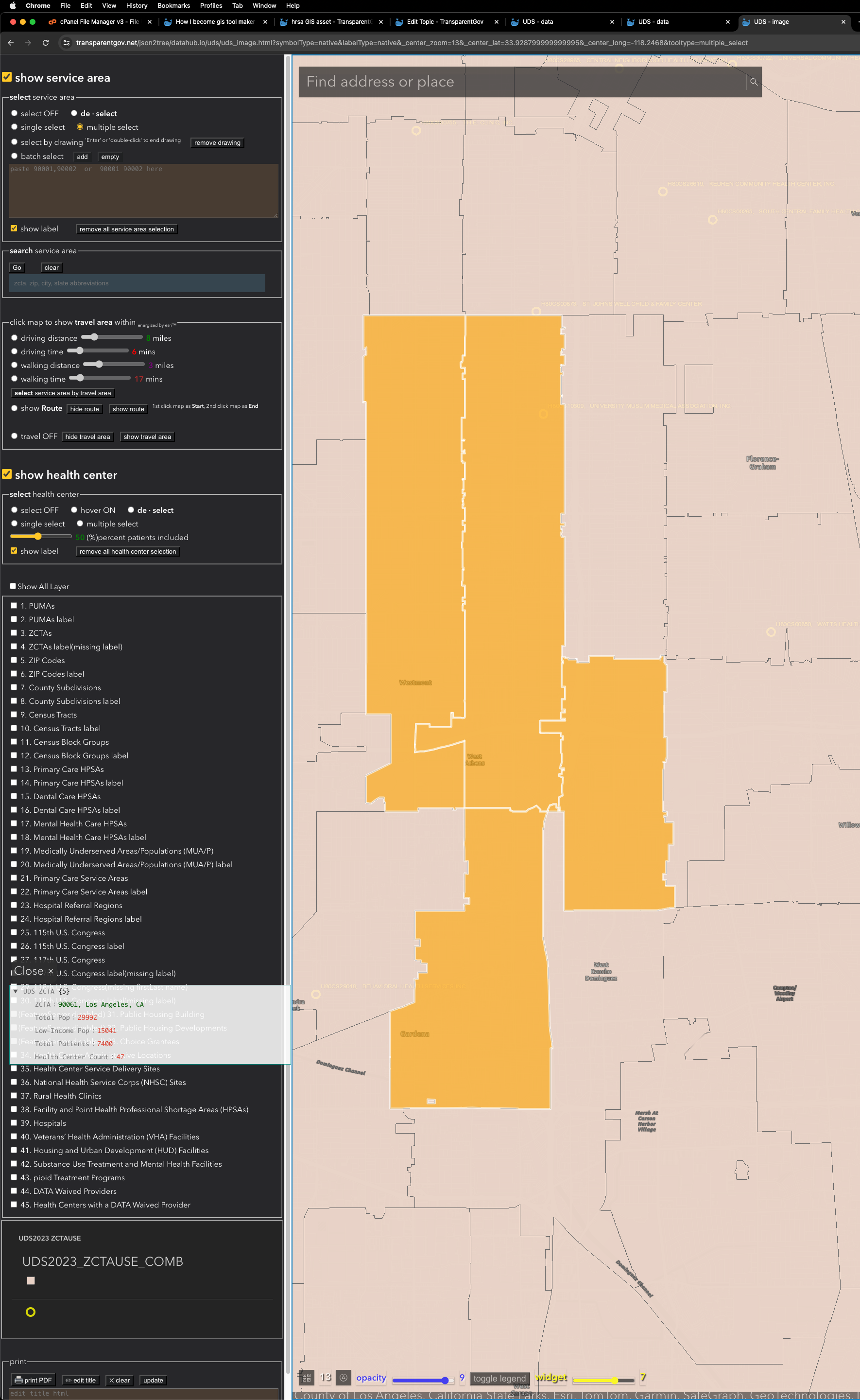
Plan B.
arcgis-server-side rendering v4.x https://transparentgov.net/json2tree/datahub.io/uds/uds_image.html

B.2 native(ArcPro build-in) color and label
https://transparentgov.net/json2tree/datahub.io/uds/uds_image.html?symbolType=native&labelType=native
C. tile ( server-side pre-cached )
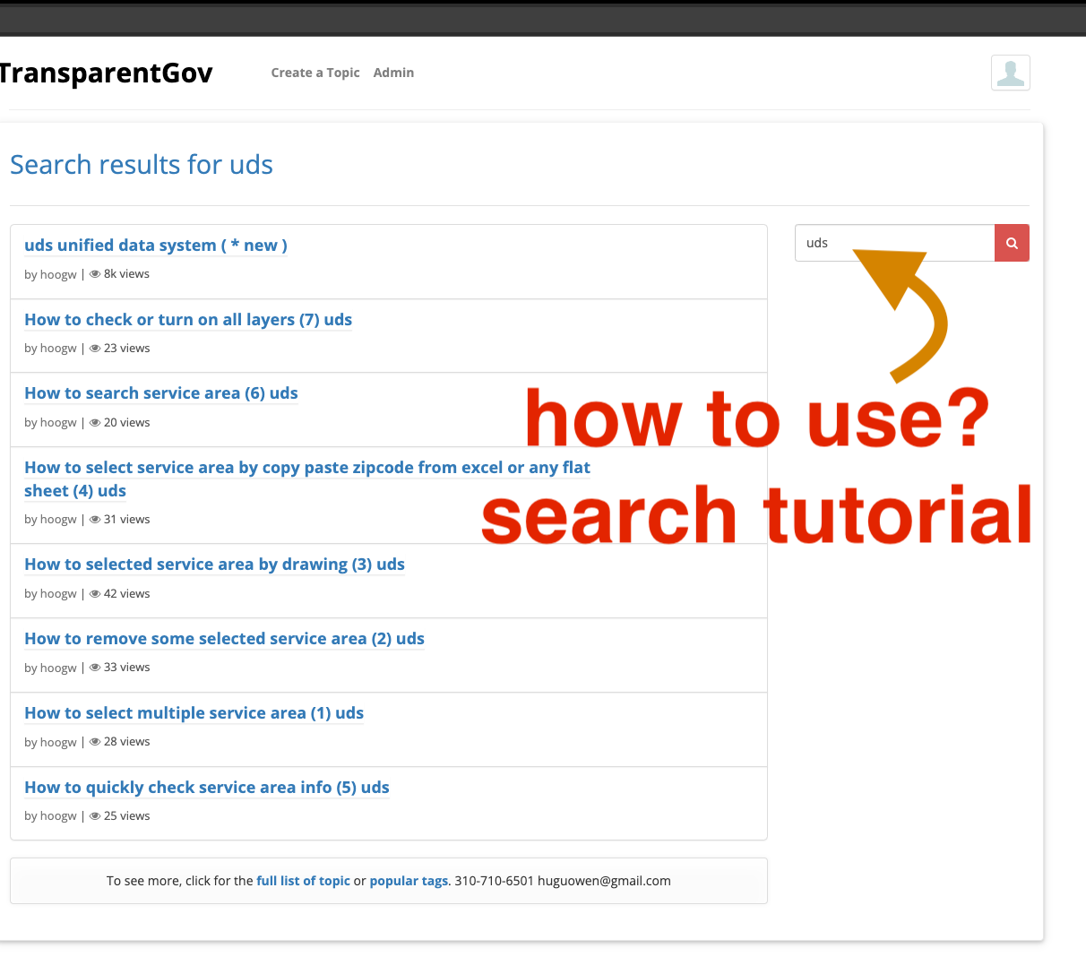
How to use
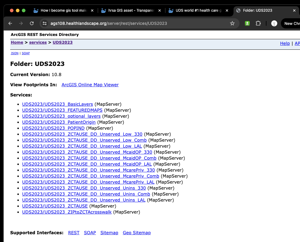
uds mapper Arcgis Rest endpoint
https://ags108.healthlandscape.org/server/rest/services
uds mapper Arcgis Service entrance
https://transparentgov.net/json2tree/esri/server/folder.html?org=https%3A%2F%2Fags108.healthlandscape.org%2Fserver%2Frest%2Fservices&url=https%3A%2F%2Fags108.healthlandscape.org%2Fserver%2Frest%2Fservices&select_folder=35&select_layer=0
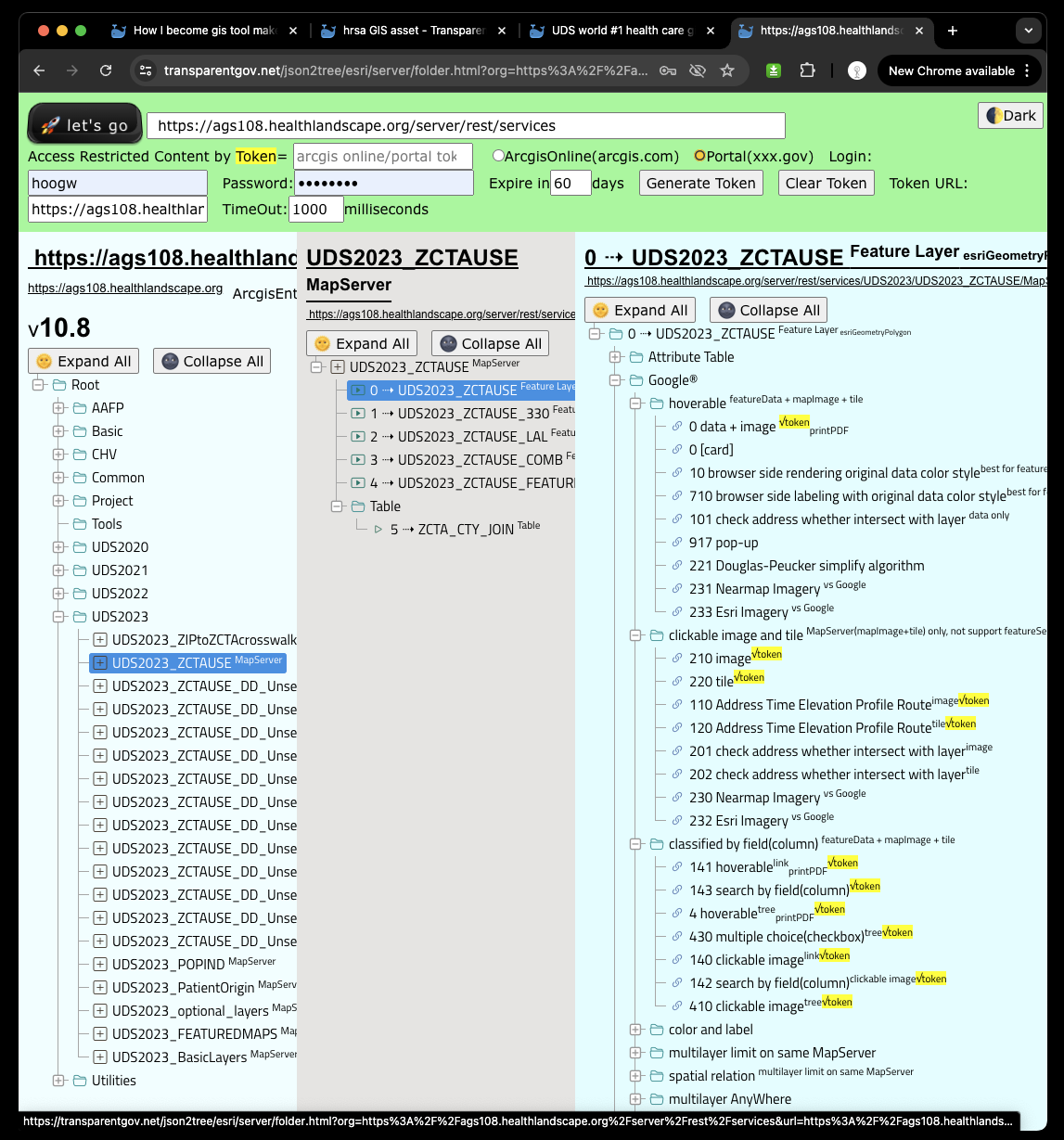
ZCTA (service area zipcode)
https://ags108.healthlandscape.org/server/rest/services/UDS2022/UDS2022_ZCTAUSE_PLACES/MapServer/3
HUD Department of Housing and Urban Development
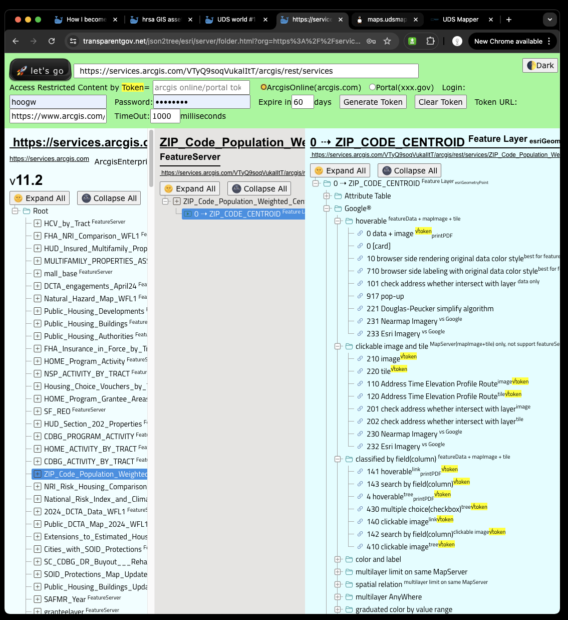
https://services.arcgis.com/VTyQ9soqVukalItT/arcgis/rest/services
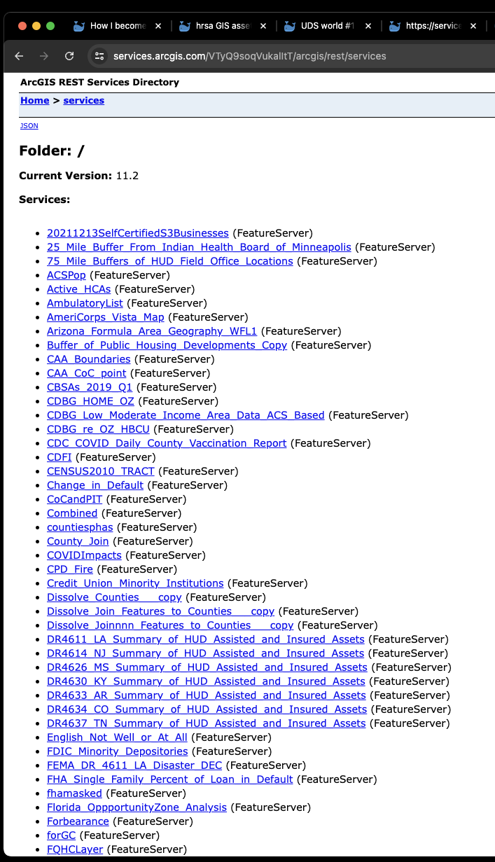
folder entrance
https://transparentgov.net/json2tree/esri/server/folder.html?org=https%3A%2F%2Fservices.arcgis.com%2FVTyQ9soqVukalItT%2Farcgis%2Frest%2Fservices&url=https%3A%2F%2Fservices.arcgis.com%2FVTyQ9soqVukalItT%2Farcgis%2Frest%2Fservices&select_folder=22&select_layer=10
I only use these 3 layers