Step 1.
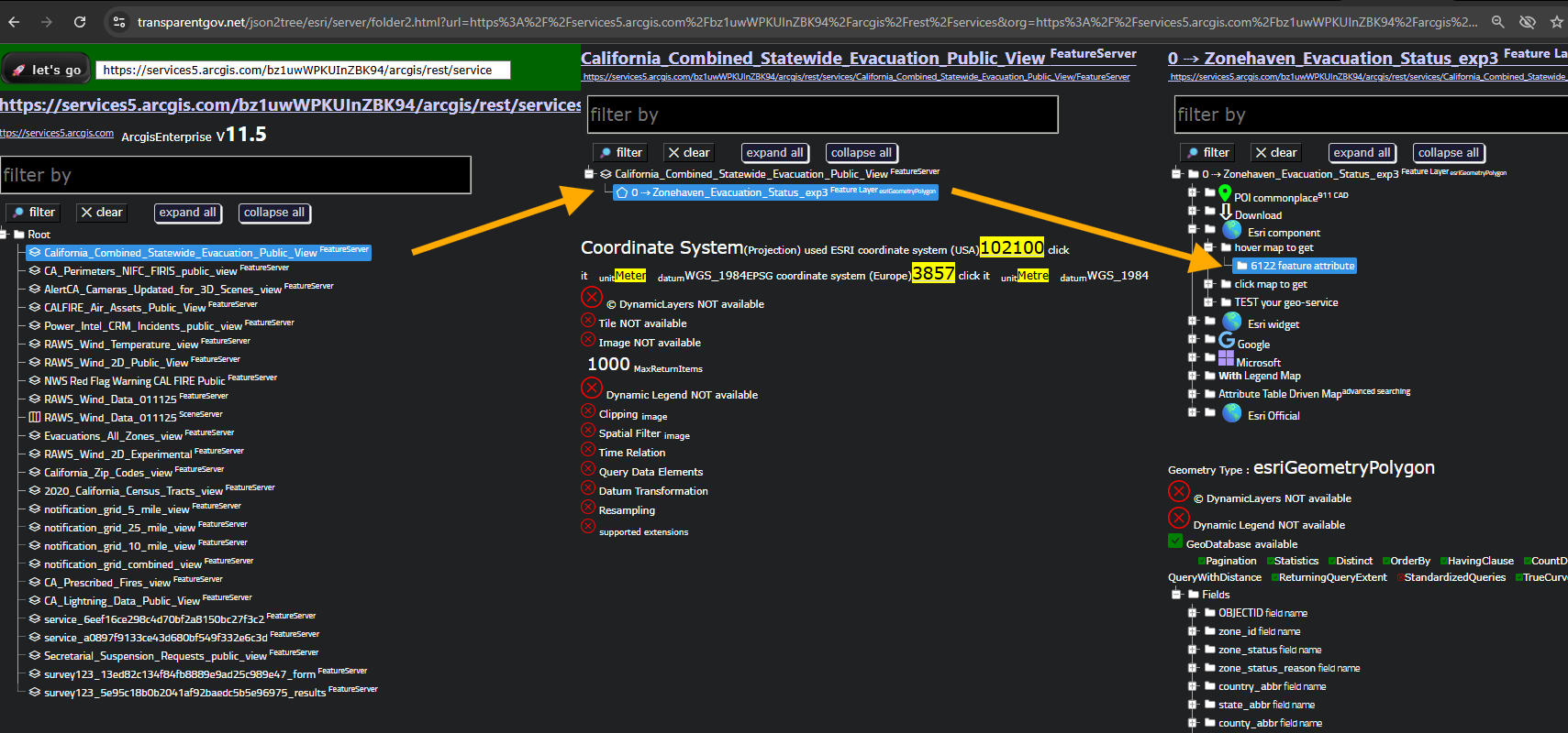
https://transparentgov.net/json2tree/esri/server/folder.html?org=https%3A%2F%2Fservices5.arcgis.com%2Fbz1uwWPKUInZBK94%2Farcgis%2Frest%2Fservices&url=https%3A%2F%2Fservices5.arcgis.com%2Fbz1uwWPKUInZBK94%2Farcgis%2Frest%2Fservices&arcgis_online_token=&timeout=9000&select_folder=1&select_layer=0&select_folder_text=California_Combined_Statewide_Evacuation_Public_View+%3Csup%3EFeatureServer%3C%2Fsup%3E&select_layer_text=0+%26%23x21E2%3B+Zonehaven_Evacuation_Status_exp3+%3Csup%3EFeature+Layer%3Csub%3E+esriGeometryPolygon%3C%2Fsub%3E%3C%2Fsup%3E

Step 2.
https://services5.arcgis.com/bz1uwWPKUInZBK94/arcgis/rest/services
Step 3.
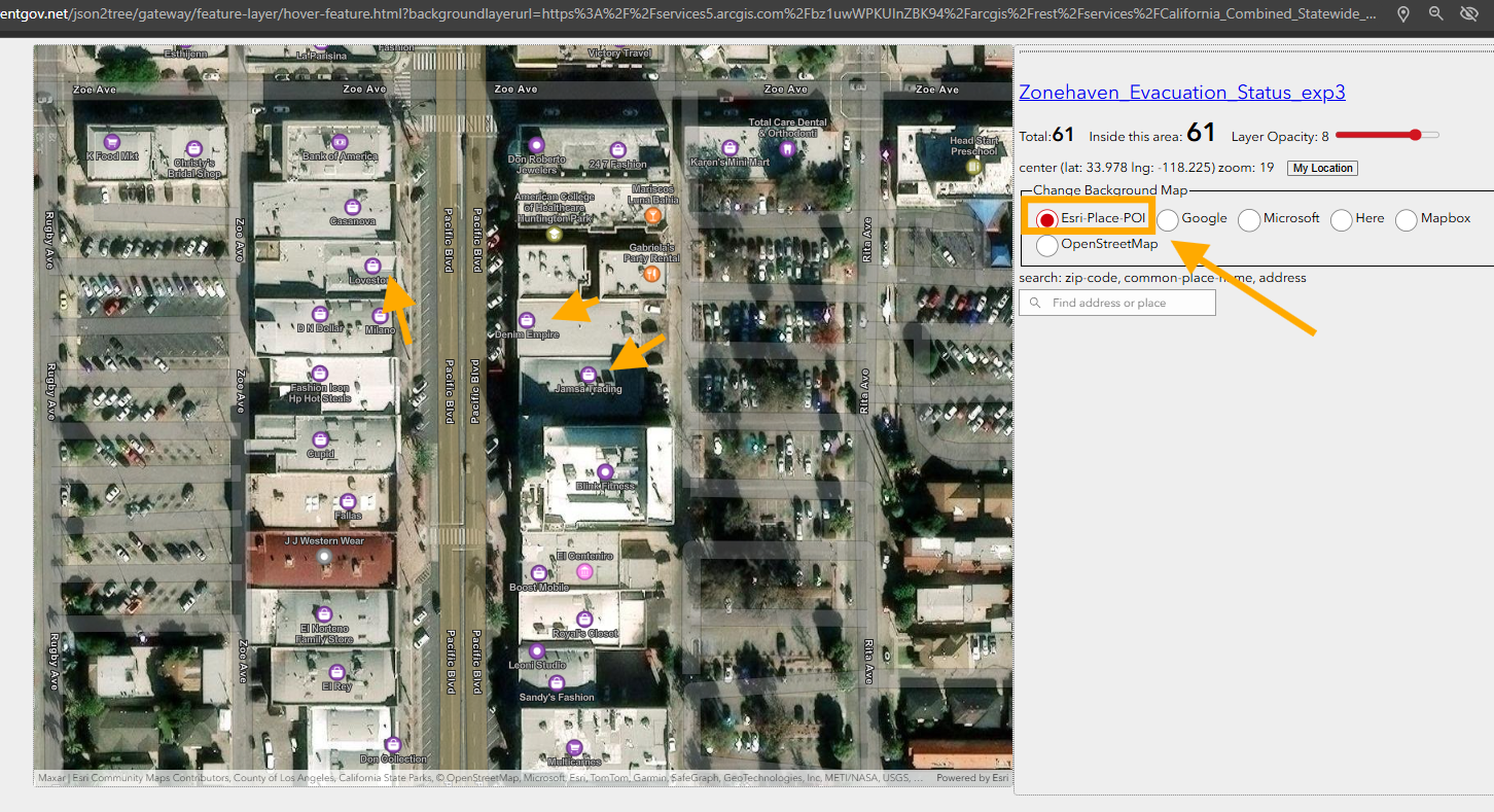
https://transparentgov.net/json2tree/gateway/feature-layer/hover-feature.html?backgroundlayerurl=https%3A%2F%2Fservices5.arcgis.com%2Fbz1uwWPKUInZBK94%2Farcgis%2Frest%2Fservices%2FCalifornia_Combined_Statewide_Evacuation_Public_View%2FFeatureServer%2F0&layer=Zonehaven_Evacuation_Status_exp3&_center_lat=33.75435480788562&_center_long=-118.36720821676064&_center_zoom=13&panto=0

Step 4.
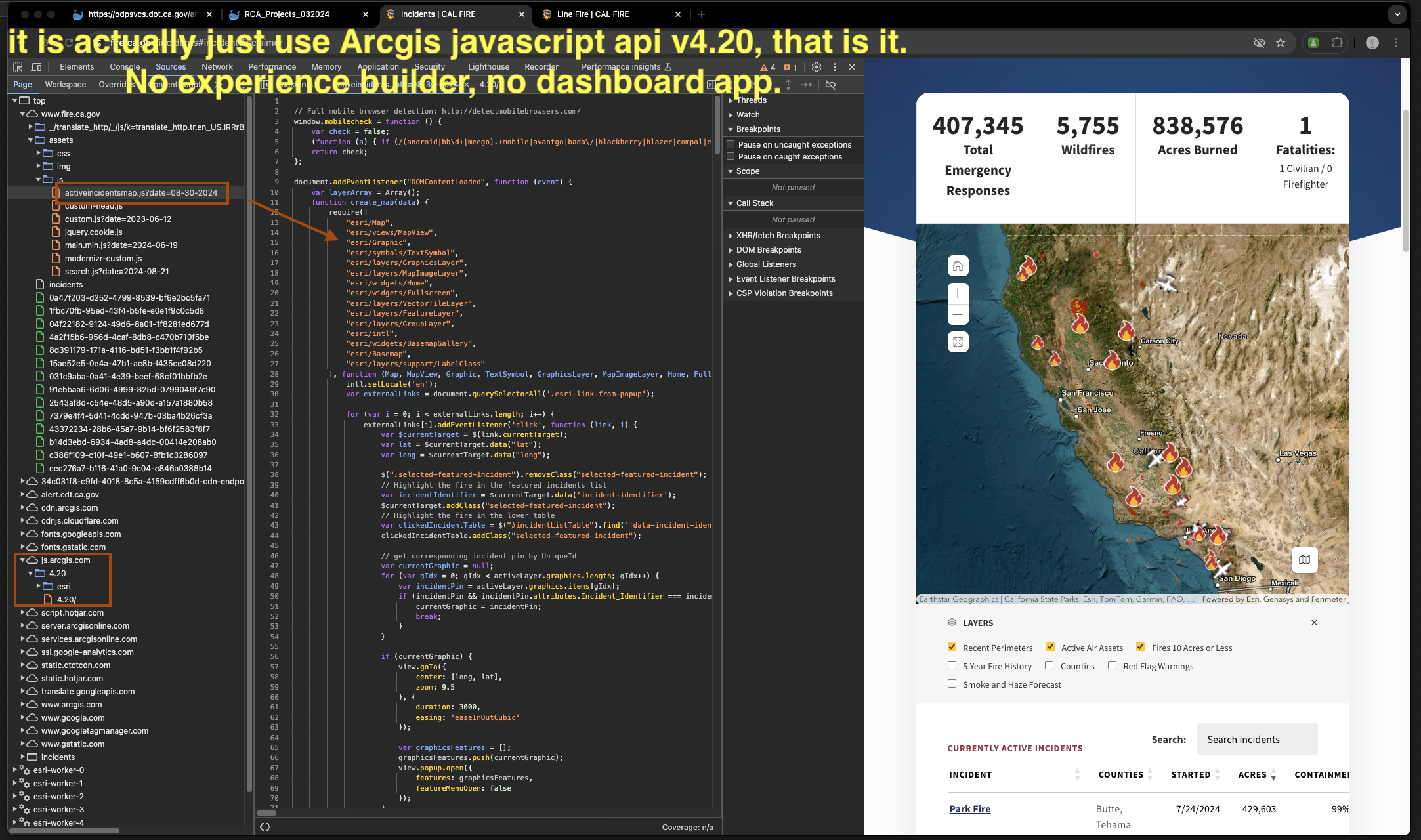
This calfire map does not use ESRI's off the shelf product, no dashboard even looks like it, no experiece builder was used.
Here is evidence, it is actually just use Arcgis javascript api v4.20, that is it. No experience builder, no dashboard app.
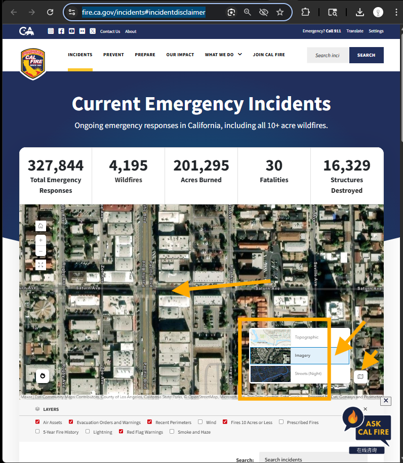
https://www.fire.ca.gov/incidents#incidentdisclaimer
Step 5.
Do you need experience builder to build such map ? Obviously not. Calfire just prove the opposite way, if Calfire use experience builder, they can't create such map now. Because experience builder has limitations, for example, in calfire map, the attribute table is very difficult or impossible to do the same way in experience builder, you click the fire name, it open on a new tab, it is outside of map. It will be very difficult to create such layer frame and layer legend in experience builder. For individual fire page, it is simple to use, intuitive for non-gis public users
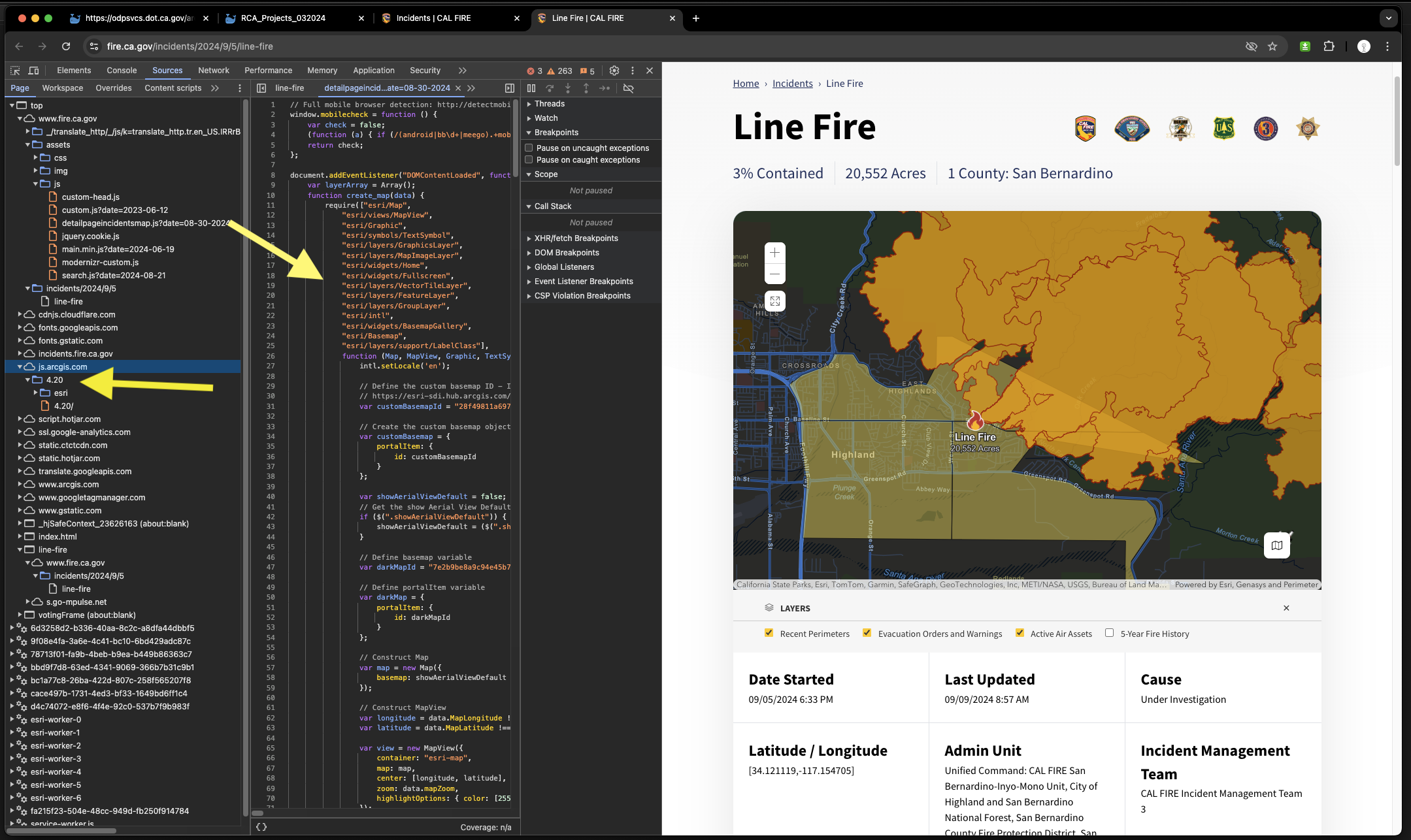
https://www.fire.ca.gov/incidents/2024/9/5/line-fire
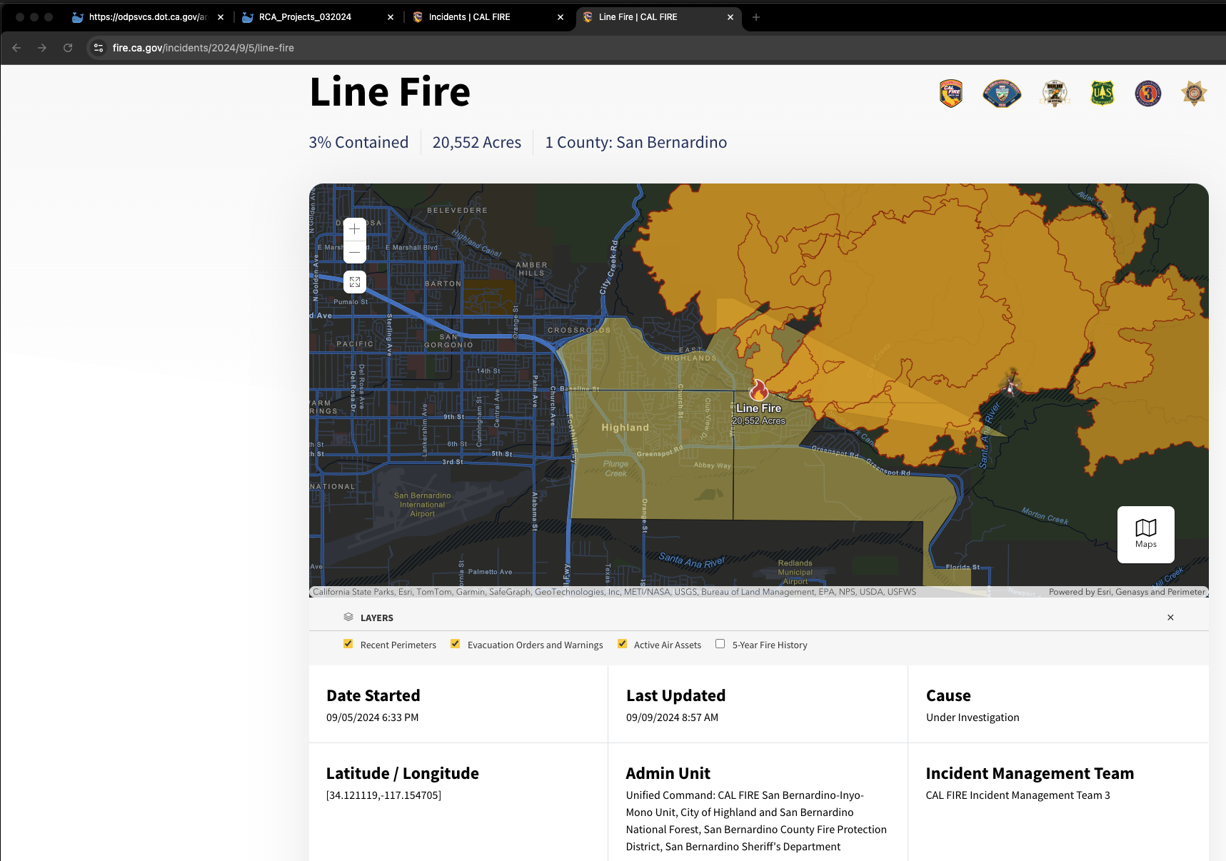
This is evidence show it does not use experience builder, just Arcgis javascript api v4.20.
Step 6.
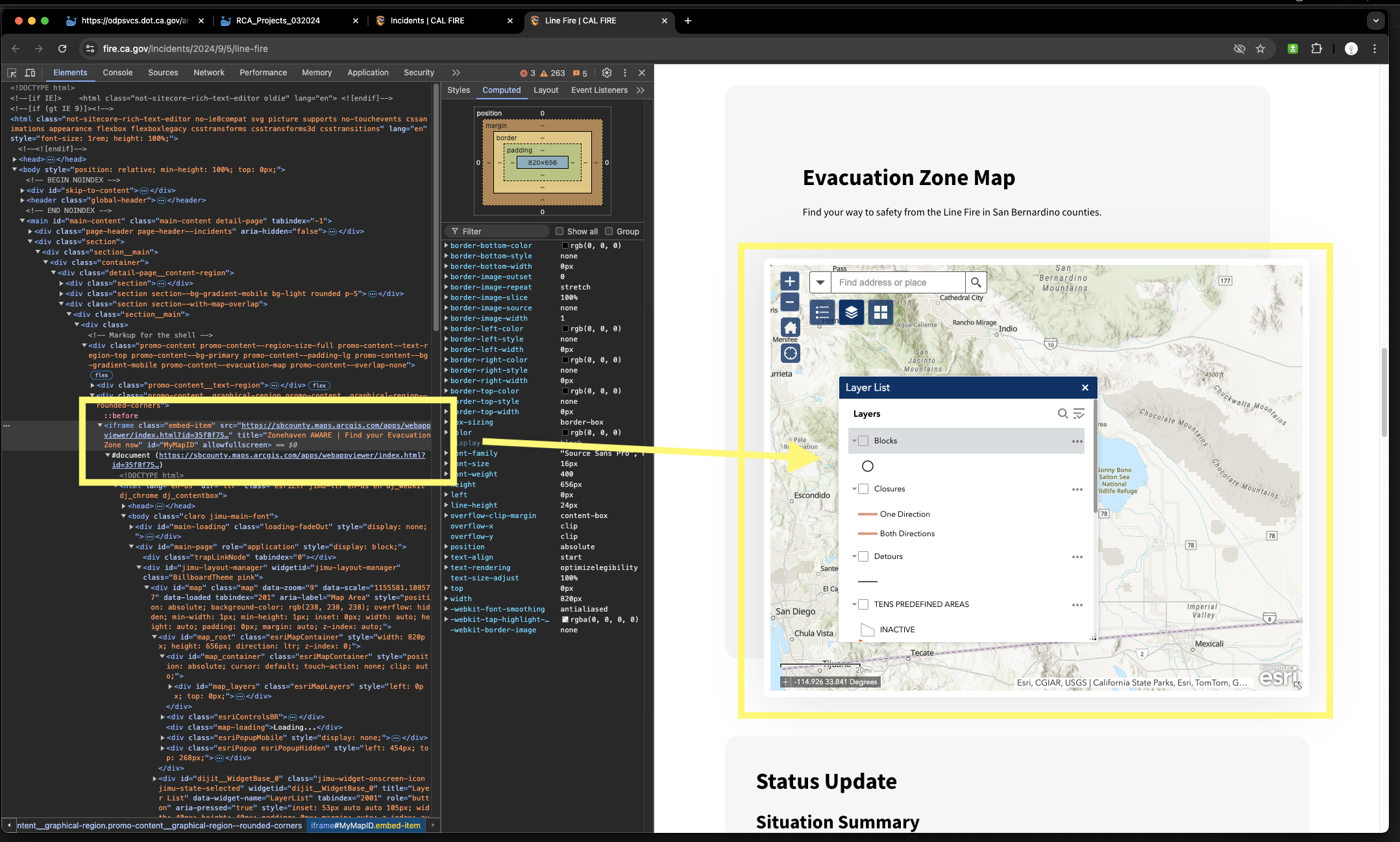
This evacuation zone map is embeded iframe, means it is not part of this web page, it actually is external web map on San Bernadino county arcgis online. It is not create or maintain by calfire, San Bernadino county create and maintain this map. This is obviously ESRI's off the shelf product you can tell from the legend button, layer frame button.
https://www.fire.ca.gov/incidents/2024/9/5/line-fire
Step 7.
Here is San Bernadino Arcgis online map embeded into calfire web page.
It is stand alone ESRI' out of box product, web app builder
https://sbcounty.maps.arcgis.com/apps/webappviewer/index.html?id=35f8f75a490f4007bc983b39c208a629
You can tell this map is typical ESRI's out of box just by looking at its button. This is San Bernadino county's
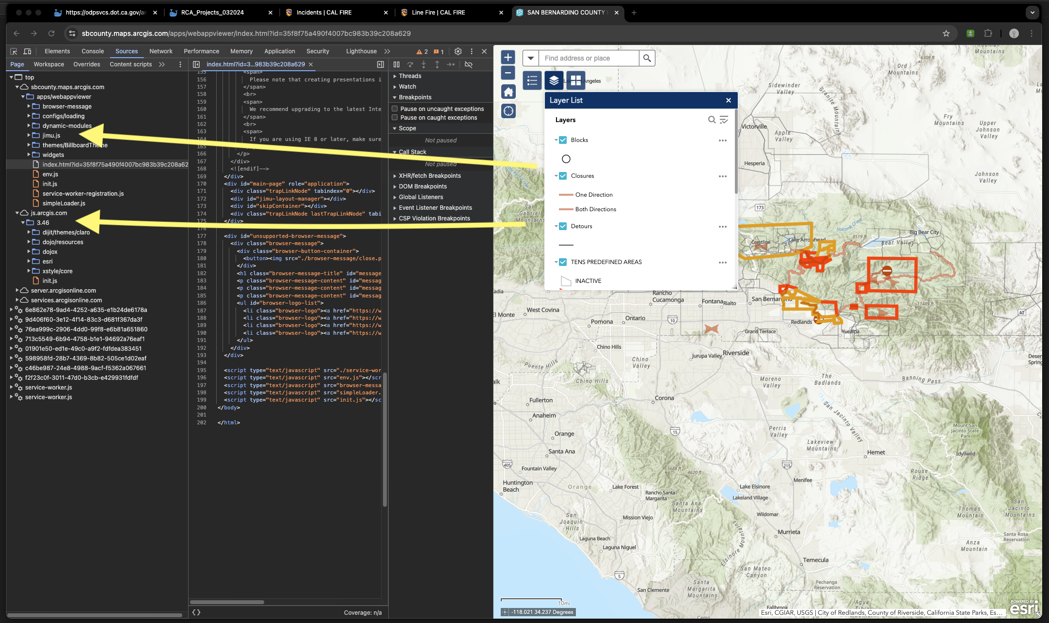
This page is a good example of combine custom build map and ESRI's off the shelf map mix together in one web page.
Step 8.
Keep in mind ESRI poi enabled basemap is only available in Mapbox vector tile style V2 format ! as of today 2025.
Esri POI basemap isn't available in traditional raster map tile like Google does. Microsoft, Here map does.
That is why you can't find poi on any of ESRI base map which is borned before 2025.
https://www.fire.ca.gov/incidents#incidentdisclaimer
For example, this map, no POI
Step 9
where you can find ESRI poi enable base map ?
I havn't see one, because if a esri map borned before 2025, it is not possible to have POI enabled.
In 2026, 2027, you will see some new born map have POI enable.
As of today, 2025, the only Esri base map with POI enabled is myself.
https://transparentgov.net/json2tree/gateway/feature-layer/hover-feature.html?backgroundlayerurl=https%3A%2F%2Fservices5.arcgis.com%2Fbz1uwWPKUInZBK94%2Farcgis%2Frest%2Fservices%2FCalifornia_Combined_Statewide_Evacuation_Public_View%2FFeatureServer%2F0&_center_lat=33.97840026627194&_center_long=-118.2249802519513&_center_zoom=19&panto=0&layer=Zonehaven_Evacuation_Status_exp3&esriBaseMap=Esri-Place-POI
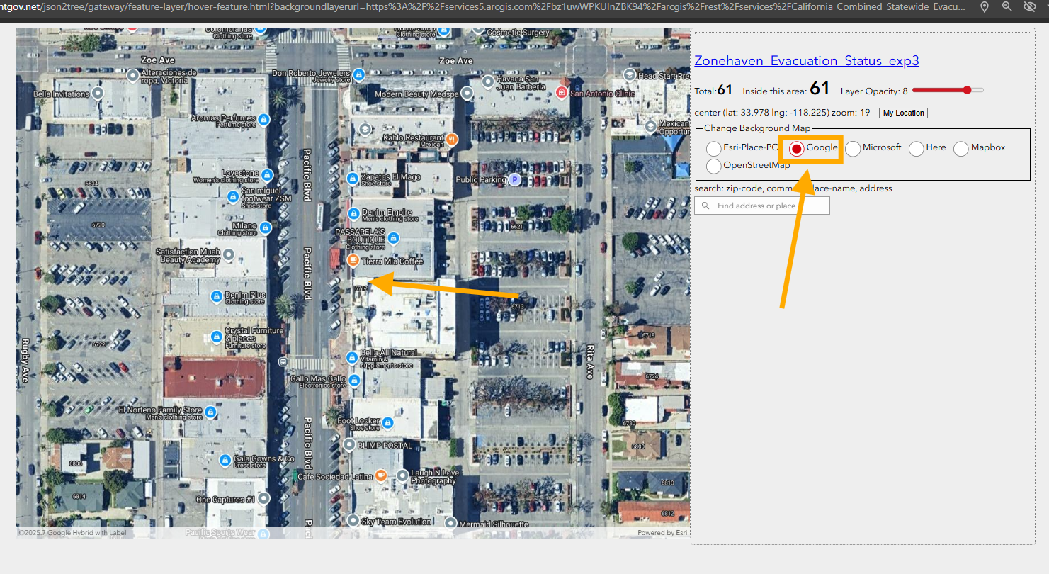
Step 10
https://transparentgov.net/json2tree/gateway/feature-layer/hover-feature.html?backgroundlayerurl=https%3A%2F%2Fservices5.arcgis.com%2Fbz1uwWPKUInZBK94%2Farcgis%2Frest%2Fservices%2FCalifornia_Combined_Statewide_Evacuation_Public_View%2FFeatureServer%2F0&_center_lat=33.97840026627194&_center_long=-118.2249802519513&_center_zoom=19&panto=0&layer=Zonehaven_Evacuation_Status_exp3&esriBaseMap=Google
This is google base map runs on Esri Arcgis Javascript API v4.33 ( lastest version ), click "google", you can compare which brand has better POI.
Step 11
you can found this model 6122 here
https://transparentgov.net/json2tree/esri/server/folder2.html?url=https%3A%2F%2Fservices5.arcgis.com%2Fbz1uwWPKUInZBK94%2Farcgis%2Frest%2Fservices&org=https%3A%2F%2Fservices5.arcgis.com%2Fbz1uwWPKUInZBK94%2Farcgis%2Frest%2Fservices&arcgis_online_token=&select_folder=1&select_layer=0&select_folder_text=California_Combined_Statewide_Evacuation_Public_View+%3Csup%3EFeatureServer%3C%2Fsup%3E&select_layer_text=0+%26%23x21E2%3B+Zonehaven_Evacuation_Status_exp3+%3Csup%3EFeature+Layer%3Csub%3E+esriGeometryPolygon%3C%2Fsub%3E%3C%2Fsup%3E