Warning: Open street map POI is collect by enthusiastic mappers and many volunteers. They were missing lots of info compare to commercial product like Google POI, Yelp POI, Microsoft POI, Esri POI. It should be used as testing, should not be used as production.
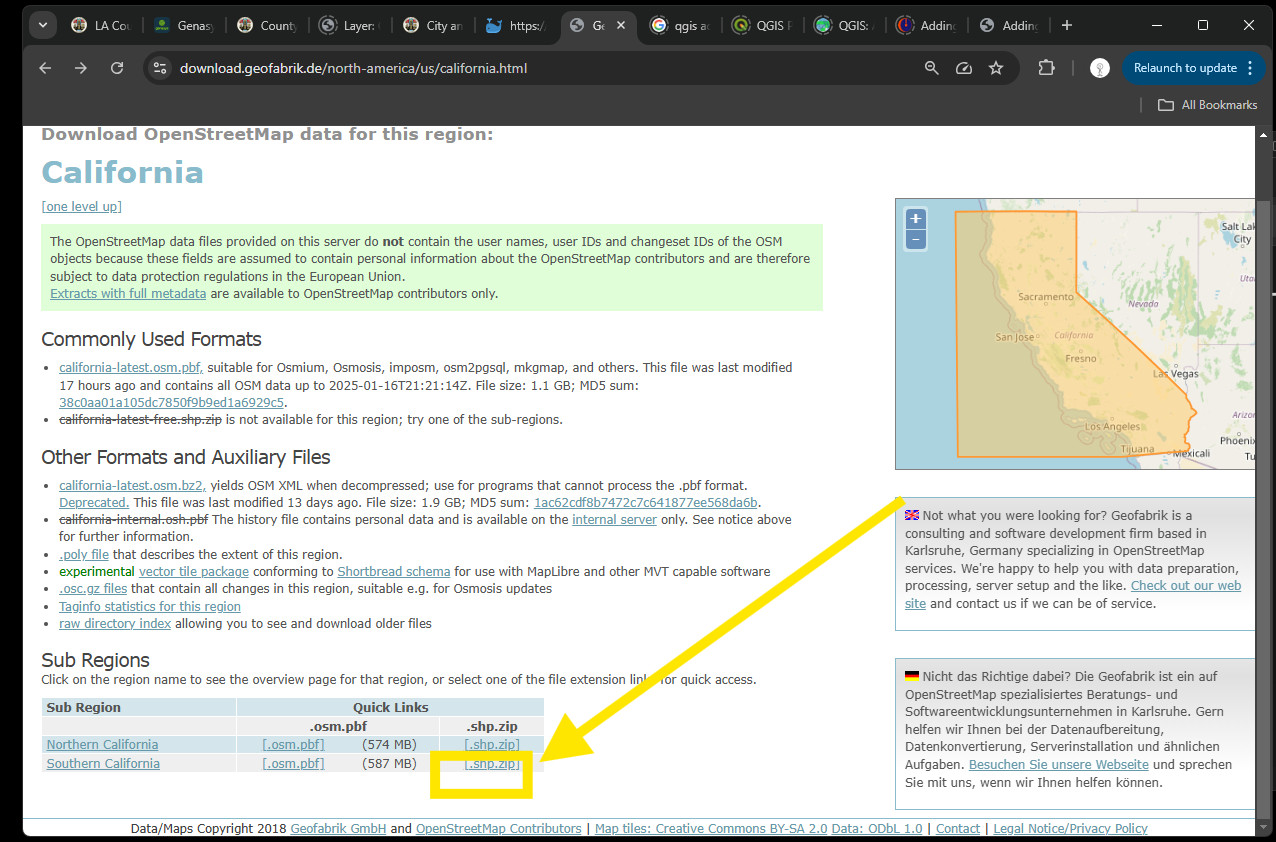
Step 1.
Download shape file at here
Note: open street map is only one source of point of interest, it will be used as part of our GeoDatabase.
https://download.geofabrik.de/north-america/us/california.html
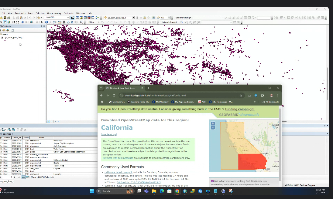
Step 2.
Note this layer only have lat long and common name, don't have actual address, you will need to geocoding by lat long to get actual address
Step 3.
Open street map point of interest is much less than google map. Yellow point is missing a lots compare to google map background colored icon.
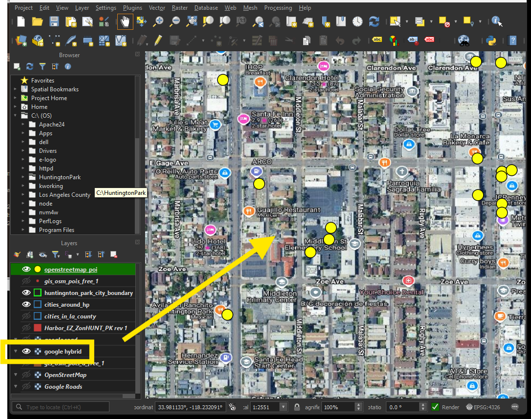
Now I have yellow point is open street map point of interest. While google map as background. As you can see, google map has a lots more point than yellow open street map point.
Why we need point of interest common place point layer ?
User call 911, usually don't know their address, not all police department can track user location by user's cell phone signal.
User may call or text 911, for example, " I am at motel 6 parking lot, I don't know what street is...."
911 should use "motel 6" to quickly locate user's location.