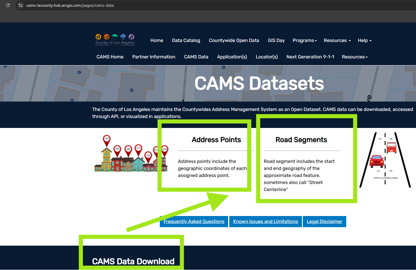
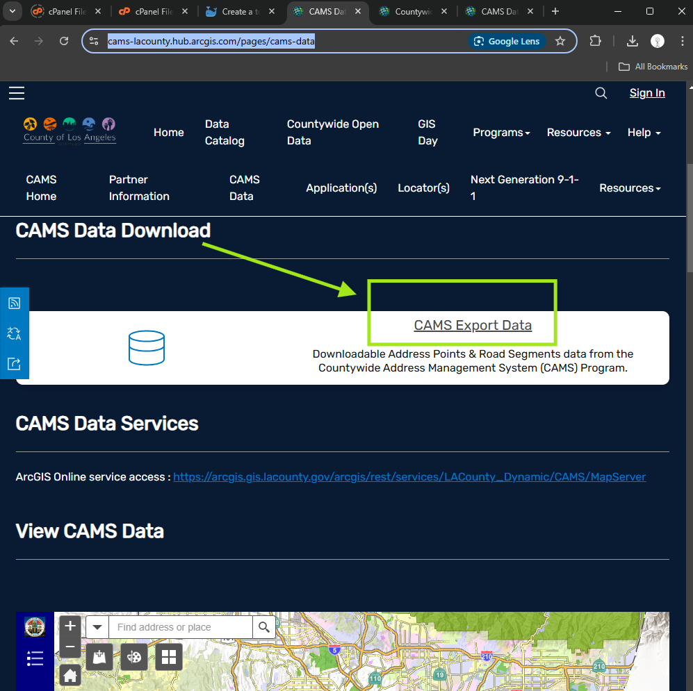
Step 1.
click download
https://cams-lacounty.hub.arcgis.com/pages/cams-data
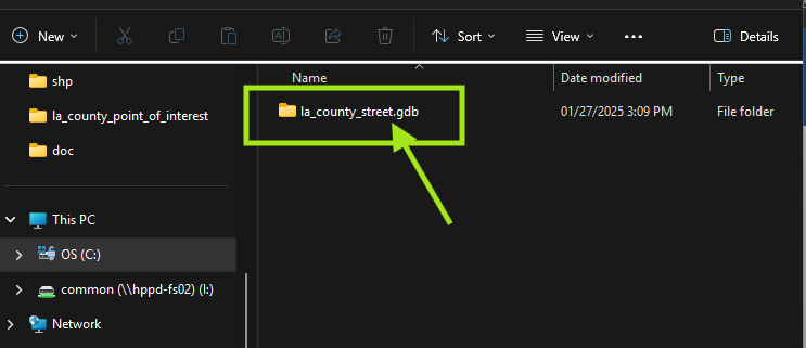
Step 2.
When unzip file, must use xxx.gdb as geodatabase folder name. Otherwise, Qgis would not read this folder.
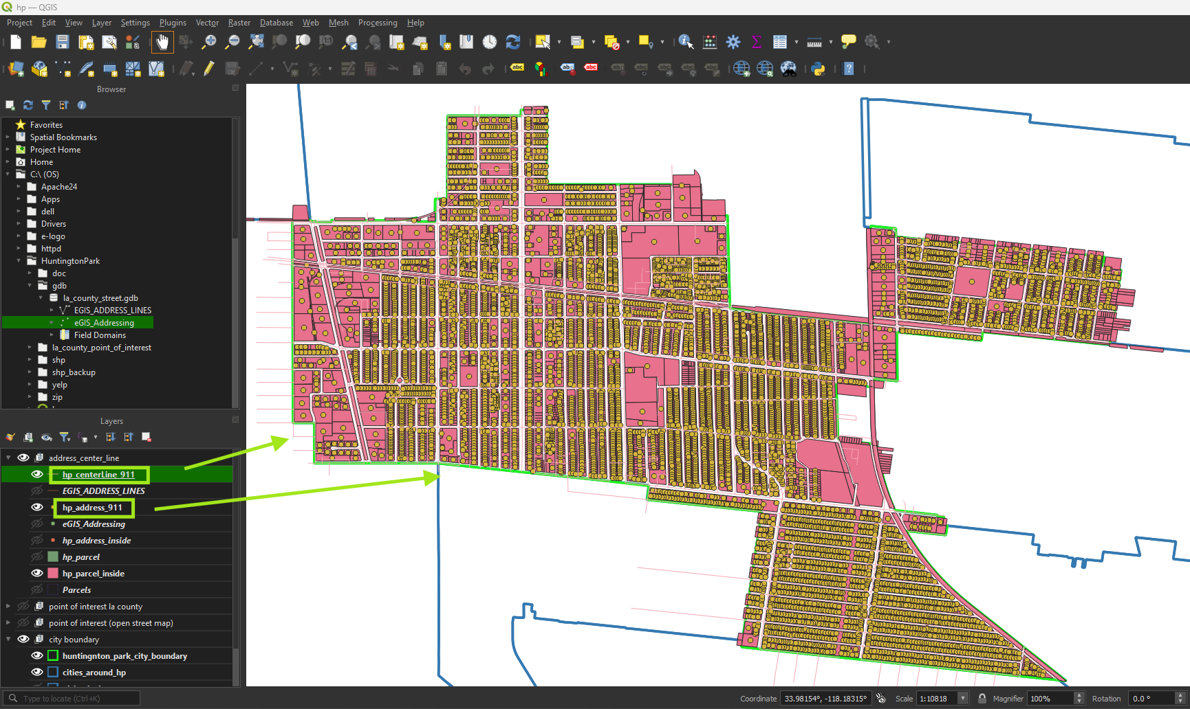
Step 3.
Select feature intersect with city boundary, then export feature
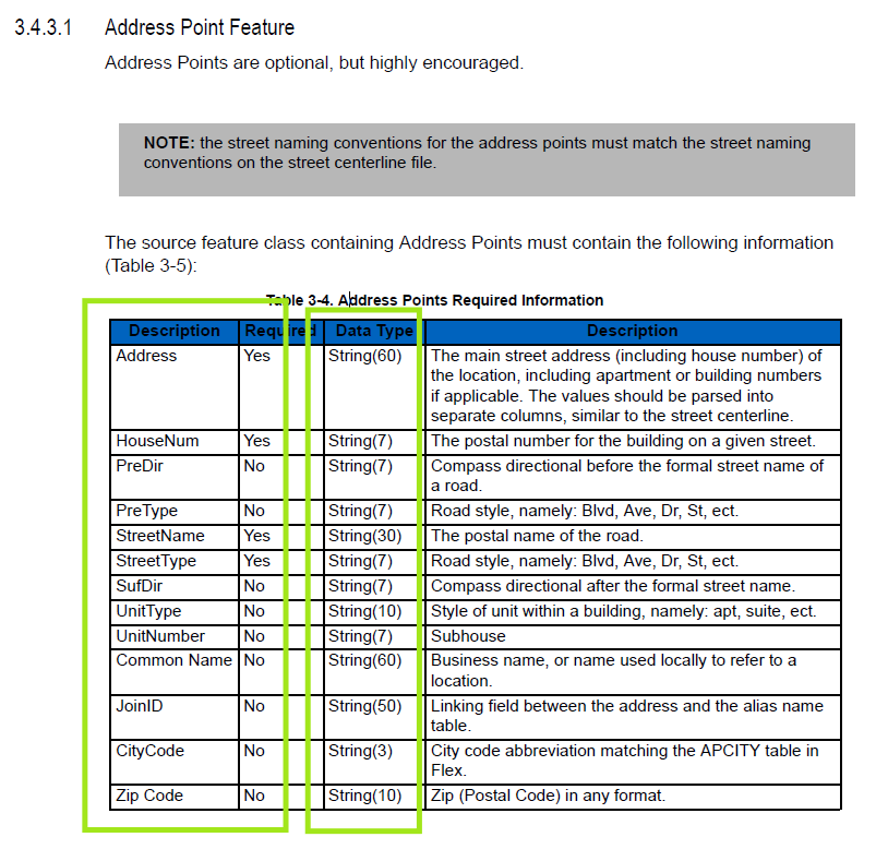
Step 4.
Format raw data into standard format
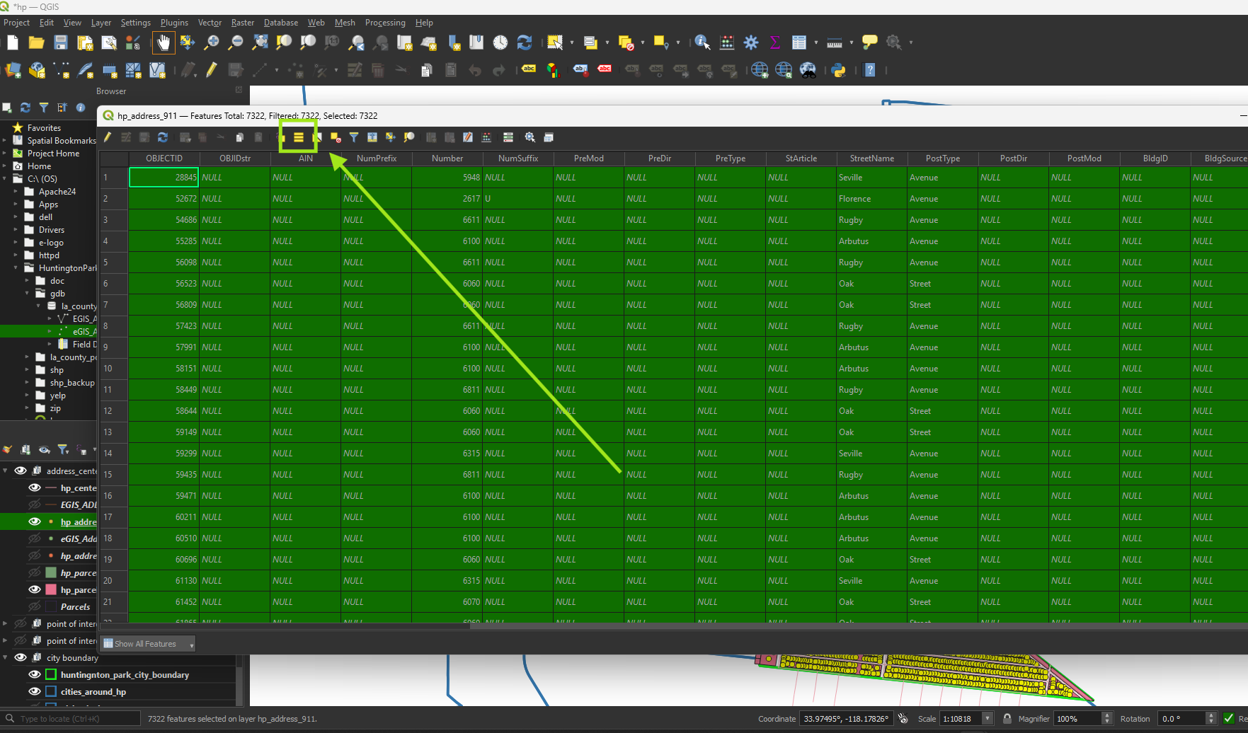
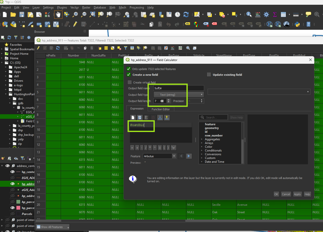
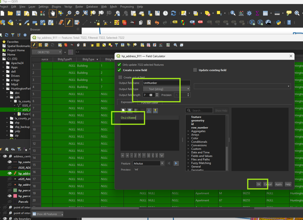
Step 5.
Must click select all button before any change, otherwise, change will not work.
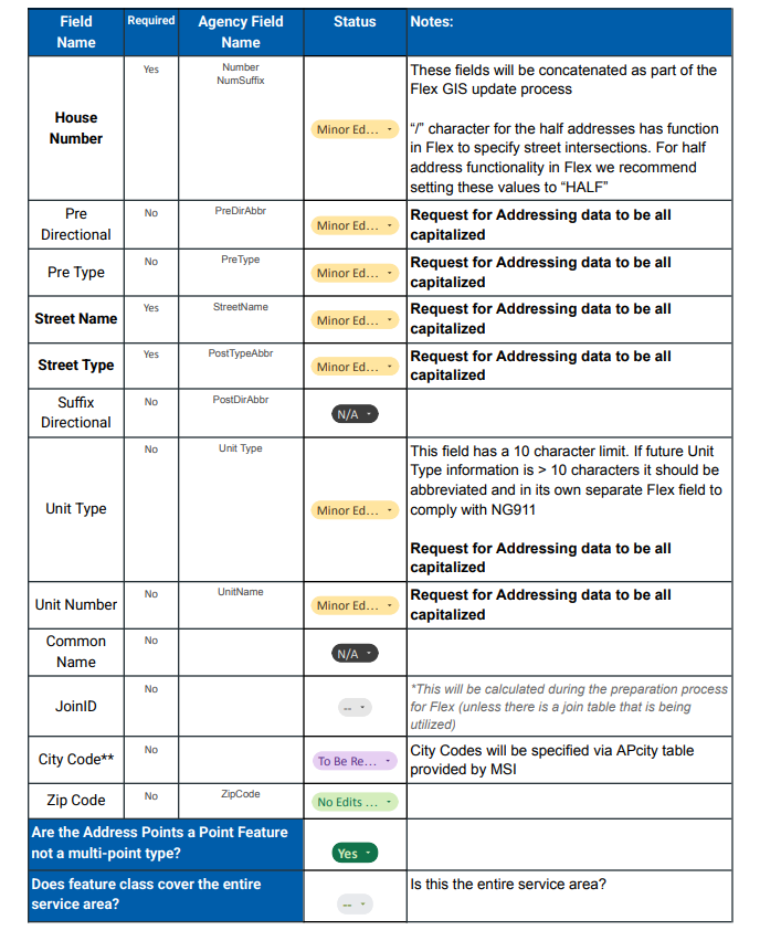
Step 6.
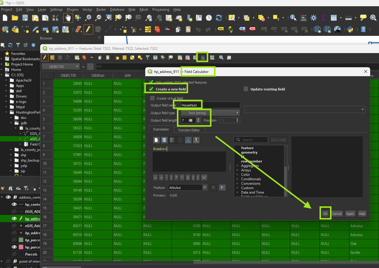
Re-creating following field as standard string length
Address field

Step 7.
HouseNum
Step 8.
StreetType

Step 9.
SufDir
Step 10.
UnitNumber
Step 11.
Delete duplicated fi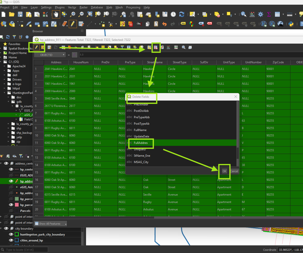
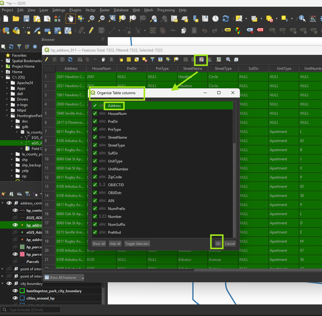
Step 12.
drag and drop standard field to top
Step 13.
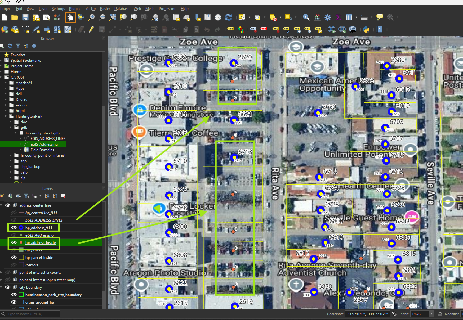
compare 2 set of address point,
the different is that address generated from parcel have multiple point for same parking lot. Because 1 parking lots has multiple parcel.
But only 1 parcel of them has house number, address info. The other parcel (address point) have empty info.
Step 14.
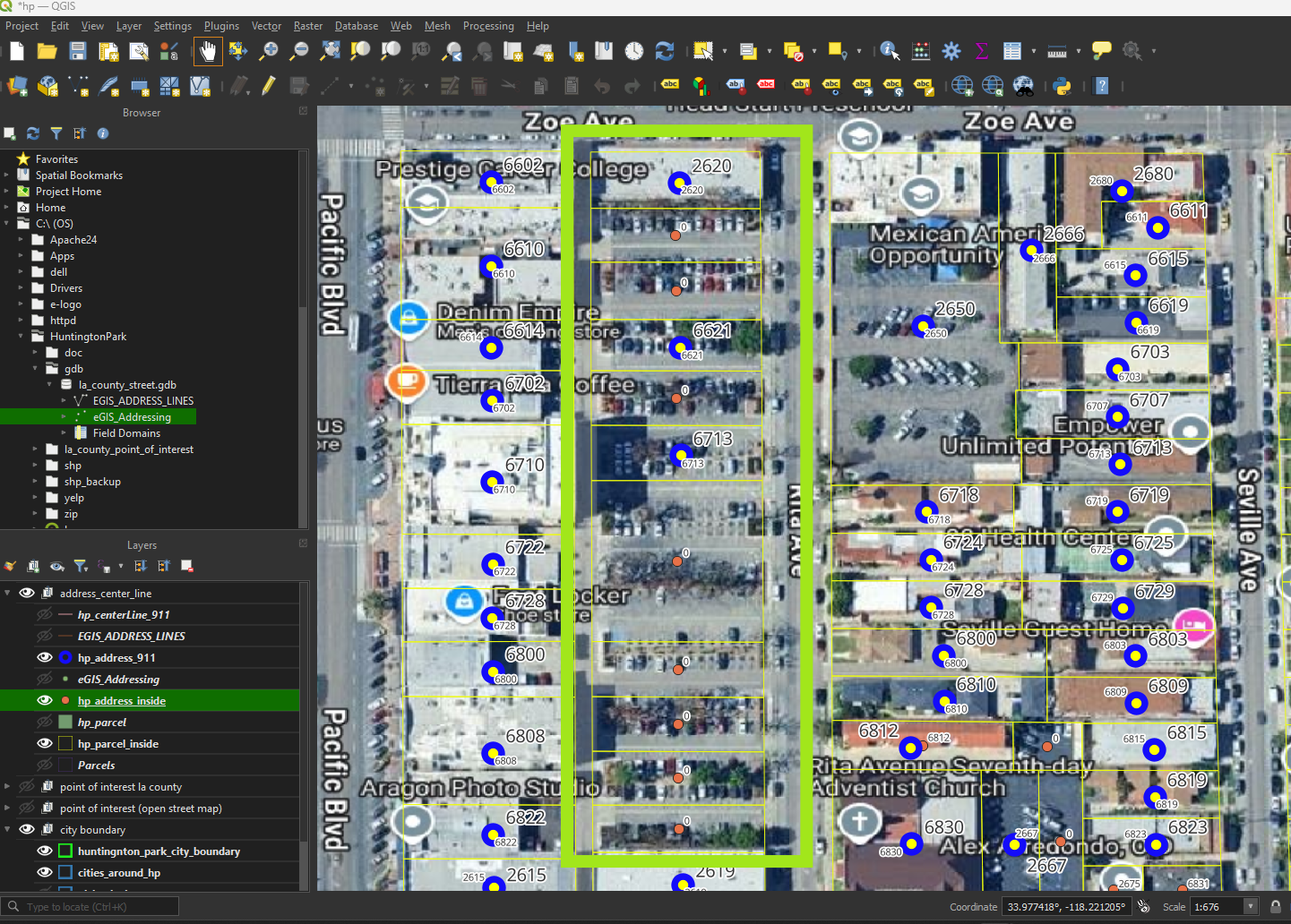
Address point not from parcel, directly from county assign 1 address for multiple parcel parking lot. For example this parking lot has 3 address point, with 11 parcels, 2620, 6621, 6713,
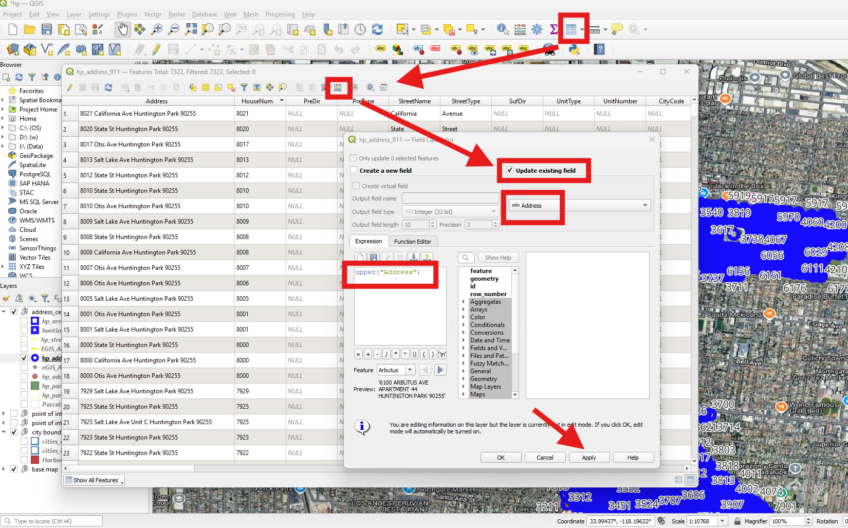
Step 15.
convert all field to upper case
Step 16