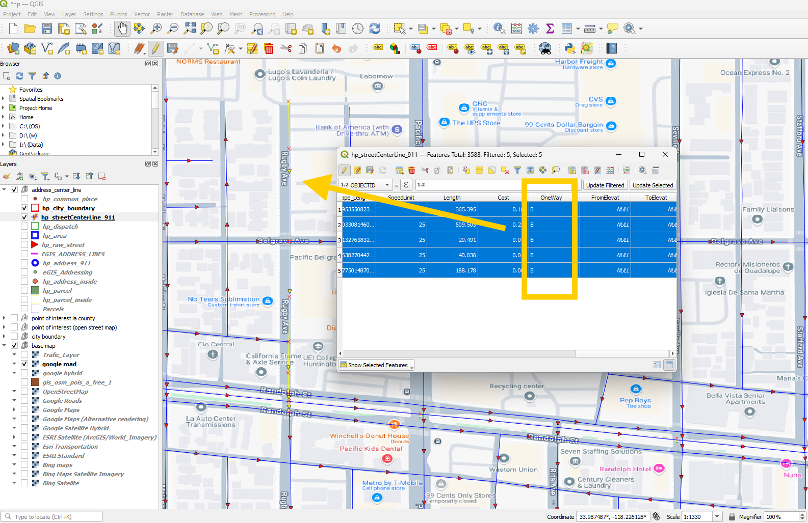
Top section of Ruby street does not have one way arrow, means, it is two-way.
bottom section of Ruby street have one - way arrow.
I am not sure, Just want to verify it. How?
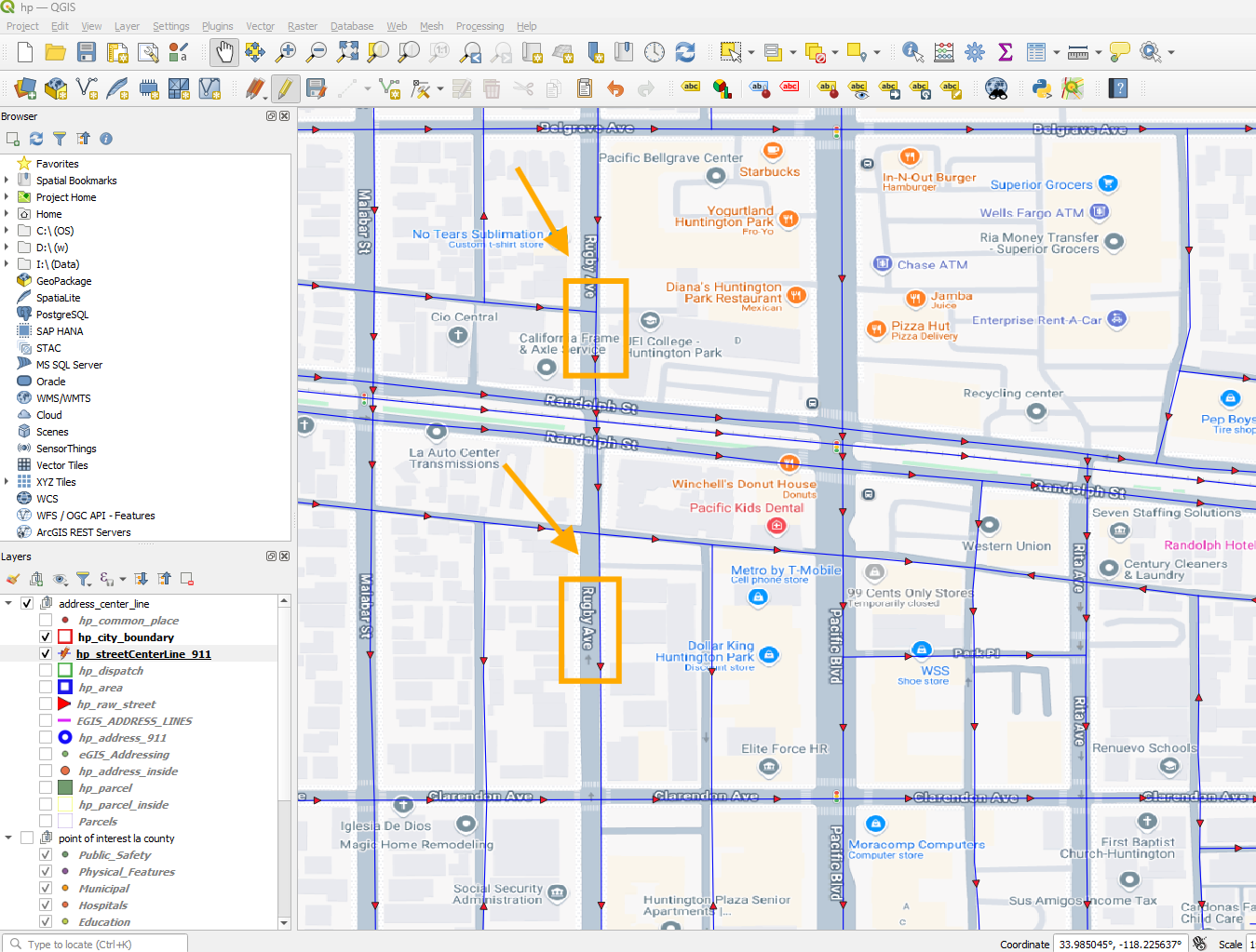
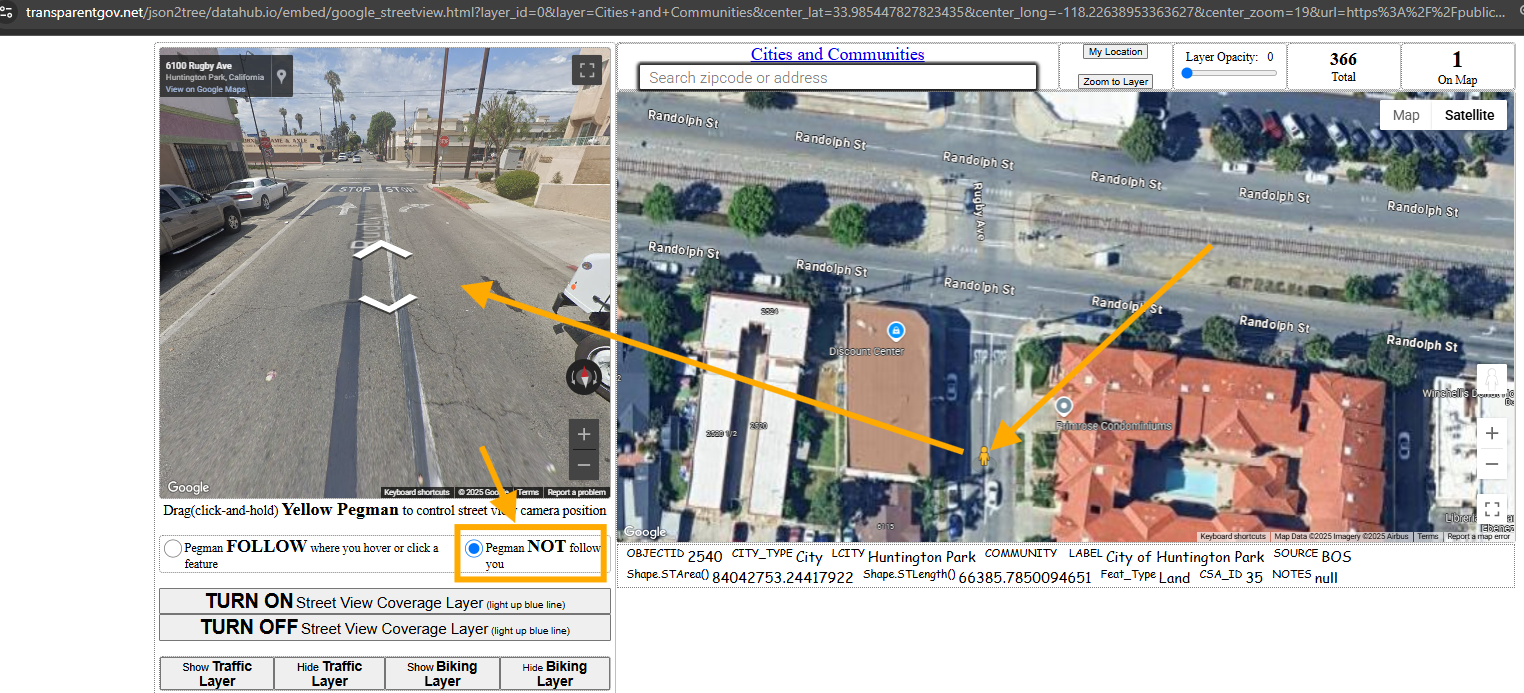
Use google street view, let pegman not follow you where you click.
drag the peggman to Ruby street, You can see bottom is one way.
https://transparentgov.net/json2tree/datahub.io/embed/google_streetview.html?layer_id=0&layer=Cities+and+Communities¢er_lat=33.985447827823435¢er_long=-118.22638953363627¢er_zoom=19&url=https%3A%2F%2Fpublic.gis.lacounty.gov%2Fpublic%2Frest%2Fservices%2FLACounty_Cache%2FLACounty_StreetMap%2FMapServer&panto=0&pegmanfollow=not_follow
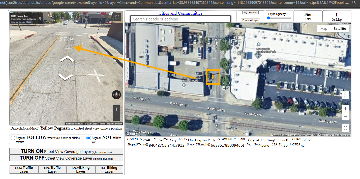
drag the peggman to top Ruby street, You can see top is two way because it has double yellow line
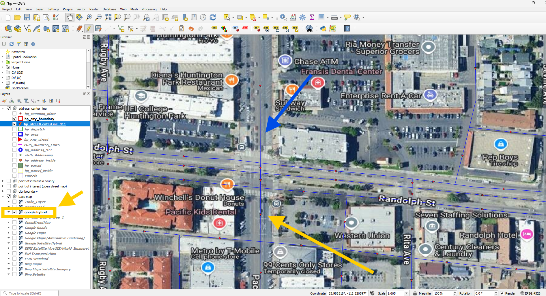
Alternatively, you can turn on google hybrid satellite map, however, the image quality and resolution is too bad to compare with google street view. In this sample, I can't even tell wether it is one way or not. But street view, you can easily.
bottom section, traffic flow direction is opposite to line digitizing direction. So the value is T
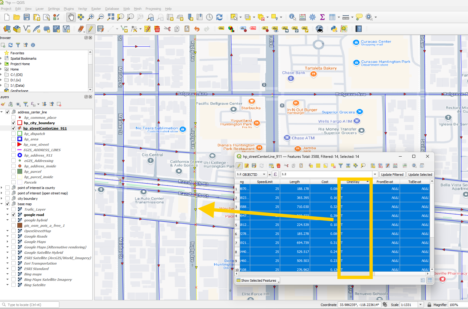
Top section is two-way, so the value is B
