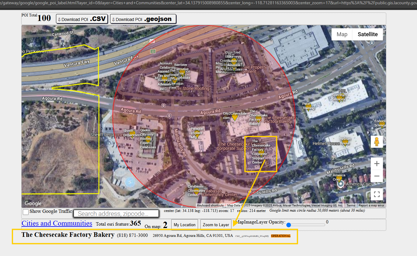
when you browse google POI, it is better to see POI name as label, otherwise, you have to hover each point to see POI name and phone, address etc..
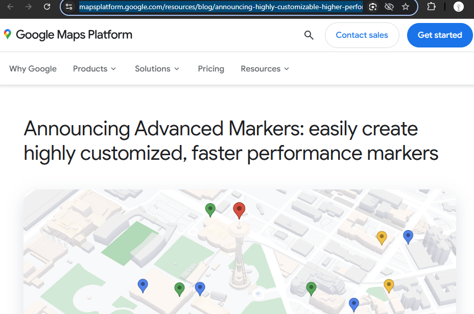
model 3837, use latest google technology advance marker to render POI point.
https://mapsplatform.google.com/resources/blog/announcing-highly-customizable-higher-performance-markers/
What is the difference ?
Since google map born, 25 years ago, google have not be able to fix the horrible marker performance issue. If you show more than 1000 point marker on google map, your browser will be freezing, not responsible, eventually crash.
Over 15 years ago, some one ask me do you know how many marker google map can display as a job interview question.
of course I don't know at the time, then he said 5k. I have spend 10 years to build testing tools to test how much exactly to know the answer. From my website as testing tool, I found chrome start to crash after reach 1k.
Think about even smallest city have 10k address points, average city have 20k to 40k address point. many county have over 1 million address points.
Think about POI, even smallest city have several thousands POI points, large city Los Angeles, New York, Chicago, have over 1 million POI points.
Google maps point marker has been failed to display these large point data in the past 20 years since 2006.
I have to cut to max 200 points each time to avoid your browser crash.
After 20 years google finally find a solution to fix this issue. Have they fix it yet?
I can't speak until I test it how many max marker the new google AdvancedMarker can display.
So far I use this new tech to display POI label, so far so good.
mouse over any POI marker, business address and phone number display at bottom.
You also can see business name on top of marker.
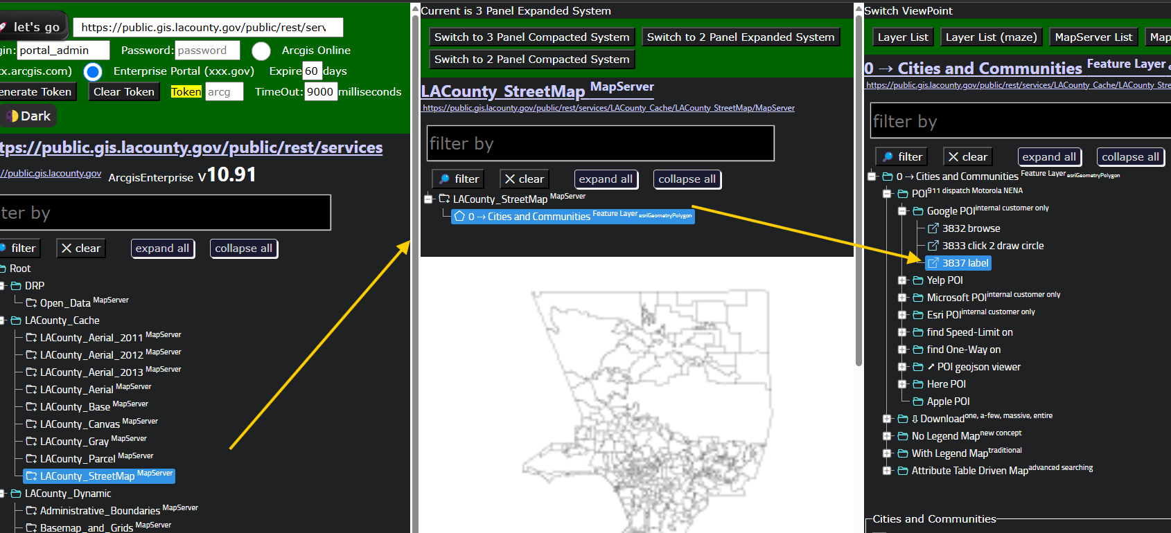
https://transparentgov.net/json2tree/esri/server/folder2.html?org=https%3A%2F%2Fpublic.gis.lacounty.gov%2Fpublic%2Frest%2Fservices&url=https%3A%2F%2Fpublic.gis.lacounty.gov%2Fpublic%2Frest%2Fservices&arcgis_online_token=&timeout=9000&select_folder=28&select_layer=0&select_folder_text=LACounty_StreetMap+%3Csup%3EMapServer%3C%2Fsup%3E&select_layer_text=0+%26%23x21E2%3B+Cities+and+Communities+%3Csup%3EFeature+Layer%3Csub%3E+esriGeometryPolygon%3C%2Fsub%3E%3C%2Fsup%3E