Step 1.
My professor work at BYU, https://cce.byu.edu/directory/dan-ames, He is the one who bring me to US from China by admit me into Idaho State University. Everything start from then.

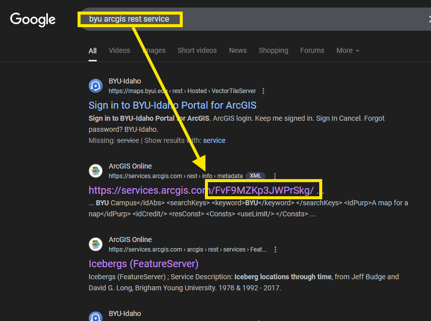
I try to google byu gis server, I found a organization id as FvF9MZKp3JWPrSkg
Step 2.
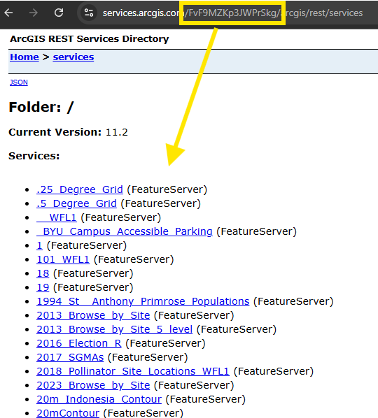
I open the REST api endpoint, however, no where says it is BYU's gis server.
How I know, this is BYU's gis server?
https://services.arcgis.com/FvF9MZKp3JWPrSkg/arcgis/rest/services
Step 3.
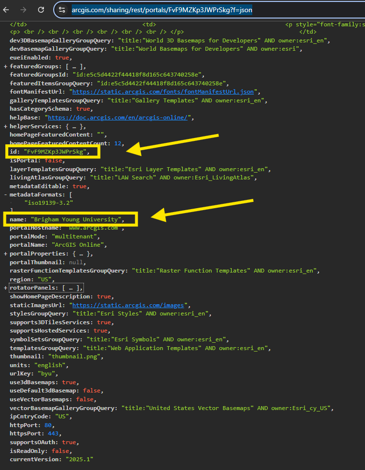
You use organization id create a URL like this format
https://www.arcgis.com/sharing/rest/portals/ what-ever-your-organization-id ?f=json
You will find organization name, customer name is here
https://www.arcgis.com/sharing/rest/portals/FvF9MZKp3JWPrSkg?f=json
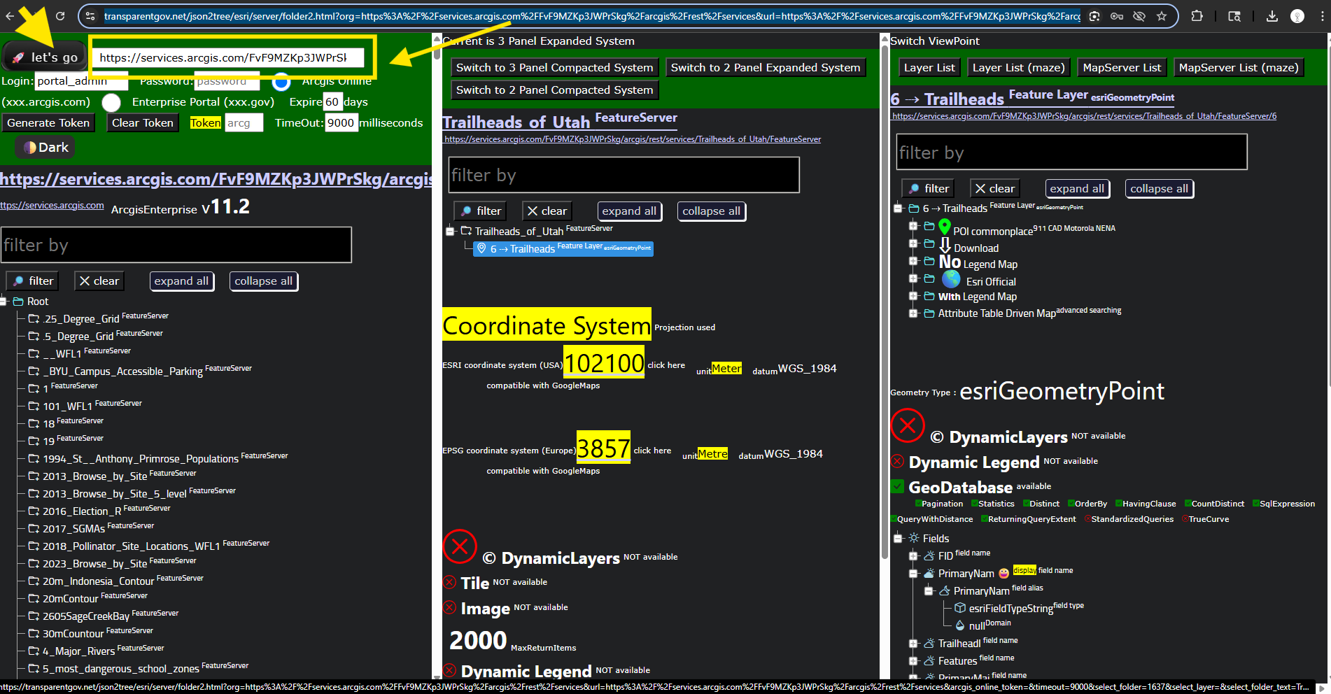
Step 4.
Now you copy past REST-api-endpoint next to let's go button, then click let's go button, you can review all layers now.
https://transparentgov.net/json2tree/esri/server/folder2.html?org=https%3A%2F%2Fservices.arcgis.com%2FFvF9MZKp3JWPrSkg%2Farcgis%2Frest%2Fservices&url=https%3A%2F%2Fservices.arcgis.com%2FFvF9MZKp3JWPrSkg%2Farcgis%2Frest%2Fservices&arcgis_online_token=&timeout=9000&select_folder=1637&select_layer=6&select_folder_text=Trailheads_of_Utah+%3Csup%3EFeatureServer%3C%2Fsup%3E&select_layer_text=6+%26%23x21E2%3B+Trailheads+%3Csup%3EFeature+Layer%3Csub%3E+esriGeometryPoint%3C%2Fsub%3E%3C%2Fsup%3E
Step 5.
Professor Dan Ames used to be professor in Idaho state university back in 2007 when he admit me.
I want to search for Idaho state university's gis server.
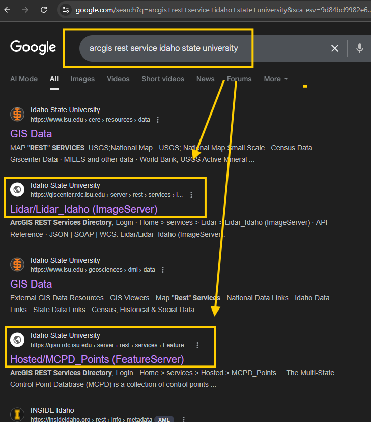
Step 6.
Found REST api endpoint
https://giscenter.rdc.isu.edu/server/rest/services
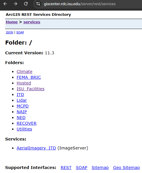
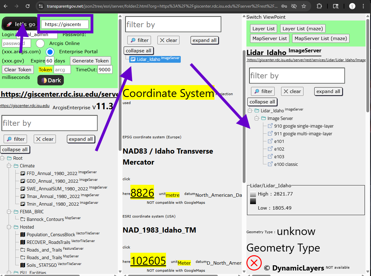
Step 7.
Now you copy past REST-api-endpoint next to let's go button, then click let's go button, you can review all layers now.
https://transparentgov.net/json2tree/esri/server/folder2.html?org=https%3A%2F%2Fgiscenter.rdc.isu.edu%2Fserver%2Frest%2Fservices&url=https%3A%2F%2Fgiscenter.rdc.isu.edu%2Fserver%2Frest%2Fservices&arcgis_online_token=&select_folder=32&select_folder_text=Lidar_Idaho+%3Csup%3EImageServer%3C%2Fsup%3E&select_layer=-1&select_layer_text=Lidar_Idaho+%3Csup%3EImageServer%3C%2Fsup%3E
Step 8.
Found REST api endpoint
https://gisu.rdc.isu.edu/server/rest/services
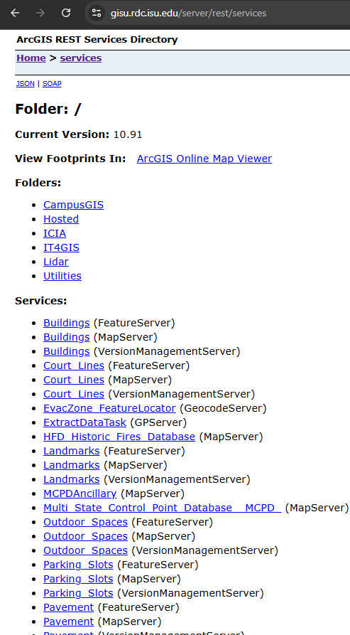
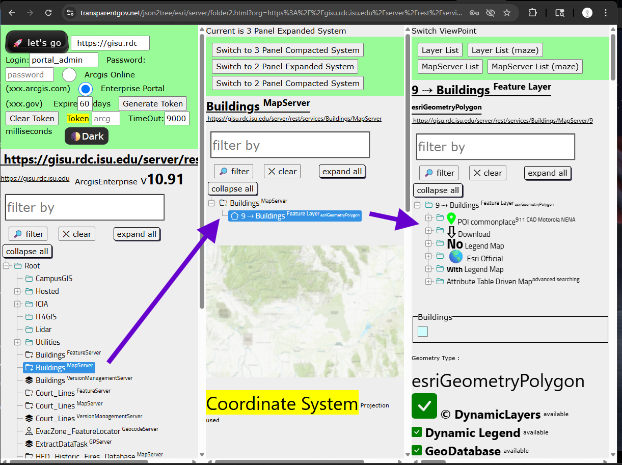
Step 9.
https://transparentgov.net/json2tree/esri/server/folder2.html?org=https%3A%2F%2Fgisu.rdc.isu.edu%2Fserver%2Frest%2Fservices&url=https%3A%2F%2Fgisu.rdc.isu.edu%2Fserver%2Frest%2Fservices&arcgis_online_token=&select_folder=8&select_folder_text=Buildings+%3Csup%3EMapServer%3C%2Fsup%3E&select_layer=9&select_layer_text=9+%26%23x21E2%3B+Buildings+%3Csup%3EFeature+Layer%3Csub%3E+esriGeometryPolygon%3C%2Fsub%3E%3C%2Fsup%3E
Now you copy past REST-api-endpoint next to let's go button, then click let's go button, you can review all layers now.