Step 1.
https://dpw.gis.lacounty.gov/dpw/rest/services
copy paste here, click start button
https://transparentgov.net/json2tree/esri/server/folder2.html?org=https%3A%2F%2Fdpw.gis.lacounty.gov%2Fdpw%2Frest%2Fservices&url=https%3A%2F%2Fdpw.gis.lacounty.gov%2Fdpw%2Frest%2Fservices&arcgis_online_token=&timeout=9000&select_folder=27&select_layer=0&select_folder_text=CityAnnexationsWAB+%3Csup%3EMapServer%3C%2Fsup%3E&select_layer_text=0+%26%23x21E2%3B+City+Annexations+%3Csup%3EFeature+Layer%3Csub%3E+esriGeometryPolygon%3C%2Fsub%3E%3C%2Fsup%3E
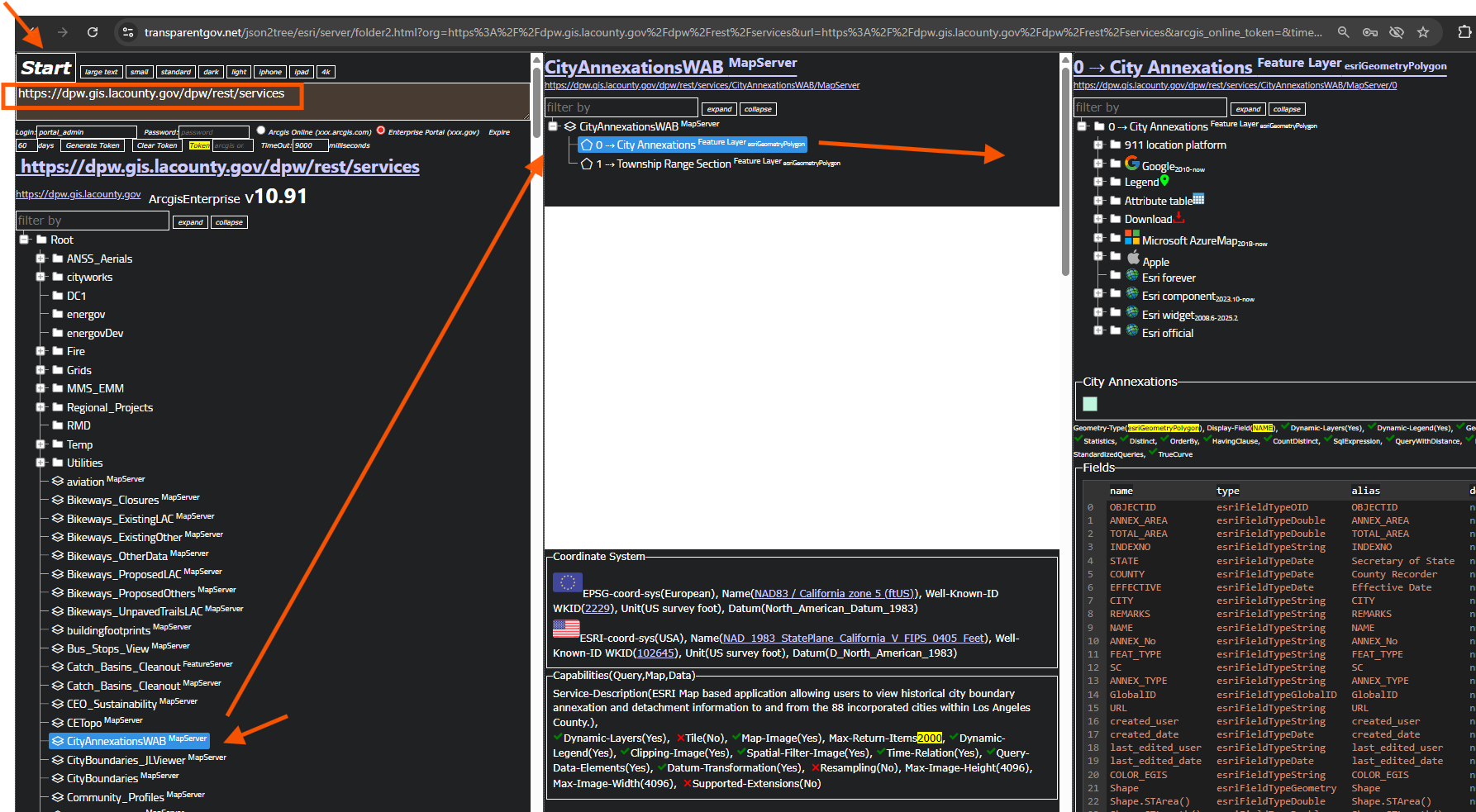
Step 2.
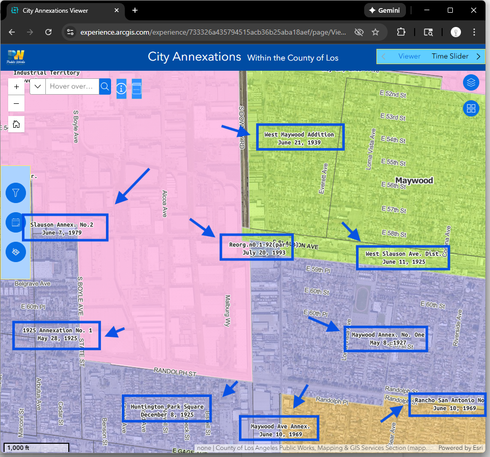
experience builder
https://experience.arcgis.com/experience/733326a435794515acb36b25aba18aef/page/Viewer#widget_25=active_datasource_id:dataSource_1,center:-13159661.3415418%2C4026725.2051648595%2C102100,scale:49709.612470915694,level:12.623456555957807,viewpoint:%7B%22rotation%22%3A0%2C%22scale%22%3A49709.612470915694%2C%22targetGeometry%22%3A%7B%22spatialReference%22%3A%7B%22latestWkid%22%3A3857%2C%22wkid%22%3A102100%7D%2C%22x%22%3A-13159661.3415418%2C%22y%22%3A4026725.2051648595%7D%7D
Step 1.
Note: Los Angeles County emergency CAMS Locator, does not have private business POI.
DPW folder is their newest Arcgis Pro (I guess v3.0-v3.3, latest v3.5) based locator,
other old ones are build from ArcMap
https://transparentgov.net/json2tree/esri/server/folder2.html?org=https%3A%2F%2Fgeocode.gis.lacounty.gov%2Fgeocode%2Frest%2Fservices&url=https%3A%2F%2Fgeocode.gis.lacounty.gov%2Fgeocode%2Frest%2Fservices&arcgis_online_token=&timeout=9000&select_folder=20&select_layer=&select_folder_text=Routing+%3Csup%3ENAServer%3C%2Fsup%3E&select_layer_text=ProLocator_A+%3Csup%3EGeocodeServer%3C%2Fsup%3E
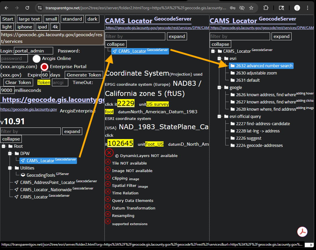
Step 2.
Los Angeles County don't currently have any business POI on their locator.
You are NOT going to see costco, walmart, home depot, in-n-out burger etc... on their locator.
Their locator build from address point, street center line, parcels
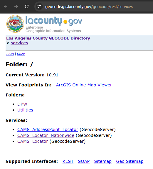
https://geocode.gis.lacounty.gov/geocode/rest/services
Step 3.
Step 4.
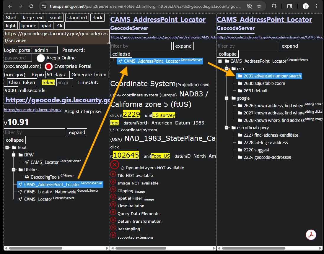
The only one that do not have fake address is this one. Because this one is build only from address point.
The other locator are build from both address point + street center line + parcel (number, you can search parcel number).
They did not remove "street address" category in locator properties windows, cause lots of fake address popup, becomes useless.
They must turn off "street address" category, eliminate fake address to make it usable.
https://transparentgov.net/json2tree/esri/server/folder2.html?org=https%3A%2F%2Fgeocode.gis.lacounty.gov%2Fgeocode%2Frest%2Fservices&url=https%3A%2F%2Fgeocode.gis.lacounty.gov%2Fgeocode%2Frest%2Fservices&arcgis_online_token=&timeout=9000&select_folder=3&select_layer=-1&select_folder_text=CAMS_AddressPoint_Locator+%3Csup%3EGeocodeServer%3C%2Fsup%3E&select_layer_text=CAMS_AddressPoint_Locator+%3Csup%3EGeocodeServer%3C%2Fsup%3E
Step 5.
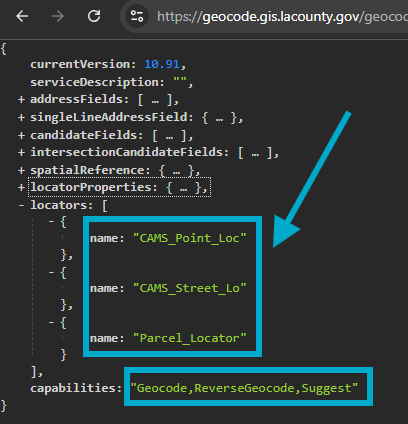
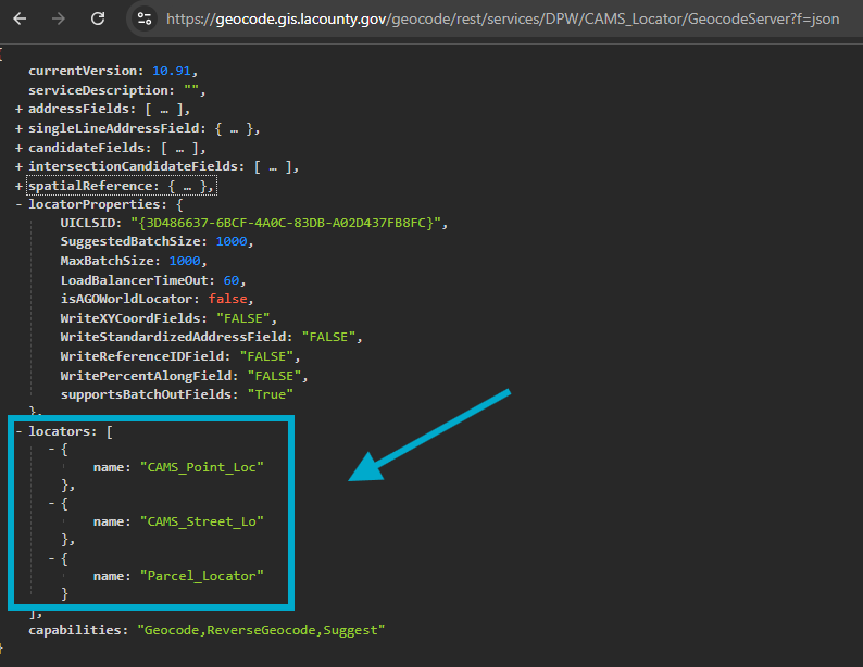
DPW folder locator is composite locator include 3 children locator, they are, address point locator, street line locator, parcel locator, should be able to search parcel number directly.
https://geocode.gis.lacounty.gov/geocode/rest/services/DPW/CAMS_Locator/GeocodeServer?f=json
also they have reverse geocode capability, see here
Step 6.
How do you know if a locator build from old ArcMap or build from new ArcPro ?
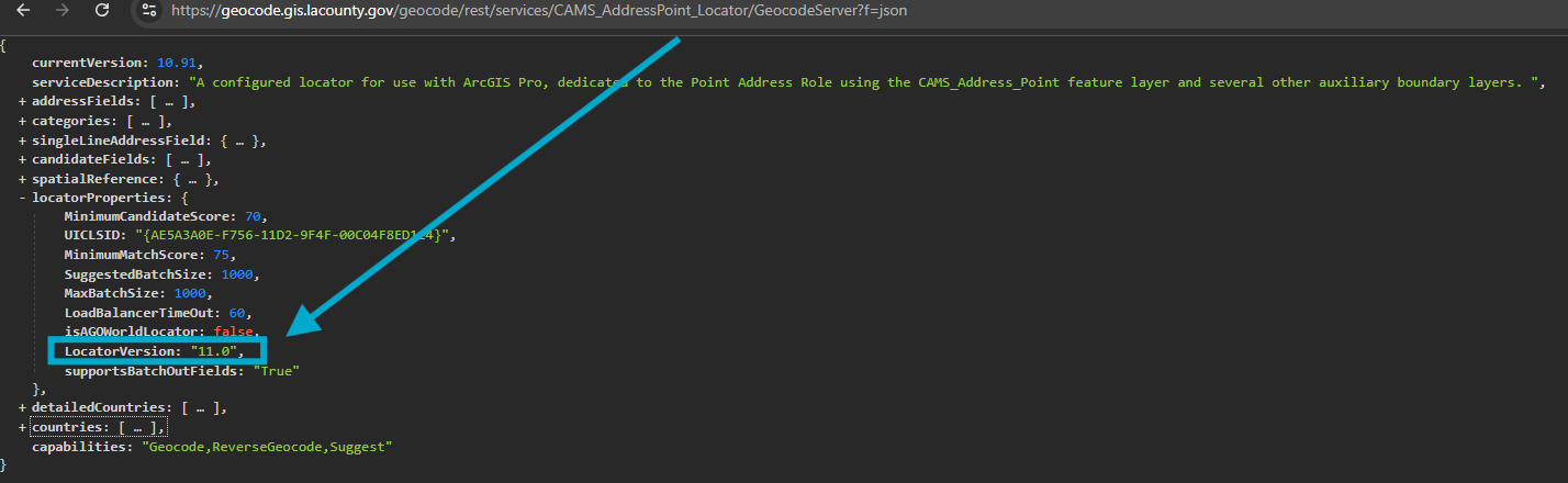
If you see locatorVersion: 11, means it is ArcPro locator, 11 means Arcgis Enterprise Portal version v11.x
If you don't see v11, that means it is old ArcMap locator.
This address point locator is ArcPro locator, because you see v11.
https://geocode.gis.lacounty.gov/geocode/rest/services/CAMS_AddressPoint_Locator/GeocodeServer?f=json
Step 7.
This is composite locator, made of 3 children locator,
https://geocode.gis.lacounty.gov/geocode/rest/services/DPW/CAMS_Locator/GeocodeServer?f=json
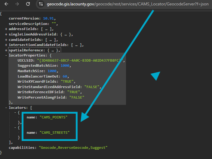
Step 8.
this one is composite locator, made with 2 children locator,
street center line locator is where those fake address comes from.
if they use street locator as child locator, I am not sure they can fix it. Maybe yes, maybe no.
To fix this problem, I would re-design locator without children, make is simple.
Just use street as Street-Address-ROLE, instead of street child locator.
https://geocode.gis.lacounty.gov/geocode/rest/services/CAMS_Locator/GeocodeServer?f=json
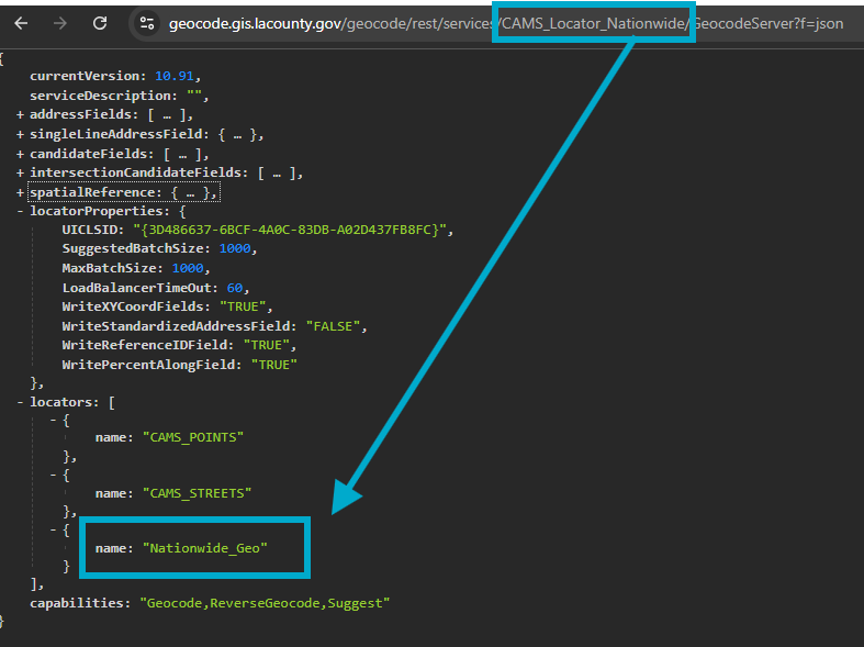
Step 9.
this nation wide is just add nation street center line as children locator to it
https://geocode.gis.lacounty.gov/geocode/rest/services/CAMS_Locator_Nationwide/GeocodeServer?f=json
Step 10.
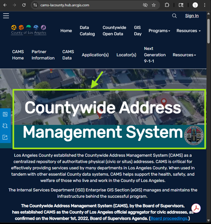
Los Angeles County established the Countywide Address Management System (CAMS)
Los Angeles County cams locator https://cams-lacounty.hub.arcgis.com/
Step 11.
monthly county parcel download
https://egis-lacounty.hub.arcgis.com/documents/4d67b154ae614d219c58535659128e71/about