Determine or knowing your State Plane Zone (coordinate system) is first thing before you open Arcgis Pro.
Every city using different state plane zone coordinate system. For federal agency because it is nation wide, WGS 1984 is commonly used, which is same as online map( such as google map, esri arcgis online map, bing map, apple map, mapbox ). But for city and county, all using different state plane zone.
Let's find out what coordinate system you should use for example, city of Los Angeles
Step 1. open this link, search 'los'
https://transparentgov.net/json2tree/datahub.io/usgs/search_byField.html?backgroundlayerurl=https%3A%2F%2Fgis.la-quinta.org%2Farcgis%2Frest%2Fservices%2Fcoordinate_systems%2Fstate_plane%2FMapServer%2F0&layer=State_Plane_Zones&_center_zoom=11&_center_lat=34.05405582509425&_center_long=-118.24544999999995
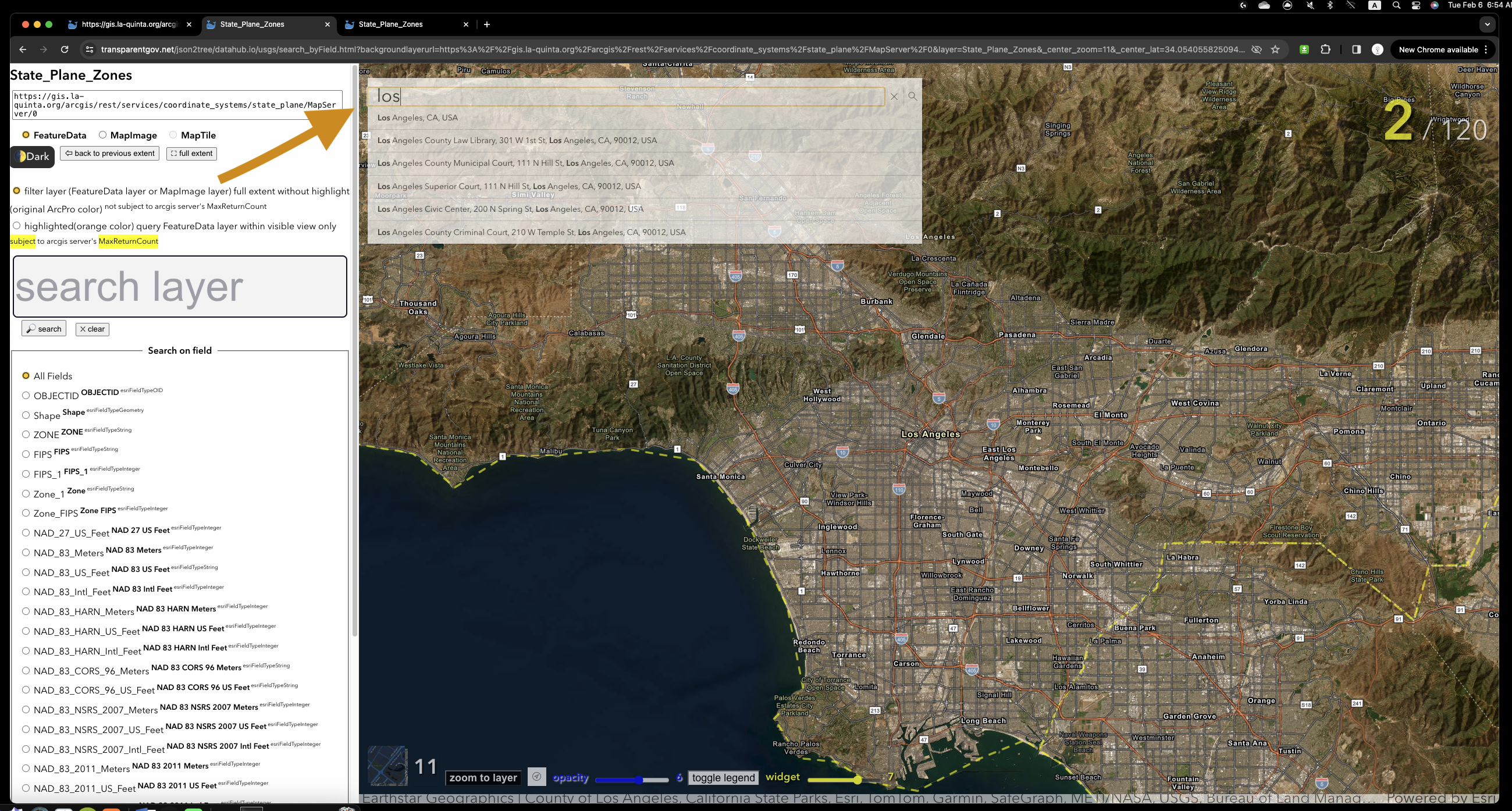
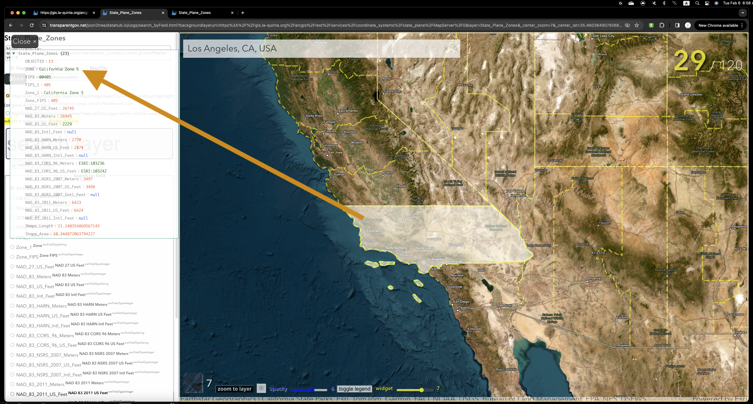
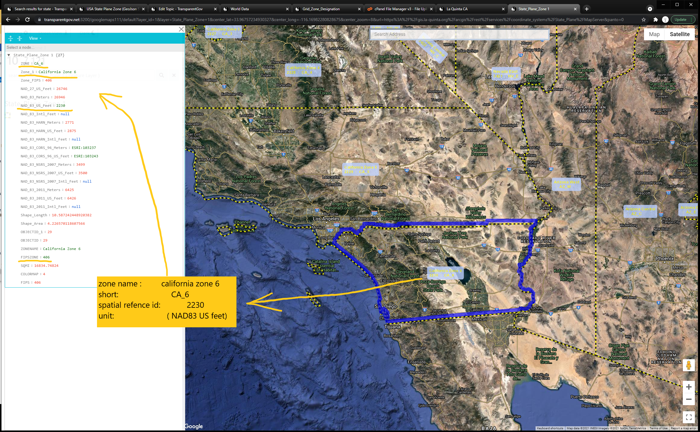
Step 2. after search completed, click map, CA zone5 is what you are looking for.
Step 3. Search by string text field
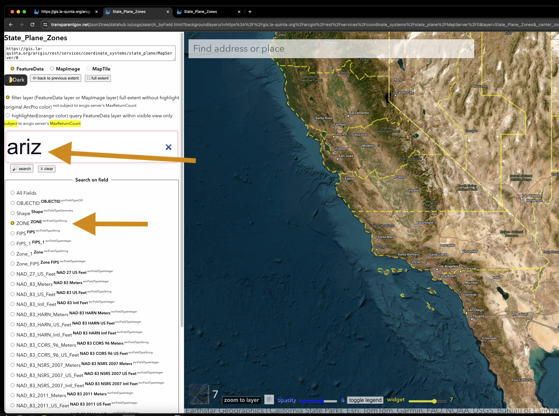
Step 4. search result only show arizona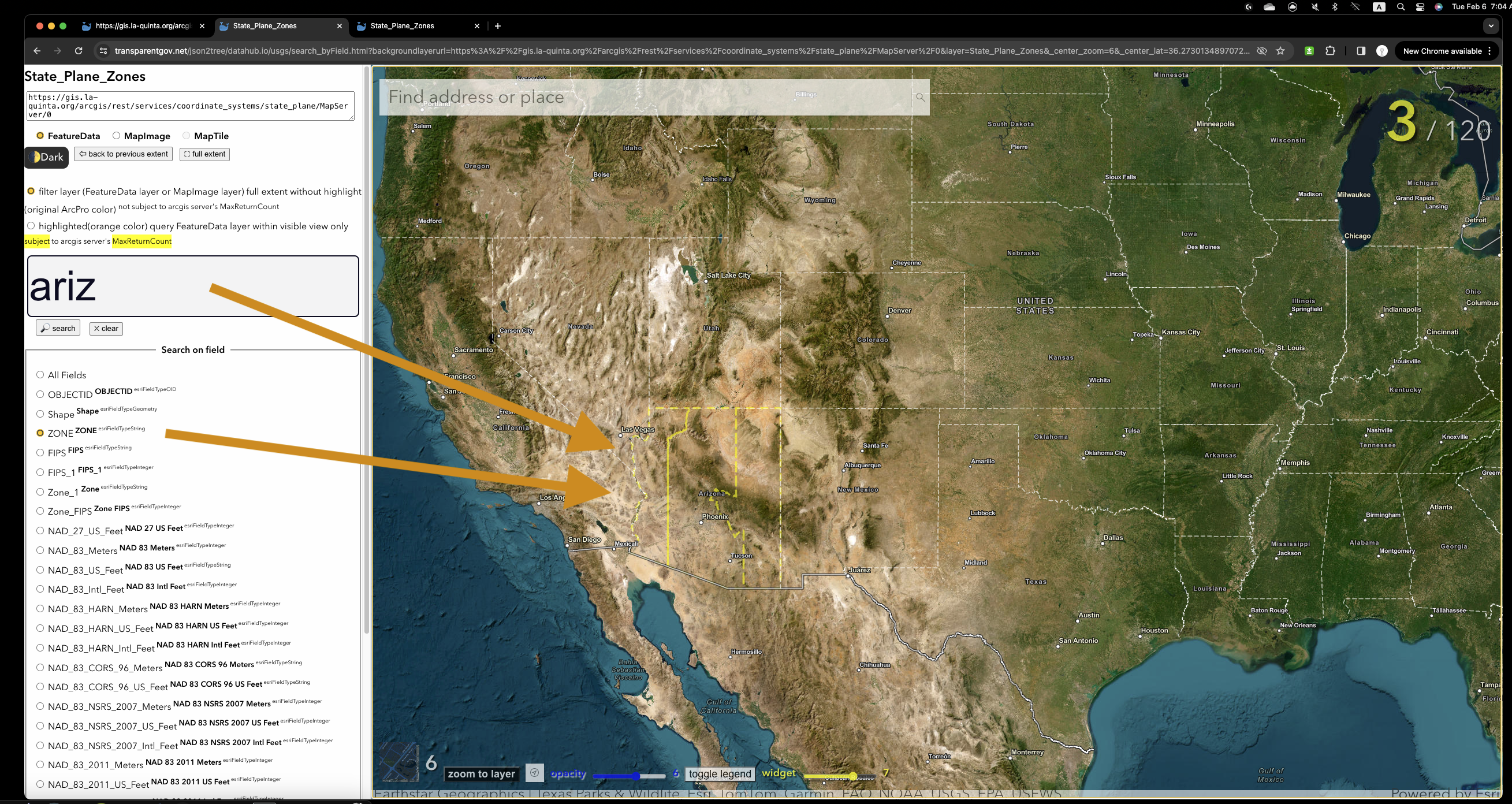
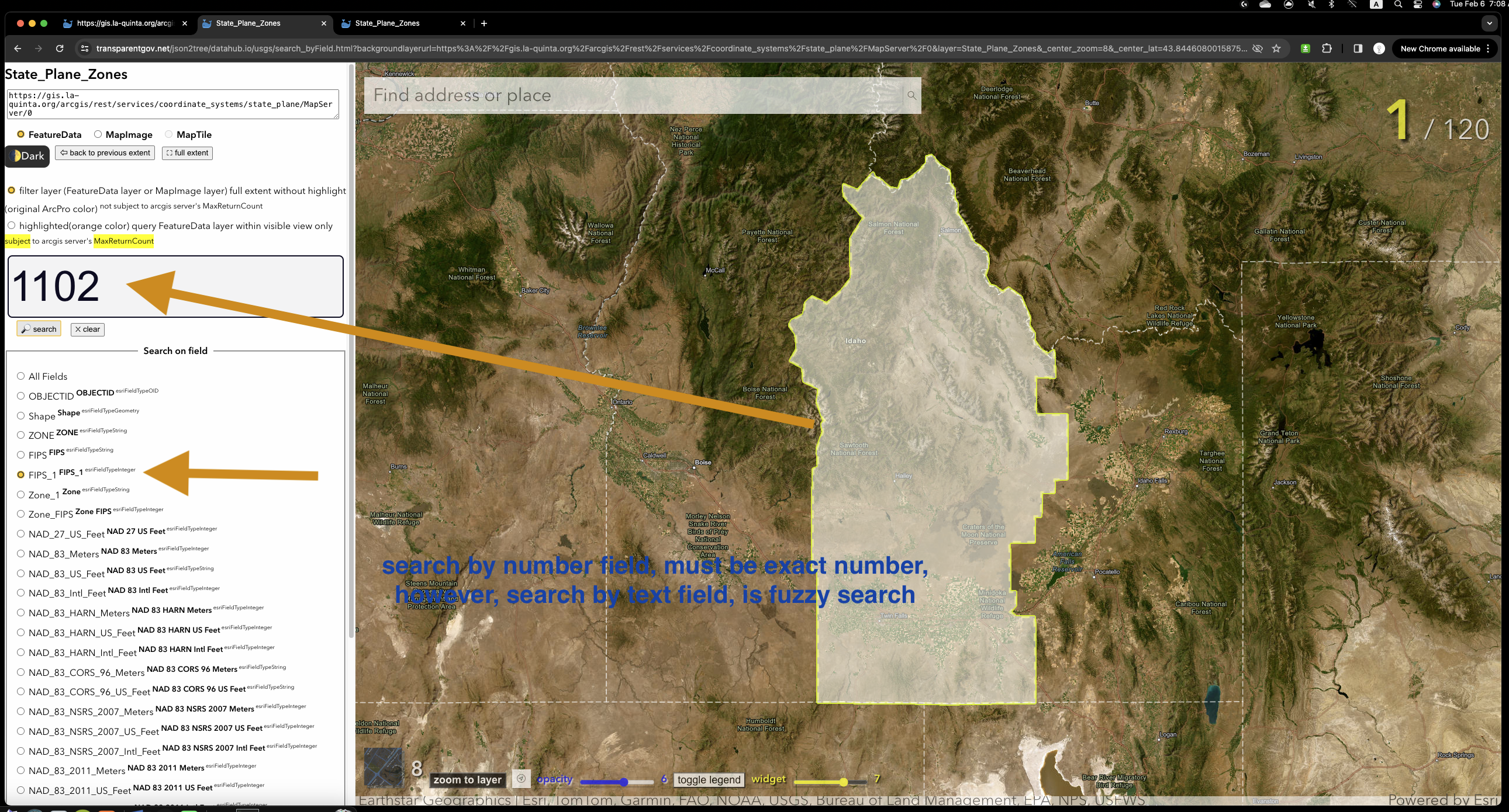
Step 5. Search by number field
How to look up your local coordinate system projection
https://transparentgov.net:3200/googlemaps110/default?layer_id=1&layer=State_Plane_Zone+1¢er_lat=35.09385268321159¢er_long=-115.63145356804058¢er_zoom=7&url=https%3A%2F%2Fgis.la-quinta.org%2Farcgis%2Frest%2Fservices%2Fcoordinate_systems%2FState_Plane_Zones%2FMapServer&overlayType=overlayType_image&panto=0
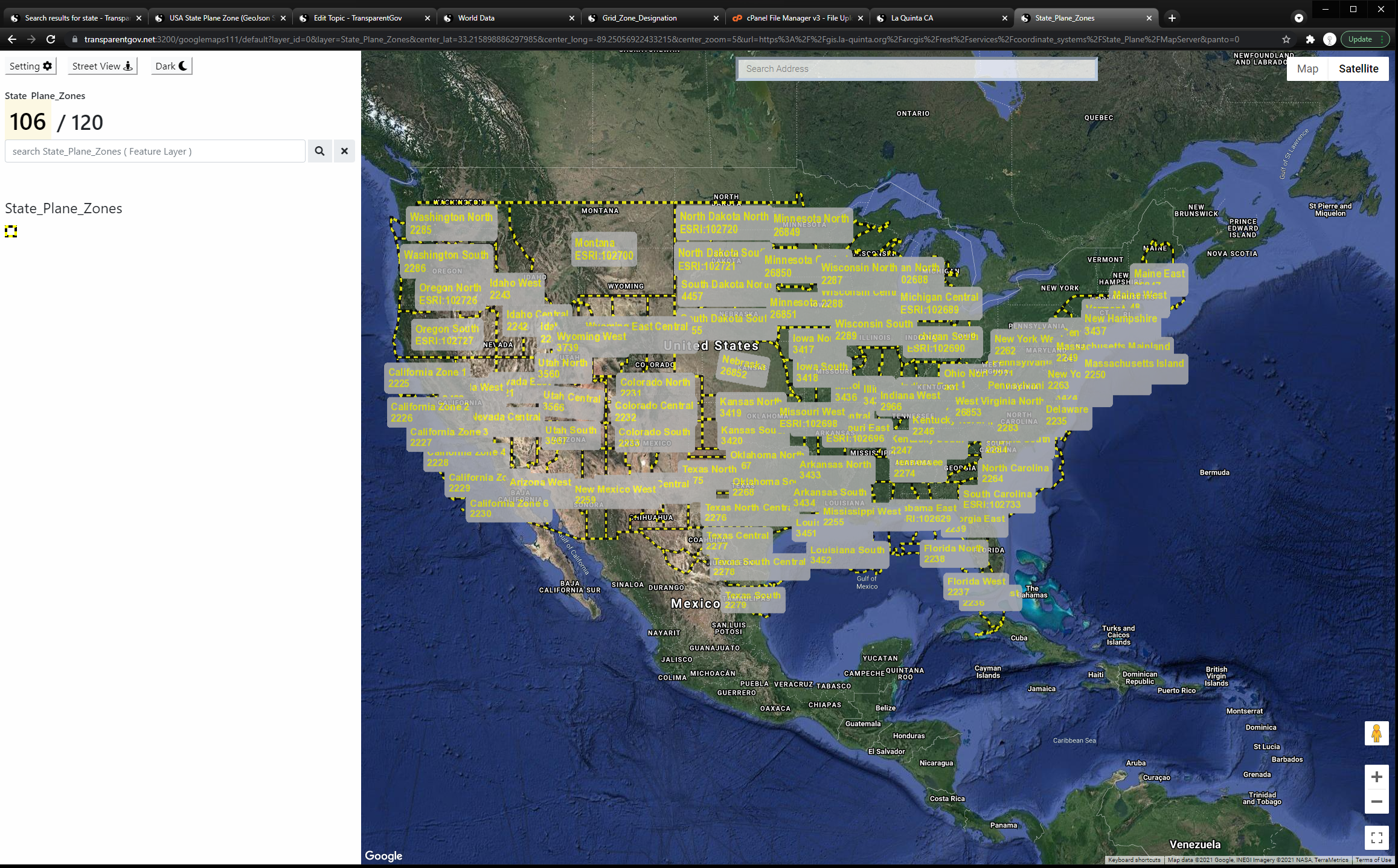
Whole US is available
https://transparentgov.net:3200/googlemaps110/default?layer_id=0&layer=State_Plane_Zones¢er_lat=26.662084912646442¢er_long=-81.71524870408523¢er_zoom=5&url=https%3A%2F%2Fgis.la-quinta.org%2Farcgis%2Frest%2Fservices%2Fcoordinate_systems%2FState_Plane_Zones%2FMapServer&overlayType=overlayType_image&panto=0
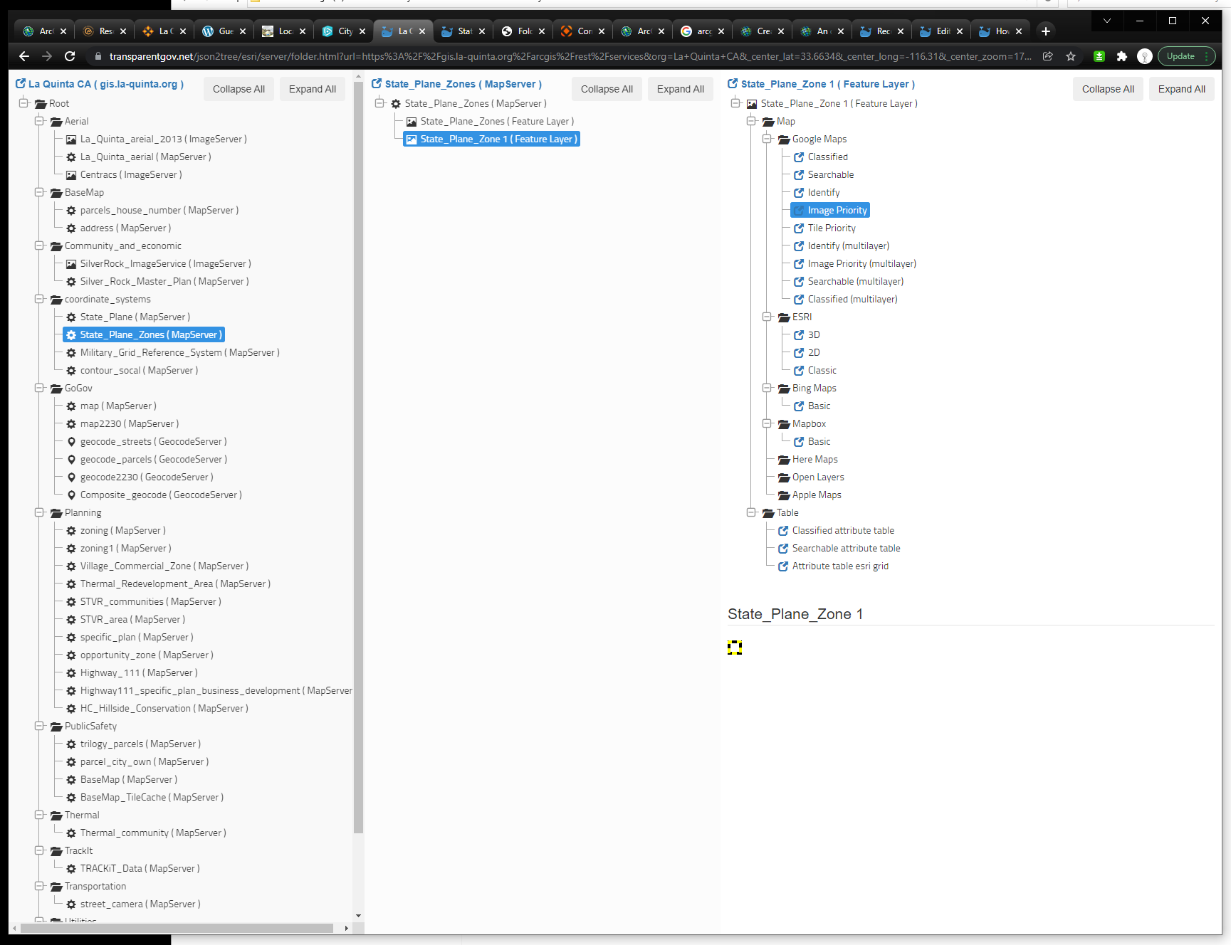
https://transparentgov.net/json2tree/esri/server/folder.html?url=https%3A%2F%2Fgis.la-quinta.org%2Farcgis%2Frest%2Fservices&org=La+Quinta+CA&_center_lat=33.6634&_center_long=-116.31&_center_zoom=17&select_folder=41&select_layer=1
Download
Download US State Plane Zones .geojson file https://transparentgov.net/data/projections_coordinate/SPCS/StatePlaneZones.geojson
Download US State Plane Zones .zipped shapefile https://transparentgov.net/data/projections_coordinate/SPCS/StatePlaneZones.zip
Download US State Plane Zones by county.csv
https://transparentgov.net/data/projections_coordinate/SPCS/State Plane Coordinate System zones by county.csv
Download US State Plane Zones EPSG numbers for SPCS.csv
https://transparentgov.net/data/projections_coordinate/SPCS/EPSG numbers for SPCS.csv
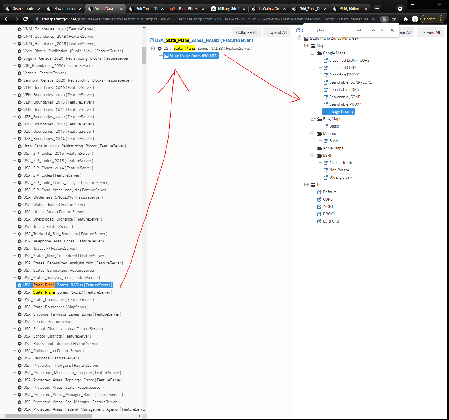
Check Geojson online click here USA State Plane Zone (GeoJson)
Check Shape file online click here USA State Plane Zone (zipped Shapefile)
ESRI hosted Version
Check ESRI hosted version click here USA State Plane Zone NAD83
Check ESRI hosted version click here USA State Plane Zone NAD27
USA State Plane Zone ( ESRI hosted)
Local Government Resource
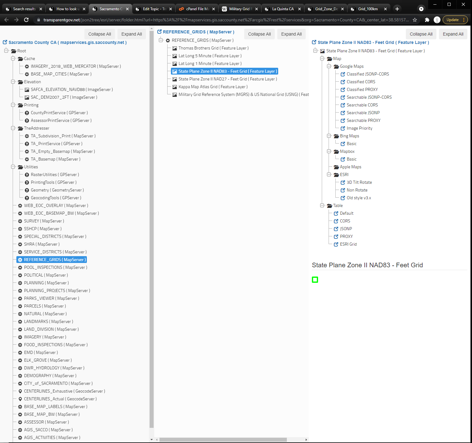
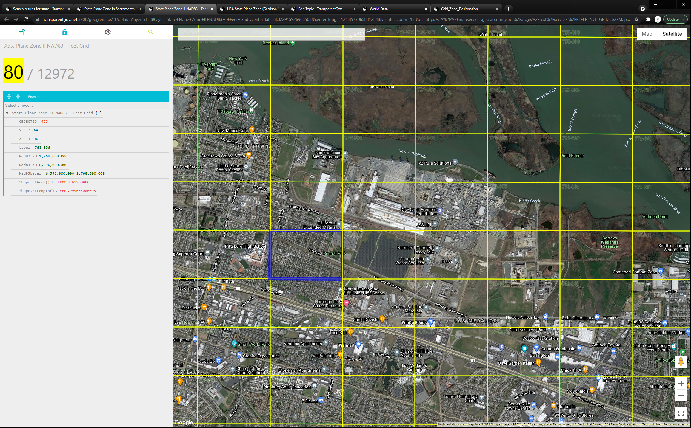
State Plane Feet Grid in Sacramento County CA
State Plane California Zone II NAD83 - Feet Grid
State Plane California Zone II NAD27 - Feet Grid
click here to open in a new tab