Step 1.
click download
https://cams-lacounty.hub.arcgis.com/pages/cams-data
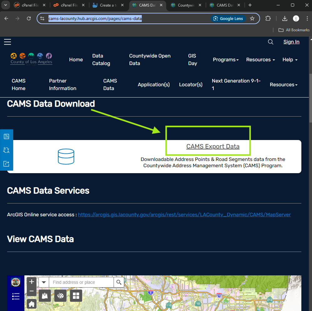
Step 2.
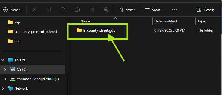
When unzip file, must use xxx.gdb as geodatabase folder name. Otherwise, Qgis would not read this folder.
Step 3.
Select feature intersect with city boundary, then export feature
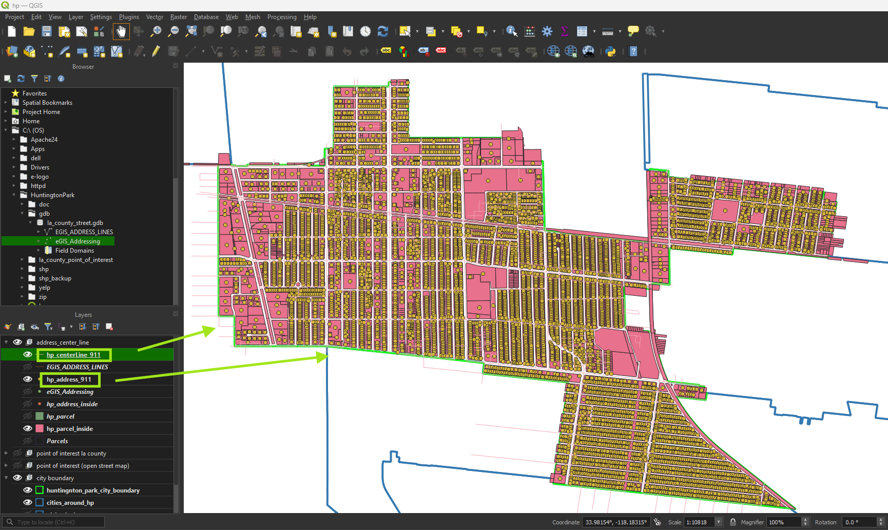
911 ng911 dispatch system CAD, need parcel, street center line, city boundary layers to work. These layers can be download from your county gis website.
Monthly parcel download GeoDatabase Zip file
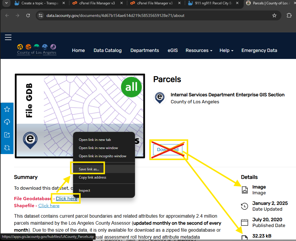
https://data.lacounty.gov/documents/4d67b154ae614d219c58535659128e71/about
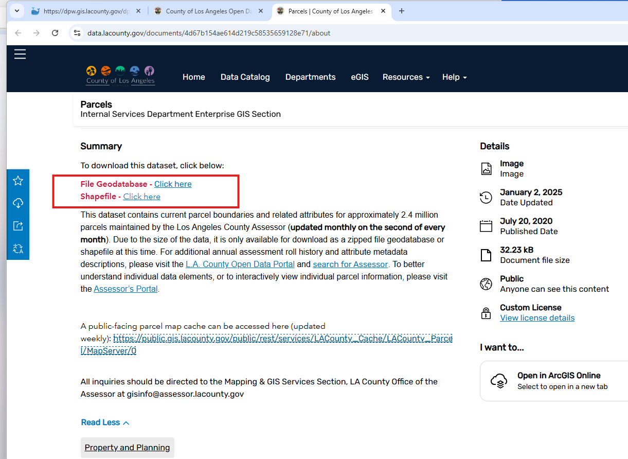
Don't click download button, it does not work, it is only a image, GIS admin just create a arcgis online image document item. Maybe the file size is too big or some other reason, GIS admin is not be able to create a zip file item. That is reason why download button not working. Instead, GIS admin put download link in Summary section.
Don't click "click here" link for download. It does not work.
If you right click "click here" then choose save link as Still does not work.
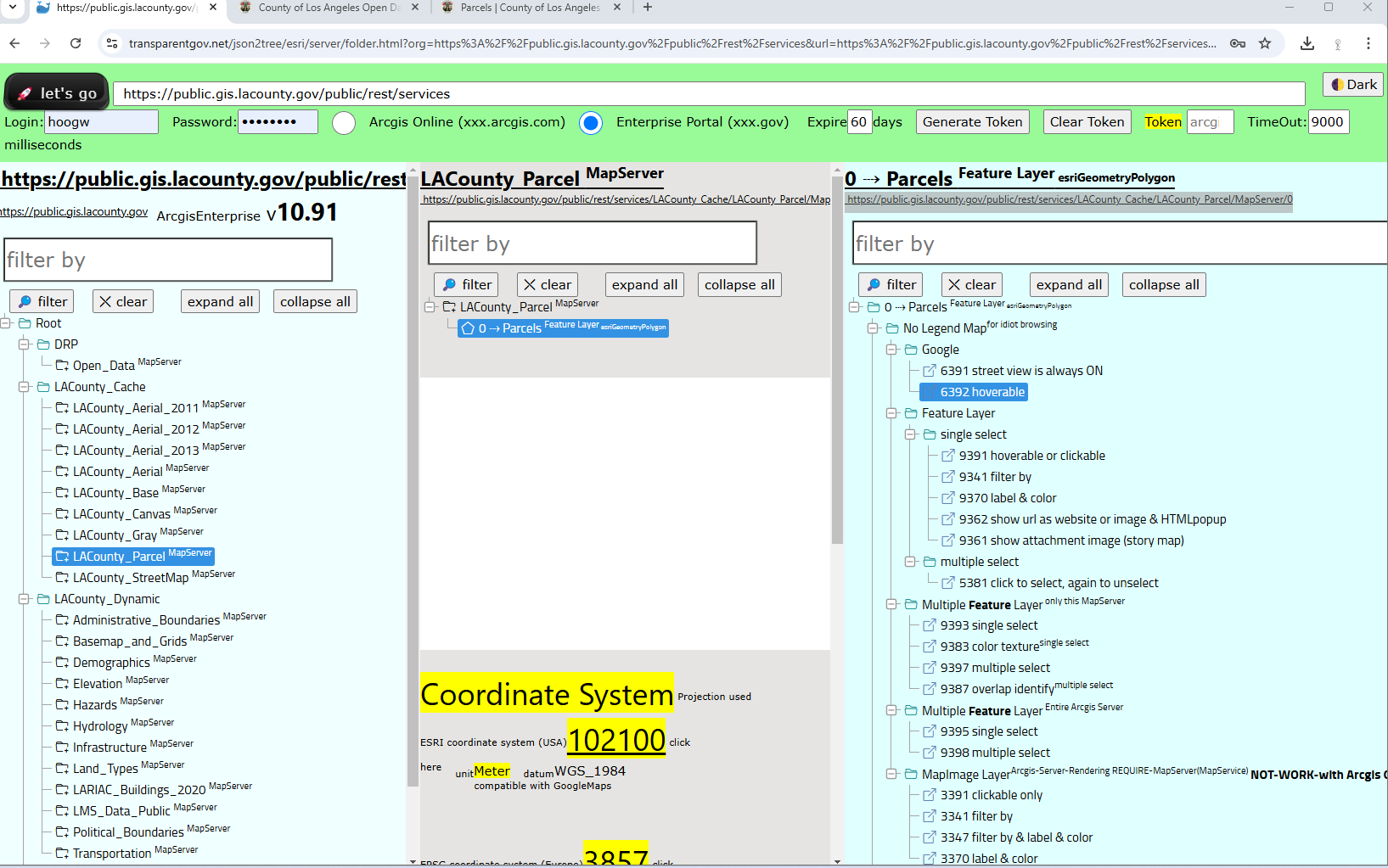
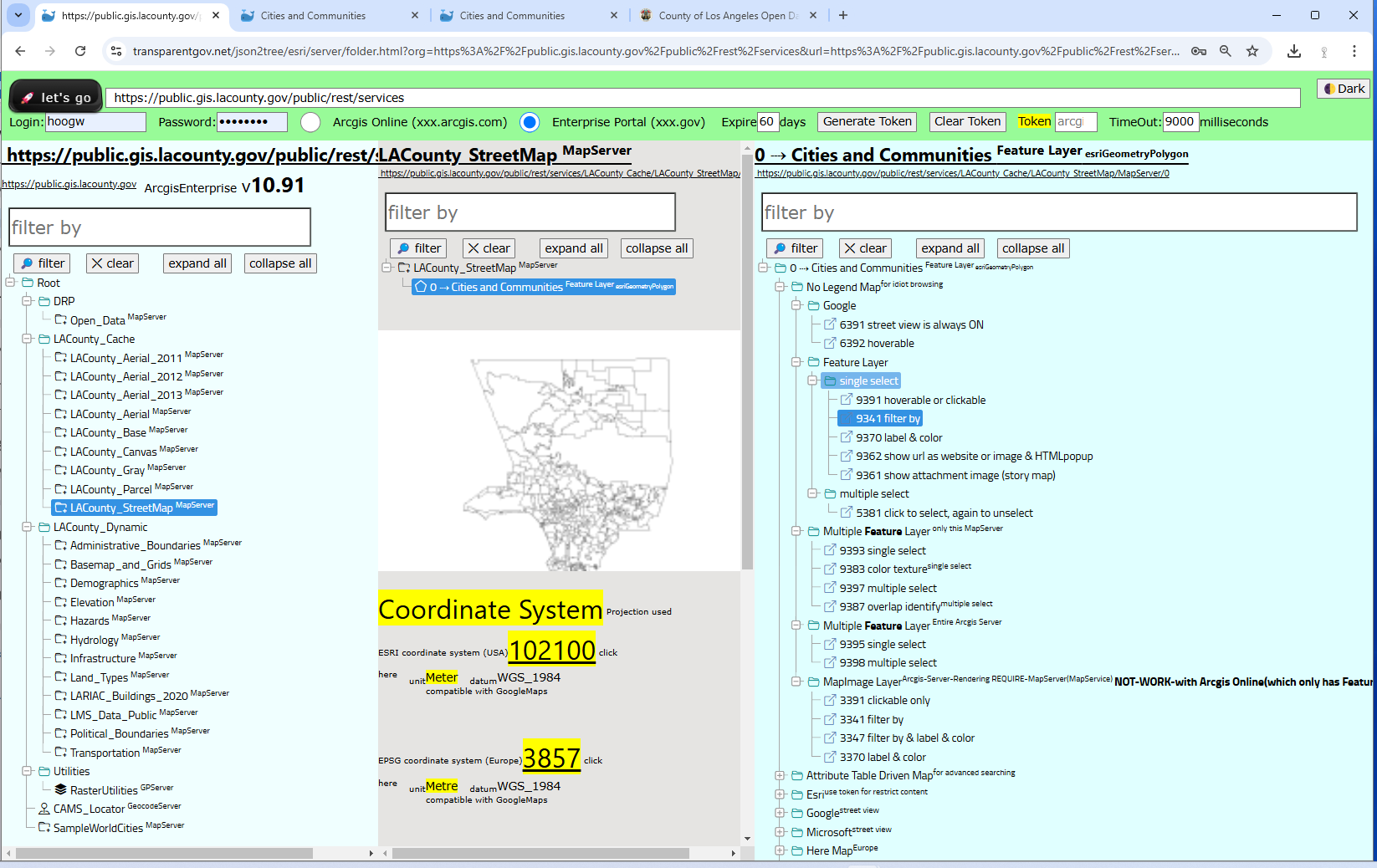
Parcel layer
https://public.gis.lacounty.gov/public/rest/services/LACounty_Cache/LACounty_Parcel/MapServer/0
Parcel layer on arcgis server
https://transparentgov.net/json2tree/esri/server/folder.html?org=https%3A%2F%2Fpublic.gis.lacounty.gov%2Fpublic%2Frest%2Fservices&url=https%3A%2F%2Fpublic.gis.lacounty.gov%2Fpublic%2Frest%2Fservices&arcgis_online_token=&timeout=9000&select_folder=27&select_layer=0&select_folder_text=LACounty_Parcel+%3Csup%3EMapServer%3C%2Fsup%3E&select_layer_text=0+%26%23x21E2%3B+Parcels+%3Csup%3EFeature+Layer%3Csub%3E+esriGeometryPolygon%3C%2Fsub%3E%3C%2Fsup%3E
https://transparentgov.net/json2tree/datahub.io/embed/featurelayer.html?backgroundlayerurl=https%3A%2F%2Fpublic.gis.lacounty.gov%2Fpublic%2Frest%2Fservices%2FLACounty_Cache%2FLACounty_Parcel%2FMapServer%2F0&layer=Parcels&clickorhover=click
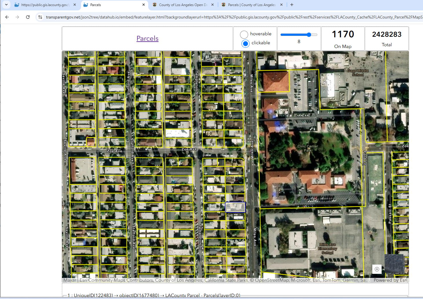
Note: this parcel layer do not have owner last name, first name. In order to get owner name, have to contact assessor office, to download monthly roll, joint table with parcel layer.
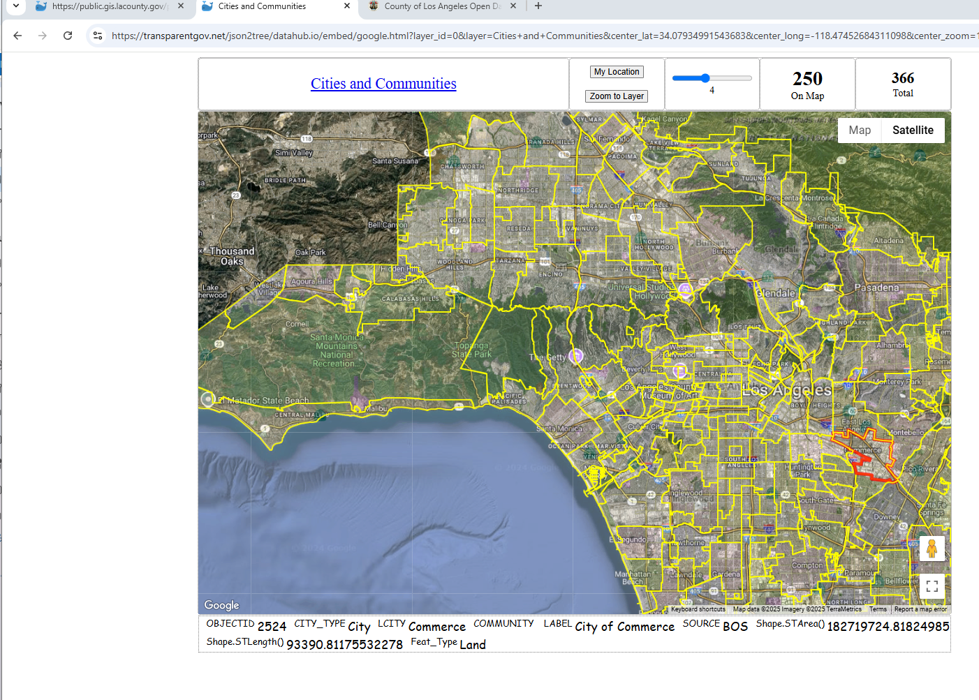
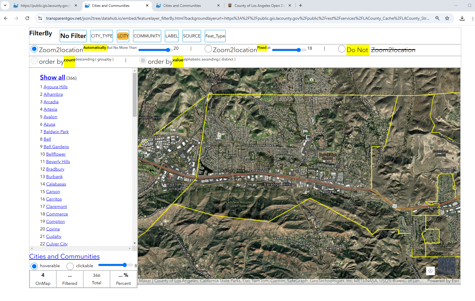
Los Angeles County City Boundary
6392
https://transparentgov.net/json2tree/datahub.io/embed/google.html?layer_id=0&layer=Cities+and+Communities¢er_lat=34.07934991543683¢er_long=-118.47452684311098¢er_zoom=11&url=https%3A%2F%2Fpublic.gis.lacounty.gov%2Fpublic%2Frest%2Fservices%2FLACounty_Cache%2FLACounty_StreetMap%2FMapServer&panto=0
9341
https://transparentgov.net/json2tree/datahub.io/embed/featurelayer_filterBy.html?backgroundlayerurl=https%3A%2F%2Fpublic.gis.lacounty.gov%2Fpublic%2Frest%2Fservices%2FLACounty_Cache%2FLACounty_StreetMap%2FMapServer%2F0&layer=Cities+and+Communities&select_field=1&select_fieldvalue=-1&distinctorgroupby=distinct&orderbycountorvalue=orderby_value
https://transparentgov.net/json2tree/esri/server/folder.html?org=https%3A%2F%2Fpublic.gis.lacounty.gov%2Fpublic%2Frest%2Fservices&url=https%3A%2F%2Fpublic.gis.lacounty.gov%2Fpublic%2Frest%2Fservices&arcgis_online_token=&timeout=9000&select_folder=28&select_layer=0&select_folder_text=LACounty_StreetMap+%3Csup%3EMapServer%3C%2Fsup%3E&select_layer_text=0+%26%23x21E2%3B+Cities+and+Communities+%3Csup%3EFeature+Layer%3Csub%3E+esriGeometryPolygon%3C%2Fsub%3E%3C%2Fsup%3E
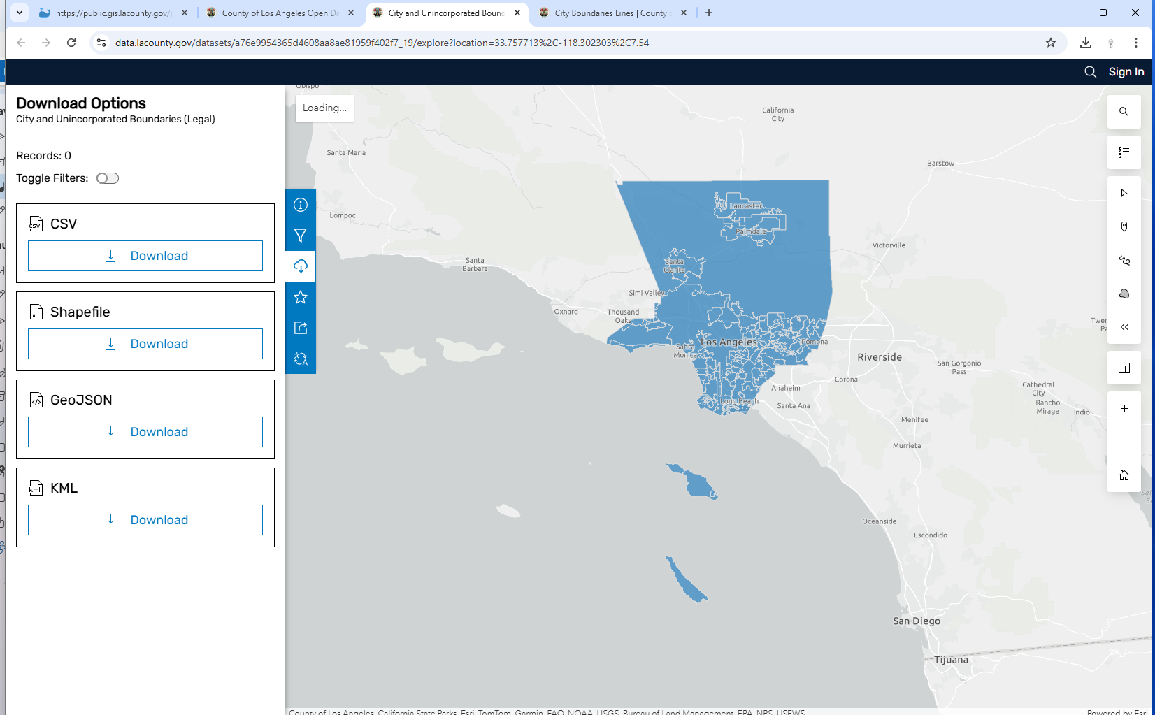
Download Geodatabase
https://data.lacounty.gov/datasets/a76e9954365d4608aa8ae81959f402f7_19/explore?location=33.771074%2C-118.302303%2C7.54
Alternatively, this public work arcgis server is not visible due to gis admin limit same origin.
Download shape file at
https://data.lacounty.gov/datasets/lacounty::city-boundaries-lines/about
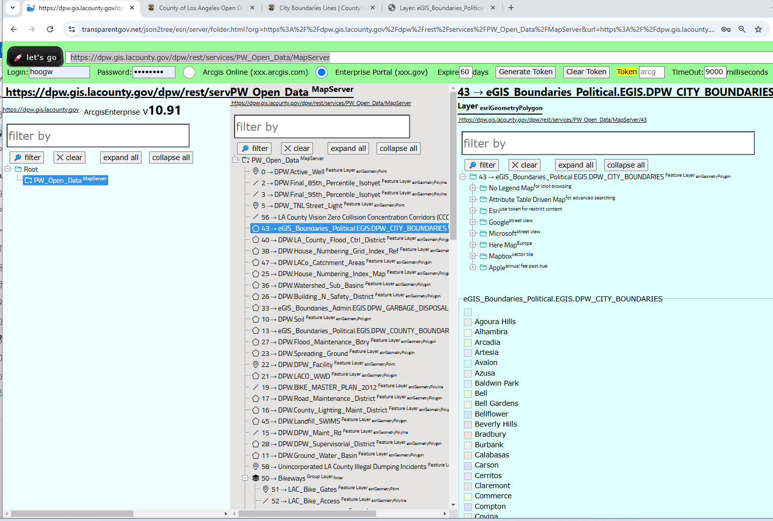
Layer source
https://dpw.gis.lacounty.gov/dpw/rest/services/PW_Open_Data/MapServer/43
Public work arcgis server
https://dpw.gis.lacounty.gov/dpw/rest/services/PW_Open_Data/MapServer
https://transparentgov.net/json2tree/esri/server/folder.html?org=https%3A%2F%2Fdpw.gis.lacounty.gov%2Fdpw%2Frest%2Fservices%2FPW_Open_Data%2FMapServer&url=https%3A%2F%2Fdpw.gis.lacounty.gov%2Fdpw%2Frest%2Fservices%2FPW_Open_Data%2FMapServer&arcgis_online_token=&timeout=9000&select_folder=1&select_layer=43&select_folder_text=PW_Open_Data+%3Csup%3EMapServer%3C%2Fsup%3E&select_layer_text=43+%26%23x21E2%3B+eGIS_Boundaries_Political.EGIS.DPW_CITY_BOUNDARIES+%3Csup%3EFeature+Layer%3Csub%3E+esriGeometryPolygon%3C%2Fsub%3E%3C%2Fsup%3E
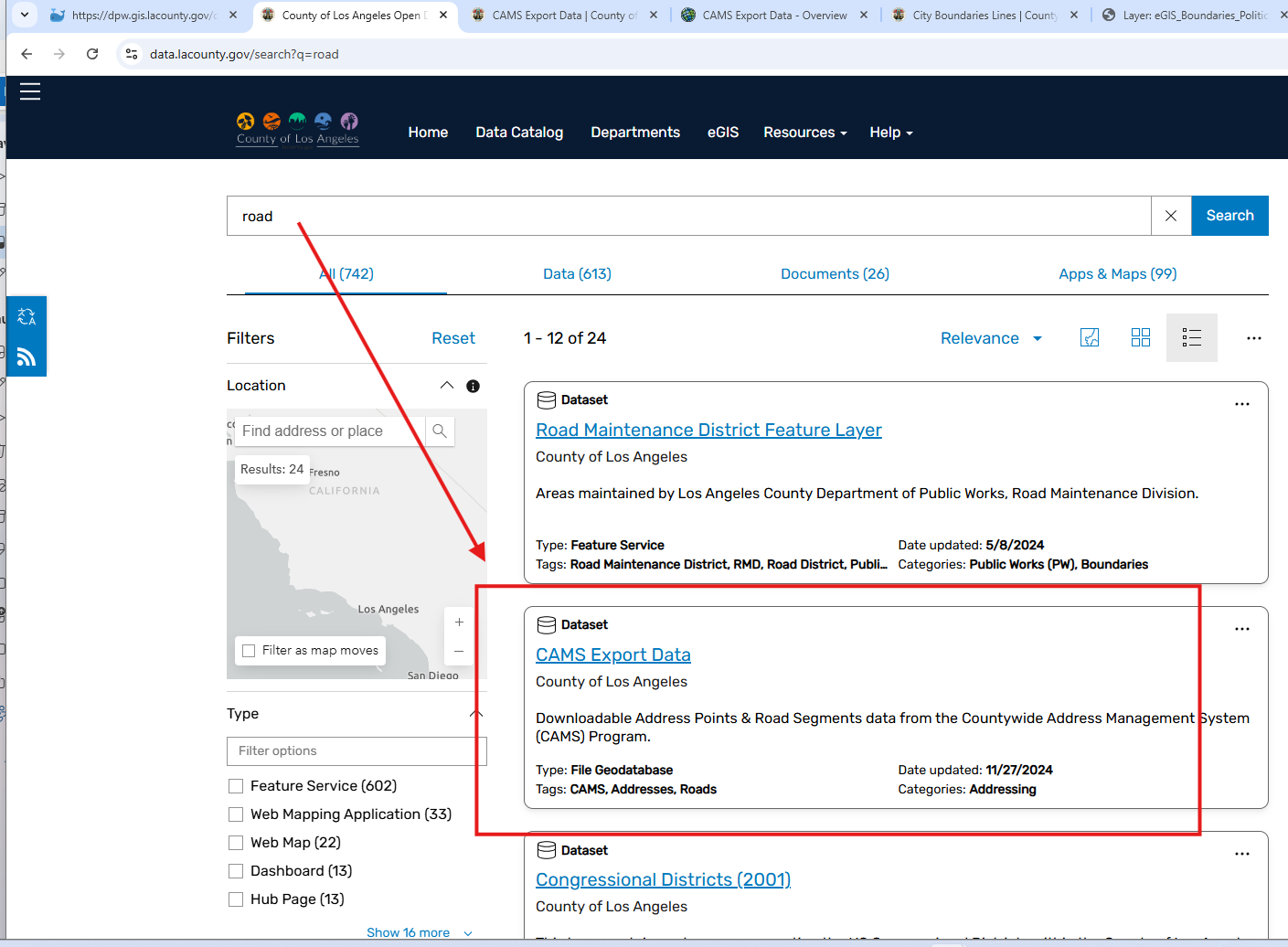
Road Street center line
Download geodatabase
https://data.lacounty.gov/search?q=road
Layer source at
https://dpw.gis.lacounty.gov/dpw/rest/services/road/MapServer/1