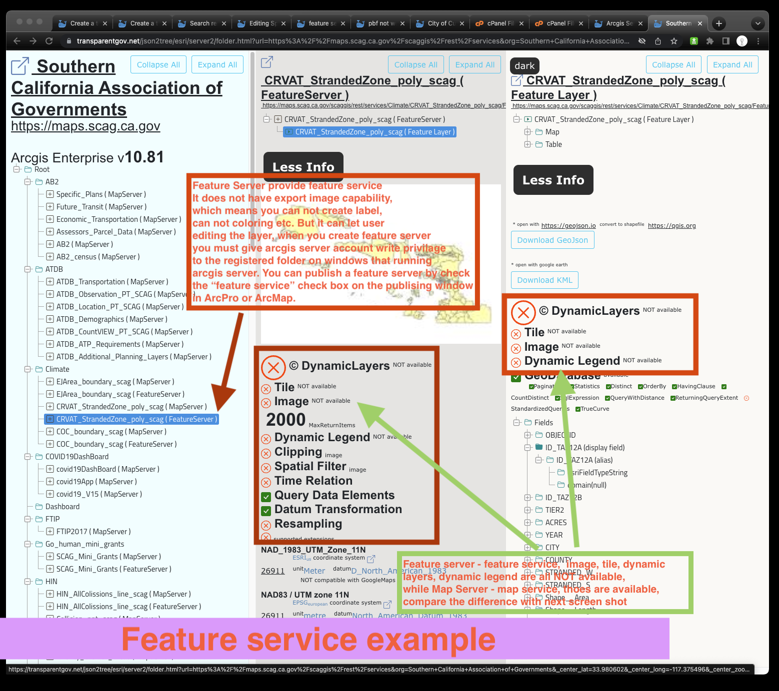
Feature Server Feature Service
https://transparentgov.net/json2tree/esri/server2/folder.html?url=https%3A%2F%2Fmaps.scag.ca.gov%2Fscaggis%2Frest%2Fservices&org=Southern+California+Association+of+Governments&_center_lat=33.980602&_center_long=-117.375496&_center_zoom=17&select_folder=126&select_layer=0
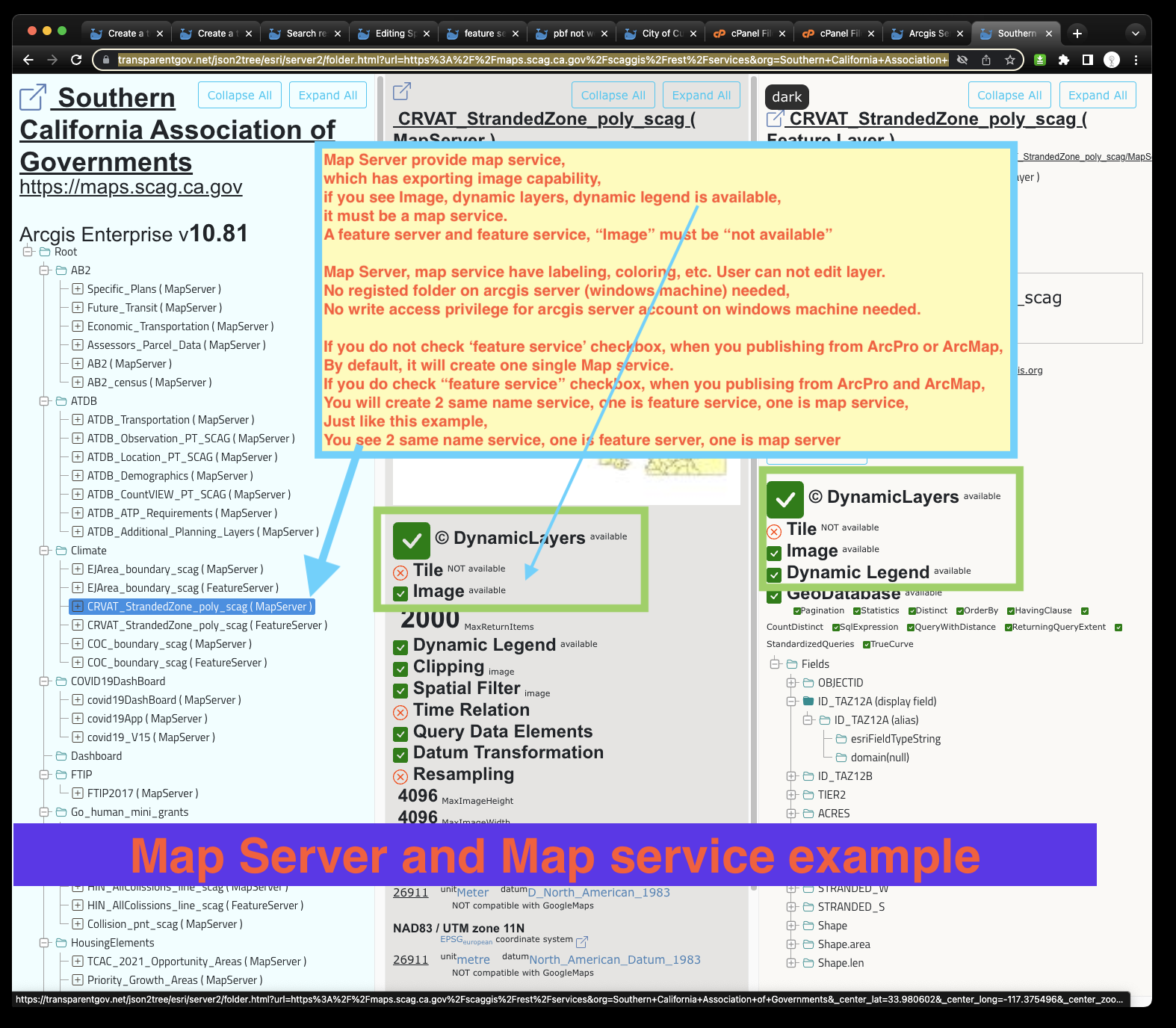
Map Server and Map service
https://transparentgov.net/json2tree/esri/server2/folder.html?url=https%3A%2F%2Fmaps.scag.ca.gov%2Fscaggis%2Frest%2Fservices&org=Southern+California+Association+of+Governments&_center_lat=33.980602&_center_long=-117.375496&_center_zoom=17&select_folder=125&select_layer=0
See my other post about Feature Server, Feature Service
https://transparentgov.net/cleargov1/873/editing-spatial-data-with-feature-server?show=873#q873
https://transparentgov.net/cleargov1/965/feature-server-does-not-have-tile-and-image-only-feature-data?show=965#q965
https://transparentgov.net/cleargov1/940/pbf-not-work-with-mapserver-but-work-with-featureserver?show=940#q940
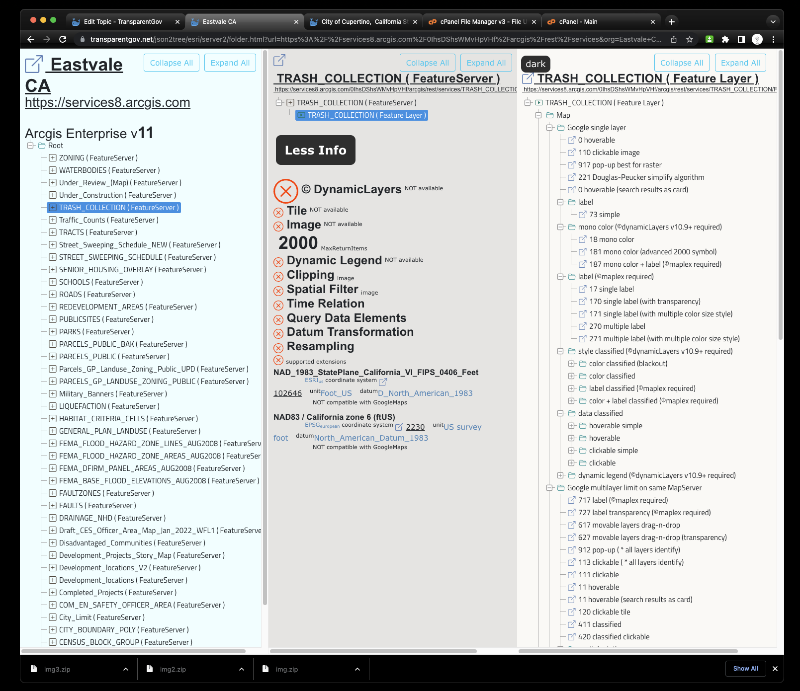
Eastvale CA, all feature service at the time, no map service found
https://transparentgov.net/json2tree/esri/server2/folder.html?url=https%3A%2F%2Fservices8.arcgis.com%2F0IhsDShsWMvHpVHf%2Farcgis%2Frest%2Fservices&org=Eastvale+CA&_center_lat=33.9525&_center_long=-117.5848&_center_zoom=17&select_folder=6&select_layer=
The good news is even all ESRI powered server side coloring, labeling, legend, styling are not exist in feature service, you still can create browser side google coloring, google labeling, google legend, google styling.
Feature service lacking of color styling, labeling is bad. The other side of bad is always good. The good is, feature service lacking of styling is non-opinioned. Which gives the public user opportunity to customize the color and label the way they needed.
Feature service is plain no color, no label. Like the children's coloring book, only had outline of the shape, children can paint color. You can create the color and label the way you like on feature service. You can save your color and label by copy past URL address to bookmark or anywhere.
Map service is opinioned, which means, map author when creating this map in ArcMap or ArcPro already paint the color and label the way they want. It may not be your interest. You of course can customize further color and label by using dynamicLayers.