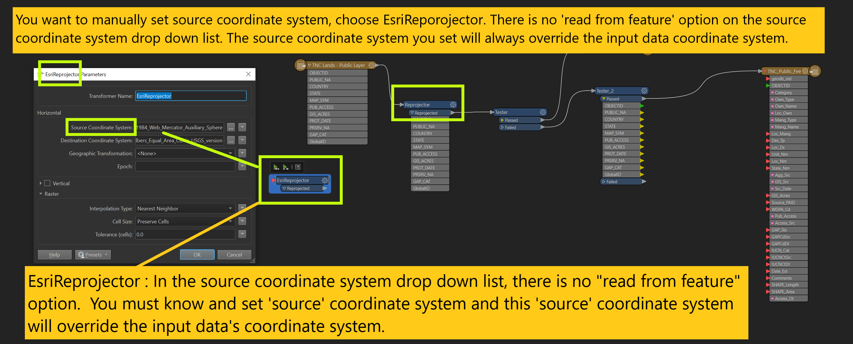
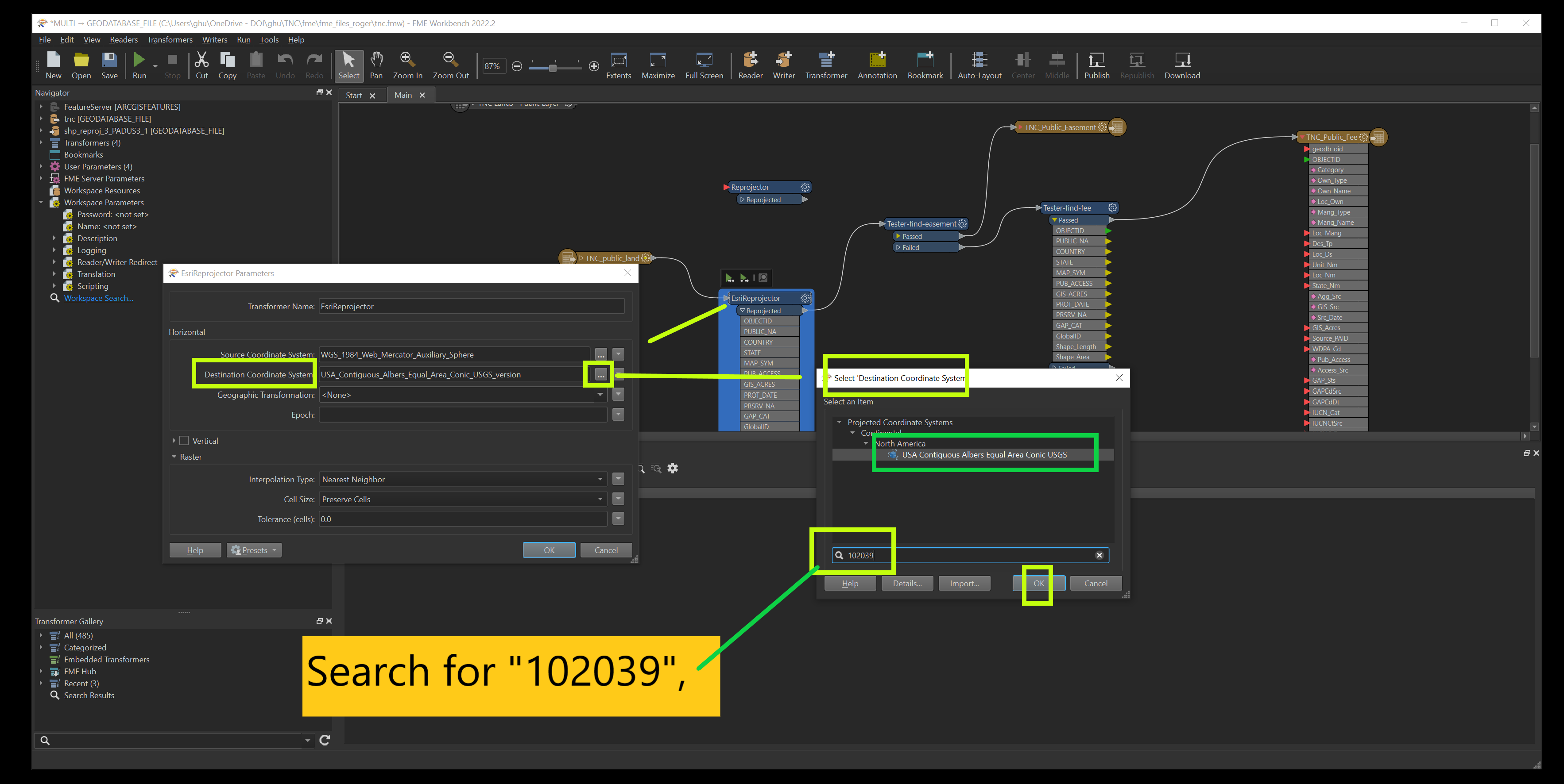
EsriReprojector
If you want to manually set source coordinate system, choose EsriReporojector
There is no 'read from feature' option on the source coordinate system drop down list.
The source
coordinate system you set will always override the input data coordinate system, no matter what.
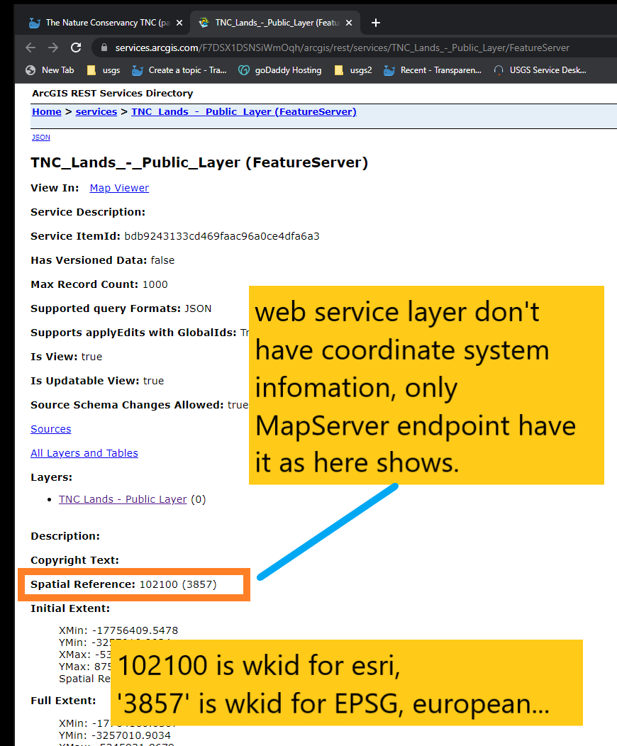
1) esriReprojector required you know the source coordinate system, but where to find source coordinate system from a web service endpoint?
https://services.arcgis.com/F7DSX1DSNSiWmOqh/arcgis/rest/services/TNC_Lands_-_Public_Layer/FeatureServer
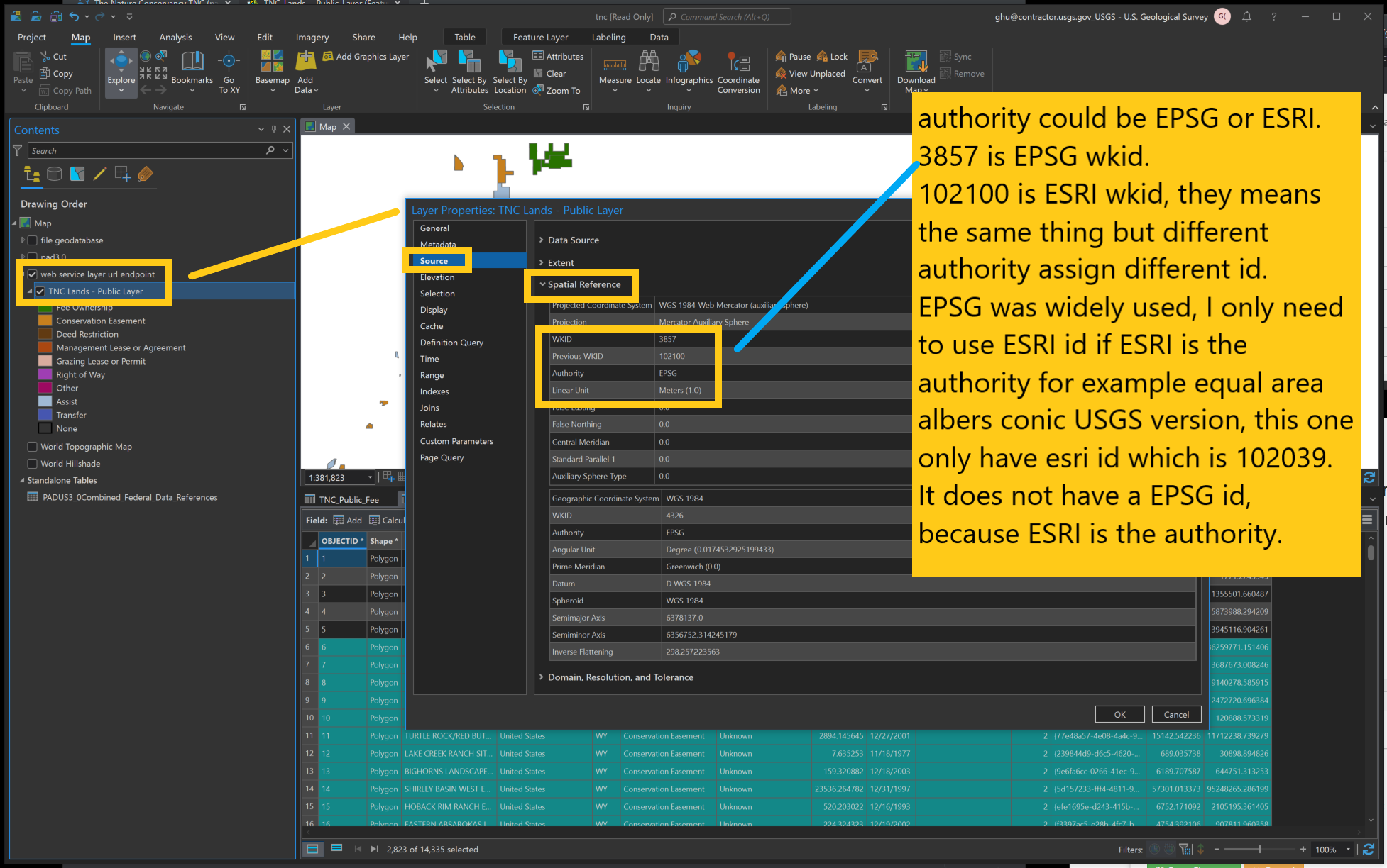
2) esriReprojector required you know the source coordinate system, but where to find source coordinate system from ArcPro?
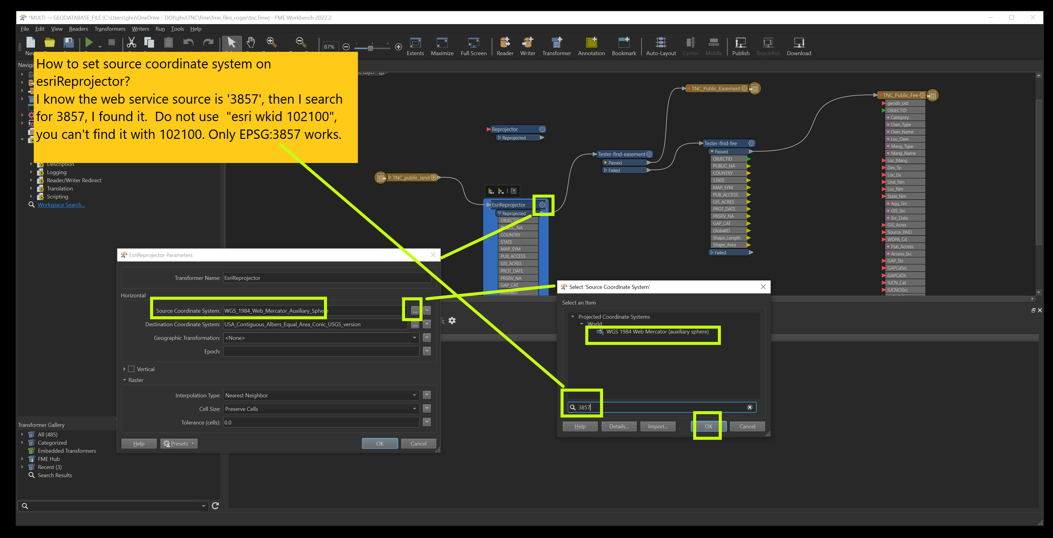
3) How to set target source coordinate system in esriReprojector?
My target coordinate system is 102039, how to find out click here https://transparentgov.net/cleargov1/1172/reproject-coordinate-system-different-version-coordinate
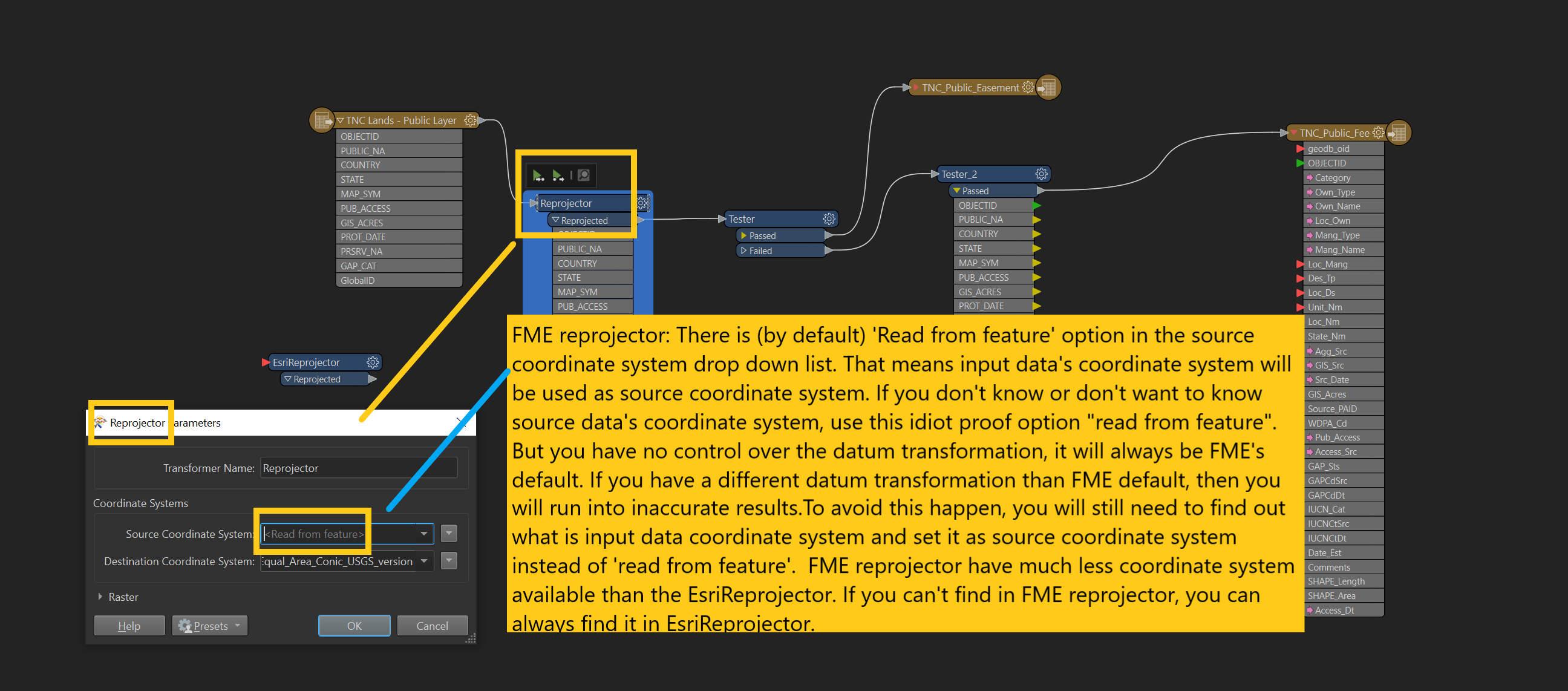
FME reprojector (cs-map)
There is (by default) 'Read from feature' option in the source coordinate system drop down list. That means input data's coordinate system will be used as source coordinate system. If you don't know or don't want to know source data's coordinate system, use this idiot proof option "read from feature". But you have no control over the datum transformation, it will always be FME's default. If you have a different datum transformation than FME default, then you will run into inaccurate results.To avoid this happen, you will still need to find out what is input data coordinate system and set it as source coordinate system instead of 'read from feature'. FME reprojector have much less coordinate system available than the EsriReprojector. If you can't find in FME reprojector, you can always find it in EsriReprojector.
FME Reprojector vs EsriReprojector
https://community.safe.com/s/question/0D54Q000080hduJSAQ/esrireprojectot-vs-reprojector
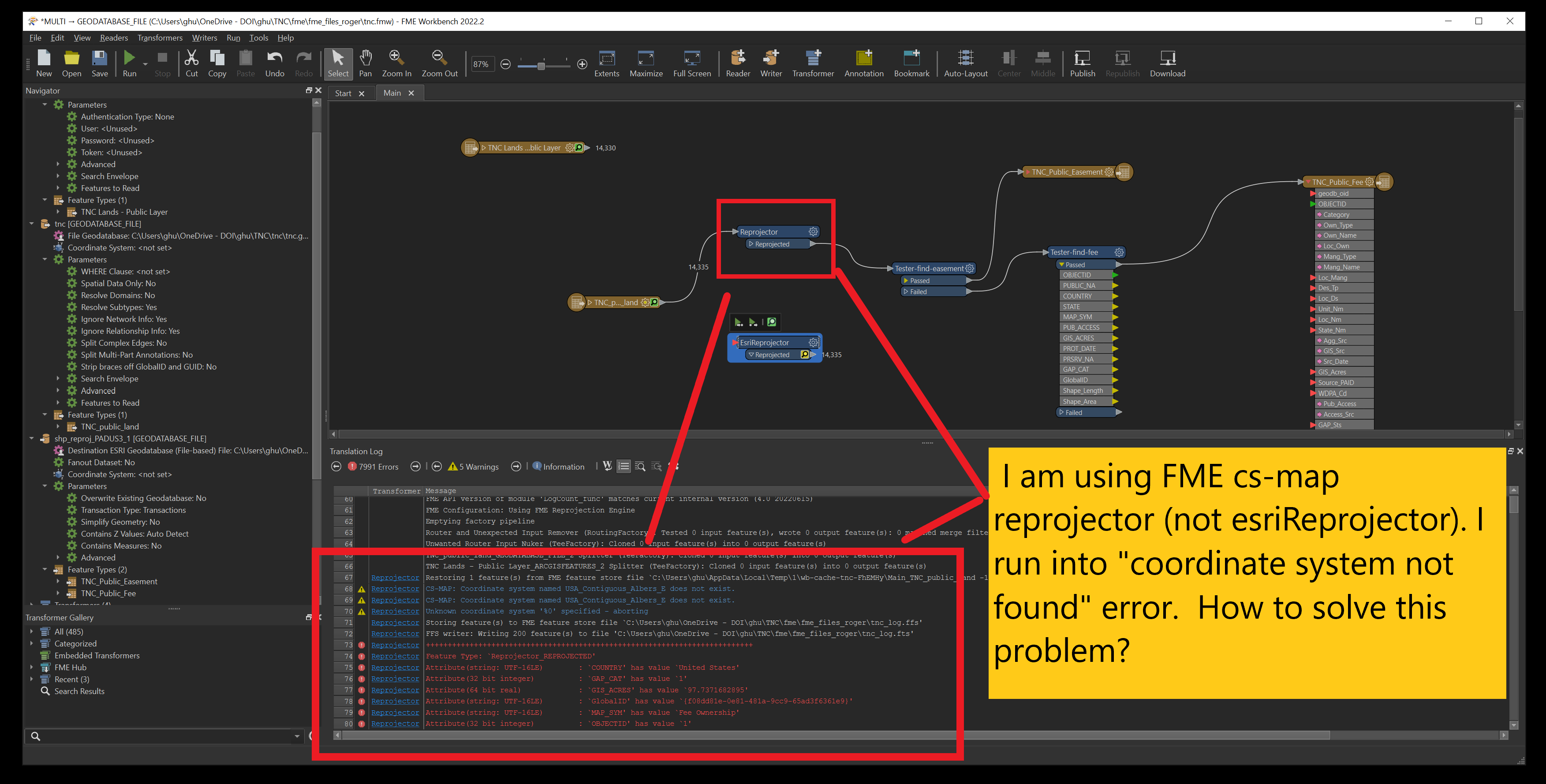
Due to FME reprojector only have a few coordinate system available. You will very likely see "coordinate system not found" error when using (FME cs-map) reprojector as below screen shows.
I need this coordinate system,
USA_Contiguous_Albers_Equal_Area_Conic_USGS
see here
https://transparentgov.net/cleargov1/1172/reproject-coordinate-system-different-version-coordinate
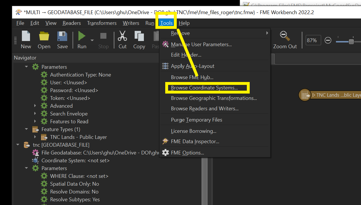
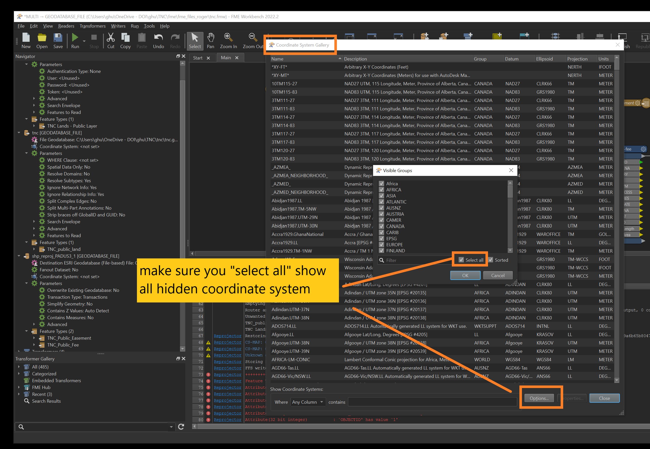
If FME reprojector missing coordinate system, first to check 2 coordinate system file FME using, make sure their are not hidding.
Missing Coordinate System
https://community.safe.com/s/article/missing-coordinate-system
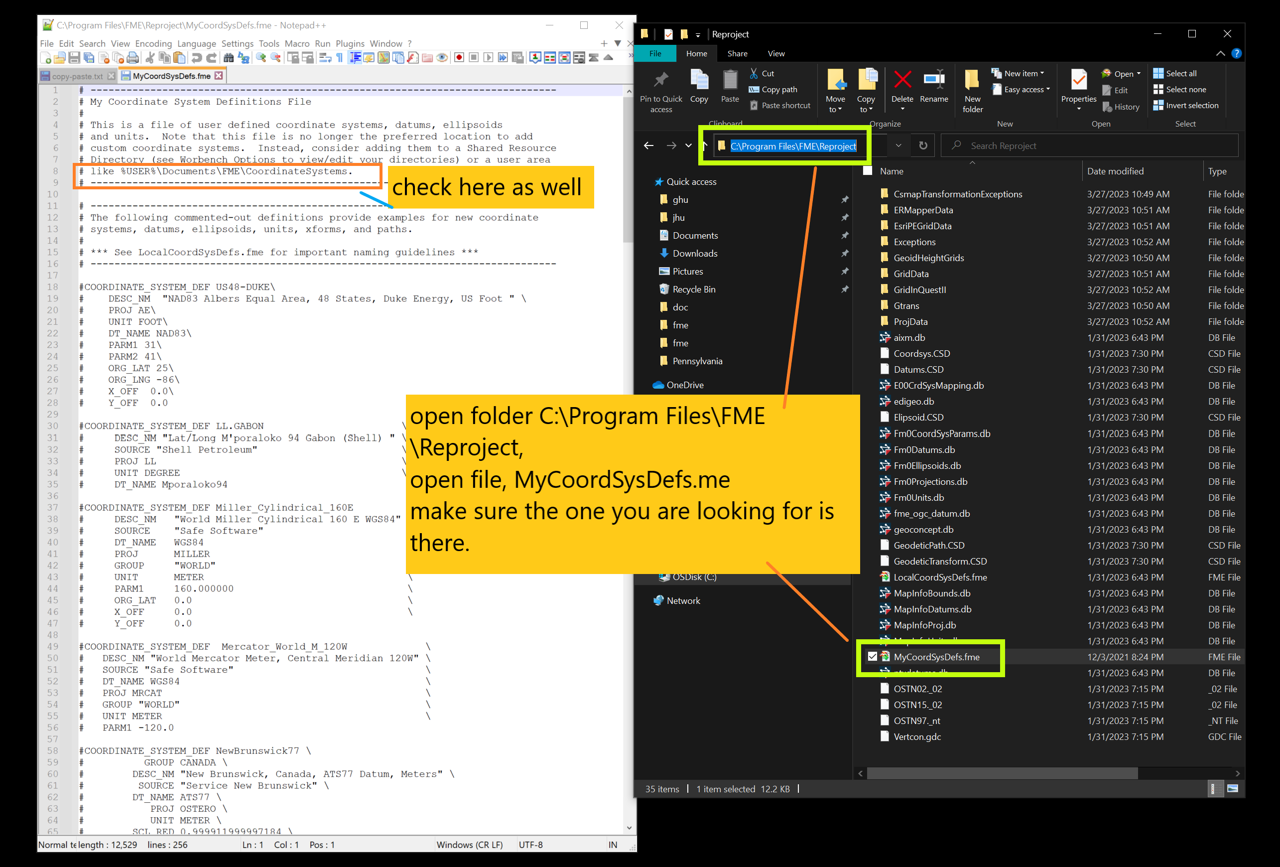
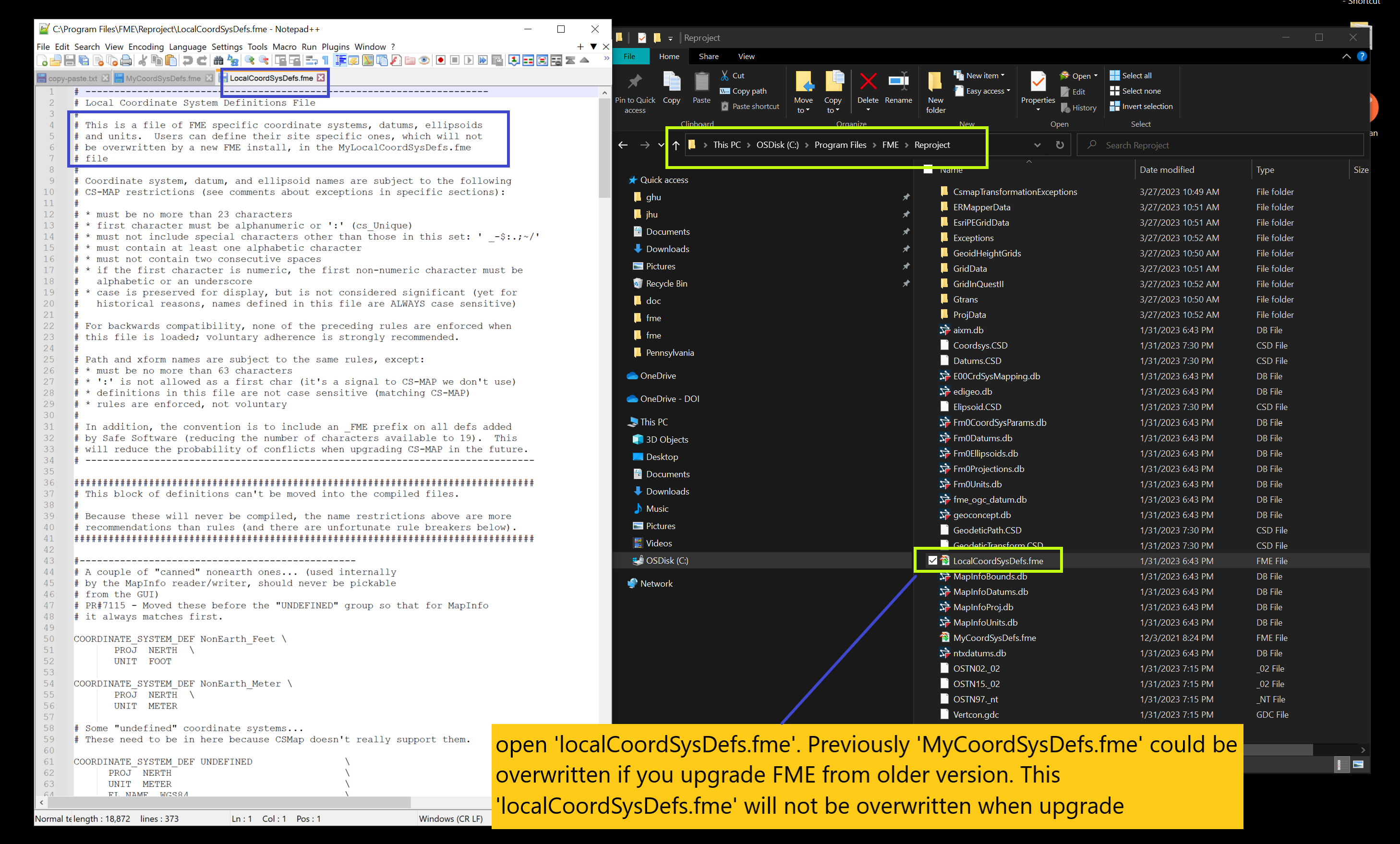
By checking both files, still could not find the coordinate system I need.
Next step, how to
Adding Custom Coordinate Systems to FME
see here https://transparentgov.net/cleargov1/1171/fme-add-custom-coordinate-systems
Warning:
If you use esriReprojector
you don't need add custom coordinate systems to FME because esriReprojector already have this coordinate system.
USA_Contiguous_Albers_Equal_Area_Conic_USGS authority is ESRI, so it has esri wkid, don't have epsg wkid.