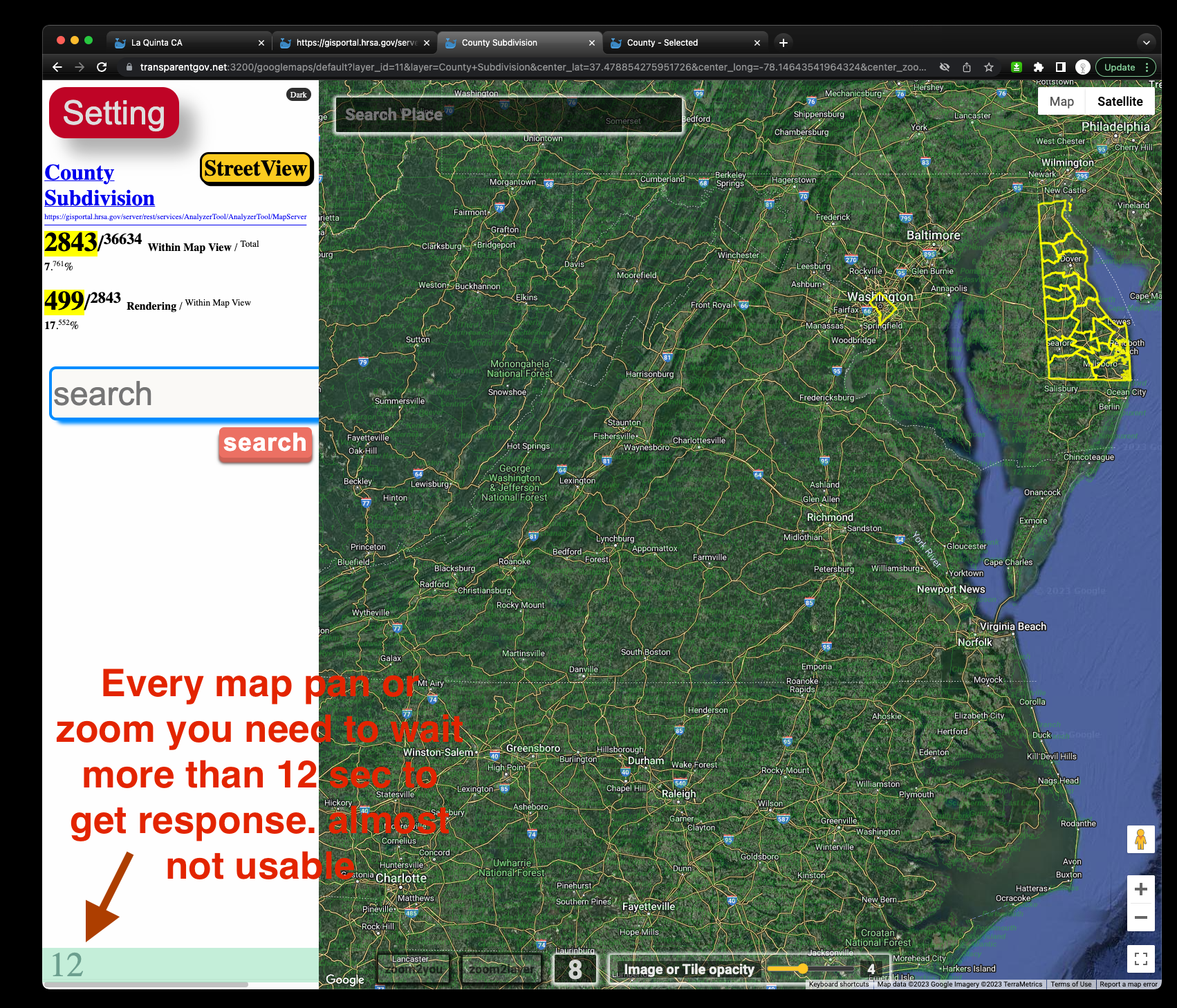
When you publish layers, by default, ESRI set 1000 or 2000 as
max return count. Which is way too large specially if you have huge amount of data.
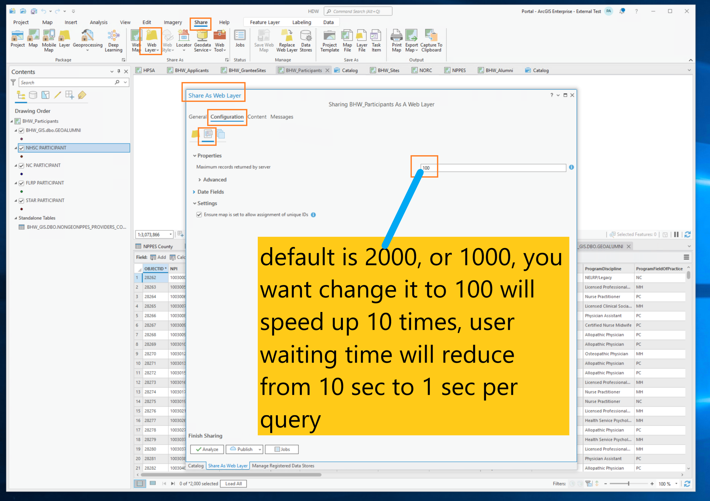
If you lower this number to 100, you will get speed up instantly, 10 times faster.
By change it to 100, it will not noticeble by user. It will not have any negative impact to user. The only noticable effect by user is they will feel "lighting fast" now.
Good example from La Quinta, set as 50
If I don't do anything, it is 1000, it is way too laggy. Almost not usable. I tried 500, much better. I then tried 100, even much better. Not enough? I set it as 50, that is fastest speed I can get. I tried 20, 10, that would not get faster than 50. So I decide 50 is best number for this arcgis server. Your arcgis server may have faster CPU frequency, more core, more RAM. 100, 200 could be your best number. More computing power of the server machine in theory should have more capacity, you can increase this number to fit its capacity. To find out exactly number, you have to try test its speed with different setting, 100, 200, 300, 500... then decide what number is best for your arcgis server.
https://transparentgov.net/json2tree/esri/server/folder.html?url=https%3A%2F%2Fgis.la-quinta.org%2Farcgis%2Frest%2Fservices&org=La+Quinta+CA&_center_lat=33.6634&_center_long=-116.31&_center_zoom=17&select_folder=34&select_layer=5

1 How to do it in ArcPro

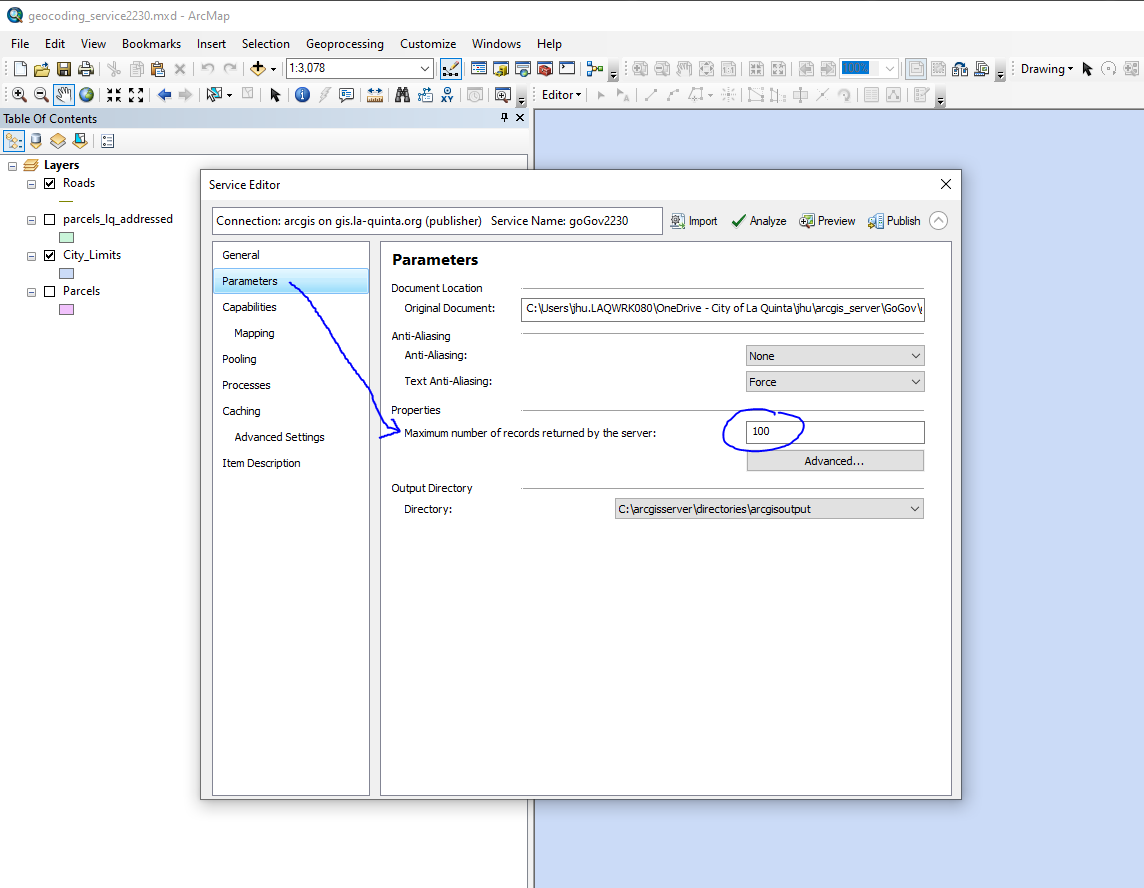
2 How to do it in ArcMap
ArcMap --> File --> Share as --> service
Service Editor --> click Parameters --> lower the default number 1000 to 100
Done. No more laggy.
3 How to do it in Arcgis server manager
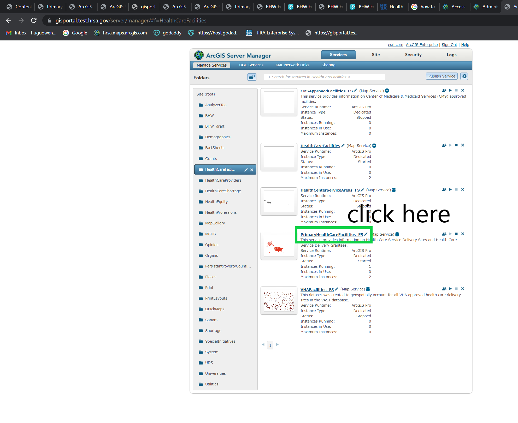
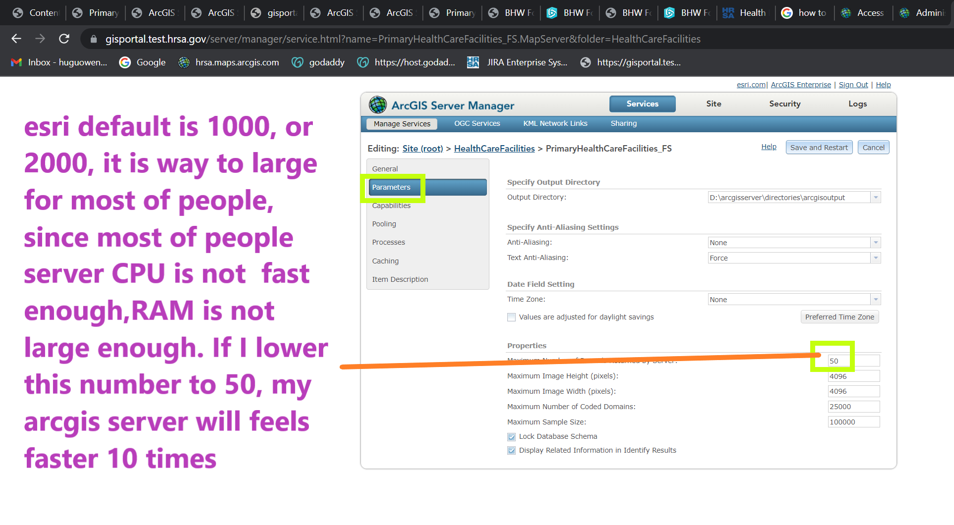
Or you can do it by Arcgis REST api remotely. see details:
You can use the ArcGIS REST API to edit the properties of an existing service
https://enterprise.arcgis.com/en/server/10.8/administer/linux/example-edit-service-properties.htm
Update Definition (Feature Service)
https://developers.arcgis.com/rest/services-reference/online/update-definition-feature-service-.htm
4 How to do it on Arcgis online
by arcgis online admin page (url)
https://community.esri.com/t5/arcgis-online-questions/increase-max-record-count-for-content-features/td-p/43132
How to increase the number of features returned by an ArcGIS Online feature service
https://gis.stackexchange.com/questions/179017/how-to-increase-the-number-of-features-returned-by-an-arcgis-online-feature-serv
Bad example from USGS, use esri default 2000
https://transparentgov.net/json2tree/esri/server2/folder.html?url=https%3A%2F%2Fgis.usgs.gov%2Fpadus%2Frest%2Fservices&org=USGS+Protected+Areas+PAD%2C%26nbsp%3B%26nbsp%3B&cross=default&timeout=10000&select_folder=11&select_layer=0
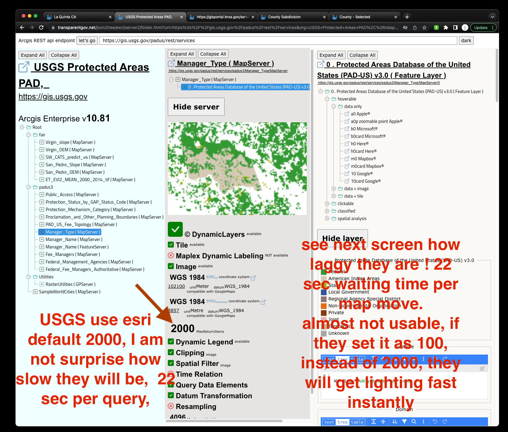
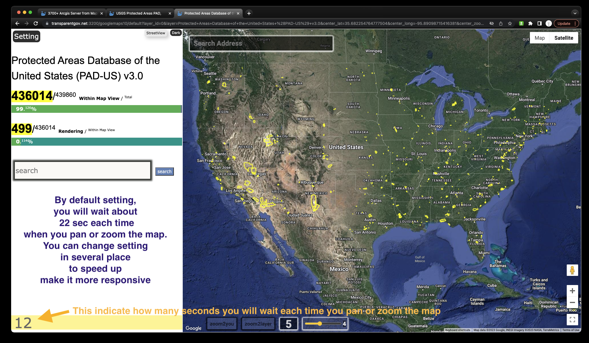
slowest speed as about 22 seconds waiting time for each map move
https://transparentgov.net:3200/googlemaps10/default?layer_id=0&layer=Protected+Areas+Database+of+the+United+States+%28PAD-US%29+v3.0¢er_lat=35.43199747063036¢er_long=-96.37438559166381¢er_zoom=5&url=https%3A%2F%2Fgis.usgs.gov%2Fpadus%2Frest%2Fservices%2Fpadus3%2FManager_Type%2FMapServer&overlayType=overlayType_none&panto=0
Bad example from HRSA, use esri default 1000
https://transparentgov.net/json2tree/esri/server/folder.html?org=https%3A%2F%2Fgisportal.hrsa.gov%2Fserver%2Frest%2Fservices&url=https%3A%2F%2Fgisportal.hrsa.gov%2Fserver%2Frest%2Fservices&select_folder=118&select_layer=12
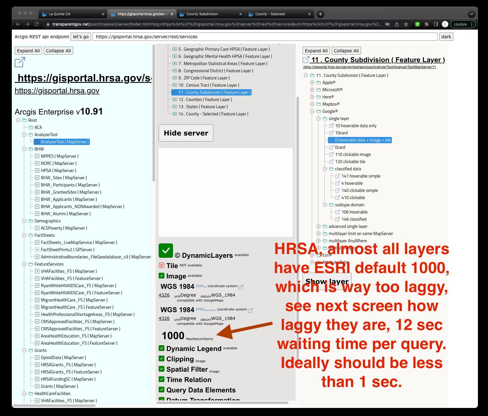
https://transparentgov.net:3200/googlemaps/default?layer_id=11&layer=County+Subdivision¢er_lat=33.561614029507524¢er_long=-78.85230700167449¢er_zoom=7&url=https%3A%2F%2Fgisportal.hrsa.gov%2Fserver%2Frest%2Fservices%2FAnalyzerTool%2FAnalyzerTool%2FMapServer&overlayType=overlayType_image&panto=0
