pad us official web map
https://maps.usgs.gov/padusdataexplorer/#/designation-type
The arcgis web service endpoint is actually hosted on ESRI server, not USGS server
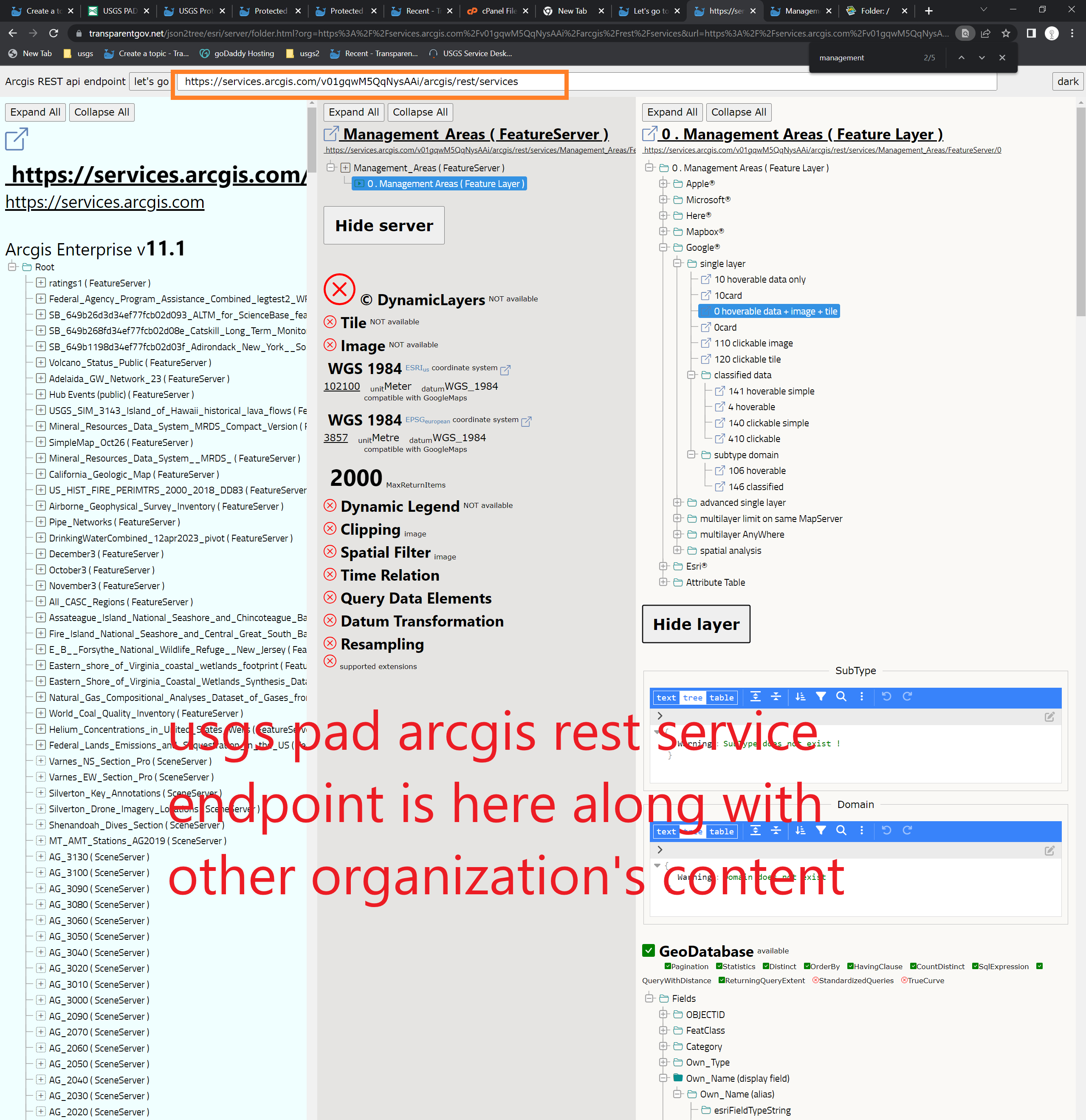
https://services.arcgis.com/v01gqwM5QqNysAAi/ArcGIS/rest/services
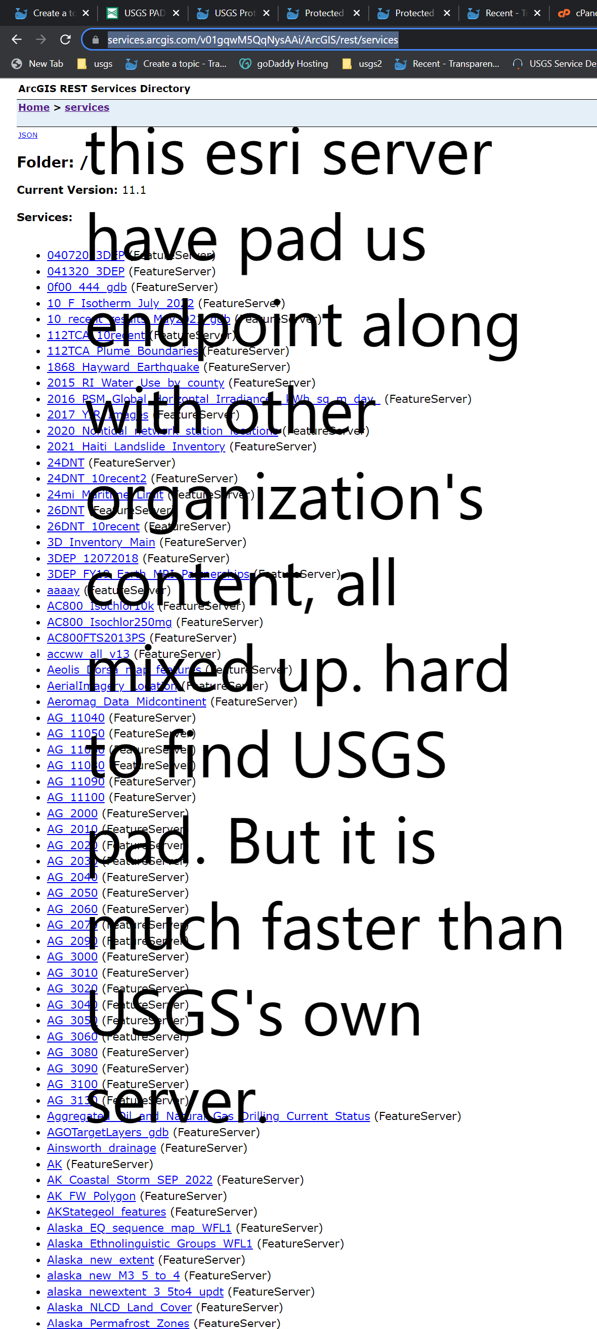
We should use this link to explore pad us. Since it mixed with other organization's content, you have to find pad.
https://transparentgov.net/json2tree/esri/server/folder.html?org=https%3A%2F%2Fservices.arcgis.com%2Fv01gqwM5QqNysAAi%2Farcgis%2Frest%2Fservices&url=https%3A%2F%2Fservices.arcgis.com%2Fv01gqwM5QqNysAAi%2Farcgis%2Frest%2Fservices&select_folder=678&select_layer=0
pad arcgis rest service endpoint on usgs server is too slow. The good thing is it has color symbol, label, traditional tiles, which are not available on ESRI hosted server.
https://transparentgov.net/json2tree/esri/server/folder.html?url=https%3A%2F%2Fgis.usgs.gov%2Fpadus%2Frest%2Fservices&org=USGS+Protected+Areas+PAD%2C%26nbsp%3B%26nbsp%3B&cross=default&timeout=10000&select_folder=14&select_layer=0
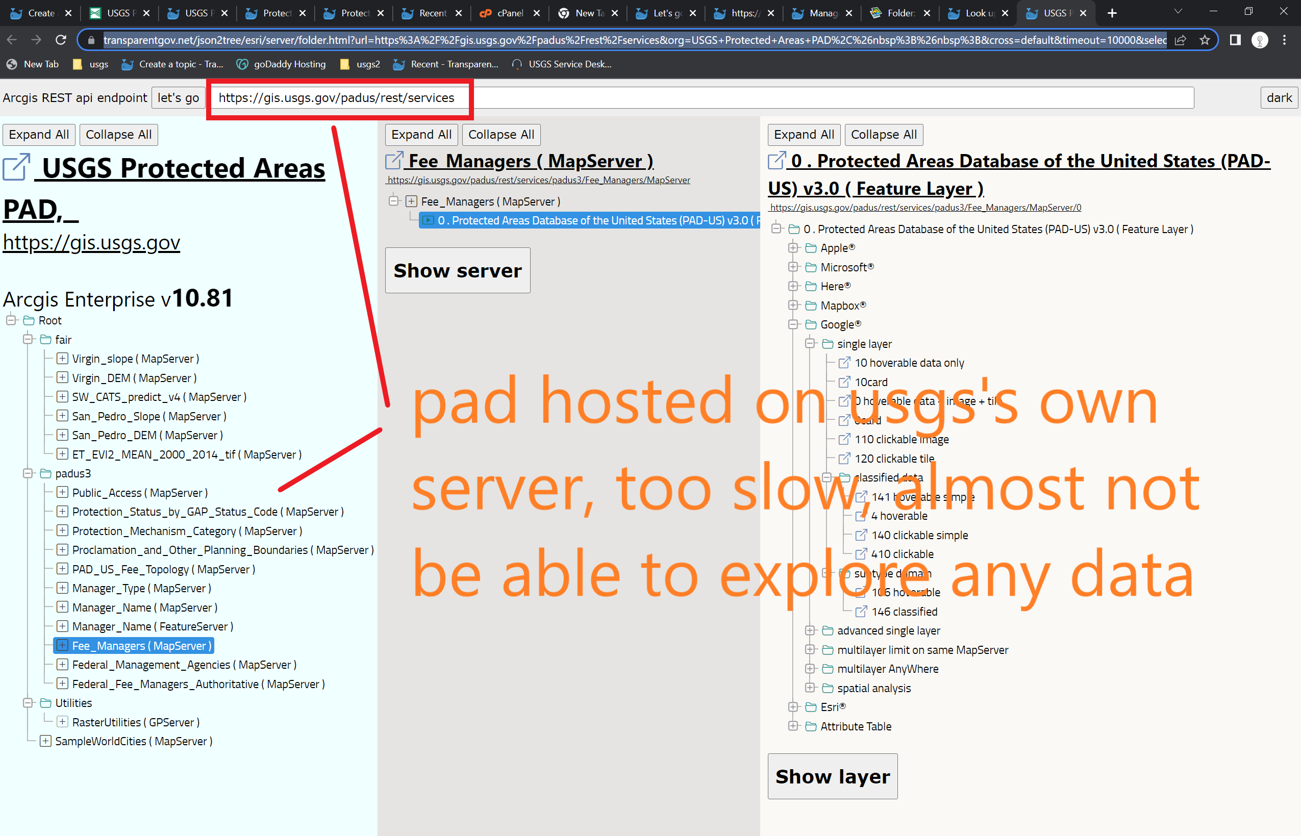
Warning: ESRI hosted web service only support Feature Service, do not support Map Service. That means, you will not have color, not have label, not have traditional tiles( except vector tile). Color, symbol, label only available at Map Service, which is only available at USGS server.