1. add excel table to map frame
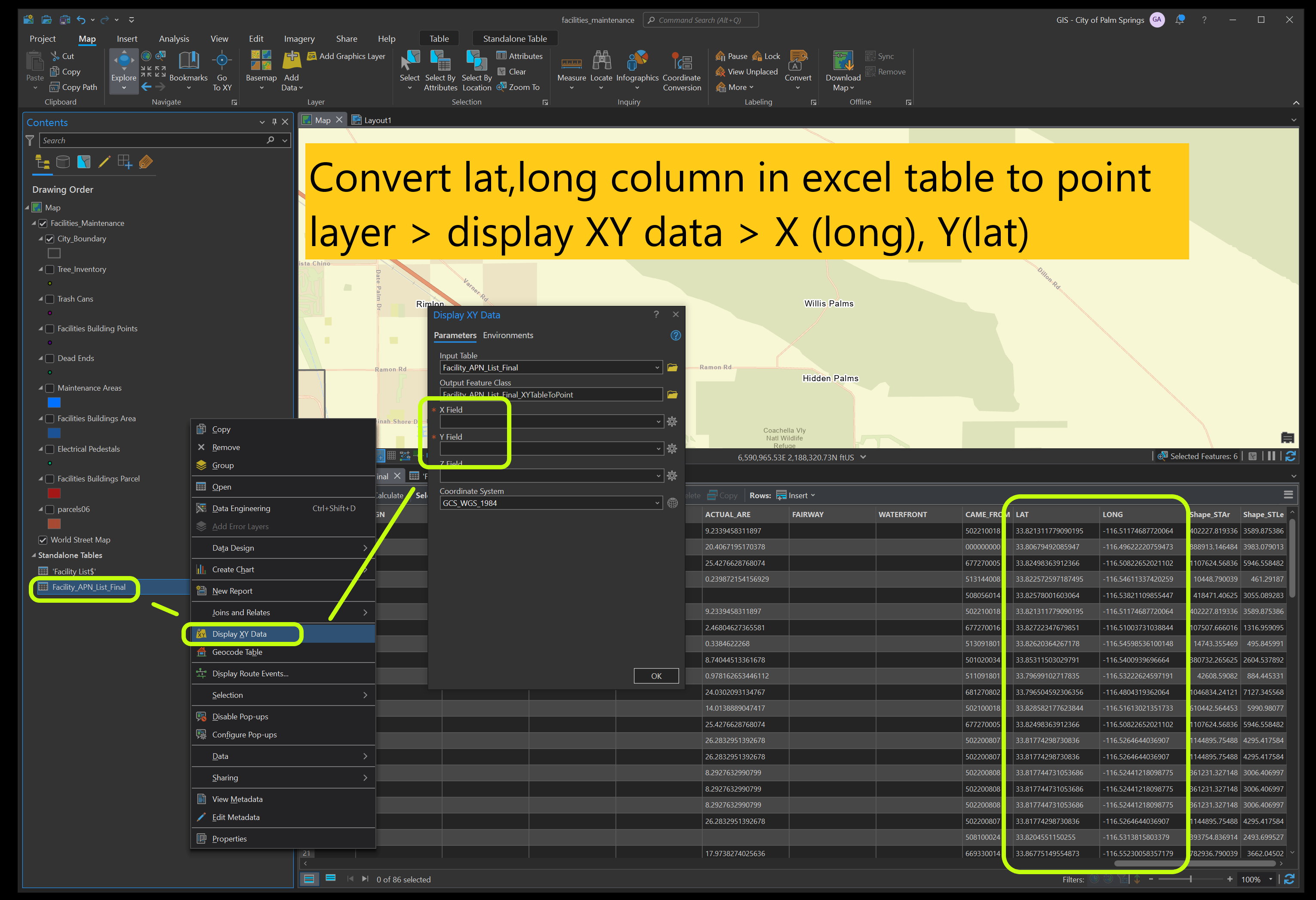
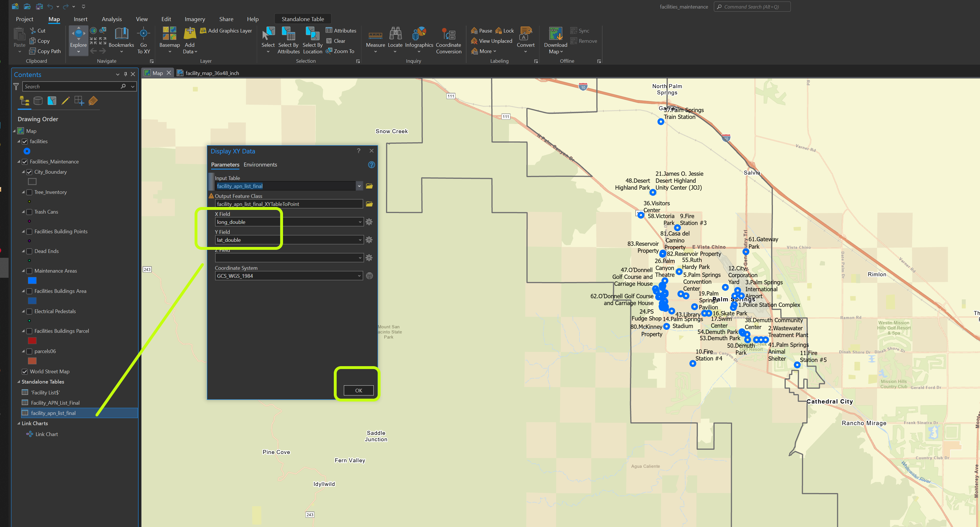
2. lat, long column must convert from text string to number(double or float)
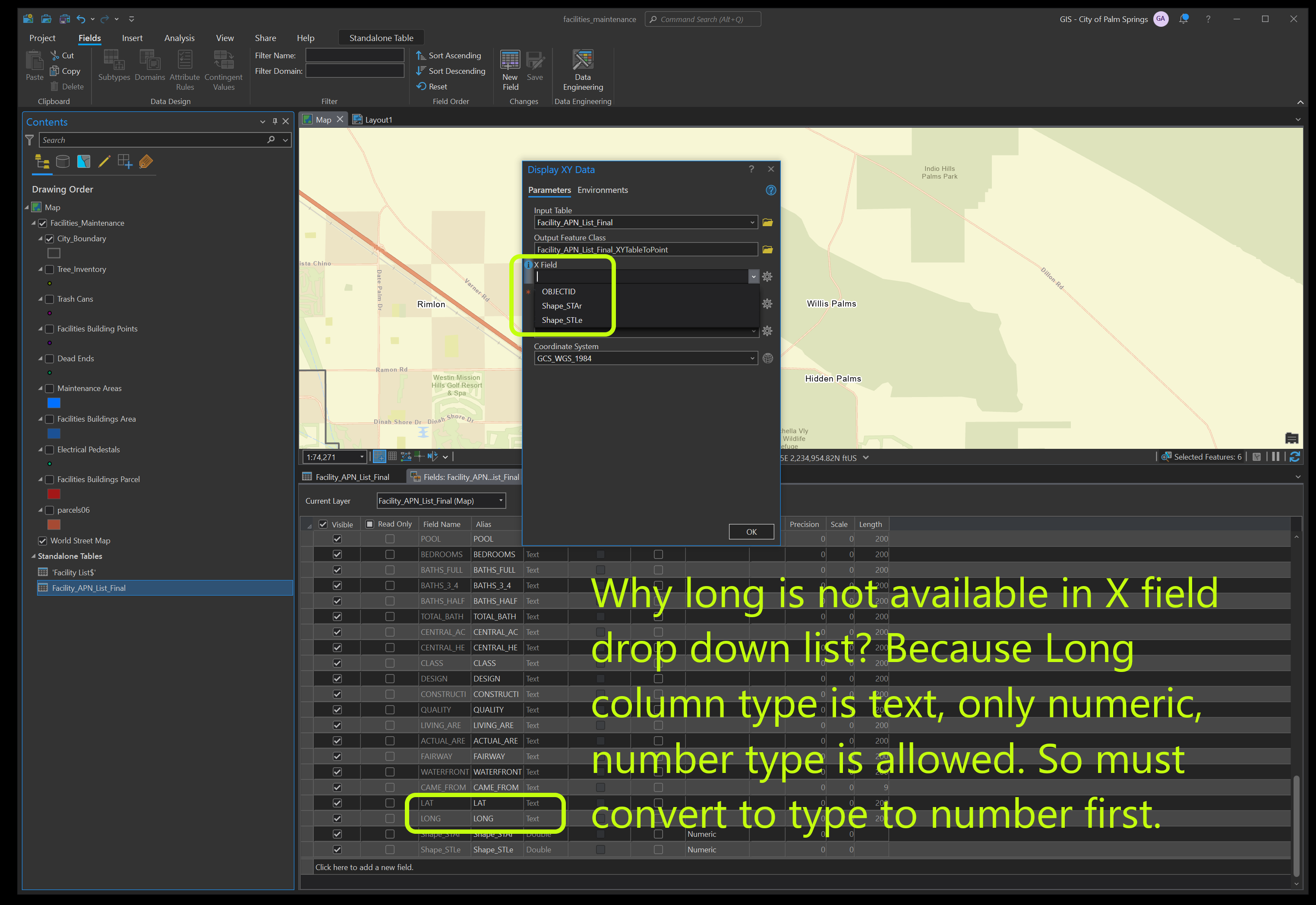
3. x for long, y for lat
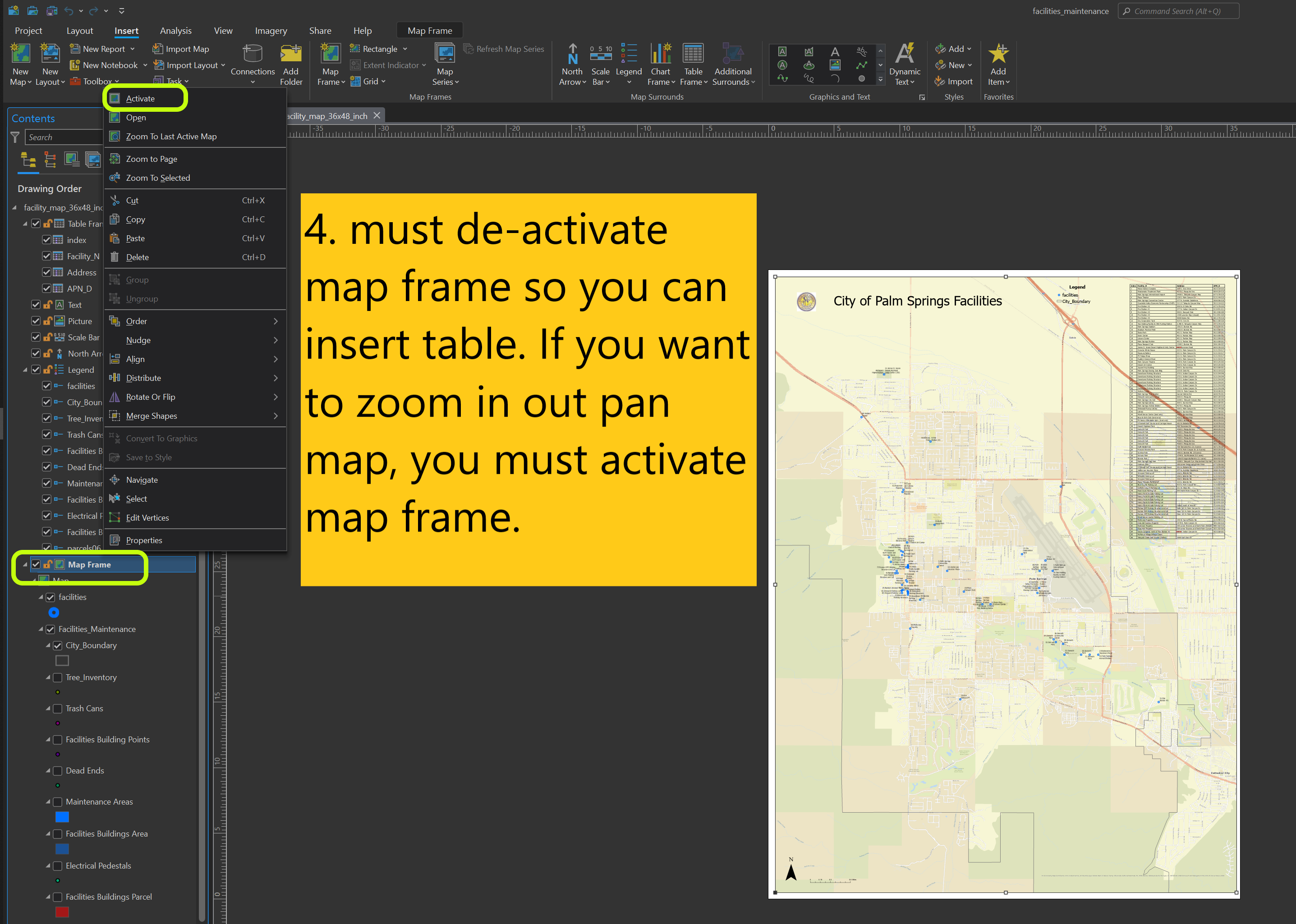
4. must de-activate map frame so you can insert table. If you want to zoom in out pan map, you must activate map frame.
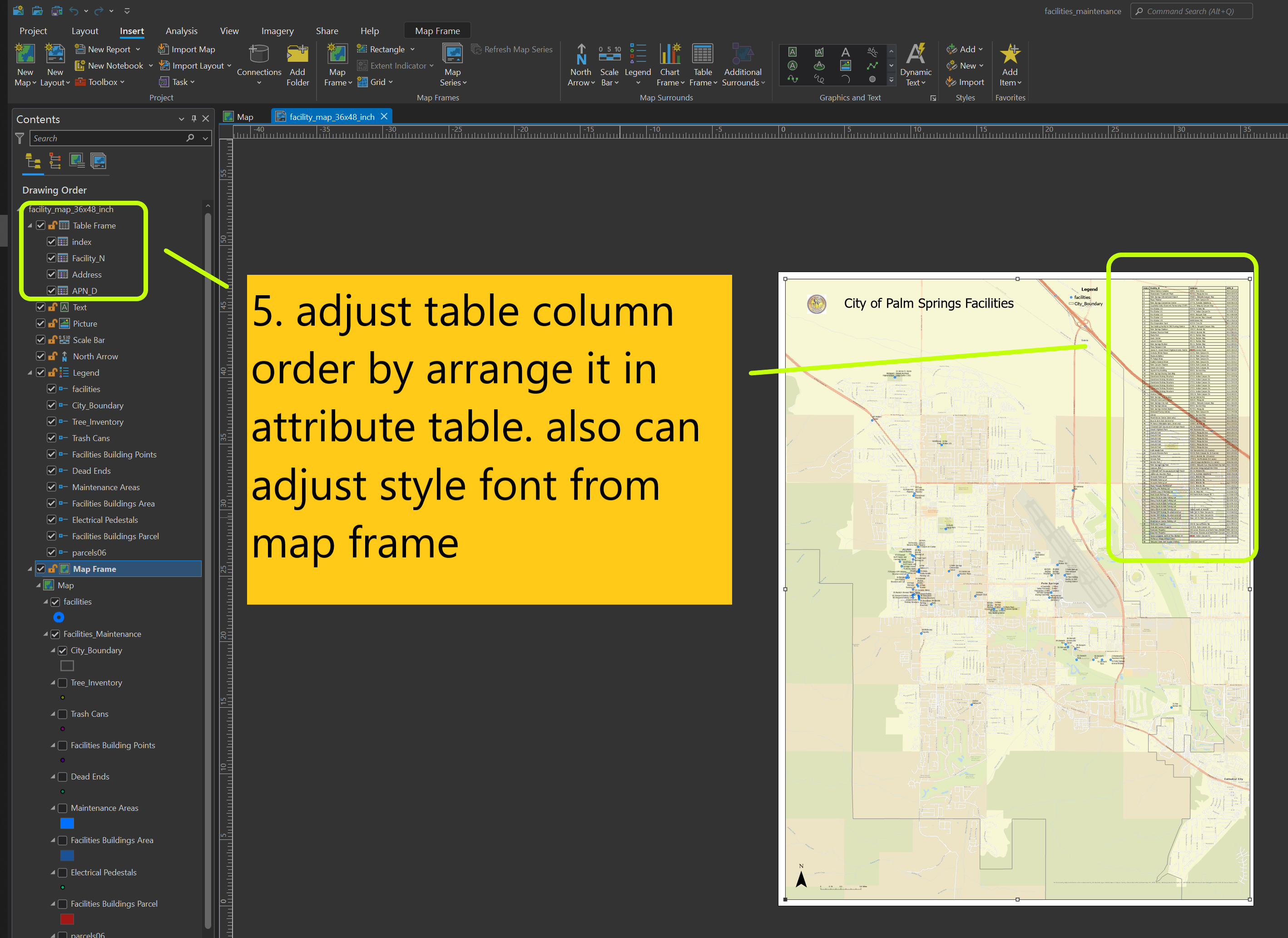
5. adjust table column order by arrange it in attribute table. also can adjust style font from map frame
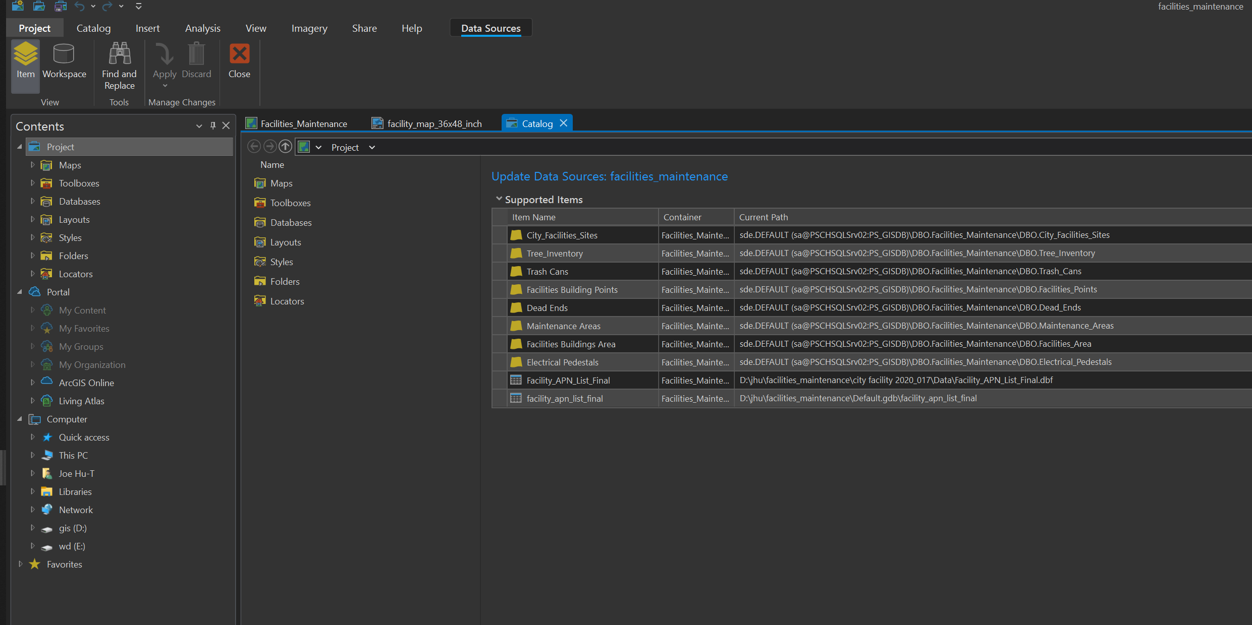
6. when publish, make sure all data source is match