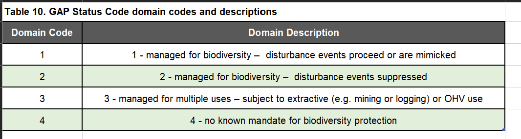
Category

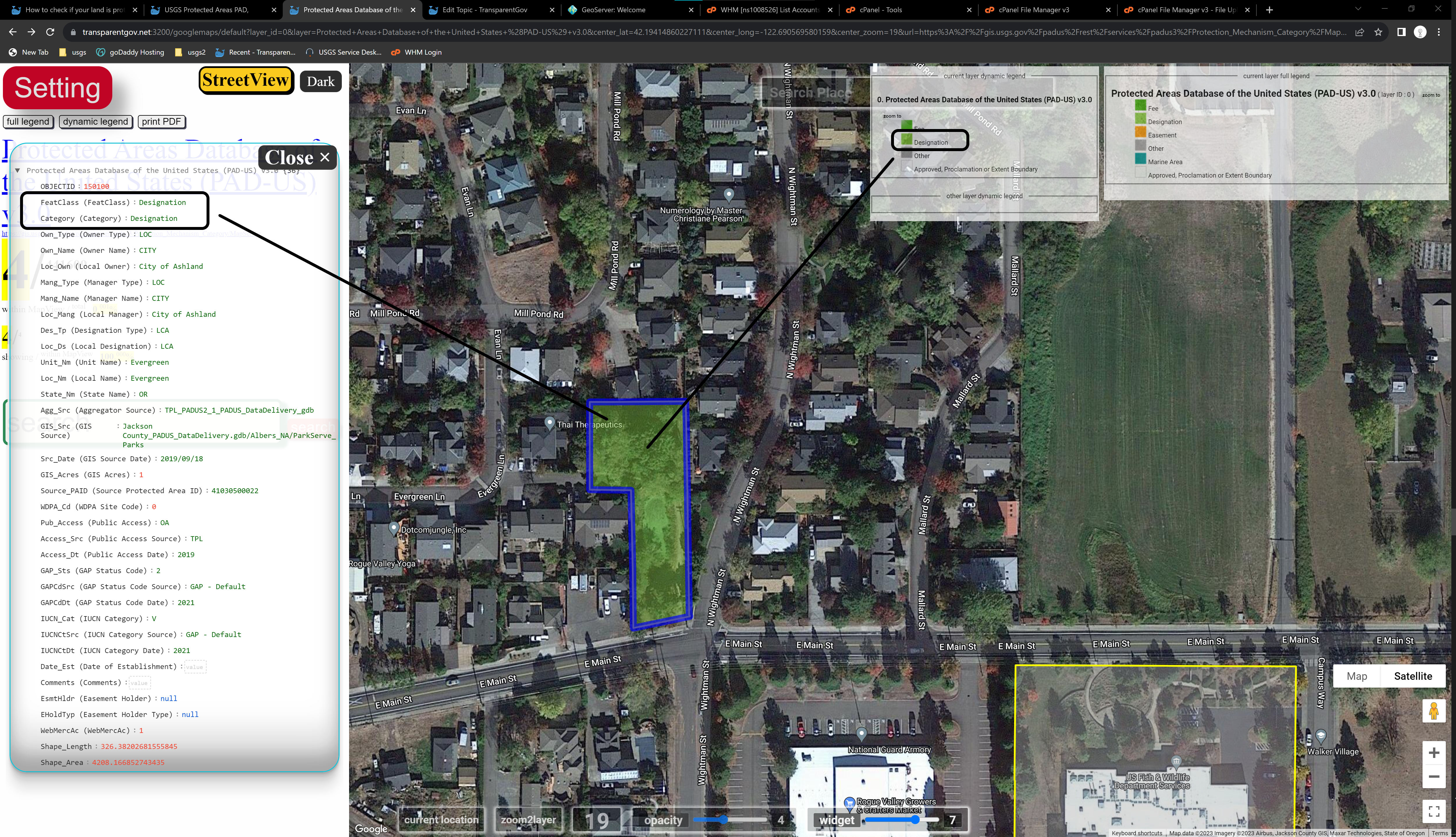
The general 'Category' for the protection mechanism associated with the protected area. 'Fee' simple, is the most common way real estate is owned. A conservation 'easement' creates a legally enforceable land preservation agreement between a landowner and government agency or qualified land protection organization (i.e. land trust). 'Other' types of protection include leases, agreements, or deed restrictions. 'Designation' is applied to management boundaries not represented in title documents (e.g. 'National Monument', 'Wild and Scenic River', and some 'State Wildlife Management Area') overlapping fee ownership parcels. 'Marine' includes outer continental shelf lands managed by the Bureau of Ocean Energy Management and Marine Protected Areas inventoried by the National Oceanic and Atmospheric Administration. 'Proclamation' defines the outer boundaries of areas without internal ownership defined: Tribal Lands (Census AIA), Military Lands (Department of Defense), Proclamation (National Park Service and Forest Service) and Approved Acquisition Boundaries (U.S. Fish and Wildlife Service) for planning purposes. See PAD-US Data Manual, Table 3, or 'Category' geodatabase lookup table for full domain codes and descriptions.
https://transparentgov.net:3200/googlemaps/default?layer_id=0&layer=Protected+Areas+Database+of+the+United+States+%28PAD-US%29+v3.0¢er_lat=42.19414860227111¢er_long=-122.690569580159¢er_zoom=19&url=https%3A%2F%2Fgis.usgs.gov%2Fpadus%2Frest%2Fservices%2Fpadus3%2FProtection_Mechanism_Category%2FMapServer&overlayType=overlayType_image&panto=0
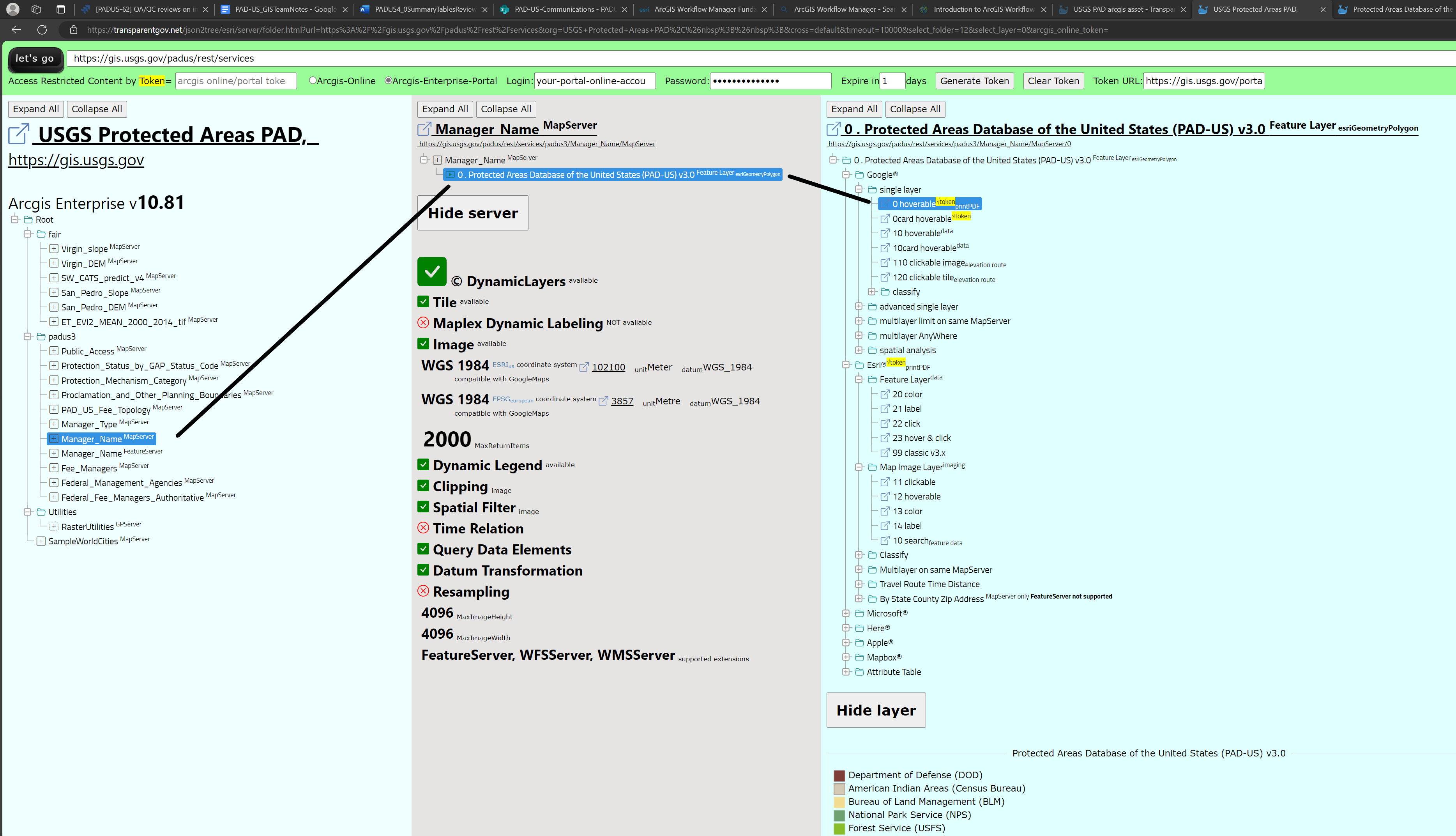
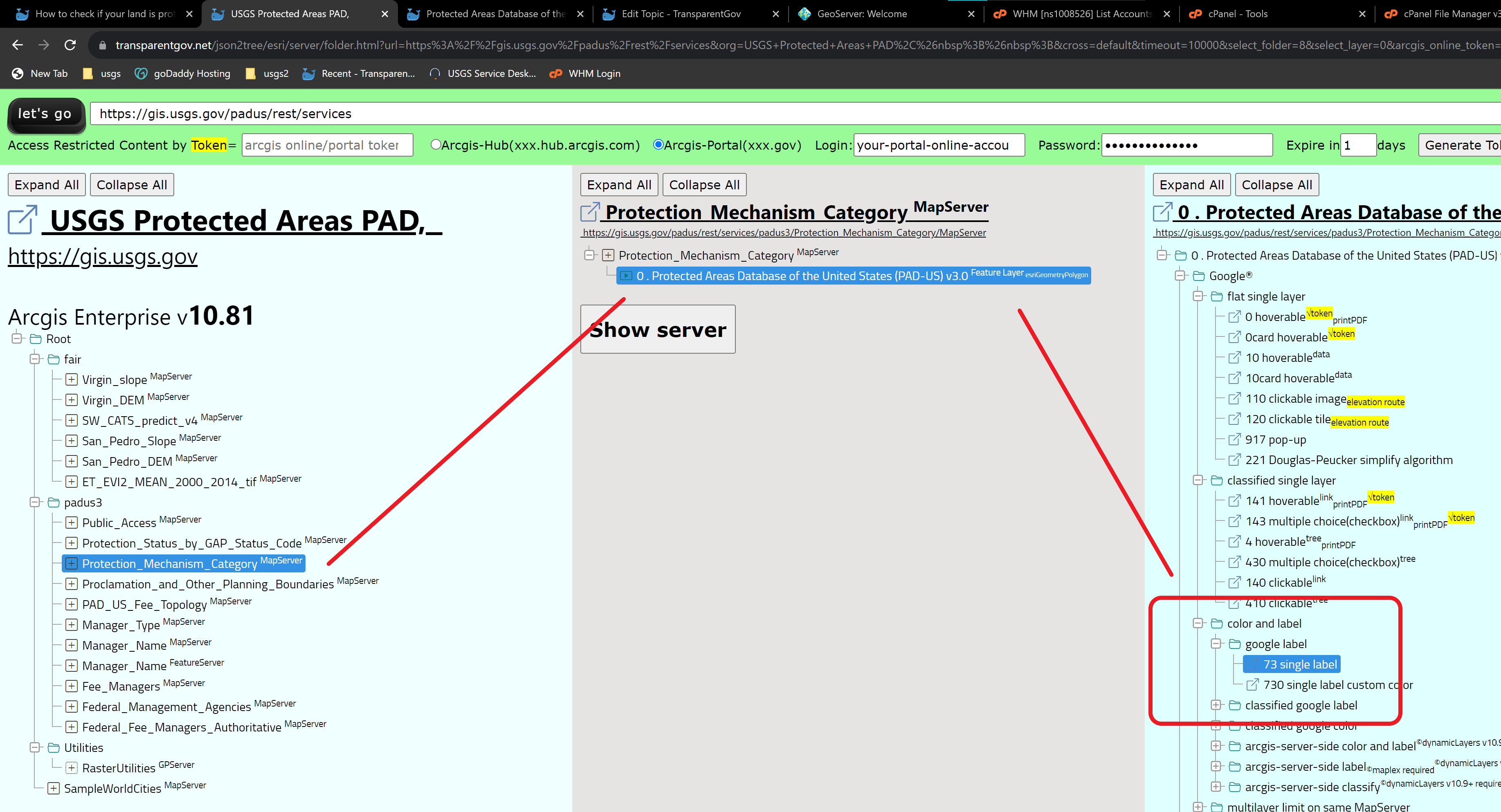
https://transparentgov.net/json2tree/esri/server/folder.html?url=https%3A%2F%2Fgis.usgs.gov%2Fpadus%2Frest%2Fservices&org=USGS+Protected+Areas+PAD%2C%26nbsp%3B%26nbsp%3B&cross=default&timeout=10000&select_folder=8&select_layer=0&arcgis_online_token=
I am tired of click each polygon to see their category, also the color is contaminated by underneath satellite imagery, not obvious to tell category by color. I will use google label tool to just label it, much easier now.
https://transparentgov.net:3200/googlemaps73/default?layer_id=0&layer=Protected+Areas+Database+of+the+United+States+%28PAD-US%29+v3.0¢er_lat=42.190719635765014¢er_long=-122.6867675488804¢er_zoom=17&url=https%3A%2F%2Fgis.usgs.gov%2Fpadus%2Frest%2Fservices%2Fpadus3%2FProtection_Mechanism_Category%2FMapServer&overlayType=overlayType_image&panto=0&labelAsField=Category
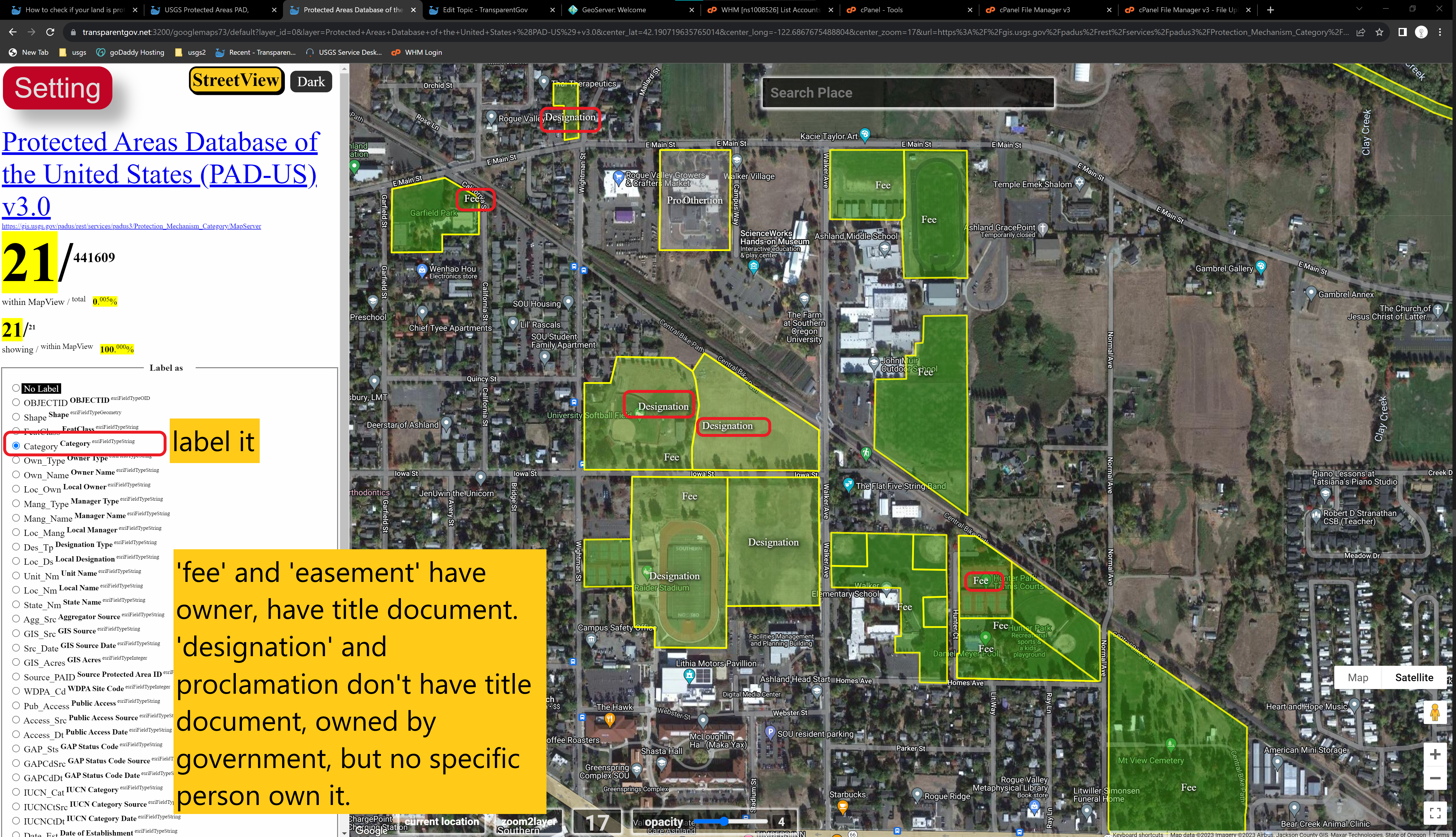
Google label model number is 73
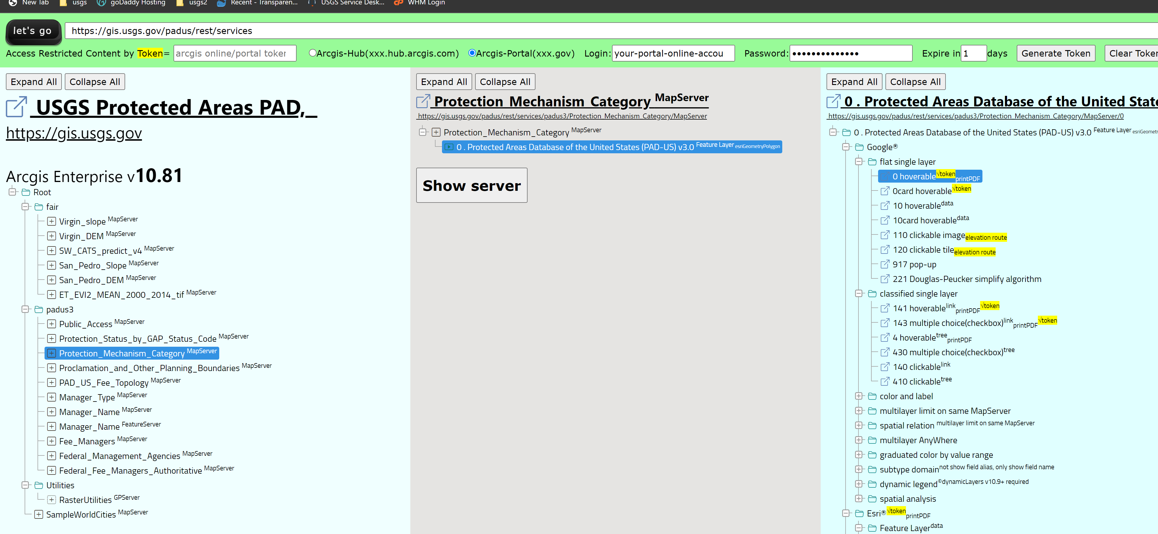
https://transparentgov.net/json2tree/esri/server/folder.html?url=https%3A%2F%2Fgis.usgs.gov%2Fpadus%2Frest%2Fservices&org=USGS+Protected+Areas+PAD%2C%26nbsp%3B%26nbsp%3B&cross=default&timeout=10000&select_folder=8&select_layer=0&arcgis_online_token=
What is public land?
https://dreamlandtours.net/public-land-designations-explained/
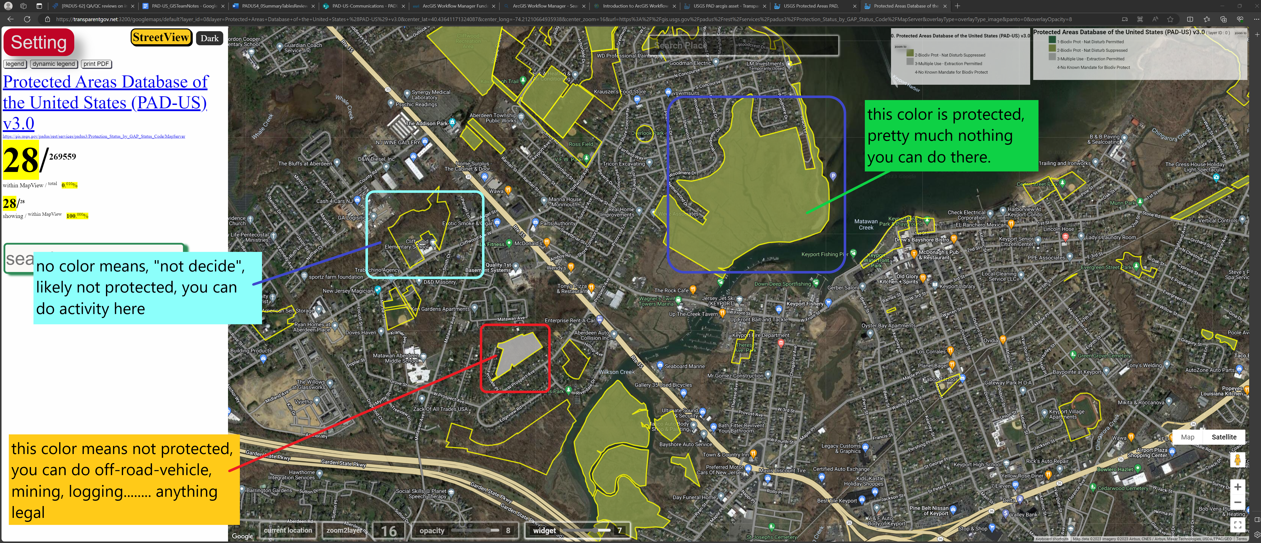
GAP status code
https://transparentgov.net:3200/googlemaps/default?layer_id=0&layer=Protected+Areas+Database+of+the+United+States+%28PAD-US%29+v3.0¢er_lat=40.43641171324087¢er_long=-74.21210664935938¢er_zoom=16&url=https%3A%2F%2Fgis.usgs.gov%2Fpadus%2Frest%2Fservices%2Fpadus3%2FProtection_Status_by_GAP_Status_Code%2FMapServer&overlayType=overlayType_image&panto=0&overlayOpacity=8
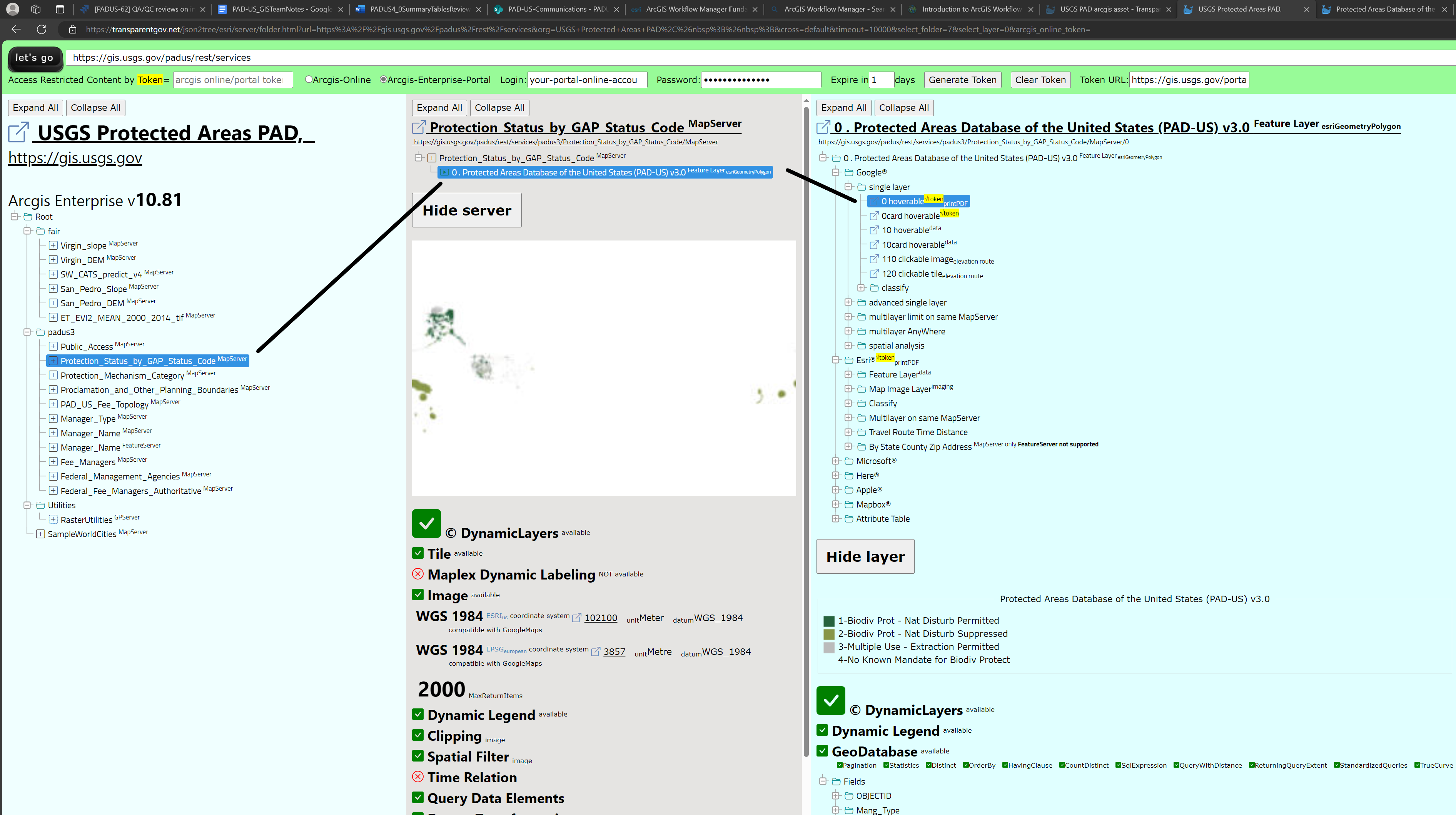
https://transparentgov.net/json2tree/esri/server/folder.html?url=https%3A%2F%2Fgis.usgs.gov%2Fpadus%2Frest%2Fservices&org=USGS+Protected+Areas+PAD%2C%26nbsp%3B%26nbsp%3B&cross=default&timeout=10000&select_folder=7&select_layer=0&arcgis_online_token=
Here is full data set
https://transparentgov.net:3200/googlemaps/default?layer_id=0&layer=Protected+Areas+Database+of+the+United+States+%28PAD-US%29+v3.0¢er_lat=20.746279540783085¢er_long=-156.43121913698354¢er_zoom=19&url=https%3A%2F%2Fgis.usgs.gov%2Fpadus%2Frest%2Fservices%2Fpadus3%2FManager_Name%2FMapServer&overlayType=overlayType_image&panto=0&overlayOpacity=6
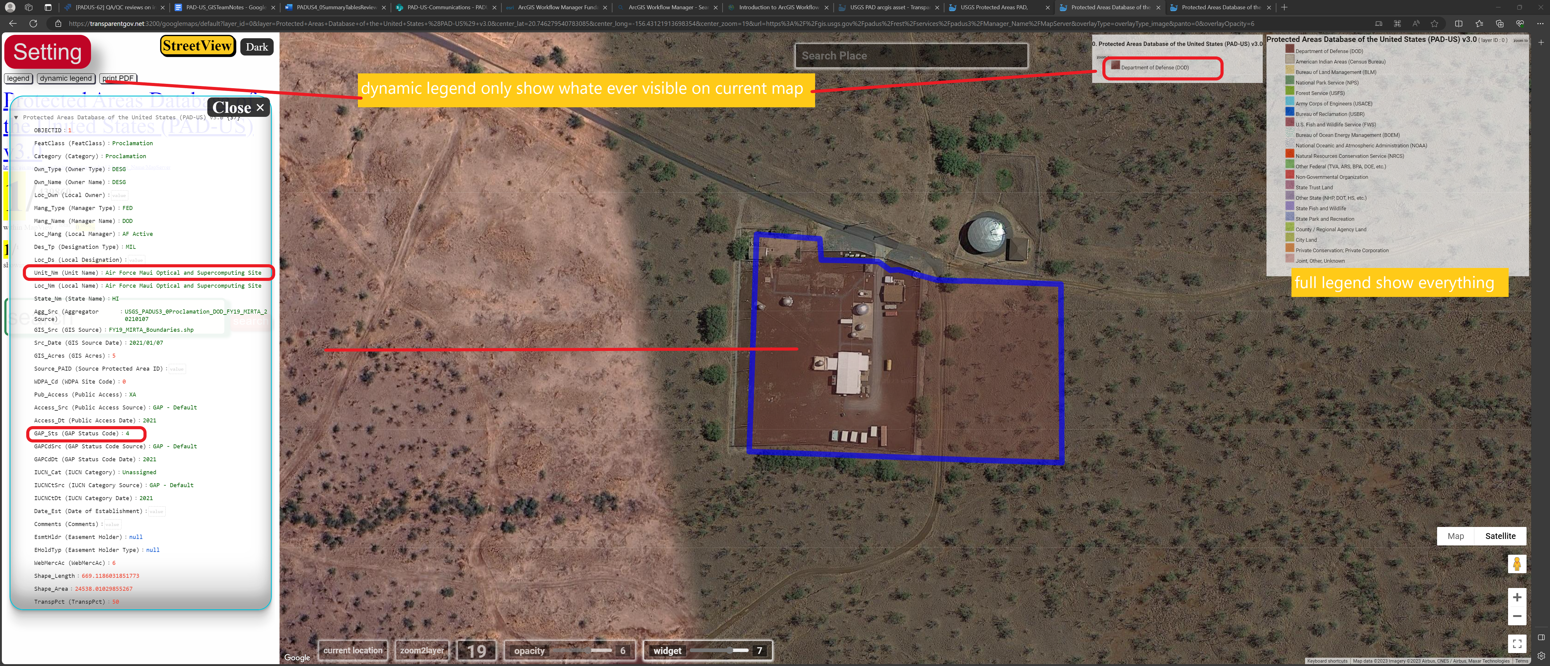
https://transparentgov.net/json2tree/esri/server/folder.html?url=https%3A%2F%2Fgis.usgs.gov%2Fpadus%2Frest%2Fservices&org=USGS+Protected+Areas+PAD%2C%26nbsp%3B%26nbsp%3B&cross=default&timeout=10000&select_folder=12&select_layer=0&arcgis_online_token=