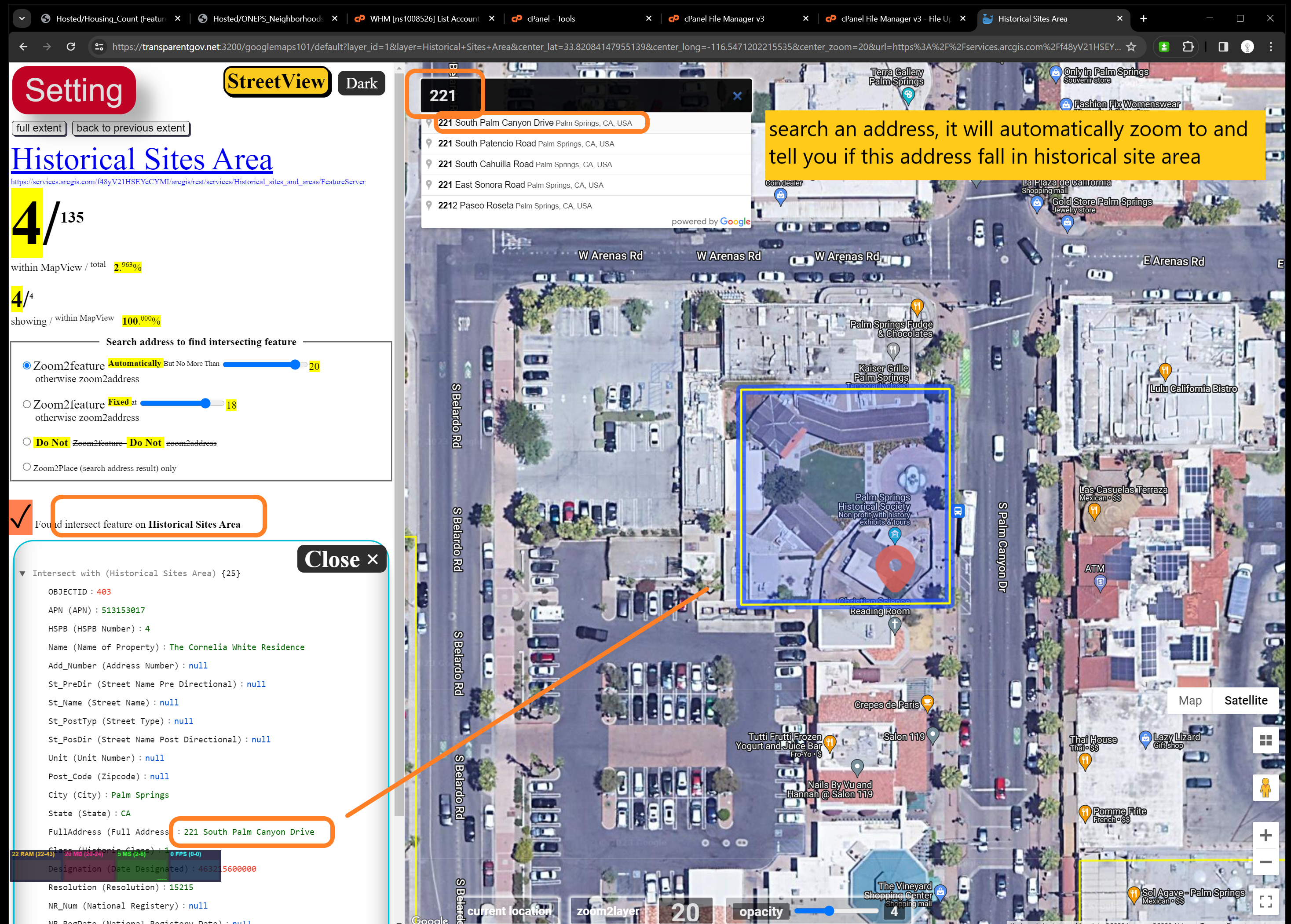
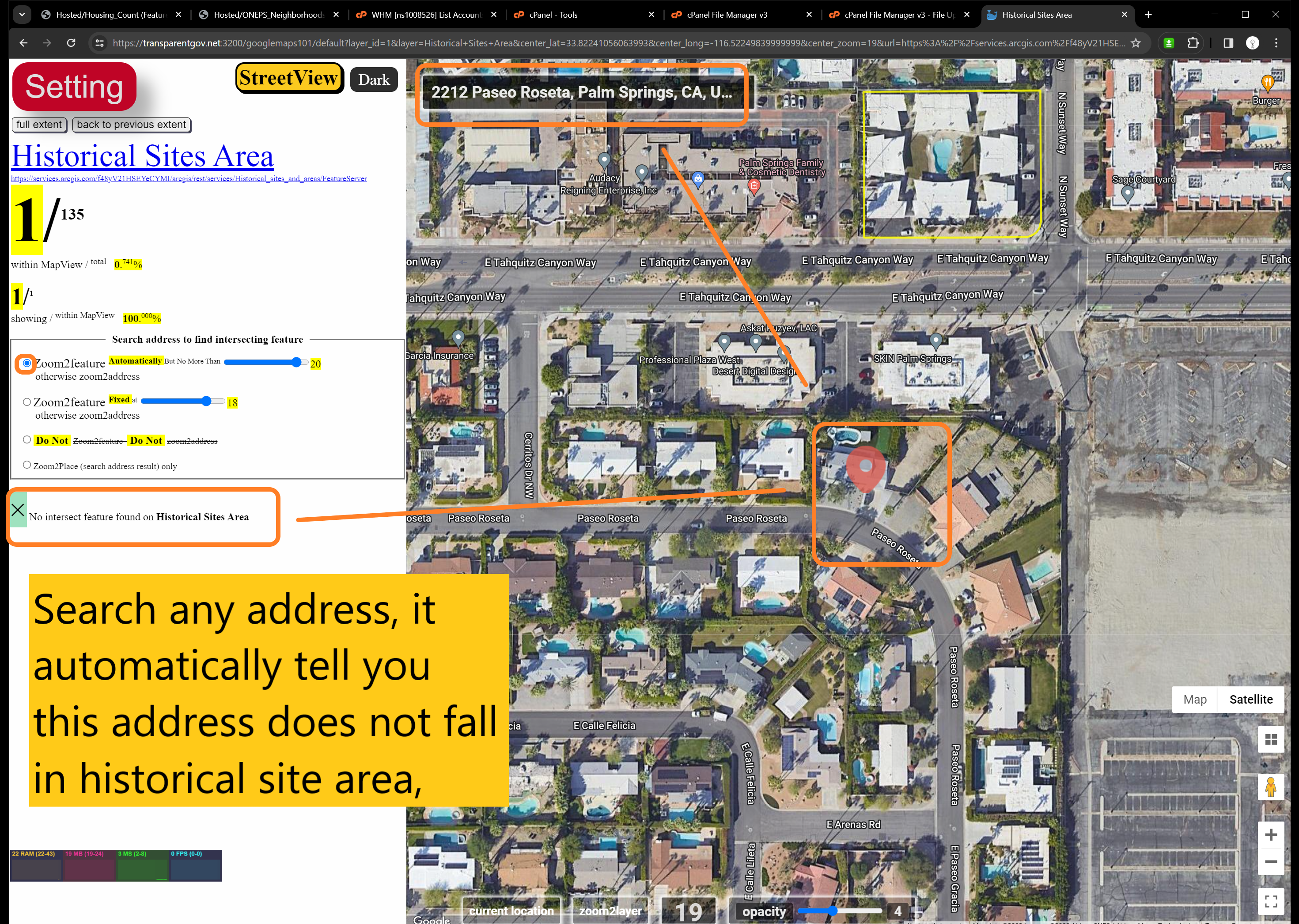
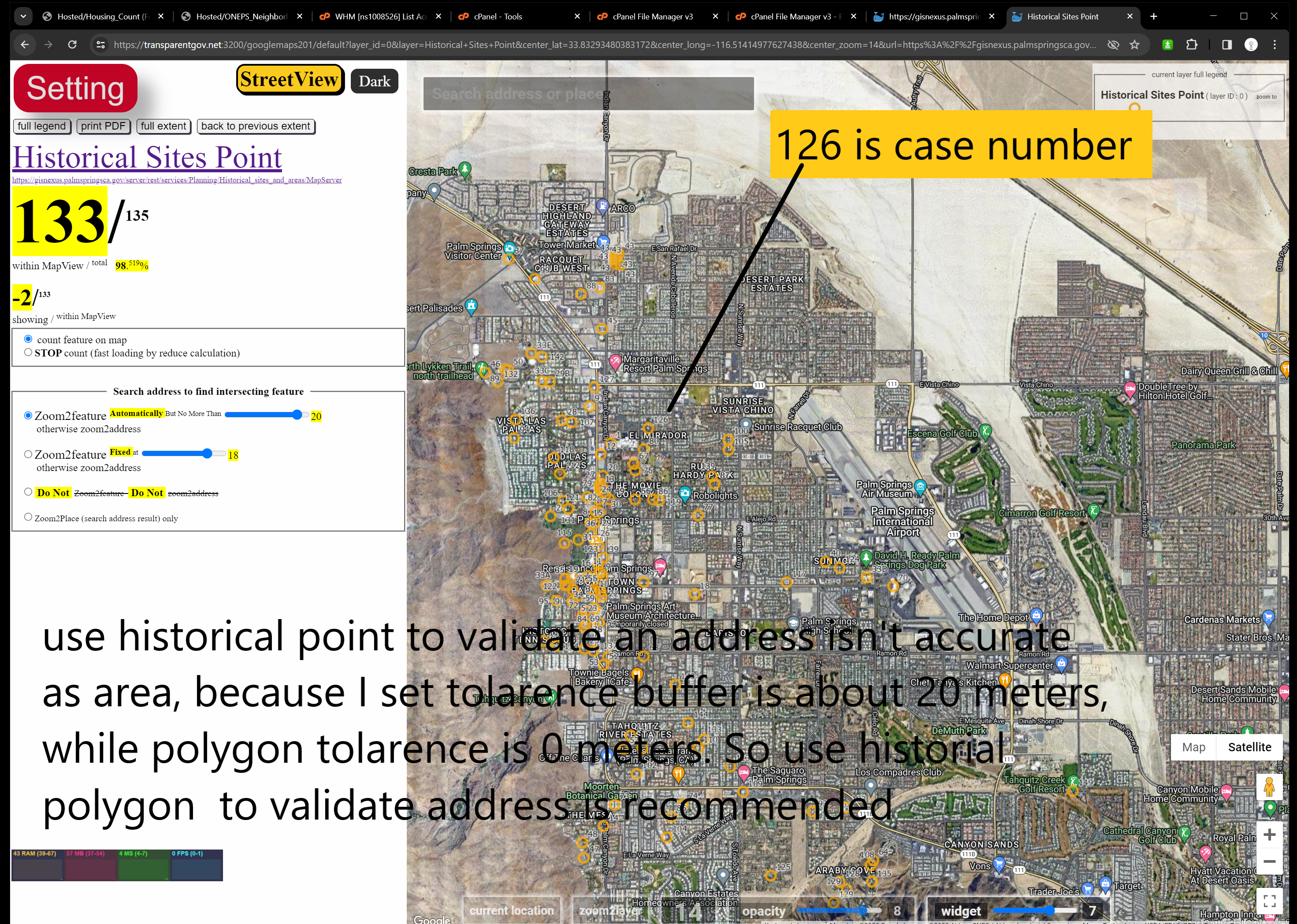
User told me that she need to check many building permit address everyday ( sometimes up to hundred address ) to see if the address falls in the historical site or area. I specially create this series model 101, 201, 202 for that purpose. You can also use this series to check other things, such as check address against land use, zoning, fire districts, police beat, etc...
You can search an address on top search bar, it will automatically zoom into that address and analysis what polygon this address falls in. In following sample, you input a address, it tells you wether this address on a historical site or area automatically. It semi-automate the validation process.
Polygon layer is most accurate since I set the tolerance buffer is 0 meter. Point layer is less accurate, so far I set default tolerance buffer is 20meter by 20meter square. Because 20 meters is roughly about the size of a house. This tolerance buffer size can be adjusted.
where is what (model 101) : data only
Polygon on FeatureServer-FeatureLayer-no-legend-no-color-no-symbole-no-label ( historical area, palm springs, ca)
https://transparentgov.net:3200/googlemaps101/default?layer_id=1&layer=Historical+Sites+Area¢er_lat=33.82054289584927¢er_long=-116.54153318631943¢er_zoom=16&url=https%3A%2F%2Fservices.arcgis.com%2Ff48yV21HSEYeCYMI%2Farcgis%2Frest%2Fservices%2FHistorical_sites_and_areas%2FFeatureServer&overlayType=overlayType_none&panto=0
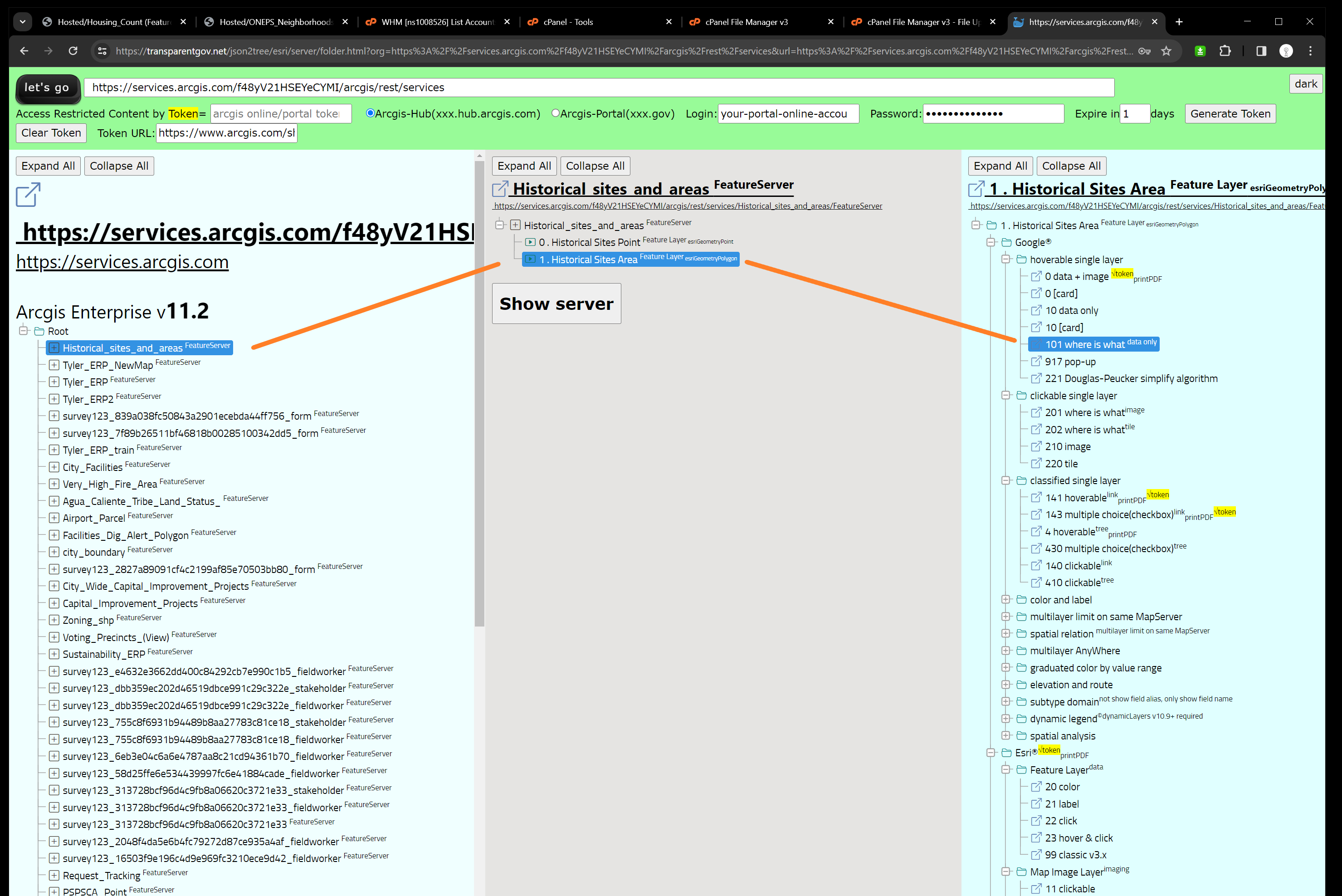
https://transparentgov.net/json2tree/esri/server/folder.html?org=https%3A%2F%2Fservices.arcgis.com%2Ff48yV21HSEYeCYMI%2Farcgis%2Frest%2Fservices&url=https%3A%2F%2Fservices.arcgis.com%2Ff48yV21HSEYeCYMI%2Farcgis%2Frest%2Fservices&select_folder=1&select_layer=1&arcgis_online_token=
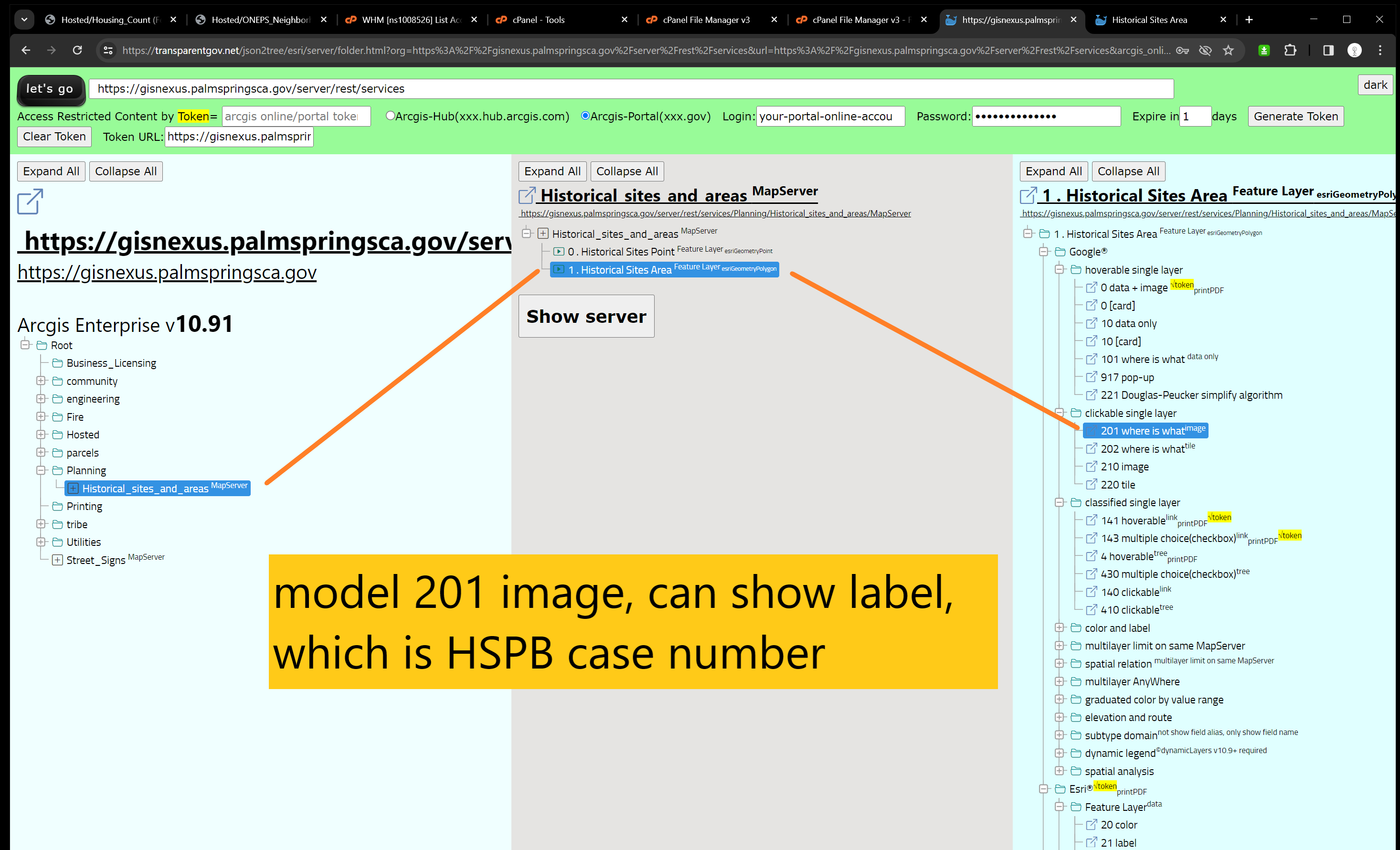
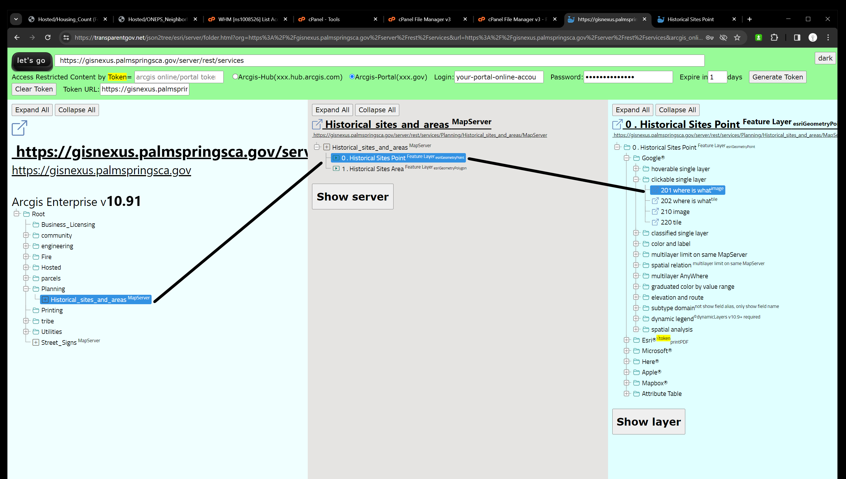
where is what (model 201) : image only
Polygon on MapServer-MapLayer-with-color-symbol-legend-label ( historical area, palm springs, ca)
https://transparentgov.net:3200/googlemaps201/default?layer_id=1&layer=Historical+Sites+Area¢er_lat=33.834549727925285¢er_long=-116.5420947193968¢er_zoom=16&url=https%3A%2F%2Fgisnexus.palmspringsca.gov%2Fserver%2Frest%2Fservices%2FPlanning%2FHistorical_sites_and_areas%2FMapServer&overlayType=overlayType_image&panto=0
https://transparentgov.net/json2tree/esri/server/folder.html?org=https%3A%2F%2Fgisnexus.palmspringsca.gov%2Fserver%2Frest%2Fservices&url=https%3A%2F%2Fgisnexus.palmspringsca.gov%2Fserver%2Frest%2Fservices&arcgis_online_token=&select_folder=14&select_layer=0
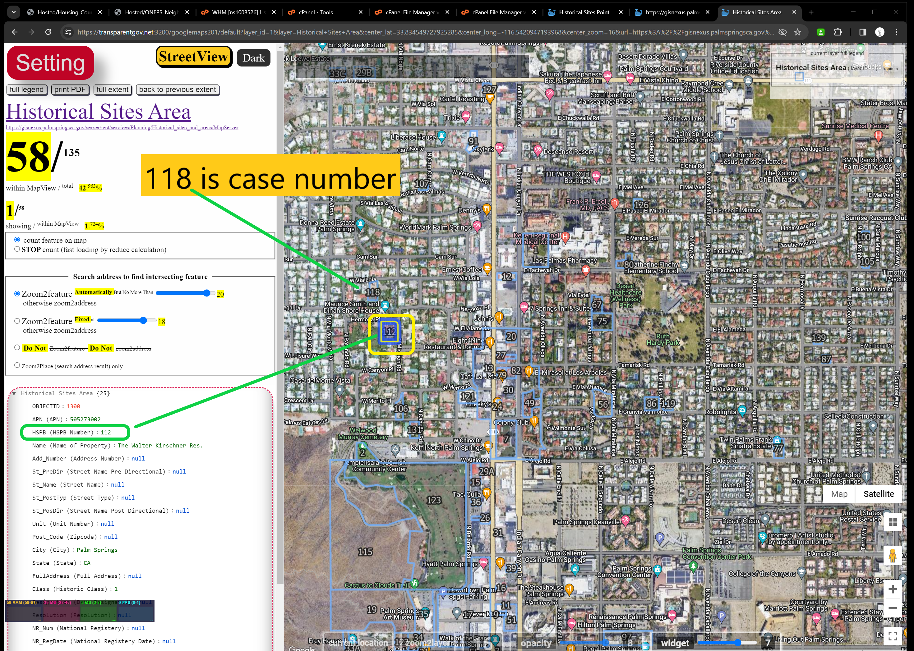
Point on MapServer-MapLayer-with-color-symbol-legend-label ( historical site, palm springs, ca)
https://transparentgov.net:3200/googlemaps201/default?layer_id=0&layer=Historical+Sites+Point¢er_lat=33.83211489002044¢er_long=-116.54632198021146¢er_zoom=15&url=https%3A%2F%2Fgisnexus.palmspringsca.gov%2Fserver%2Frest%2Fservices%2FPlanning%2FHistorical_sites_and_areas%2FMapServer&overlayType=overlayType_image&panto=0
https://transparentgov.net/json2tree/esri/server/folder.html?org=https%3A%2F%2Fgisnexus.palmspringsca.gov%2Fserver%2Frest%2Fservices&url=https%3A%2F%2Fgisnexus.palmspringsca.gov%2Fserver%2Frest%2Fservices&arcgis_online_token=&select_folder=14&select_layer=0
where is what (model 202) : tile only