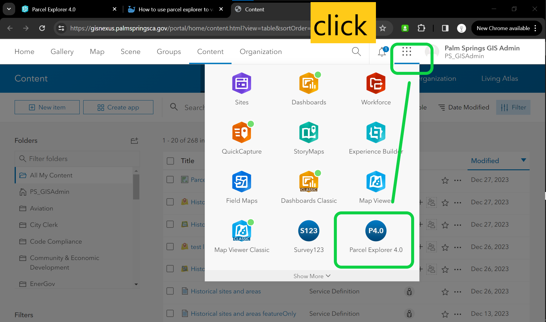
Step 1, go to arcgis portal home page, open parcel explorer
https://gisnexus.palmspringsca.gov/portal/home/content.html?view=table&sortOrder=desc&sortField=modified&folder=all#content
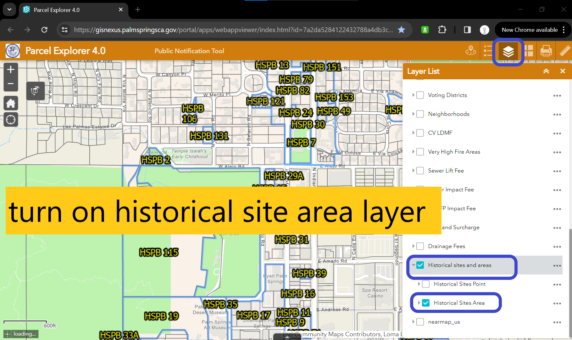
Step 2, turn on historical site area layer
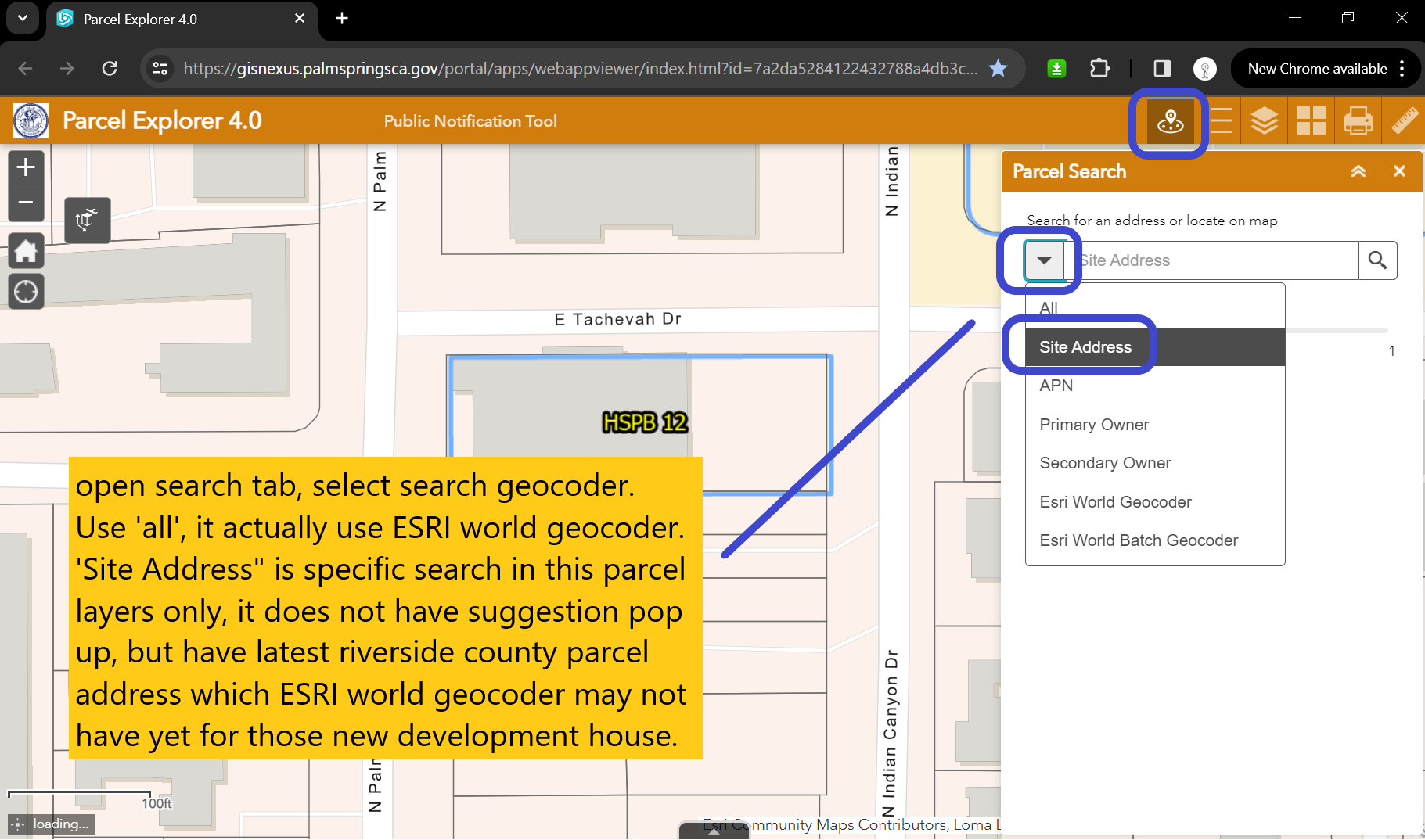
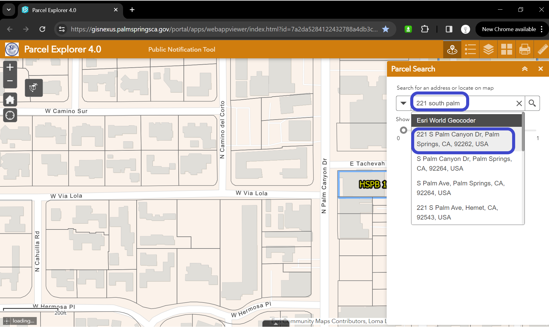
Step 3, open search tab, select search geocoder. Use 'all', it actually use ESRI world geocoder. 'Site Address" is specific search in this parcel layers only, it does not have suggestion pop up, but have latest riverside county parcel address which ESRI world geocoder may not have yet for those new development house.
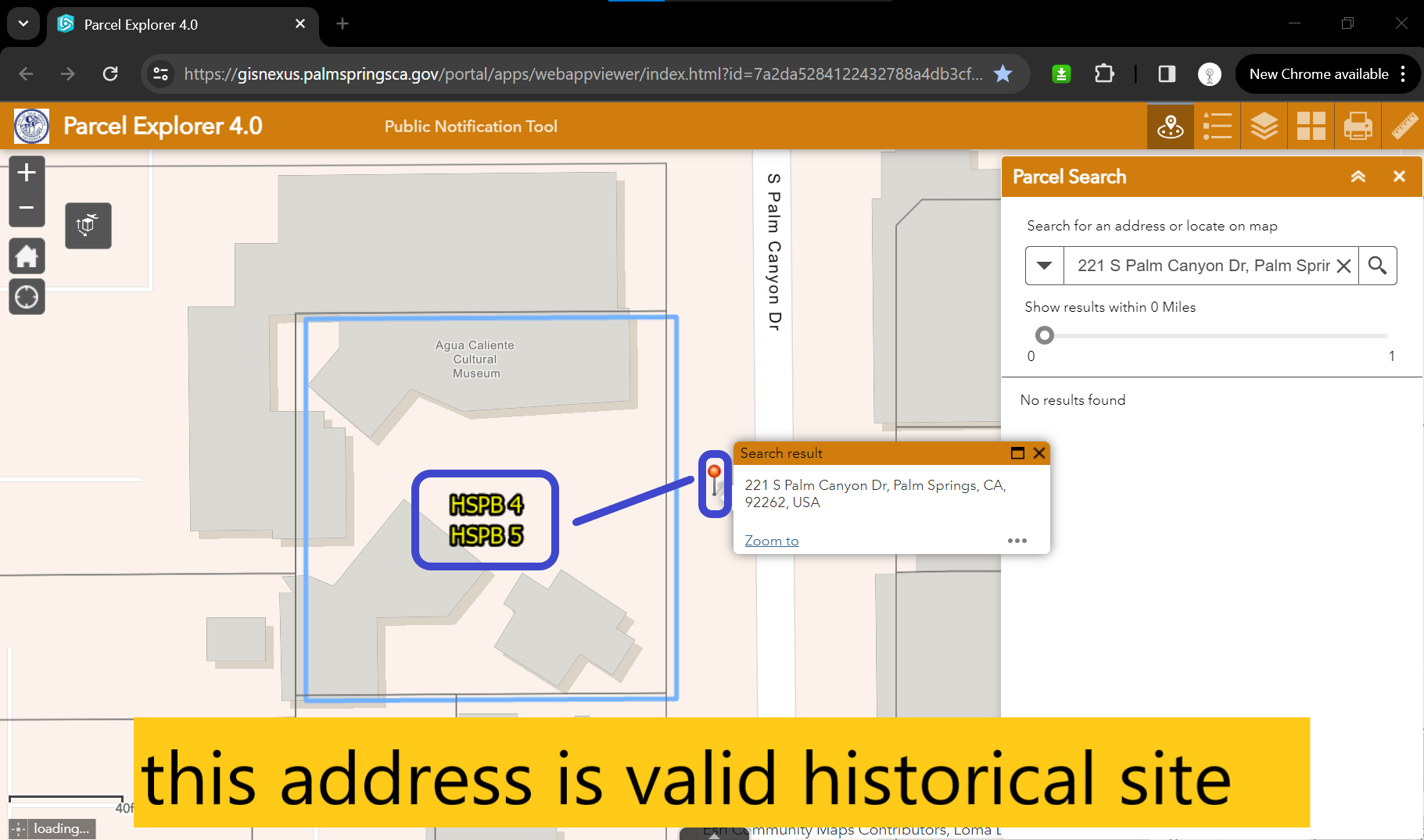
Step 4, try a address
Step 5, check result