Background information
ESRI hosted layer ( hosted at xxx.arcgis.com), feature layer is only choice. Map image layer is not supported there.
However, enterprise portal ( your local version of arcgis online ), you can publish both feature layer and map image layer.
Feature layer only provide feature service. Map Image layer only provide map service.
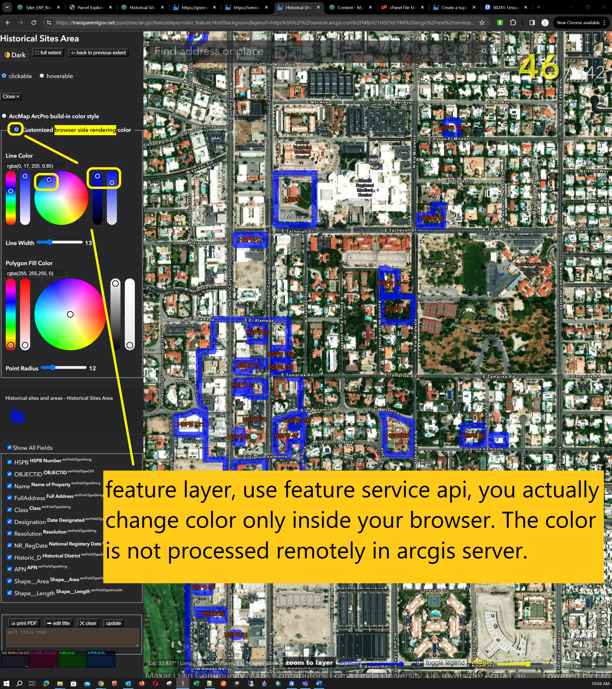
Feature service means all the labeling and coloring occured at your browser, arcgis server would not processing these function.
However Map service is opposite, all labeling and coloring process happened on the arcgis server, not in your browser.
Feature service has its own feature service API.
Map service has complete seperated different set of map service API.
Feature service API, you are targeting on single layer, you are targeting on geometry shape only. You will use json format.
Map service API, you are working on multiple layers, you are working on image combined by multiple layers. You will use .PNG or .JPEG format.
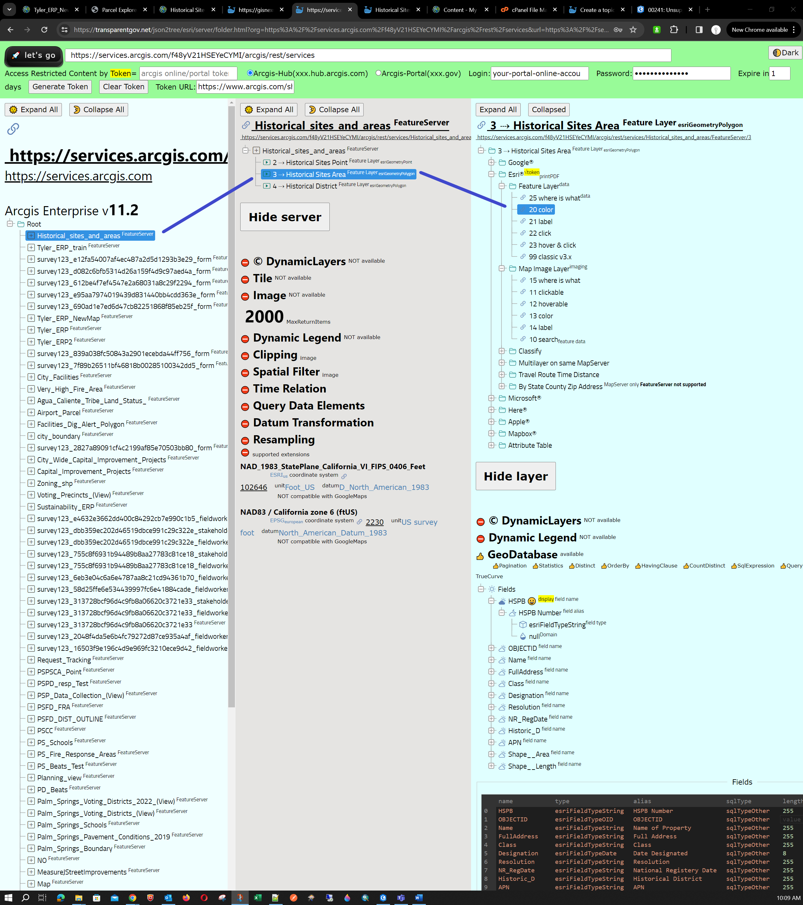
sample layer are feature layer hosted on ESRI's arcgis online. (xxxx.arcgis.com)
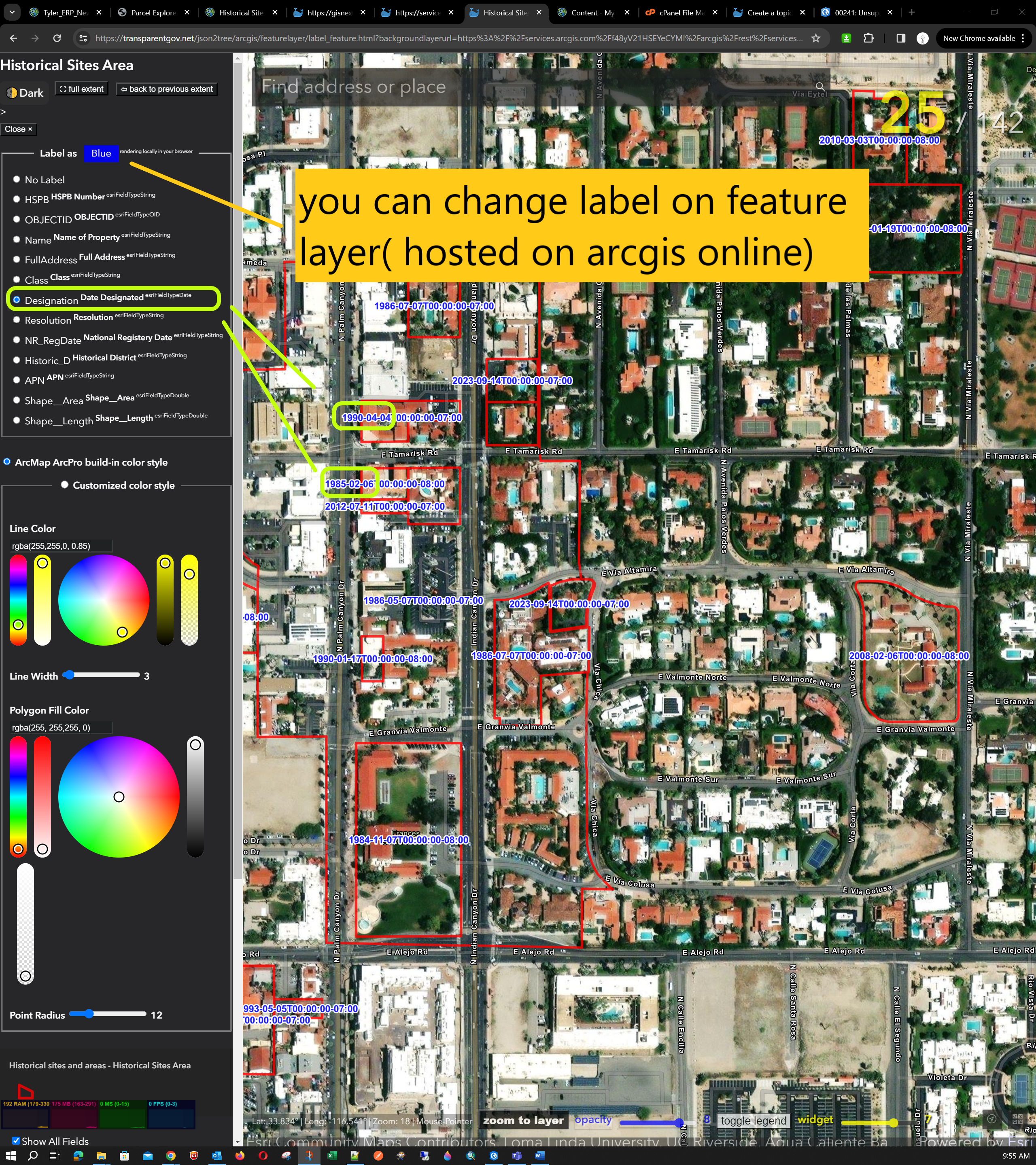
how to change label by using model 21.
https://transparentgov.net/json2tree/arcgis/featurelayer/label_feature.html?backgroundlayerurl=https%3A%2F%2Fservices.arcgis.com%2Ff48yV21HSEYeCYMI%2Farcgis%2Frest%2Fservices%2FHistorical_sites_and_areas%2FFeatureServer%2F3&layer=Historical+Sites+Area&dynamicLabelField=Designation&symbolType=native&_center_lat=33.83289828821803&_center_long=-116.54415392045921&_center_zoom=18&panto=0
how to change color by using model 20
https://transparentgov.net/json2tree/arcgis/featurelayer/color_feature.html?backgroundlayerurl=https%3A%2F%2Fservices.arcgis.com%2Ff48yV21HSEYeCYMI%2Farcgis%2Frest%2Fservices%2FHistorical_sites_and_areas%2FFeatureServer%2F3&layer=Historical+Sites+Area&symbolType=customized&_center_lat=33.8344961332112&_center_long=-116.54236935761283&_center_zoom=17&panto=0&strokeColor=rgba%280%2C+17%2C+255%2C+0.85%29&strokeWeight=13
https://transparentgov.net/json2tree/esri/server/folder.html?org=https%3A%2F%2Fservices.arcgis.com%2Ff48yV21HSEYeCYMI%2Farcgis%2Frest%2Fservices&url=https%3A%2F%2Fservices.arcgis.com%2Ff48yV21HSEYeCYMI%2Farcgis%2Frest%2Fservices&select_folder=1&select_layer=3&arcgis_online_token=