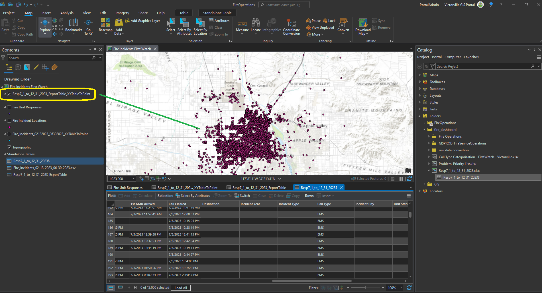
step 1. drag and drop excel file from catalog pane to map frame table section

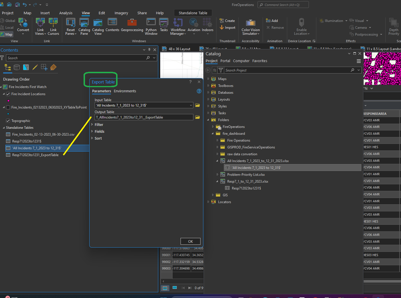
step 2. export excel to file geodatabase table
Skip step 2. directly use excel file xy to table also works, you don't have to export to file geodatabase table.
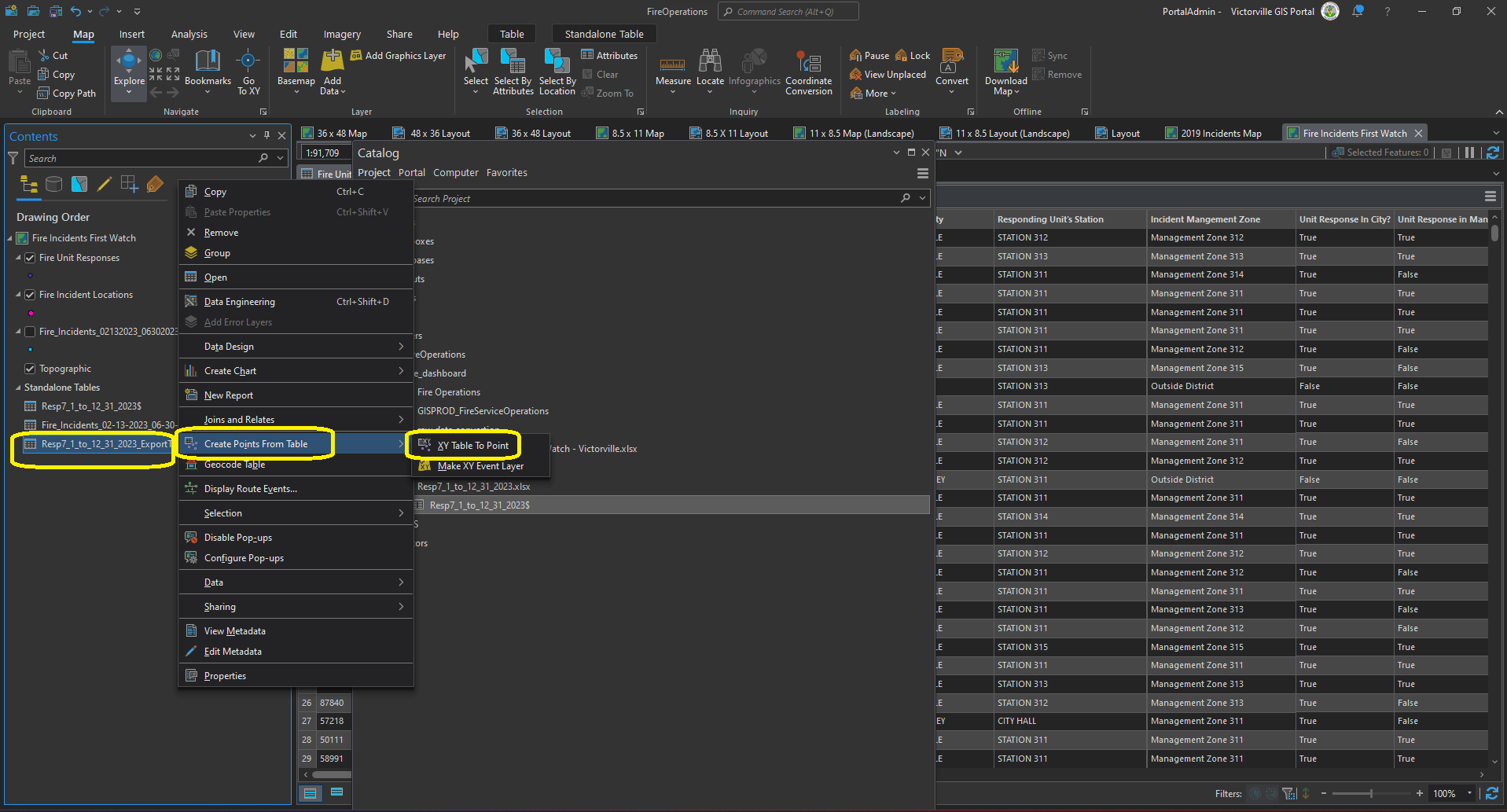
Step 3. create point from table, xy table to point
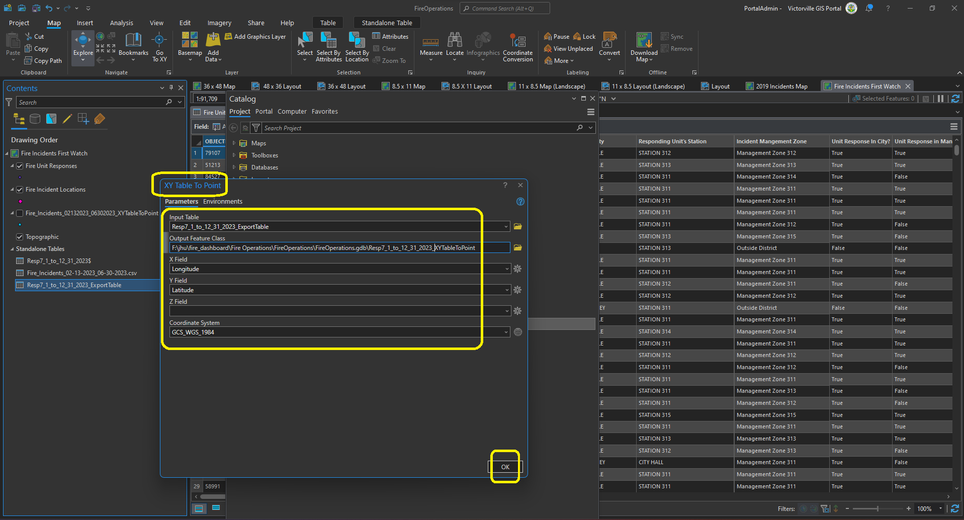
Step 4. xy table to point layer
Step 5. Point layer is ready