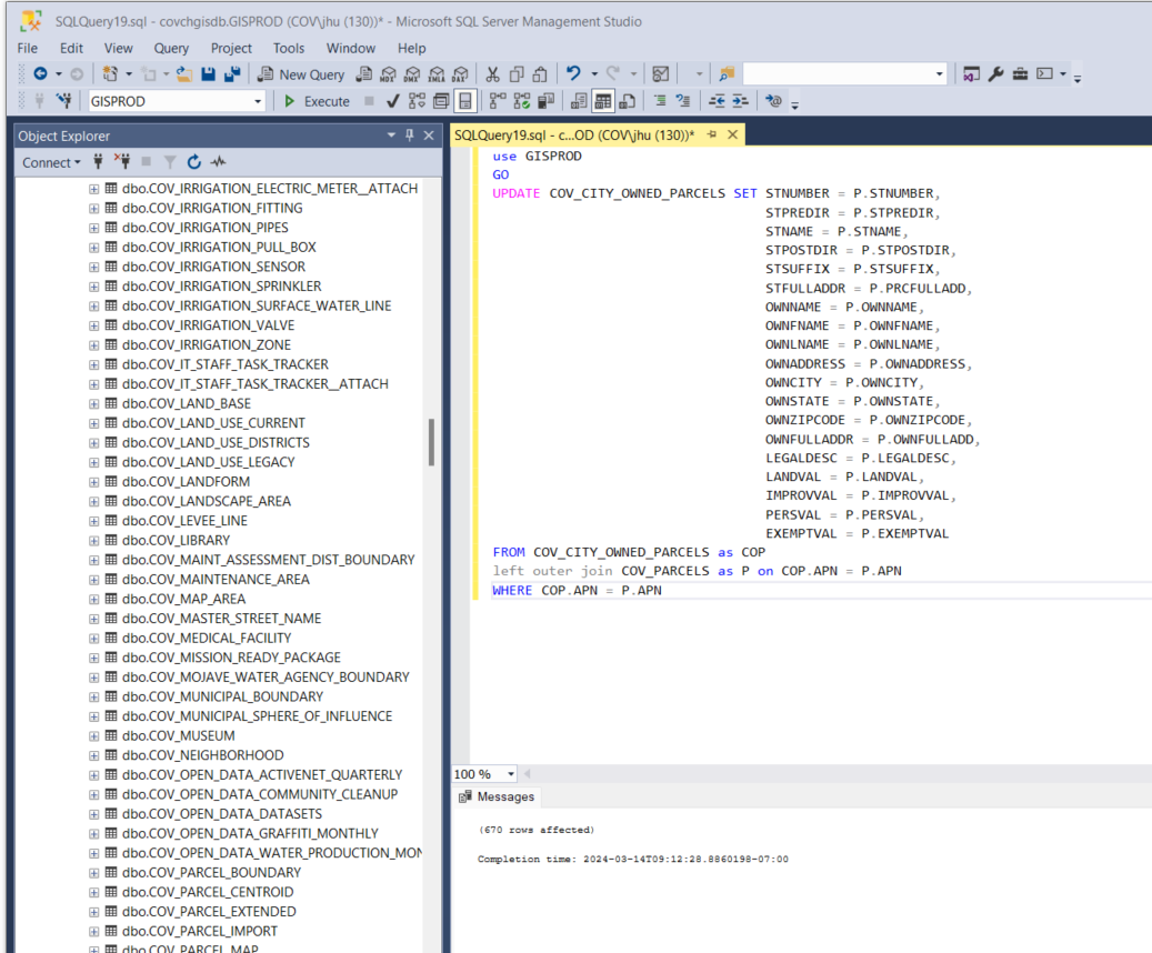
1. UPDATE PARCEL OWNERSHIP ON COVCHGISDB.GISPROD DATABASE
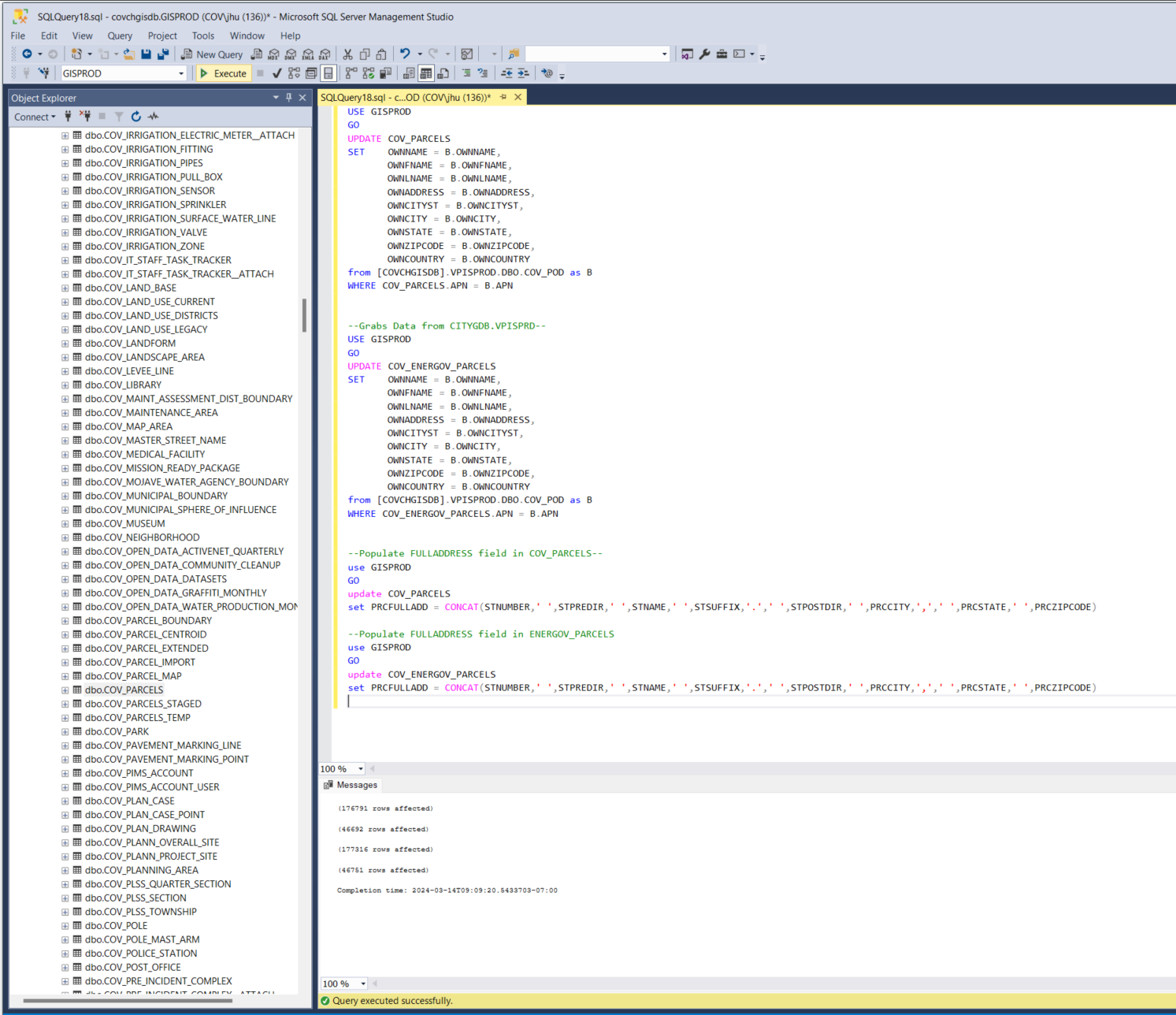
2. QUERY TO UPDATE CITY OWNED PARCEL LAYER ON COVCHGISDB.GISPROD DATABASE
3. Update static copy of addresses with ownership which is what drives the address extractor web application.
3.1 TRUNCATE TABLE GISPROD.DBO.COV_SITE_ADDRESS_POINT_OWNERSHIP
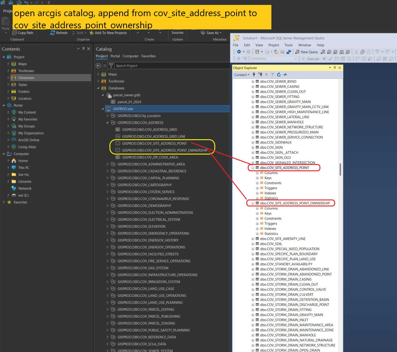
3.2 open arcgis catalog, append from cov_site_address_point to cov_site_address_point_ownership
3.3 run append tool
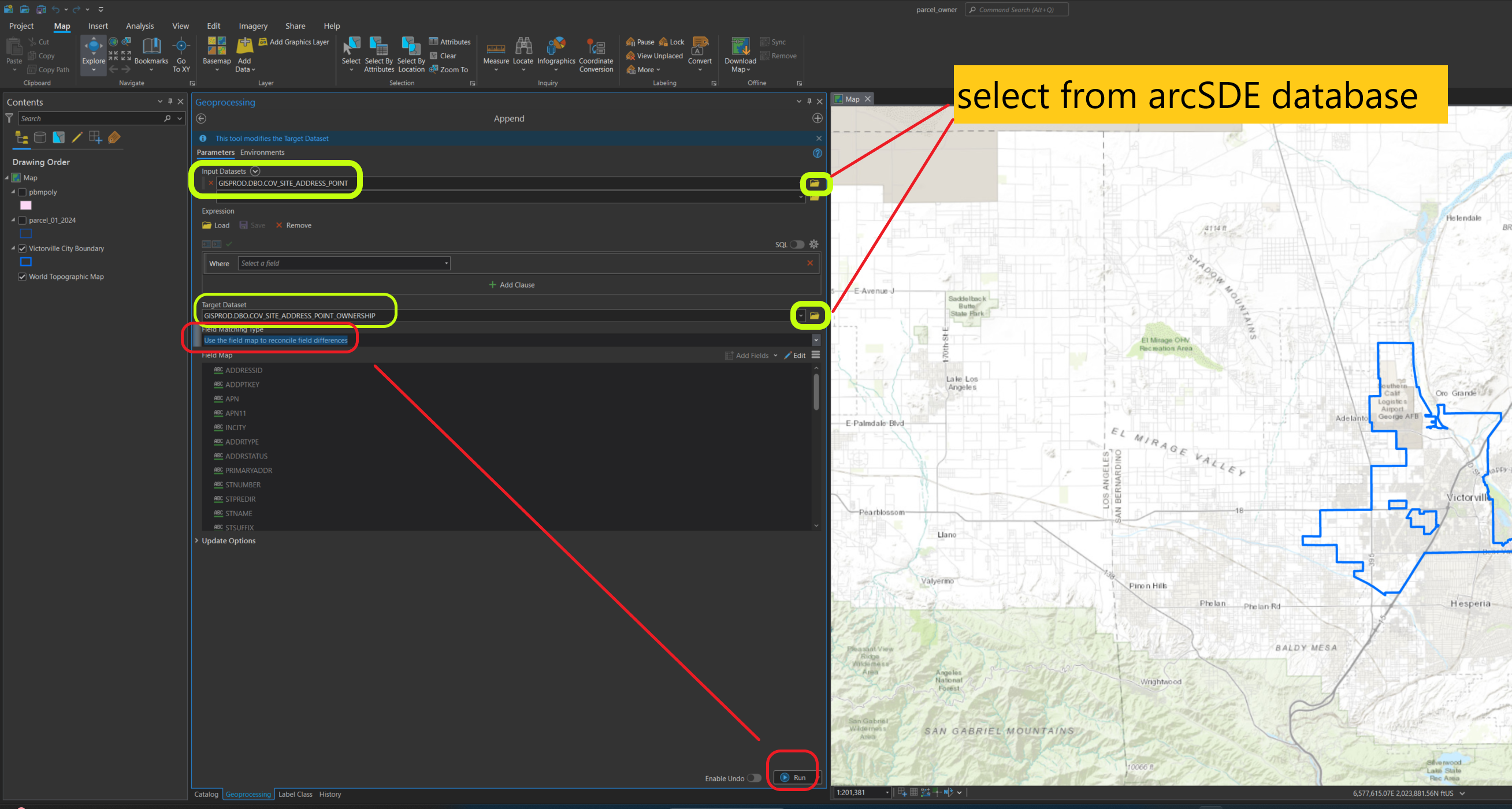
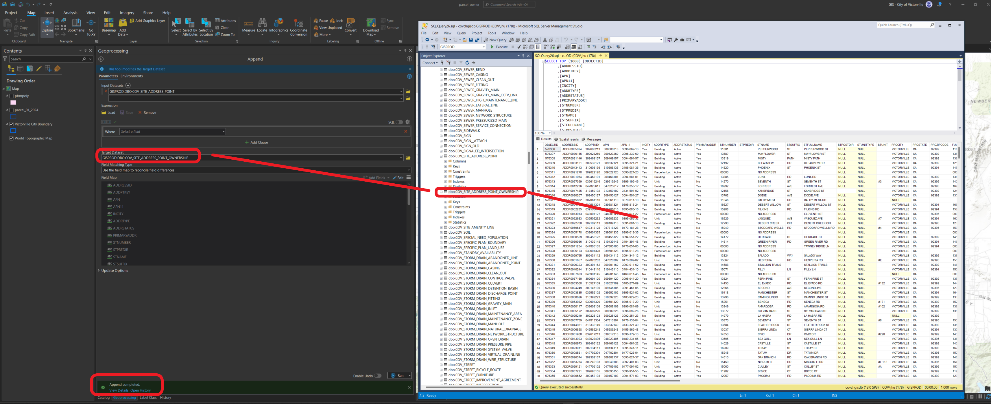
3.4 success, now address point ownership table get populated.
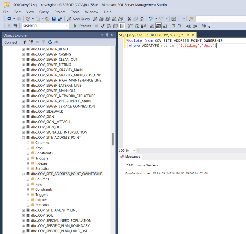
4. remove all addresses that are not a building or unit
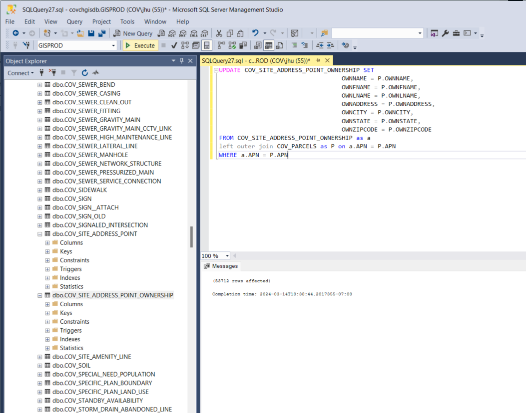
5.updating ownership information. This will be around 53,000 records as it is only updating buildings and units.