Part 1: summary :
Create 660 feet buffer zone along with main water line.
Then select all parcel that on this buffer zone.
Step 1
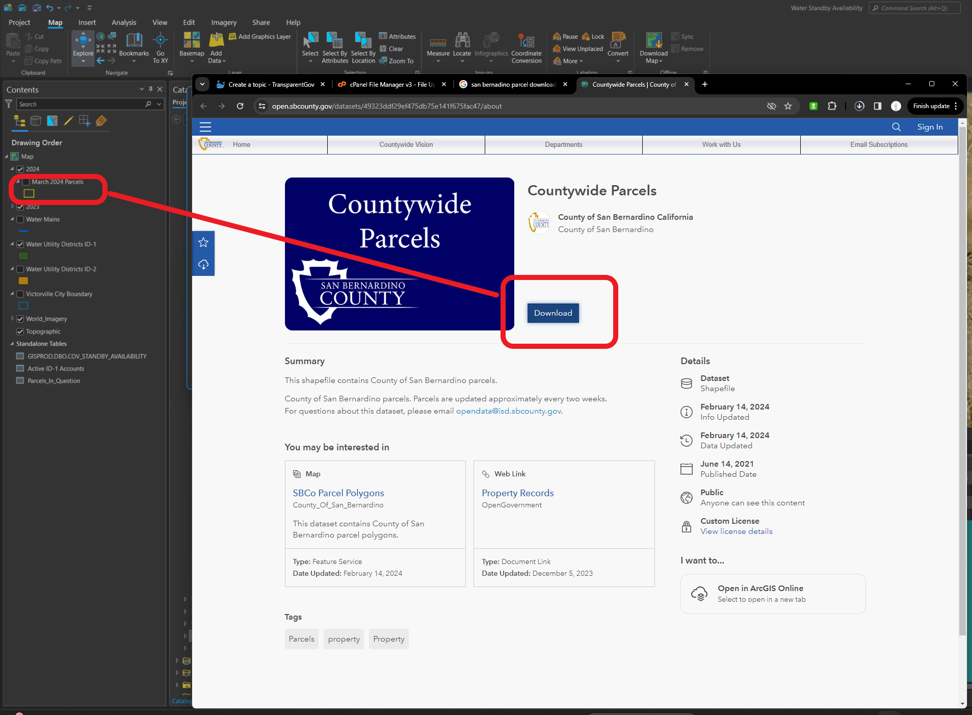
download san bernadino parcel
https://open.sbcounty.gov/datasets/49323ddf29ef475db75e141f675fac47/about
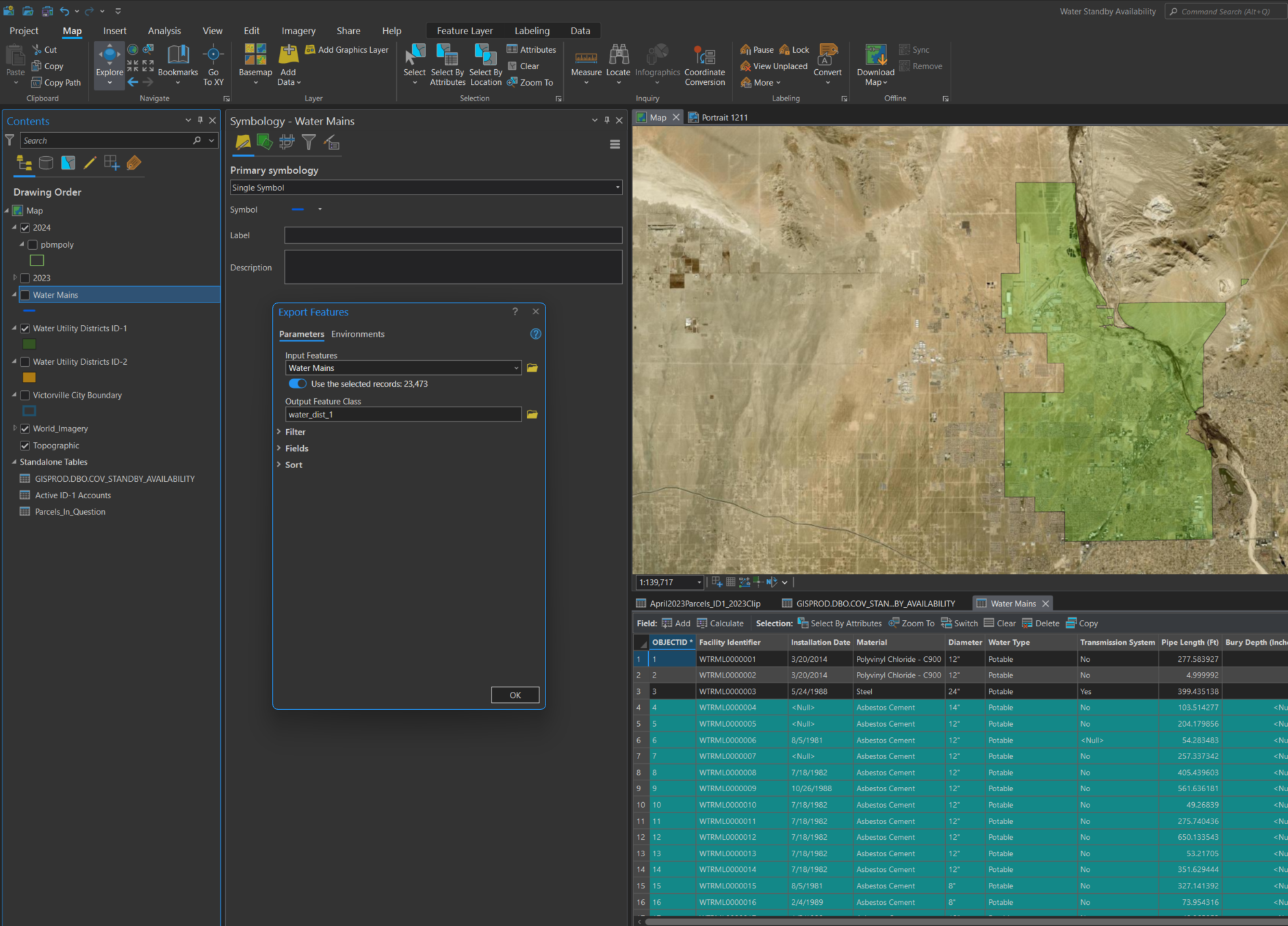
step 2
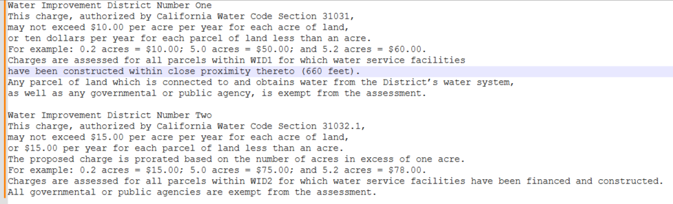
cut water main line into district 1 and 2, since district 1 charge $10 per arce, district 2 charge $15 per arce
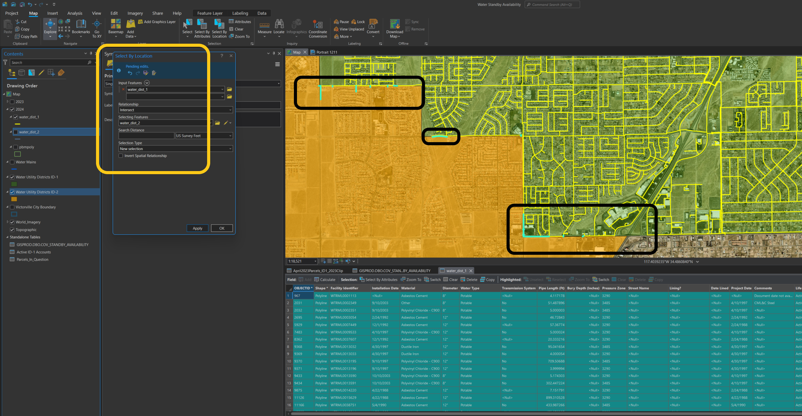
step 3
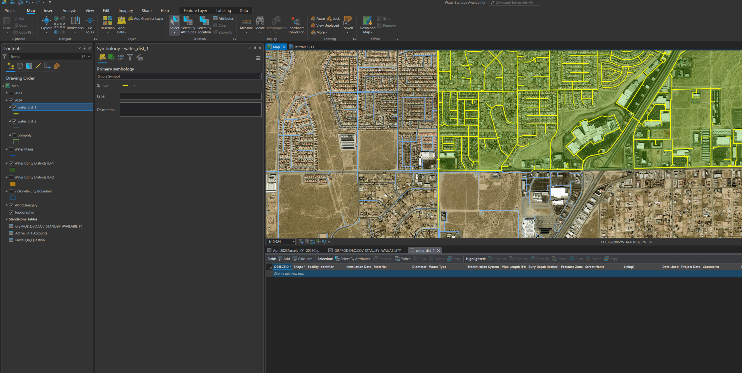
clean up some water line should be in district 2, just delete a few of these
step 4
create 660 feet buffer on district 1, water main line
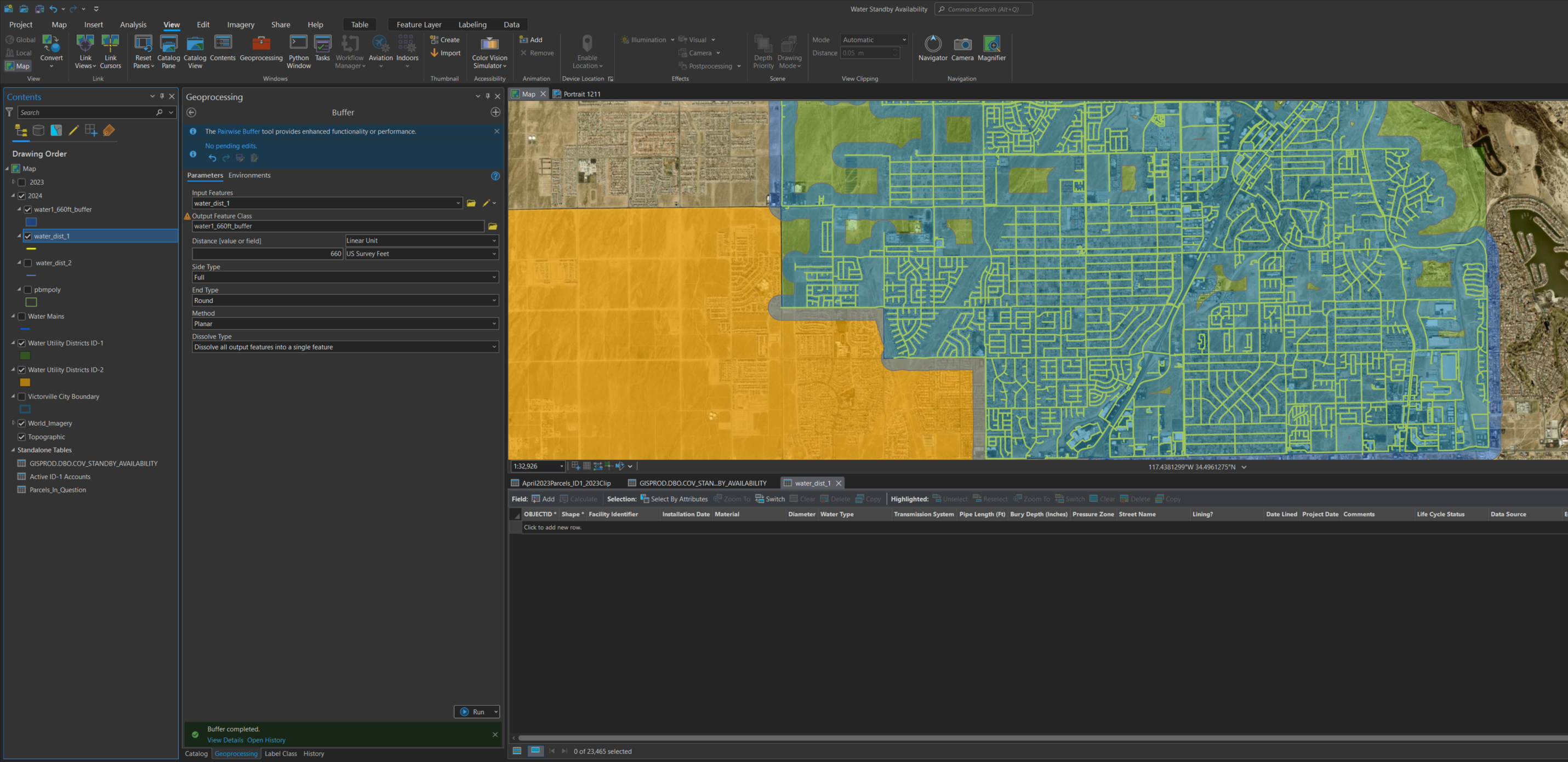
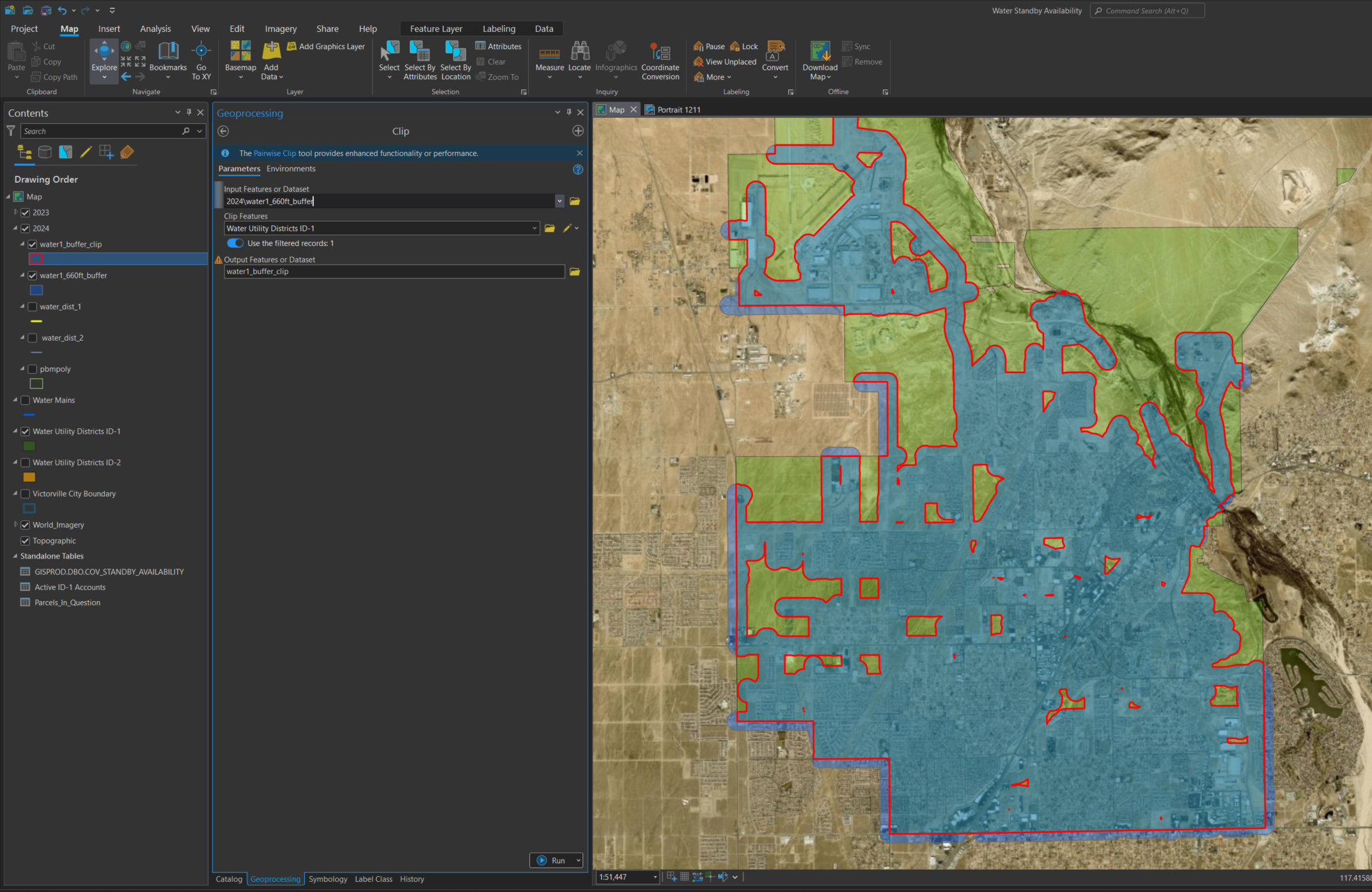
step 5
use district 1 boundary to clip previous 660 feet buffer zone
step 6
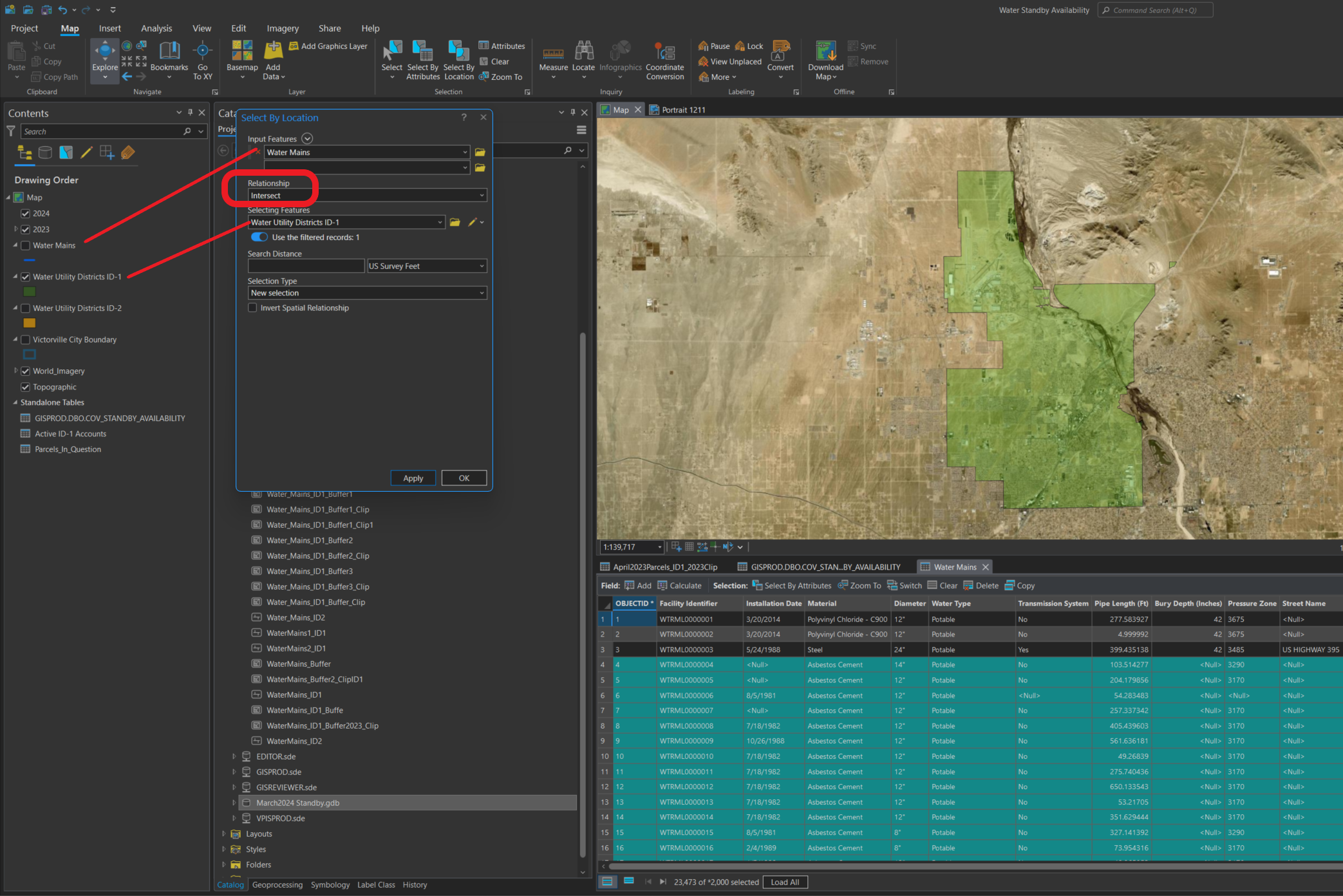
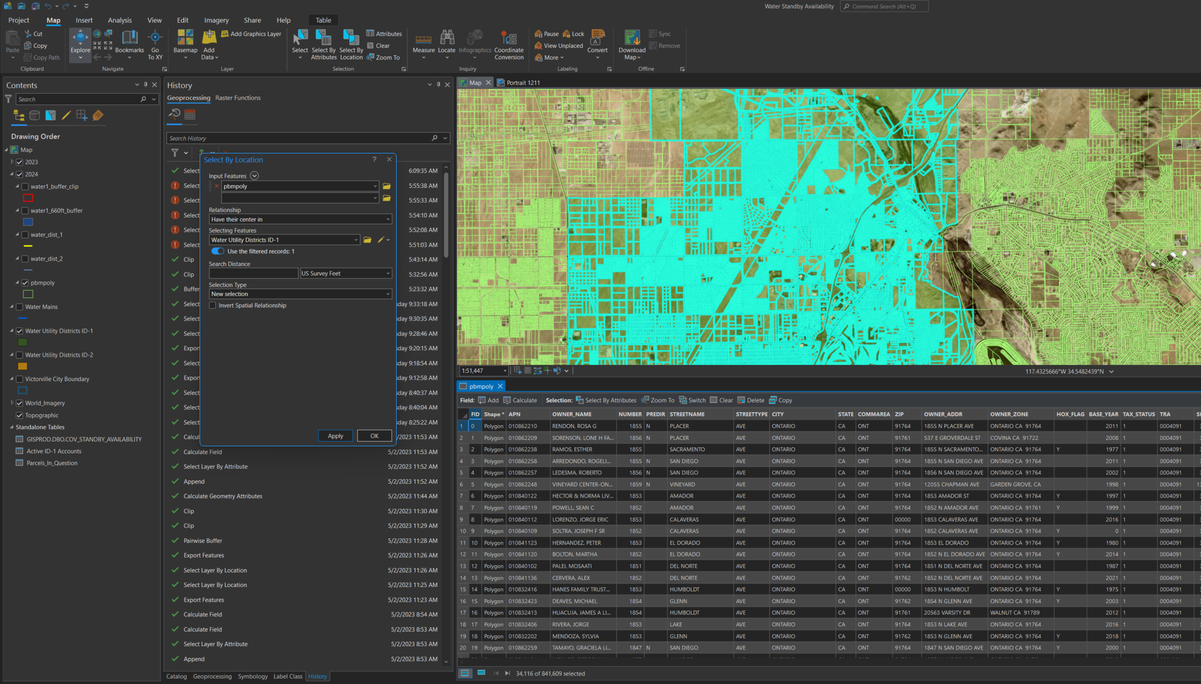
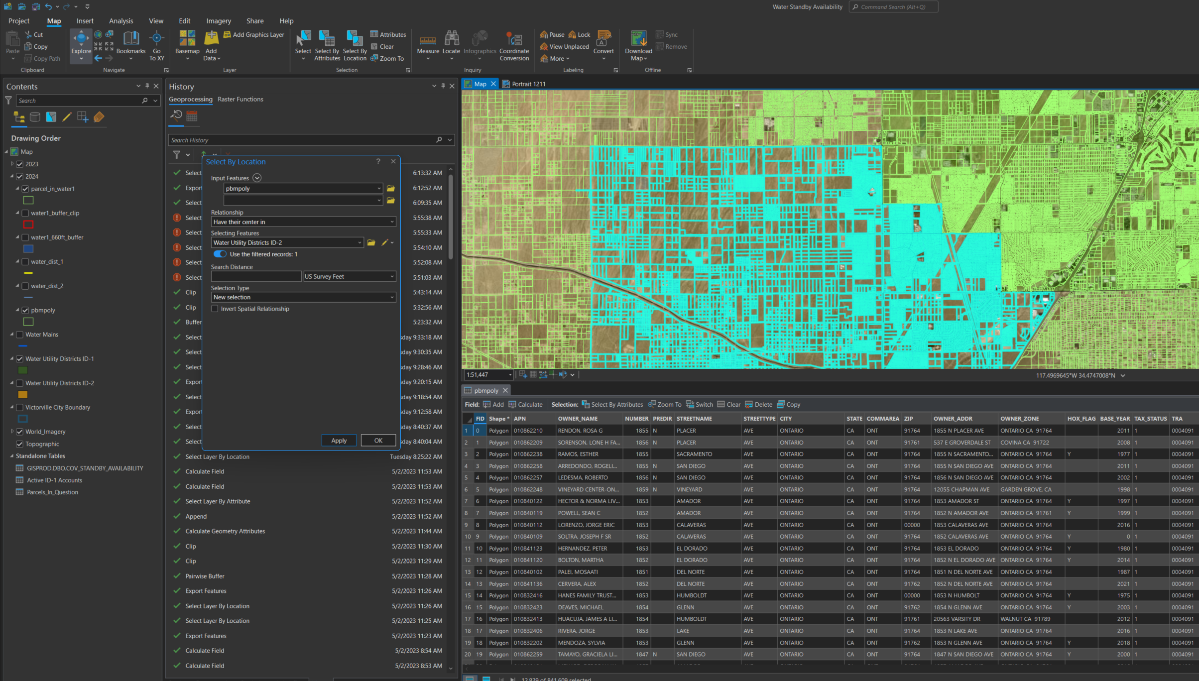
export parcel with parcel center in water district 1 and 2
step 7
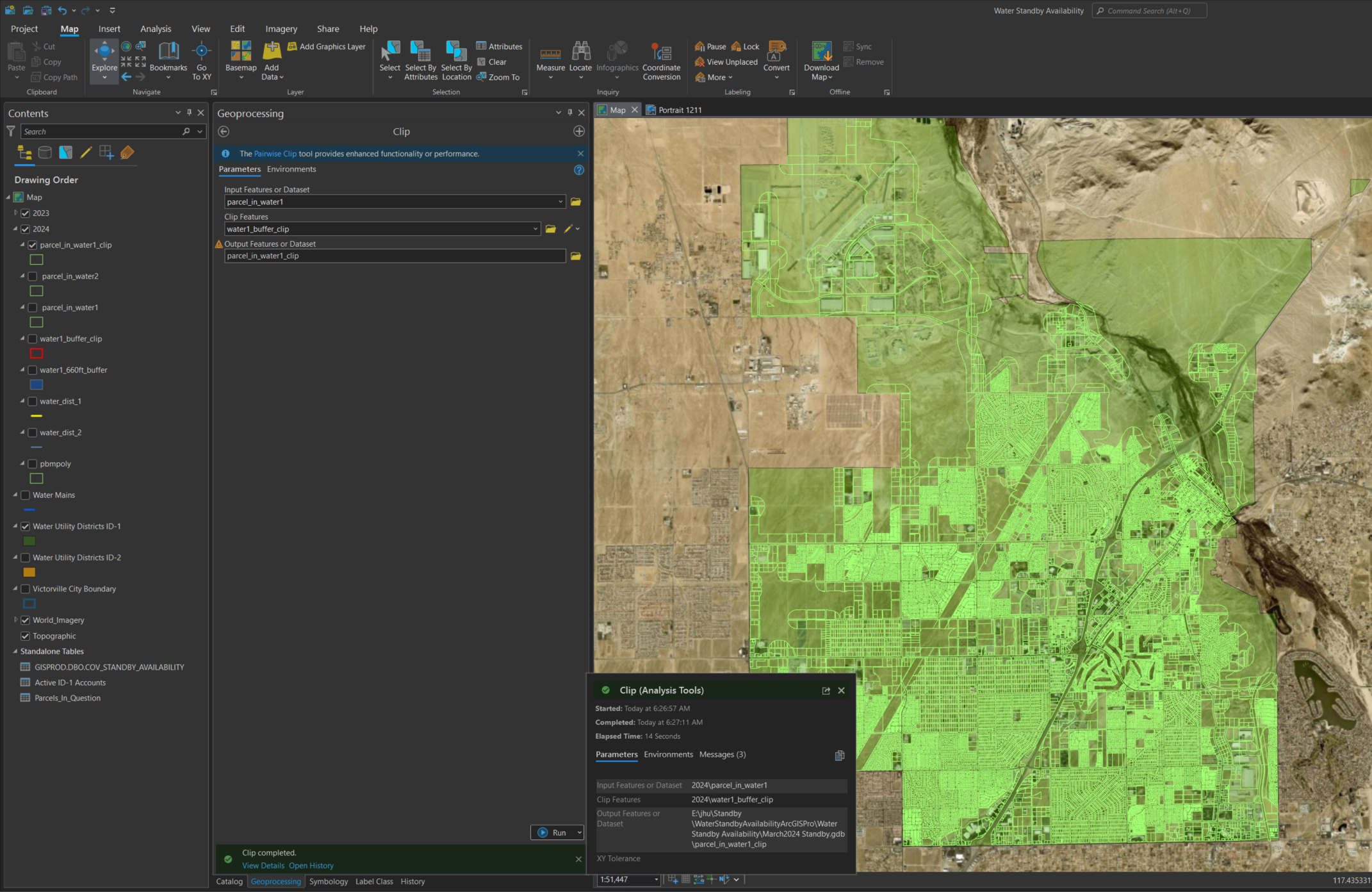
parcels in water district 1 clipped by previous water main line 660 feet buffer
step 8
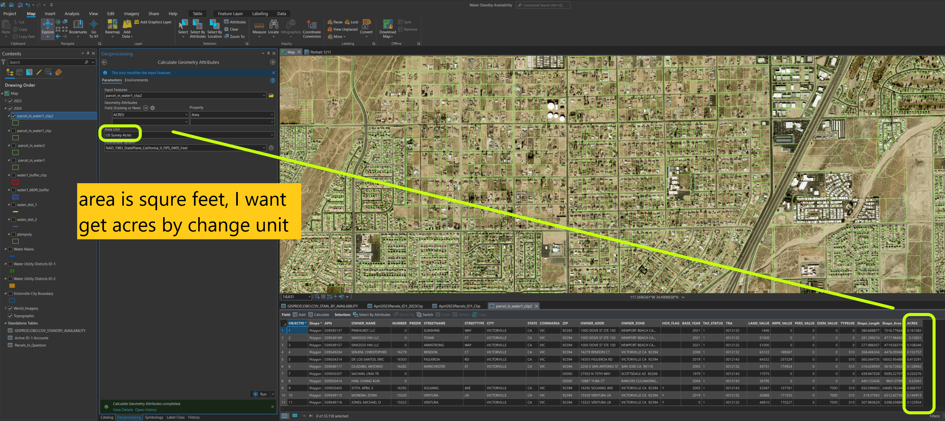
add a field ACRES, also populate this field by reformat existing Area field value from squre feet to acres