calculate acres column value on both water district
Step 1
add following 3 field to both district 1,2 table
Step 2
populate standby year and district id
Step 3
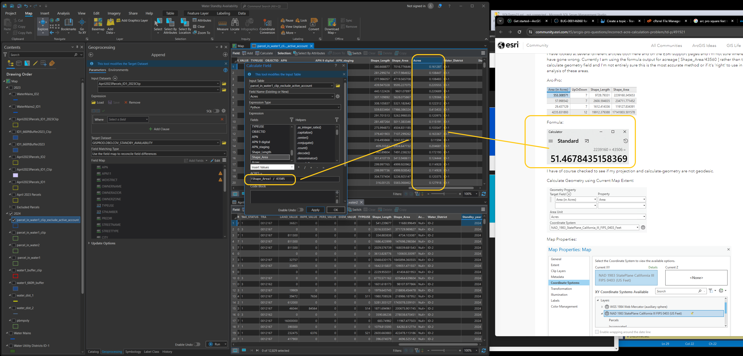
calculate acres
Step 4
ready to append district 1, 2
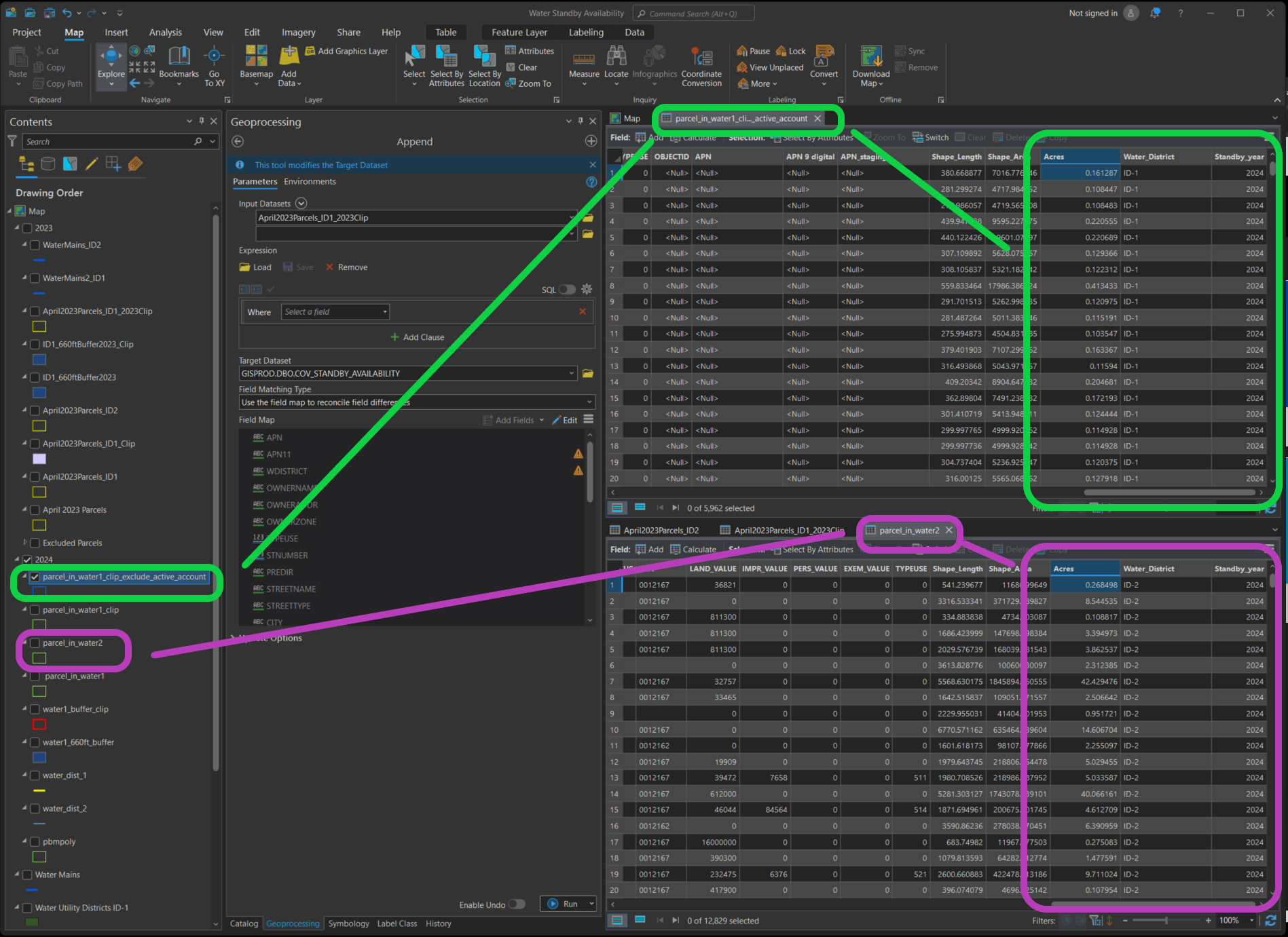
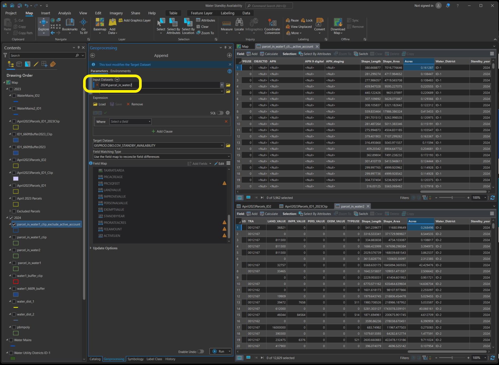
use append tool to combine water district 1 and 2
Step 1
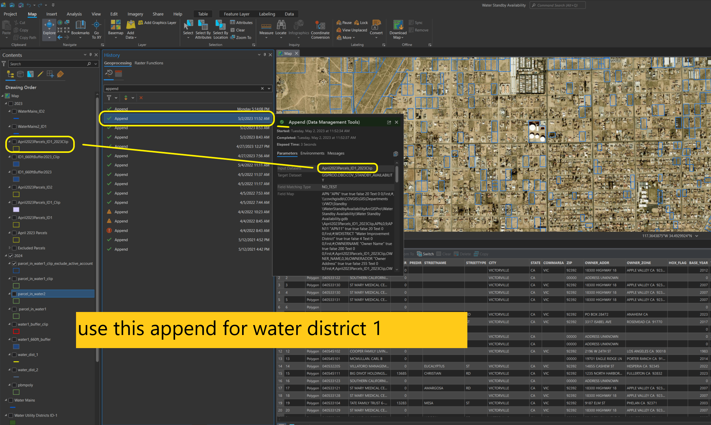
search 'append' in geoprocessing tab, history, I will use these 2 append tool

Step 2
use this append for water district 1
Step 3
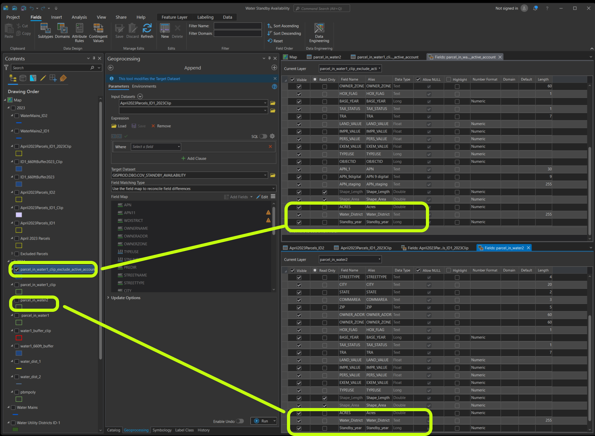
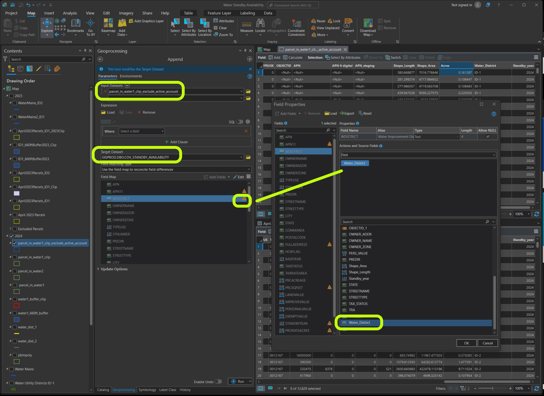
manully mapping following field, water district
Step 4
manully mapping following field, standby year

Step 5
Following field leave it as unmapped, because I will calculate after


Step 6
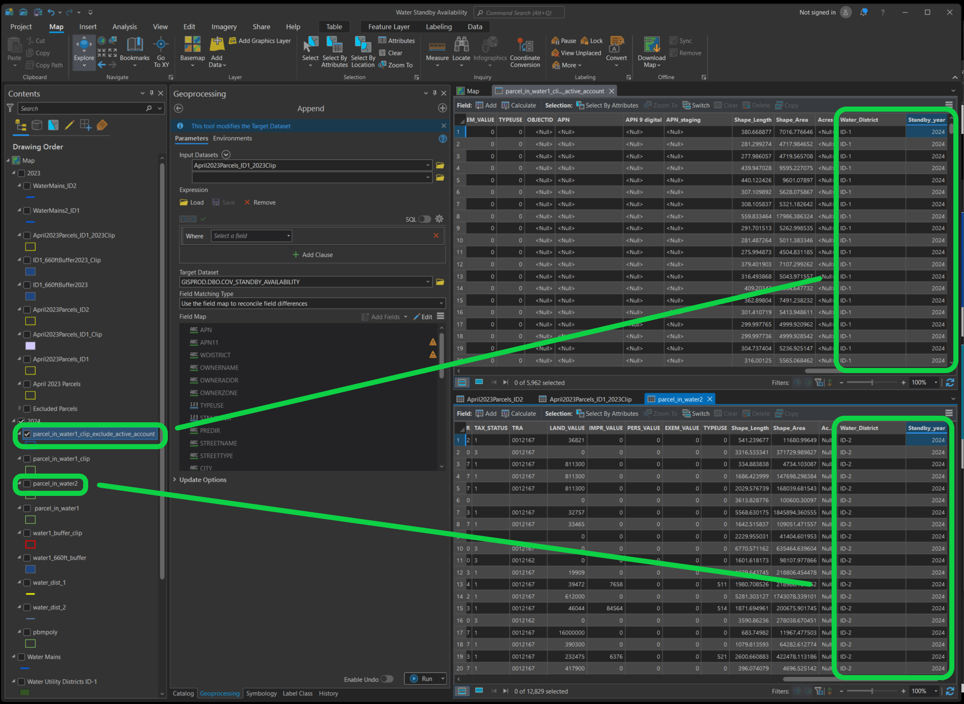
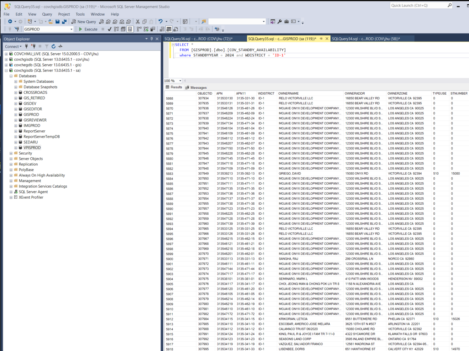
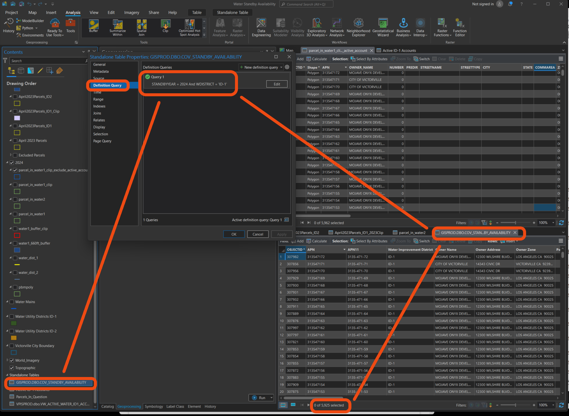
Warning. ArcPro bug, append tool does append 5962 rows, however, only district number and standby year 2 column get copied. The other colum are all value in target table COV_standby_availability. You can check in SQL server
Step 7
or you can check in ArcPro
Step 8
To fix ArcPro bug, you need to start a new arcPro project just do this append tool only
use load function to load previously saved exported fieldmap file, so you don't have to spend half hour again to map each field. To save you time

Step 8.1
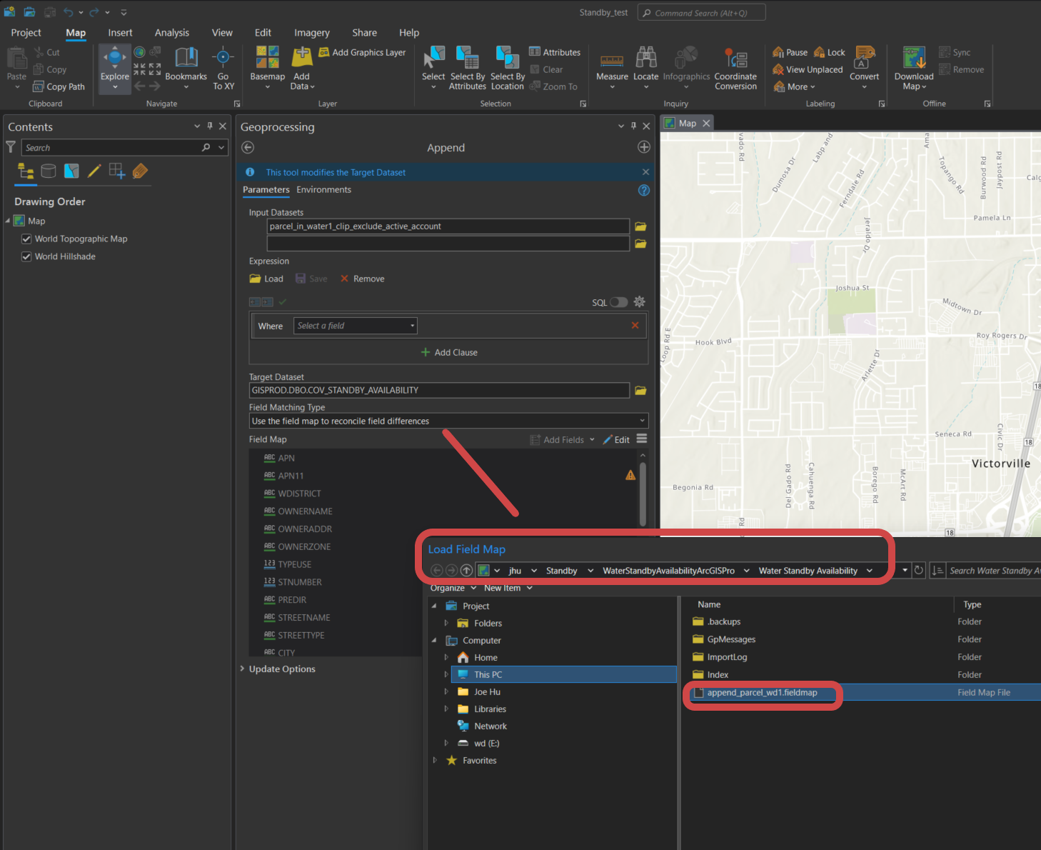
Step 8.2
repeat step 6 and 7 to check whether this time success. In my case, this fix the bug, no more null value
Step 9
Repeat step 4 to 8 again, but against water district 2