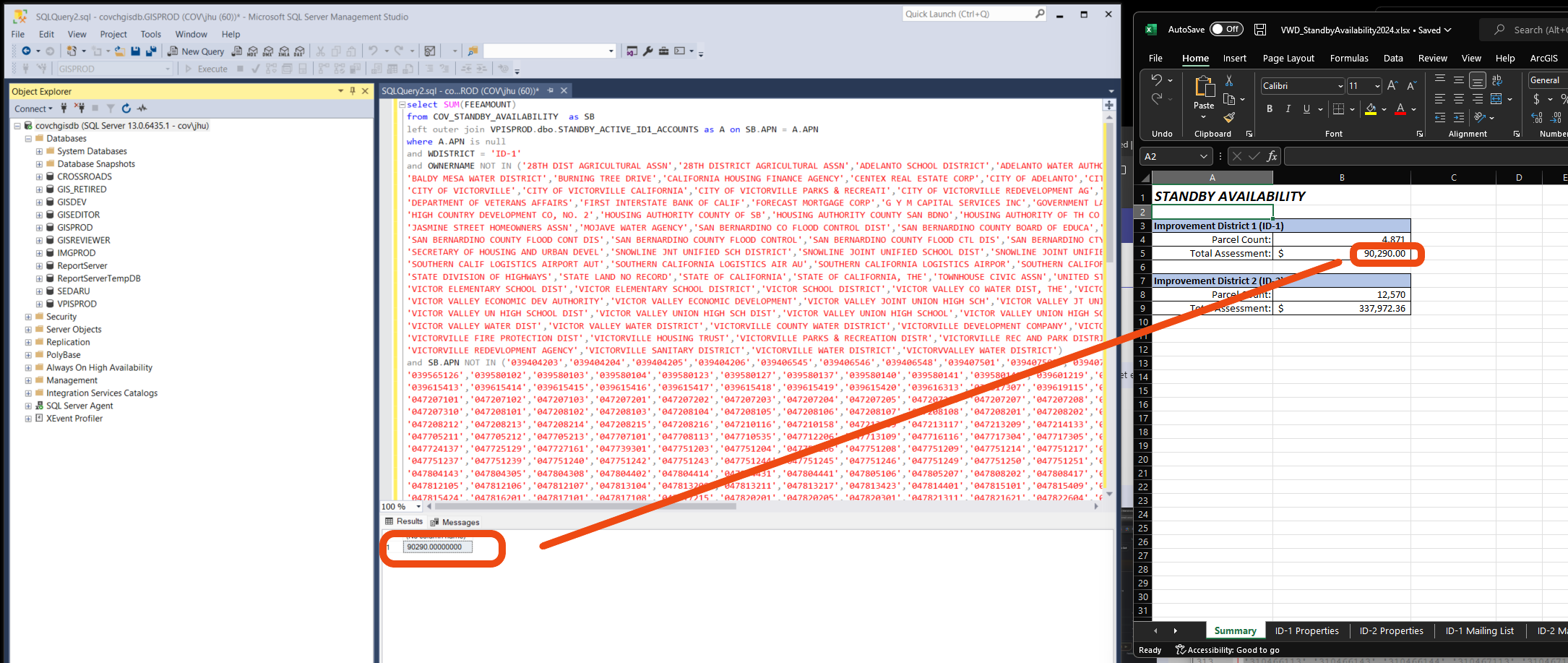
By state law, every water district in every city in California needs to run this report each year. It charge parcel owner water standby fee annually.
FAQ question 1
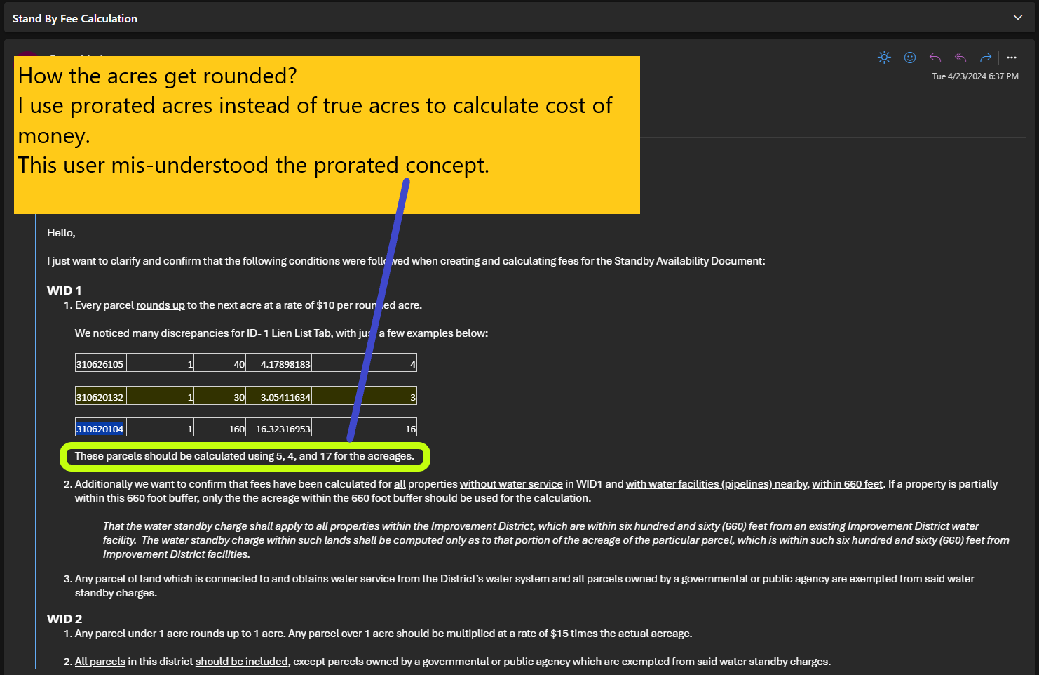
How the acres get rounded?
I use prorated acres instead of true acres to calculate cost of money.
This user mis-understood the prorated concept.
4.17 acres = 4 x $10 = $40 / per year
4.6 acres = 5 x $10 = $50 / per year
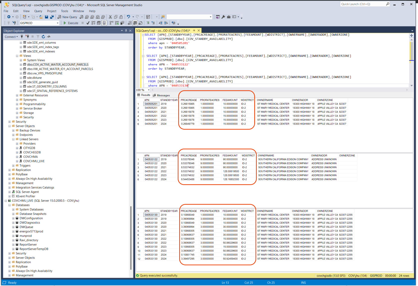
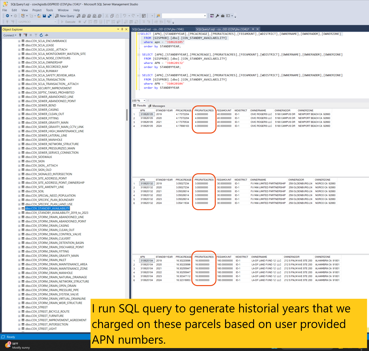
Regarding this user's question, I run SQL query to generate historial years that we charged on these parcels based on user provided APN numbers.
FAQ question 2
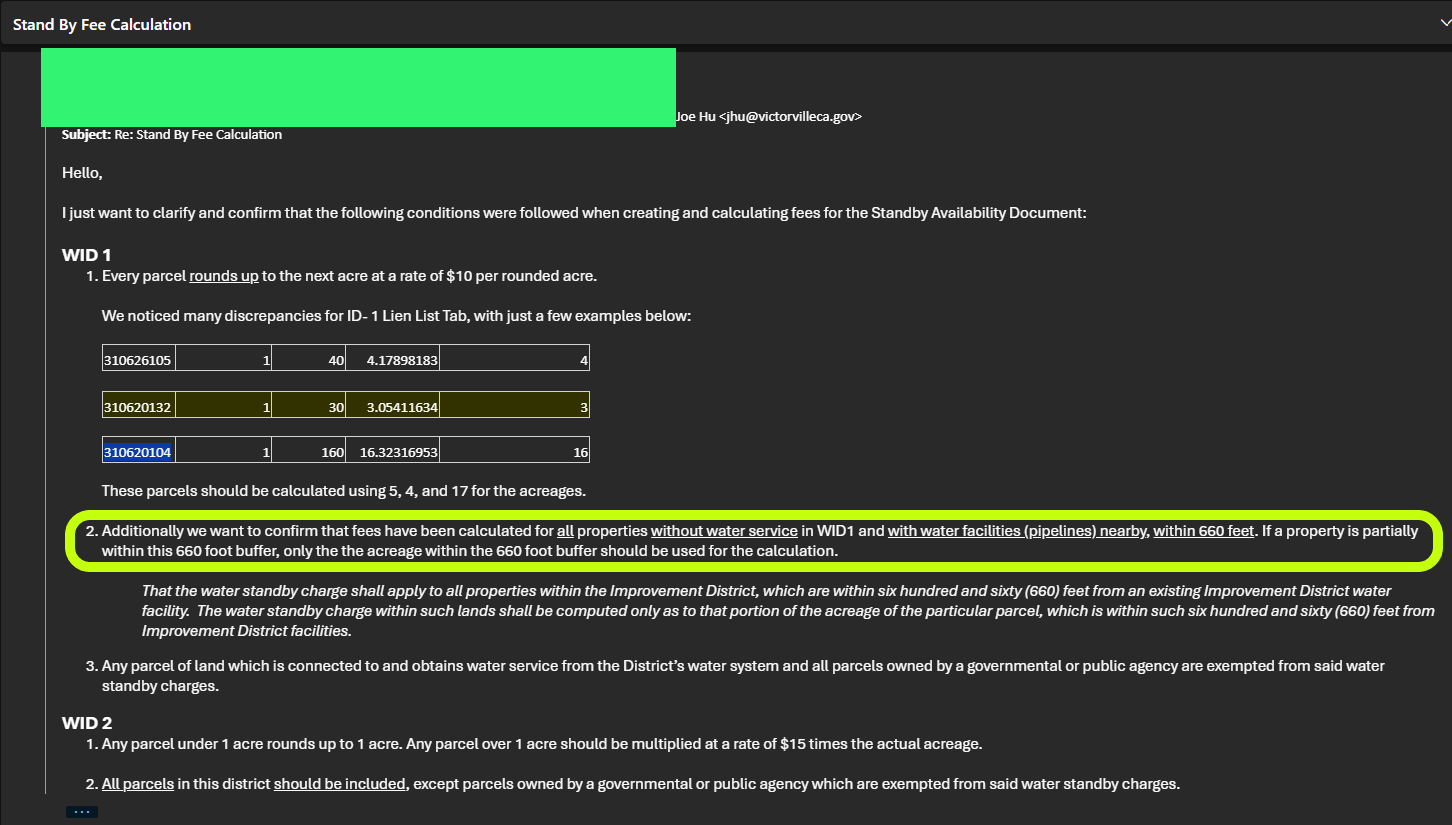
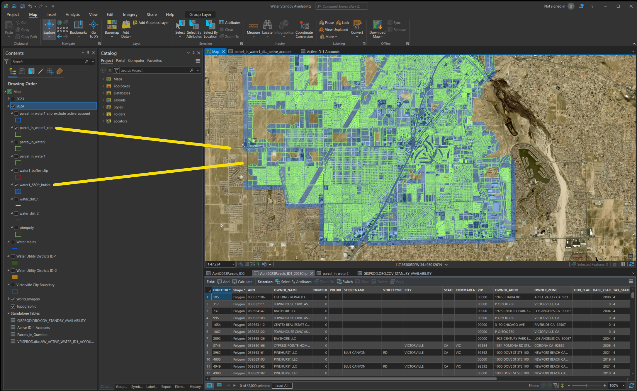
By california state law, #2 was implemented by use ArcPro to generate 660 feet buffer, then use this buffer to clip(cut) the true original parcel polygon. As result some parcels could be cut into 2 parts, only 1 part overlapped by 660 feet butter zone, the other part don't. I only charge overlapped part by prorated acres x $10.
FAQ question 3
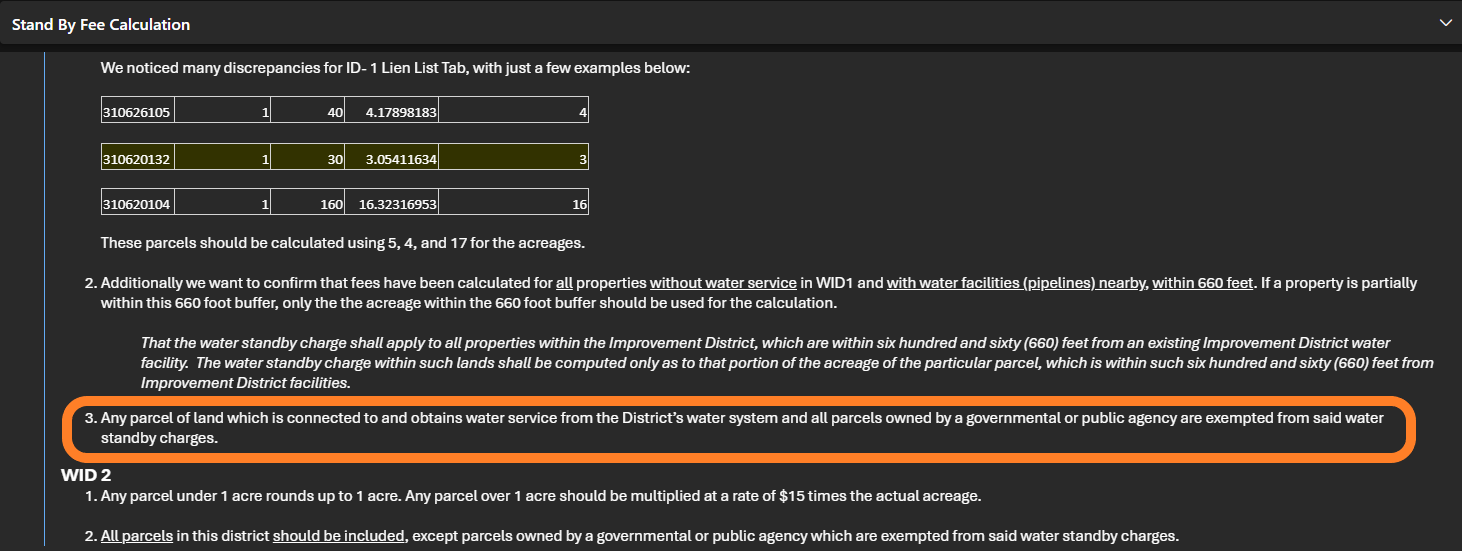
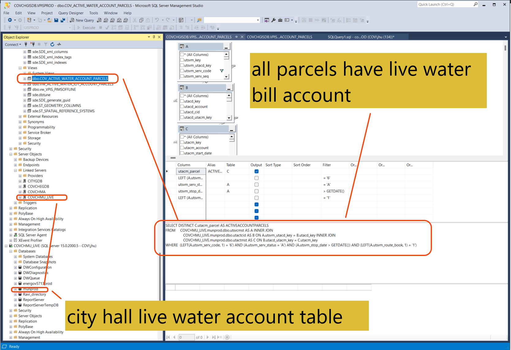
Any parcel of land which is connected to and obtains water service from the District’s water system is exempted.
This was implement in SQL server, those parcel have active water bill account. I first use SQL to select all those parcels that have active water bill account. Then remove these parcels from Standby parcels.
Exempt parcels was removed from standby charge
These are government owned parcels along with other exempt parcel number.
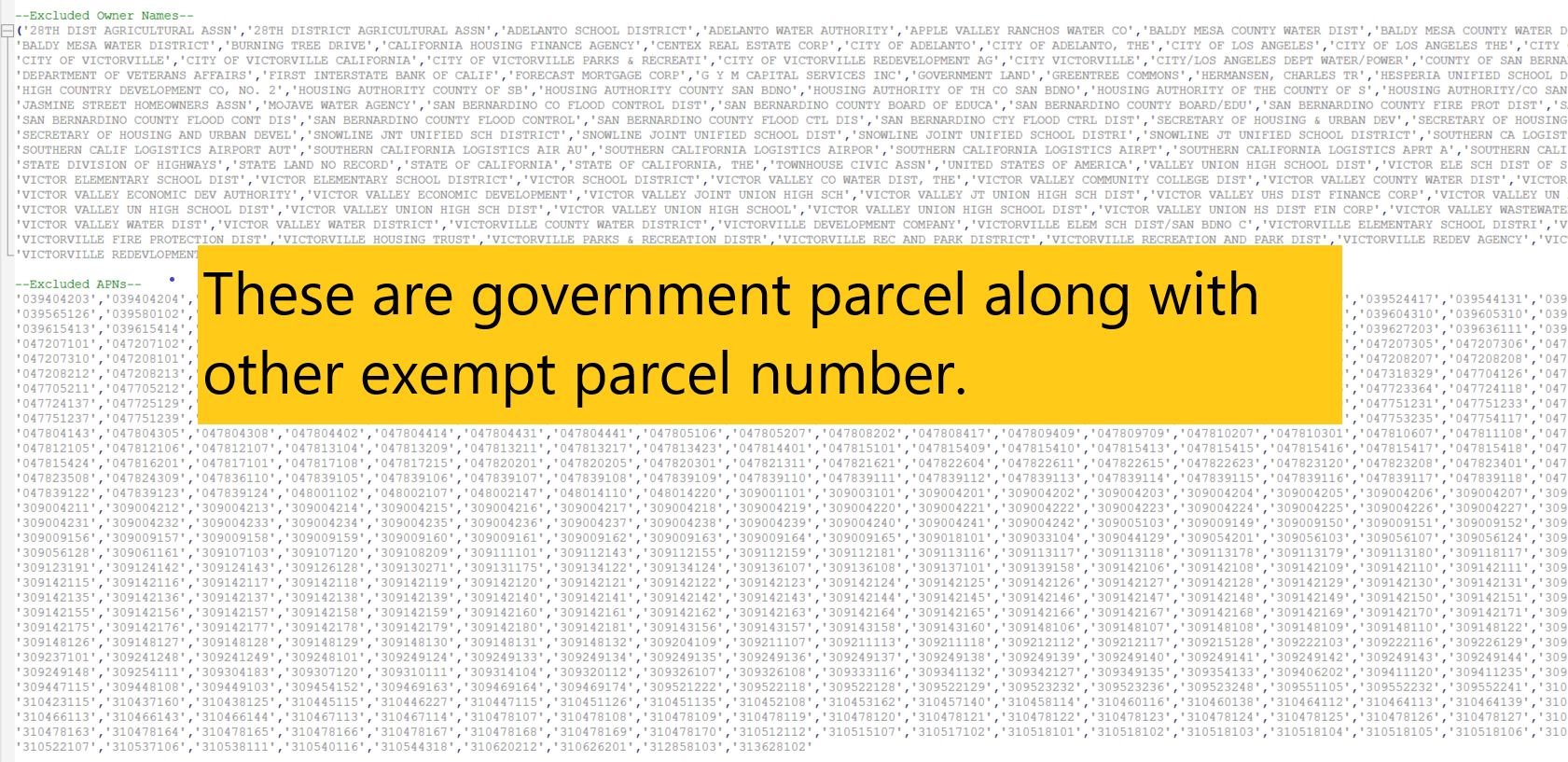
Government parcel are exempted was implement use SQL query in down stream process.
FAQ question 4
water district #2 has different rate
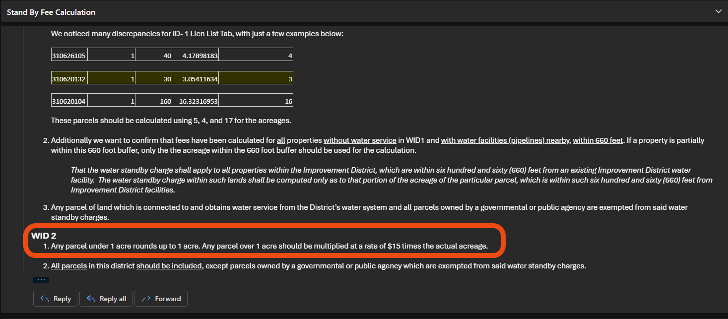
Prorated acres was used to calculate cost of money instead of true arcres, similar to water district 1 but with different rate. I run SQL to get a few samples parcel in water district 2.