step 1
Click top left home button link to reveal the root URL of any arcgis REST api endpoint
For example New York State arcgis server REST service API root URL is here by click home
https://gisservices.its.ny.gov/arcgis/rest/services
The root URL is always ending as ..../arcgis/rest/services
The exception is if you don't use arcgis as default arcgis web adaptor name, then the root URL will be your customized web adaptor name/rest/service
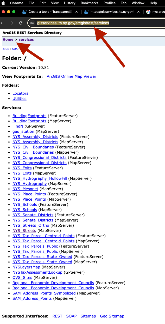
The problem is you can't see any map so far. You only see a list of topic, basically it is useless. You really want to see the real map of each topic.
step 2
open transparentgov home page,
https://transparentgov.net
click this tool
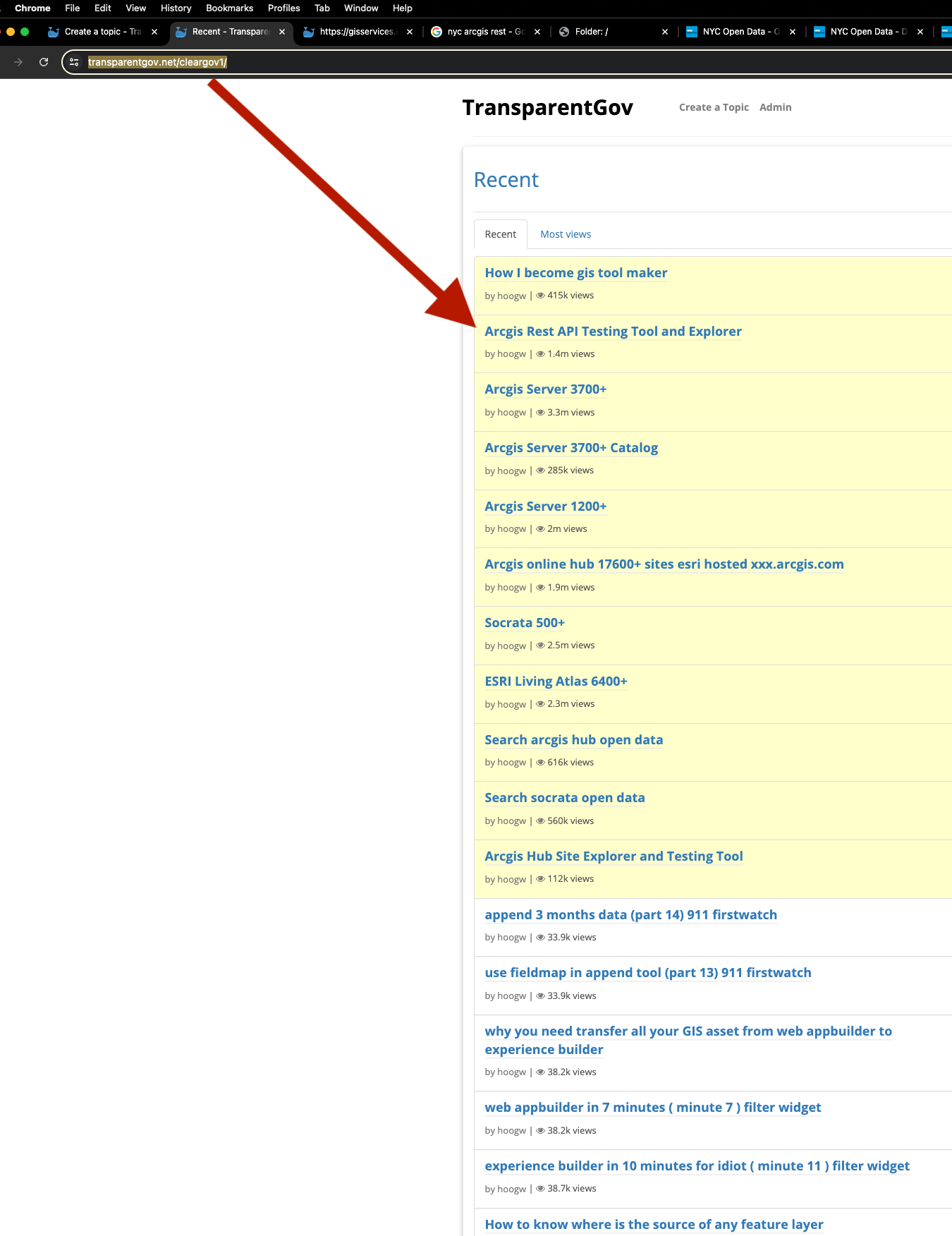
step 3
There are 4 kind of tools available, I will just pick the first one as example to show here
https://transparentgov.net/cleargov1/1148/arcgis-rest-api-testing-tool-and-explorer
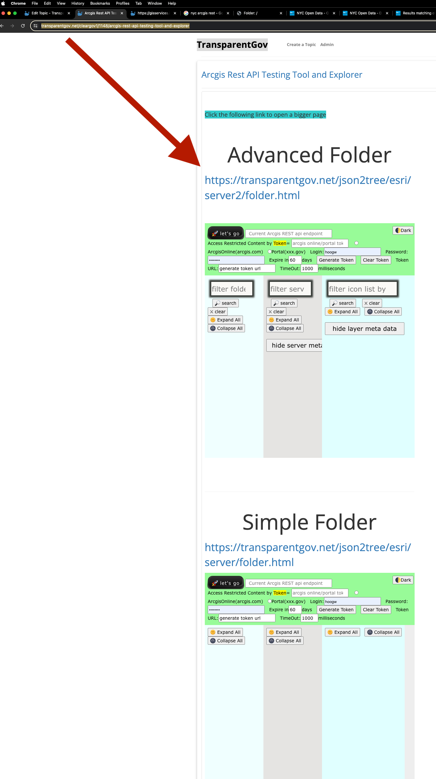
step 4
Copy and past the root of Arcgis REST api endpoint URL next to let's go button, then click let's go button
https://transparentgov.net/json2tree/esri/server2/folder.html?org=https%3A%2F%2Fgisservices.its.ny.gov%2Farcgis%2Frest%2Fservices&url=https%3A%2F%2Fgisservices.its.ny.gov%2Farcgis%2Frest%2Fservices&arcgis_online_token=&select_folder=31&select_layer=4
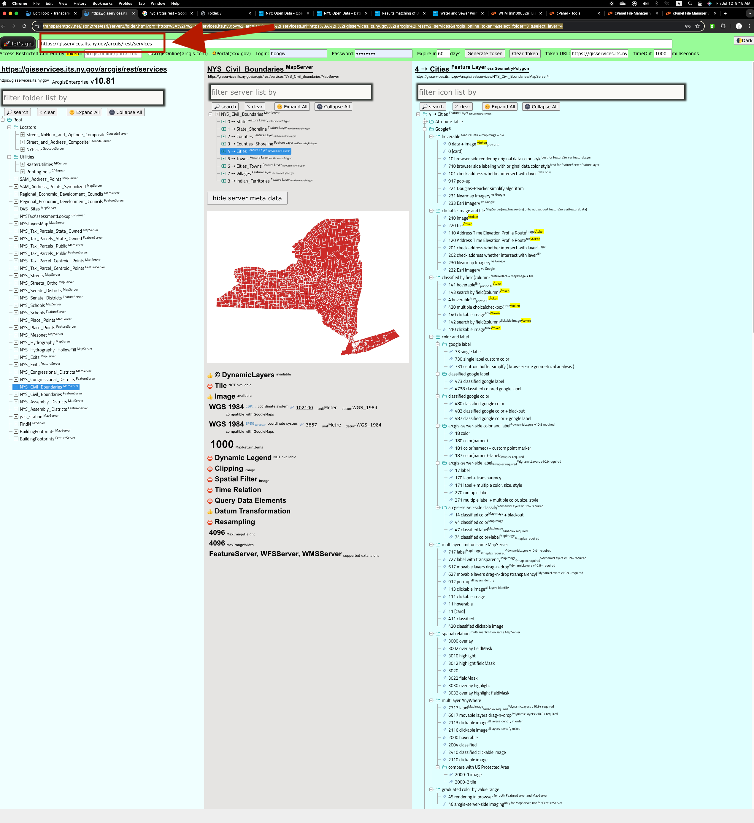
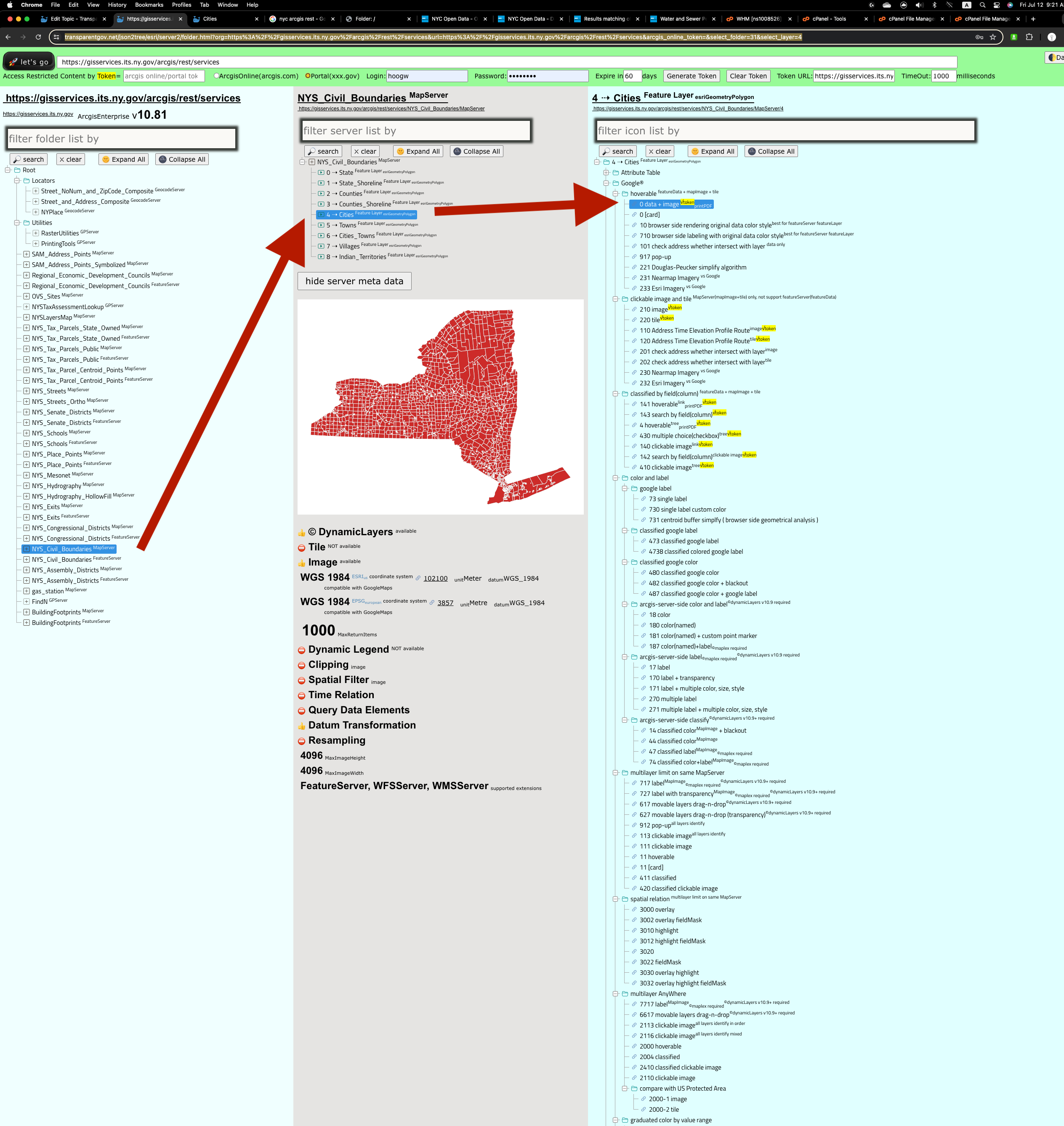
step 5
Select the topic you are interest in, select the google map viewer or other more than 100 types of viewer to see the real map
https://transparentgov.net/json2tree/esri/server2/folder.html?org=https%3A%2F%2Fgisservices.its.ny.gov%2Farcgis%2Frest%2Fservices&url=https%3A%2F%2Fgisservices.its.ny.gov%2Farcgis%2Frest%2Fservices&arcgis_online_token=&select_folder=31&select_layer=4
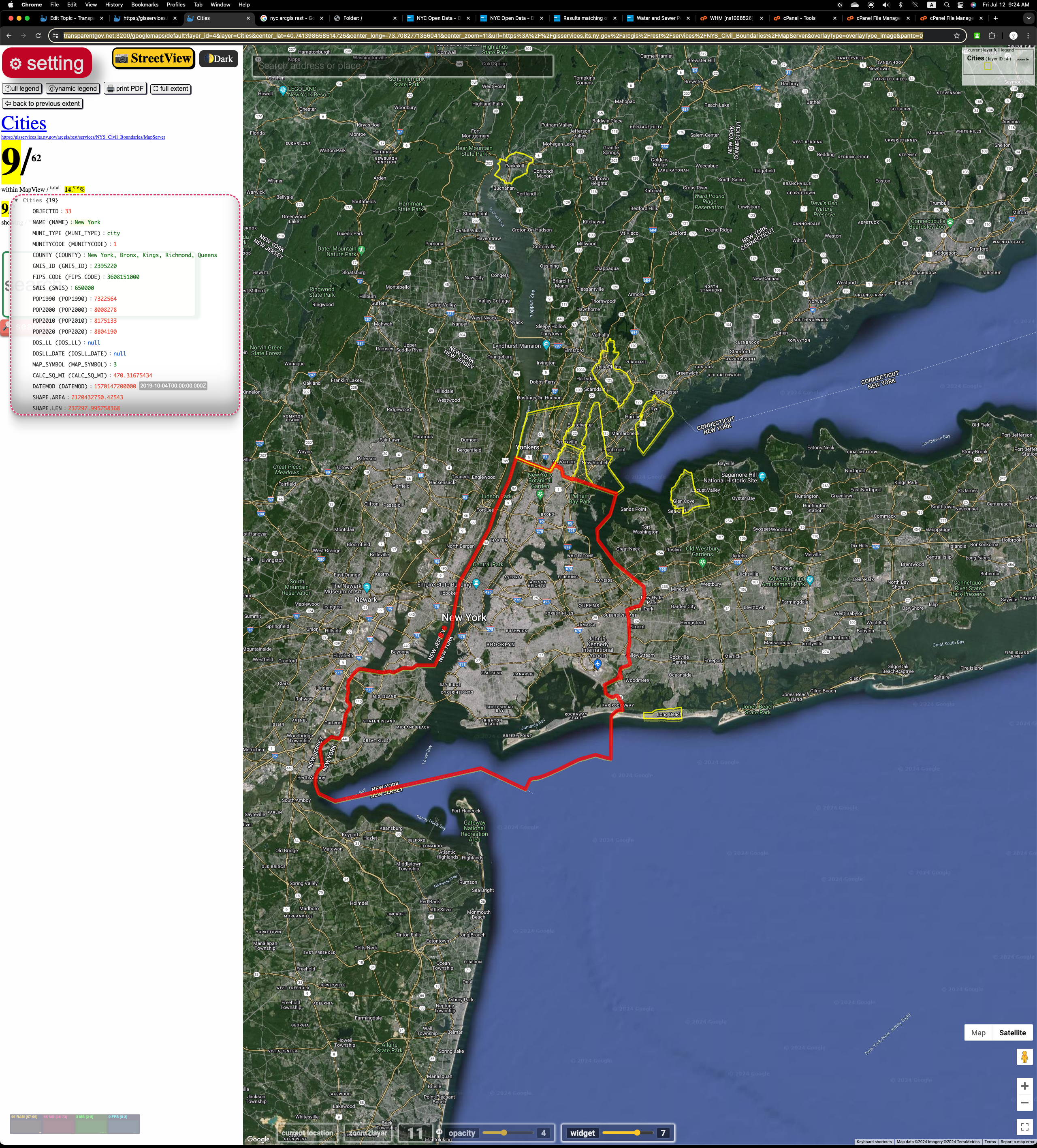
step 6
Now you can see the real map of each topic, in this case, it is all cities in New York State on google maps.
https://transparentgov.net:3200/googlemaps/default?layer_id=4&layer=Cities¢er_lat=40.741398658514726¢er_long=-73.7082771356041¢er_zoom=11&url=https%3A%2F%2Fgisservices.its.ny.gov%2Farcgis%2Frest%2Fservices%2FNYS_Civil_Boundaries%2FMapServer&overlayType=overlayType_image&panto=0
step 7
With this free transparentgov tool, you can see tens of thousands of US government agency's arcgis map content, it is like a bike allow you use less effort to move longer distance. I spend 10+ years to develope this free tool allow human to use less effort see meaningful map otherwise you can't make use of Arcgis REST api endpoint alone. You need some tools to make use of Arcgis REST api.