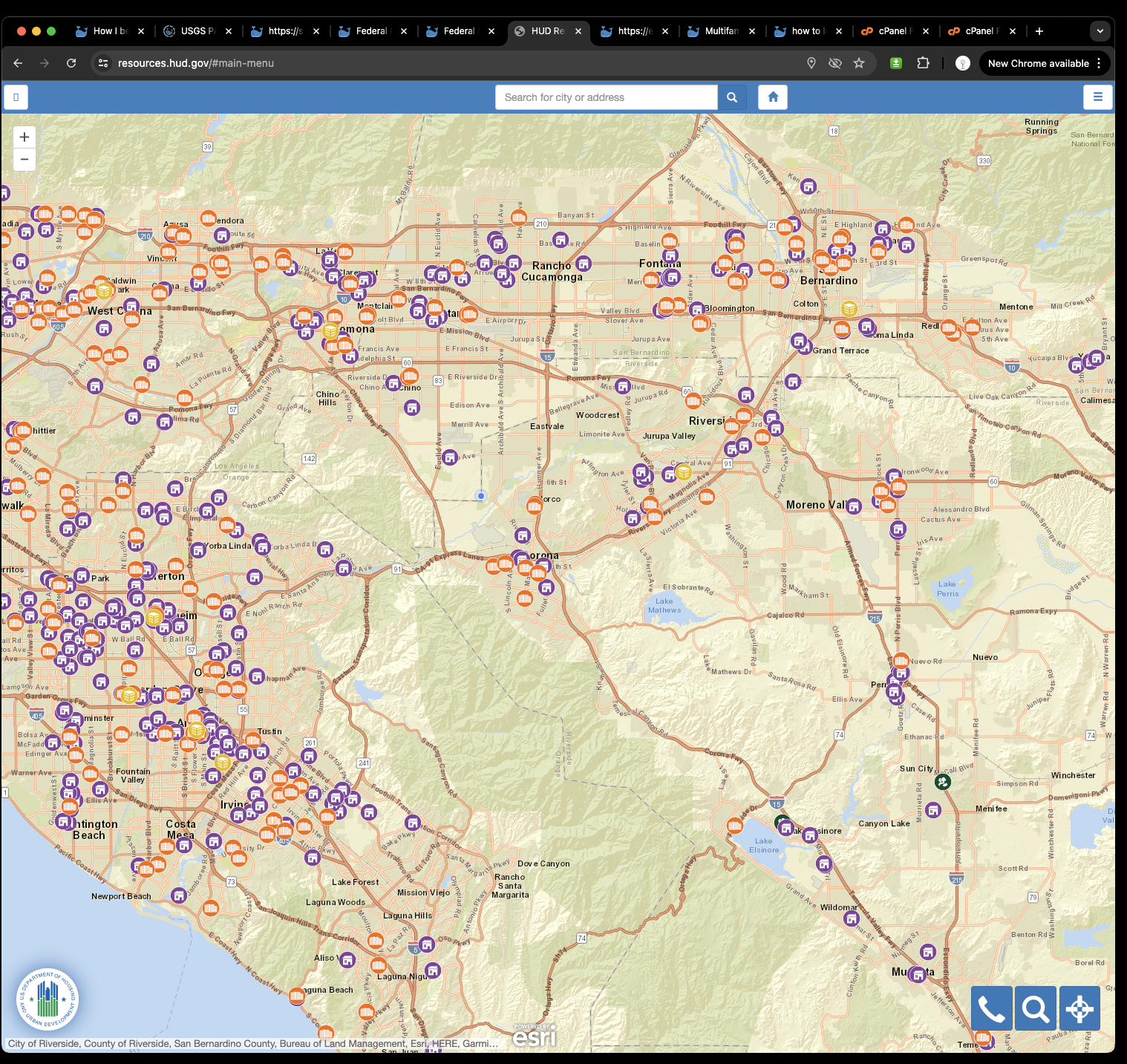
Official map is here
https://resources.hud.gov/#
But where the data comes from ?
This arcgis server REST api endpoint feed the official HUD resource locator map
https://egis.hud.gov/arcgis/rest/services/hrl/HudResourceLocator/MapServer
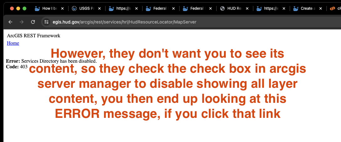
However, they don't want you to see its content, so they check the check box in arcgis server manager to disable showing all layer content, you then end up looking at this ERROR message, if you click that link
Smart ? or NOT ?
Stupid. Period.
If you don't want public to see all layer content, you should configure it as share within organization only on your arcgis enterprise portal for this particular resource.
By just let user watch error message is not grace, not effective, public user still can see your full content by using some sort of GIS tools.
Here is how
Copy and past Arcgis REST api endpoint in here, then click let's go button
https://transparentgov.net/json2tree/esri/server2/folder.html?org=https%3A%2F%2Fegis.hud.gov%2Farcgis%2Frest%2Fservices%2Fhrl%2FHudResourceLocator%2FMapServer&url=https%3A%2F%2Fegis.hud.gov%2Farcgis%2Frest%2Fservices%2Fhrl%2FHudResourceLocator%2FMapServer&arcgis_online_token=&select_folder=1&select_layer=2
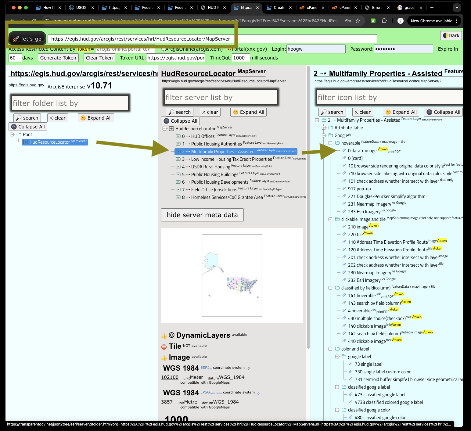
Click any of google map, will open a new window or new tab
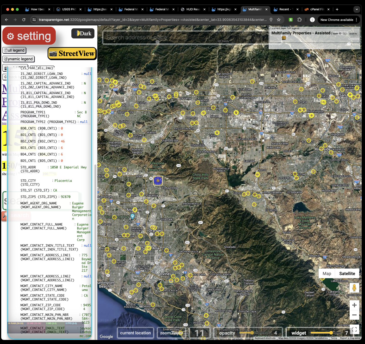
This google map based web map, use the same data from HUD official map,
You don't need training, you don't need tutorial, you can just find the government funded apartment intuitive as you use google map.
https://transparentgov.net:3200/googlemaps/default?layer_id=2&layer=Multifamily+Properties+-+Assisted¢er_lat=33.90063543103844¢er_long=-117.64180464785156¢er_zoom=11&url=https%3A%2F%2Fegis.hud.gov%2Farcgis%2Frest%2Fservices%2Fhrl%2FHudResourceLocator%2FMapServer&overlayType=overlayType_image&panto=0
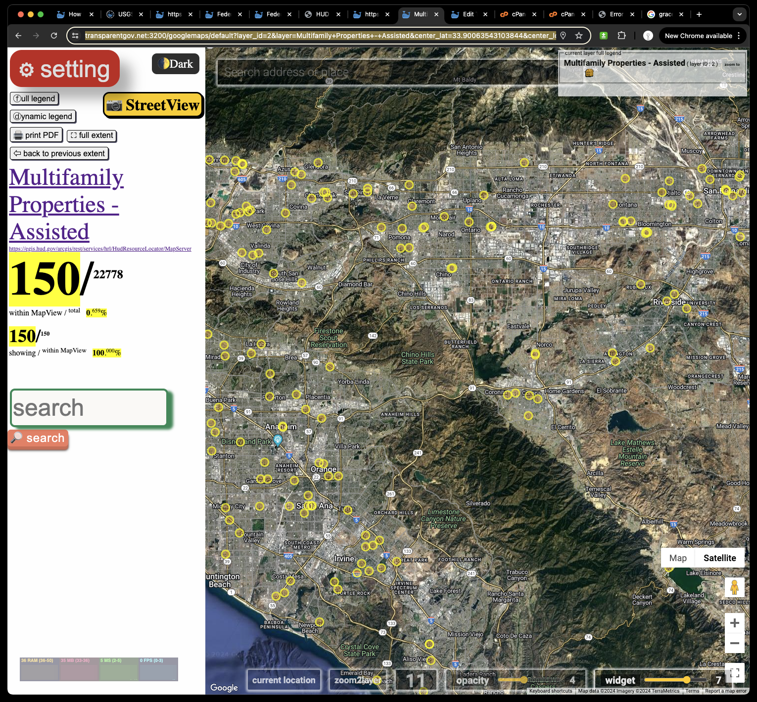
You can click any yellow circle to see apartment phone number along with other information