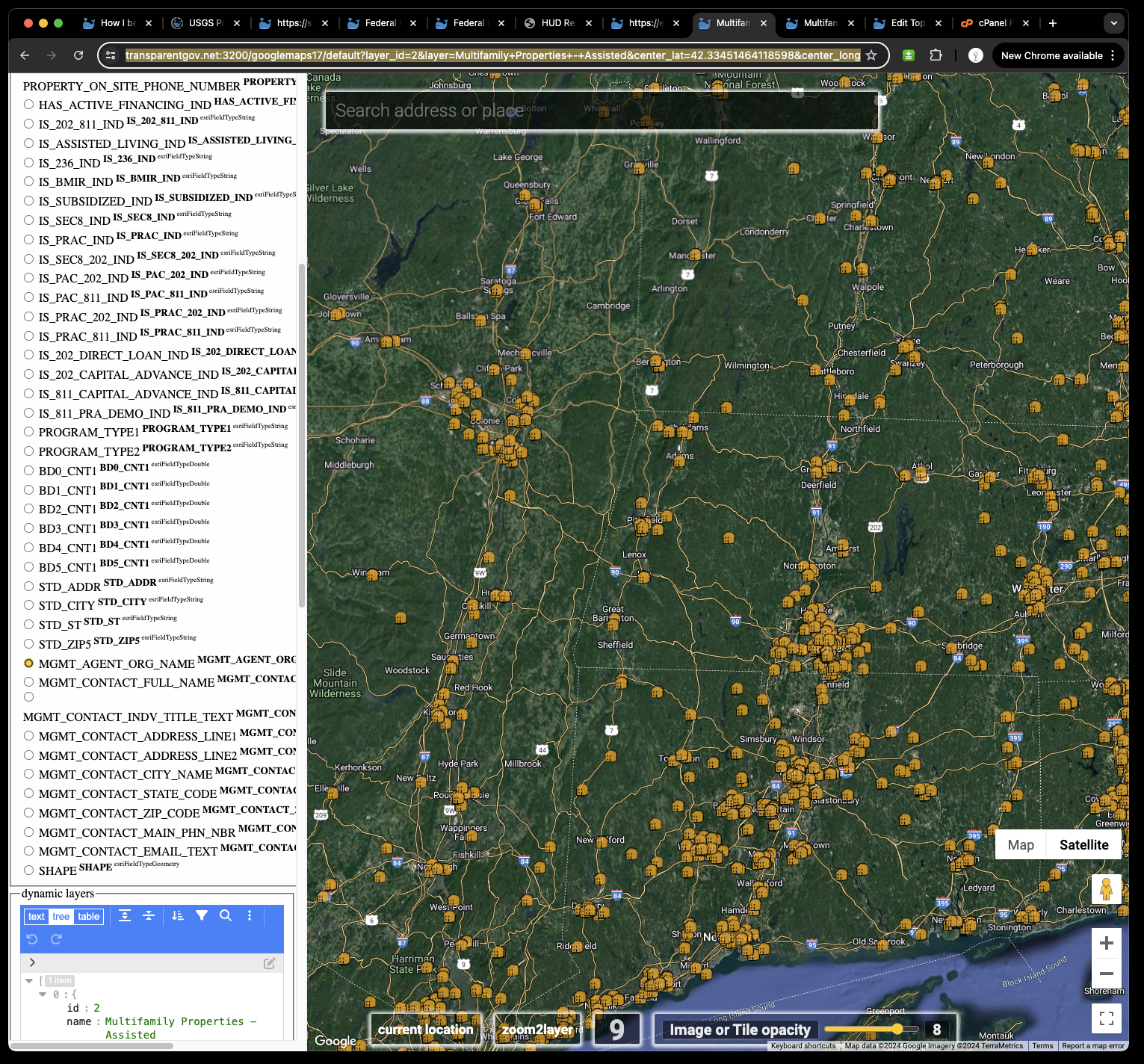
Official map is here
https://resources.hud.gov/#
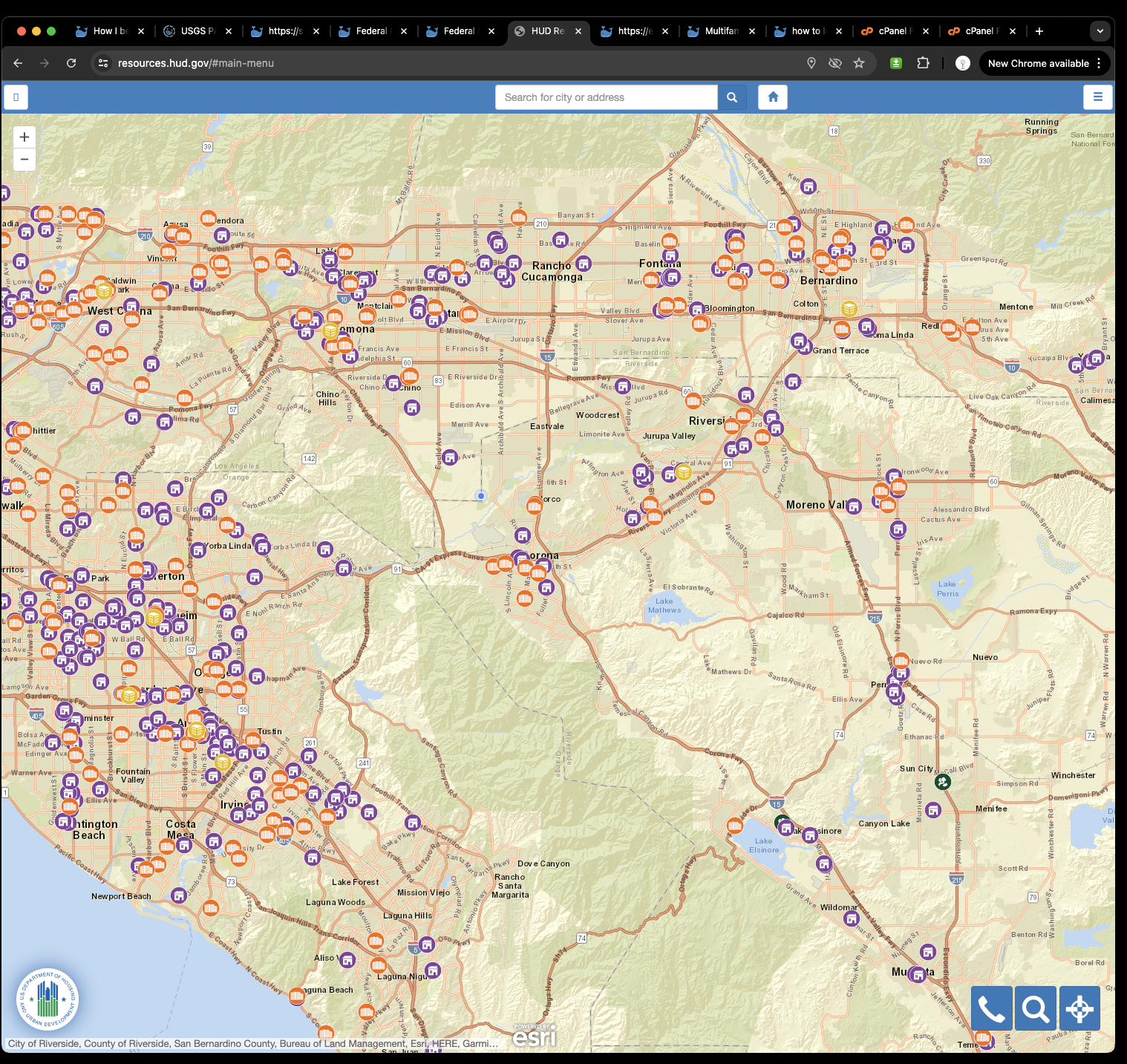
But no label ?
No wonder why it is horrible to use.
For example, I have to click every little icon to review each one. I am watching 500 little icon, just can't click 500 times to open each one to find the apartment name.
Don't you use google map ? walmart, costco, target, etc are all labeled, I don't need to click every little dot to see whether it is walmart or homedepot. All shops has label, user don't need to click anything. That is intuitive design.
If hub label all apartment name, user can easily remember apartment name with location.
Human intuitively remember name easier( remember pronounced name sound, saved in memory)
Human does not effective to remember map location by remember the map view of image ( show where the location ).
Hud don't provide label for each apartment, that means, user have to remember image of map location, that is horrible user experience. If you tell me the apartment name, I can remember for a long time.
If you only let me look at the apartment location on map without name, in a few minutes I will not be able to point where it should be on map.
How to solve this problem?
Yes, you can with some sort of GIS tools.
Copy HUD arcgis server REST api endpoint
https://egis.hud.gov/arcgis/rest/services/hrl/HudResourceLocator/MapServer
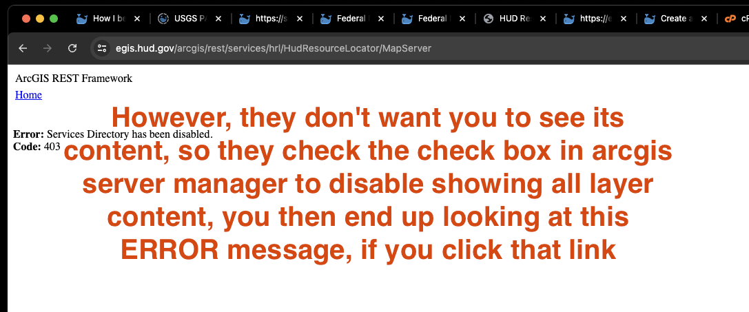
paste here
Copy and past Arcgis REST api endpoint in here, then click let's go button
https://transparentgov.net/json2tree/esri/server2/folder.html?org=https%3A%2F%2Fegis.hud.gov%2Farcgis%2Frest%2Fservices%2Fhrl%2FHudResourceLocator%2FMapServer&url=https%3A%2F%2Fegis.hud.gov%2Farcgis%2Frest%2Fservices%2Fhrl%2FHudResourceLocator%2FMapServer&arcgis_online_token=&select_folder=1&select_layer=2
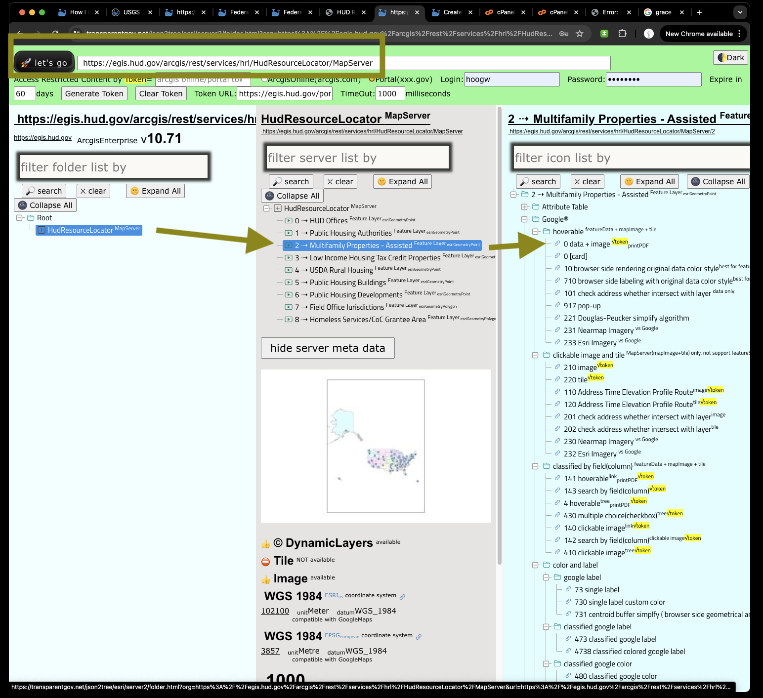
Click 73 google single label, will open a new new tab
https://transparentgov.net/json2tree/esri/server2/folder.html?org=https%3A%2F%2Fegis.hud.gov%2Farcgis%2Frest%2Fservices%2Fhrl%2FHudResourceLocator%2FMapServer&url=https%3A%2F%2Fegis.hud.gov%2Farcgis%2Frest%2Fservices%2Fhrl%2FHudResourceLocator%2FMapServer&arcgis_online_token=&select_folder=1&select_layer=2
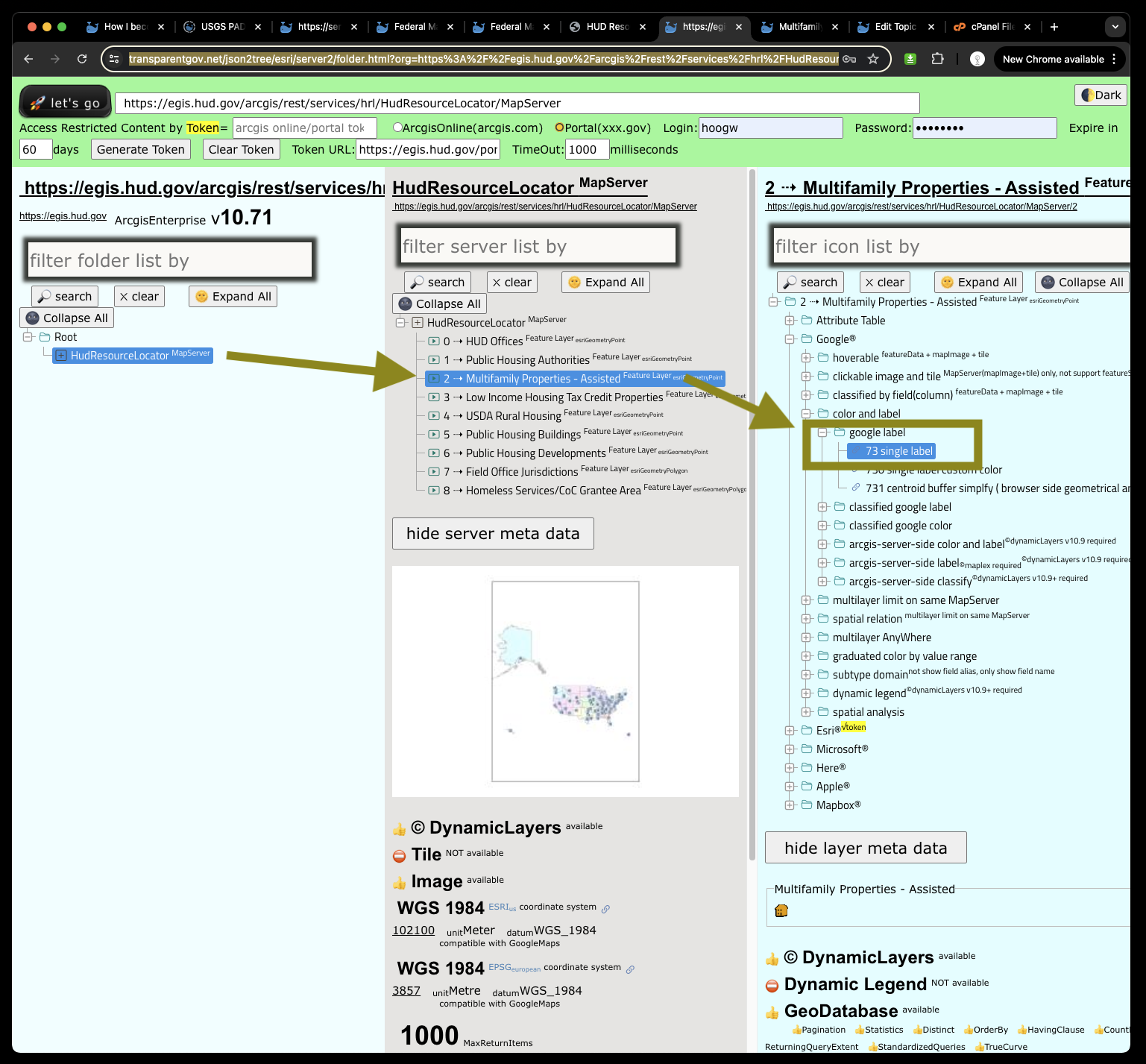
First, should select label as 'management name'
Then all apartment name labeled on google map
This google map based web map, use the same data from HUD official map,
You don't need training, you don't need tutorial, you can just find the government funded apartment intuitive as you use google map.
https://transparentgov.net:3200/googlemaps73/default?layer_id=2&layer=Multifamily+Properties+-+Assisted¢er_lat=42.74237910096875¢er_long=-73.86859572247425¢er_zoom=12&url=https%3A%2F%2Fegis.hud.gov%2Farcgis%2Frest%2Fservices%2Fhrl%2FHudResourceLocator%2FMapServer&overlayType=overlayType_image&panto=0&labelAsField=PROPERTY_NAME_TEXT
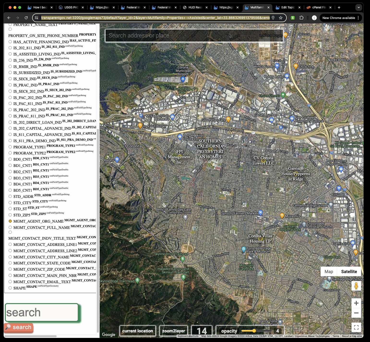
Above is google map client side label, which is limited by your computer's RAM memory, with thousands of label showing at same time, could slow down or freeze your browser.
To avoid this problem, you should use server side labeling, by click 17
https://transparentgov.net/json2tree/esri/server2/folder.html?org=https%3A%2F%2Fegis.hud.gov%2Farcgis%2Frest%2Fservices%2Fhrl%2FHudResourceLocator%2FMapServer&url=https%3A%2F%2Fegis.hud.gov%2Farcgis%2Frest%2Fservices%2Fhrl%2FHudResourceLocator%2FMapServer&arcgis_online_token=&select_folder=1&select_layer=2
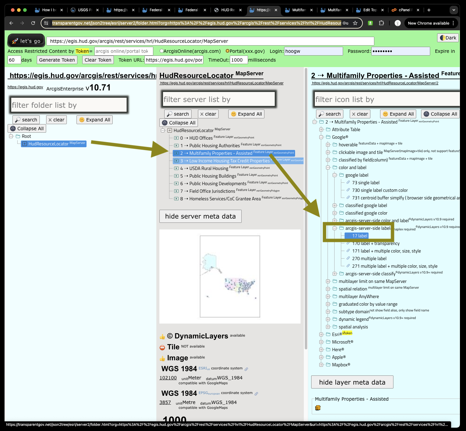
However, due to HUD arcgis server version is V10.71 which is also 10+ years old, does not have server side labeling function yet.
At least use V10.91, arcgis server start to add server side labeling with maplex and dynamic layers concept.
So you can not see label in below sample, is not because of my GIS tool problem, it is because HUD use too old arcgis server version, don't have server side label function yet.
https://transparentgov.net:3200/googlemaps17/default?layer_id=2&layer=Multifamily+Properties+-+Assisted¢er_lat=42.33451464118598¢er_long=-72.97646849742222¢er_zoom=9&url=https%3A%2F%2Fegis.hud.gov%2Farcgis%2Frest%2Fservices%2Fhrl%2FHudResourceLocator%2FMapServer&overlayType=overlayType_image&panto=0&dynamicLabelField=MGMT_AGENT_ORG_NAME
