Who is runing v10.71, What v10.71 isn't working
There are many of v10.71 running in 2024, I only pick 1 example to show you what things is not working
Not working No.1
calculate current feature within current map view isn't working for v10.71
Where is the evidence ?
I am going to show you use Federal agency HUD, housing development v10.71
https://egis.hud.gov/arcgis/rest/services/hrl/HudResourceLocator/MapServer
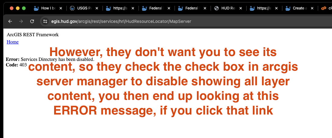
Not a problem, you can use my free GIS tool to still look at what layer they have.
Copy HUD arcgis server REST api endpoint
paste here then click let's go button
https://transparentgov.net/json2tree/esri/server2/folder.html?org=https%3A%2F%2Fegis.hud.gov%2Farcgis%2Frest%2Fservices%2Fhrl%2FHudResourceLocator%2FMapServer&url=https%3A%2F%2Fegis.hud.gov%2Farcgis%2Frest%2Fservices%2Fhrl%2FHudResourceLocator%2FMapServer&arcgis_online_token=&select_folder=1&select_layer=2
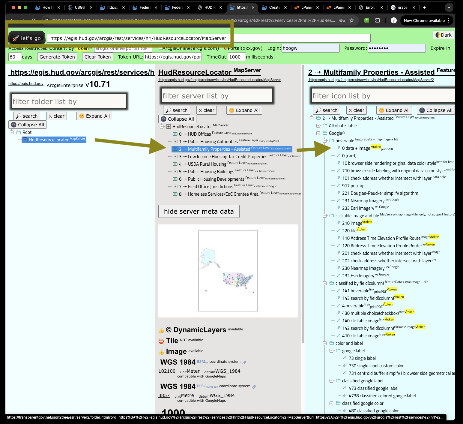
Click 21 esri feature layer client side label, will open a new tab
https://transparentgov.net/json2tree/esri/server2/folder.html?org=https%3A%2F%2Fegis.hud.gov%2Farcgis%2Frest%2Fservices%2Fhrl%2FHudResourceLocator%2FMapServer&url=https%3A%2F%2Fegis.hud.gov%2Farcgis%2Frest%2Fservices%2Fhrl%2FHudResourceLocator%2FMapServer&arcgis_online_token=&select_folder=1&select_layer=2
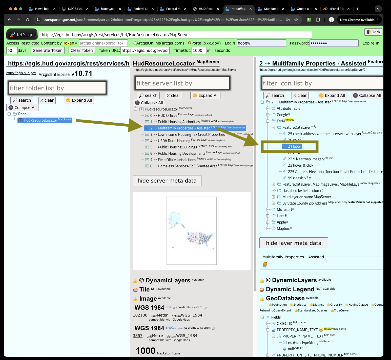
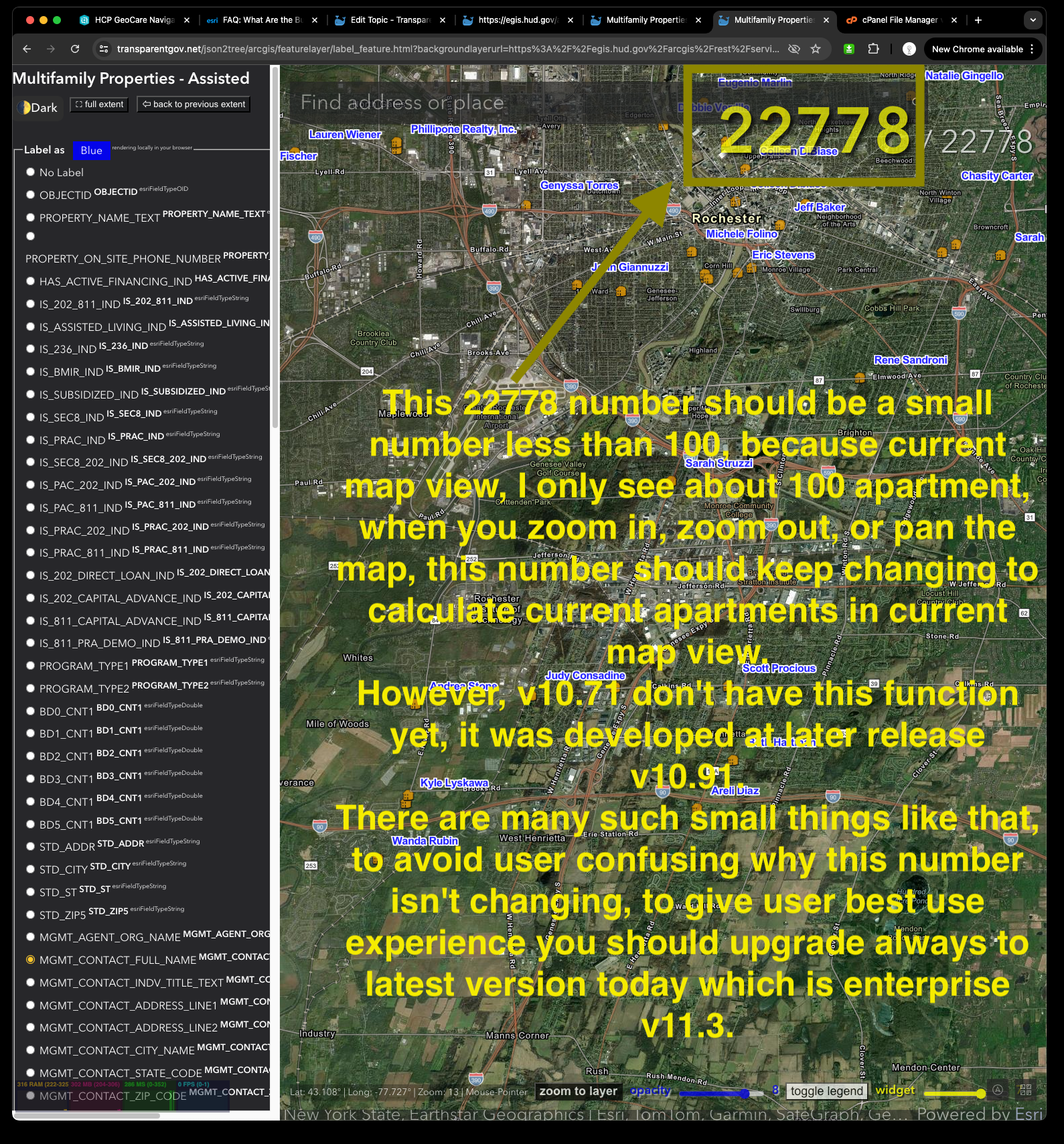
First, should select label as 'management name' Then all apartment name labeled on ESRI map
https://transparentgov.net/json2tree/arcgis/featurelayer/label_feature.html?backgroundlayerurl=https%3A%2F%2Fegis.hud.gov%2Farcgis%2Frest%2Fservices%2Fhrl%2FHudResourceLocator%2FMapServer%2F2&_center_lat=43.068245998837874&_center_long=-77.64106600029693&_center_zoom=13&panto=0&symbolType=native&layer=Multifamily+Properties+-+Assisted&dynamicLabelField=MGMT_AGENT_ORG_NAME
This 22778 number should be a small number less than 100, because current map view, I only see about 100 apartment, when you zoom in, zoom out, or pan the map, this number should keep changing to calculate current apartments in current map view.
However, v10.71 don't have this function yet, it was developed at later release v10.81
There are many such small things like that, to avoid user confusing why this number isn't changing, to give user best use experience you should upgrade always to latest version today which is enterprise v11.3.
Ok, show me a working one ! sure
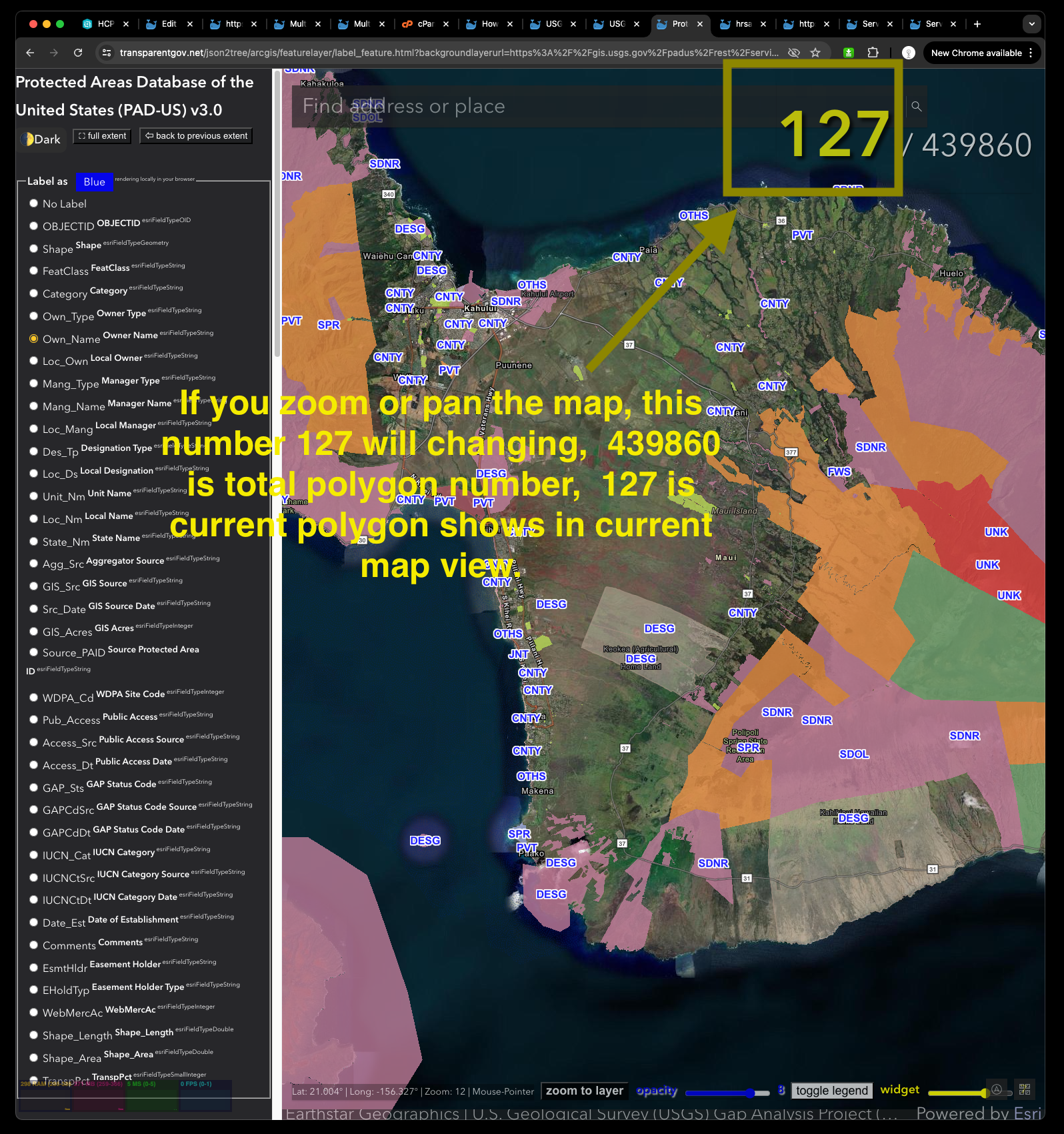
I am going to show you federal agency USGS's server with v10.81
https://transparentgov.net/json2tree/esri/server/folder.html?url=https%3A%2F%2Fgis.usgs.gov%2Fpadus%2Frest%2Fservices&org=USGS+Protected+Areas+PAD%2C%26nbsp%3B%26nbsp%3B&cross=default&timeout=10000&select_folder=14&select_layer=0&arcgis_online_token=
use the same 21 esri feature layer labeling
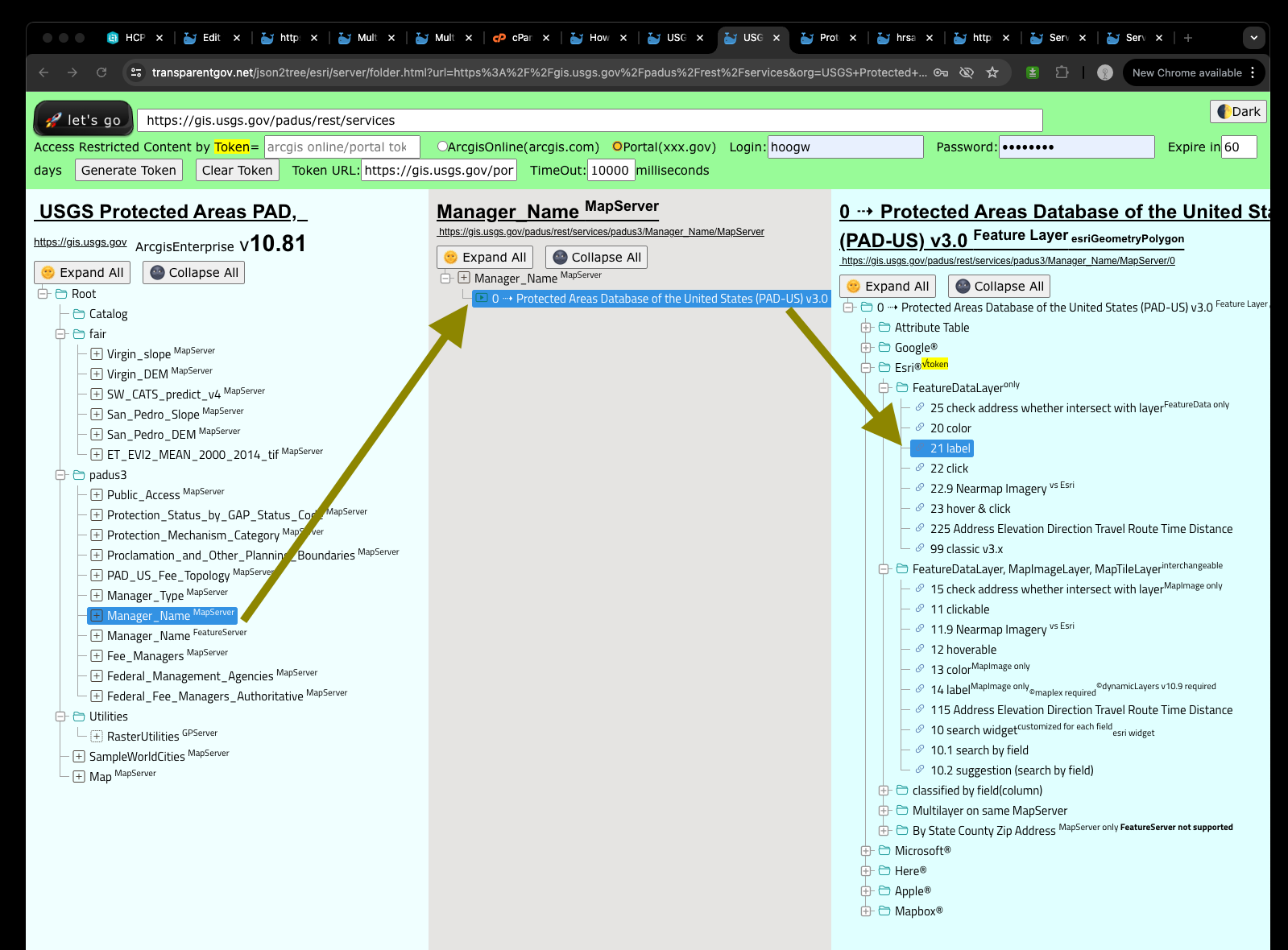
If you zoom or pan the map, this number 127 will changing, 439860 is total polygon number, 127 is current polygon shows in current map view.
https://transparentgov.net/json2tree/arcgis/featurelayer/label_feature.html?backgroundlayerurl=https%3A%2F%2Fgis.usgs.gov%2Fpadus%2Frest%2Fservices%2Fpadus3%2FManager_Name%2FMapServer%2F0&_center_lat=20.750957428900342&_center_long=-156.3733169498745&_center_zoom=12&panto=0&symbolType=native&layer=Protected+Areas+Database+of+the+United+States+%28PAD-US%29+v3.0&dynamicLabelField=Own_Name