How to look up Public land, Public access
So when you hiking, you know who is owner of land under your foot, whether it is open to public or not.
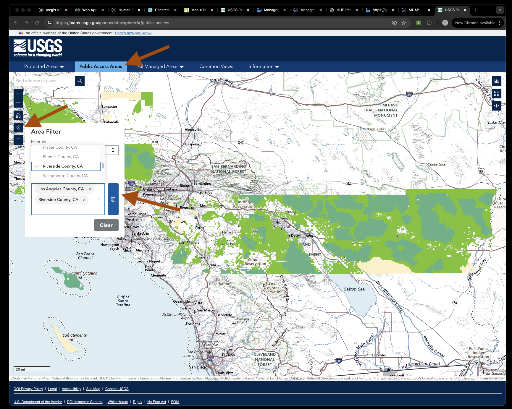
https://maps.usgs.gov/padusdataexplorer/#/public-access
How this filter was created?
There is a special layer just for filter by county and state, actually each polygon already been assign a county name.
Otherwise if you use geo-spatial analysis by select all polygon that interact with certain county will be too slow.
The fast way is you filter by county in Arcgis Pro, make each polygon has a county name and state name.
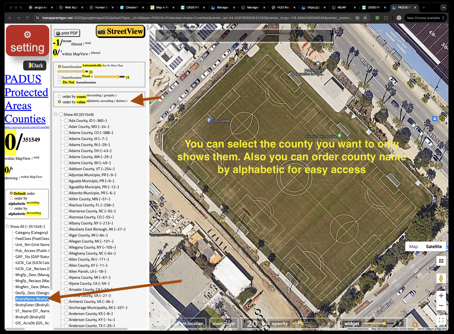
https://transparentgov.net:3200/googlemaps430/default?layer_id=0&layer=PADUS+Protected+Areas+Counties¢er_lat=34.009795592643265¢er_long=-118.4884168006545¢er_zoom=20&url=https%3A%2F%2Fservices.arcgis.com%2Fv01gqwM5QqNysAAi%2Farcgis%2Frest%2Fservices%2FPADUS_Protected_Areas_Counties%2FFeatureServer&panto=0&overlayType=overlayType_none&select_field=11&select_fieldvalue=-1&distinctorgroupby=groupby&orderbycountorvalue=orderby_value
You can select the county you want to only shows them. Also you can order county name by alphabetic for easy access
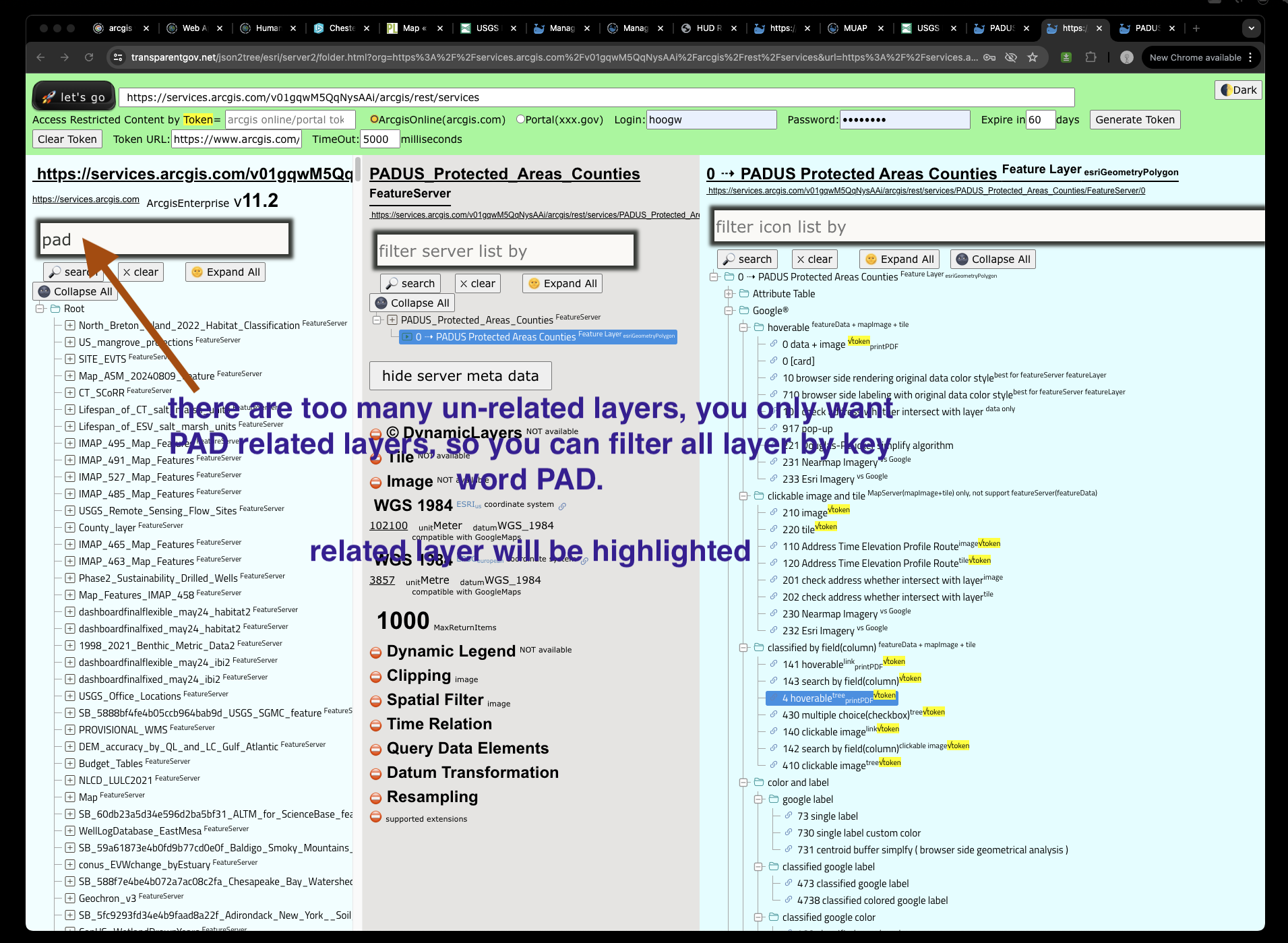
https://transparentgov.net/json2tree/esri/server2/folder.html?org=https%3A%2F%2Fservices.arcgis.com%2Fv01gqwM5QqNysAAi%2Farcgis%2Frest%2Fservices&url=https%3A%2F%2Fservices.arcgis.com%2Fv01gqwM5QqNysAAi%2Farcgis%2Frest%2Fservices&select_folder=76&select_layer=0&arcgis_online_token=&timeout=5000
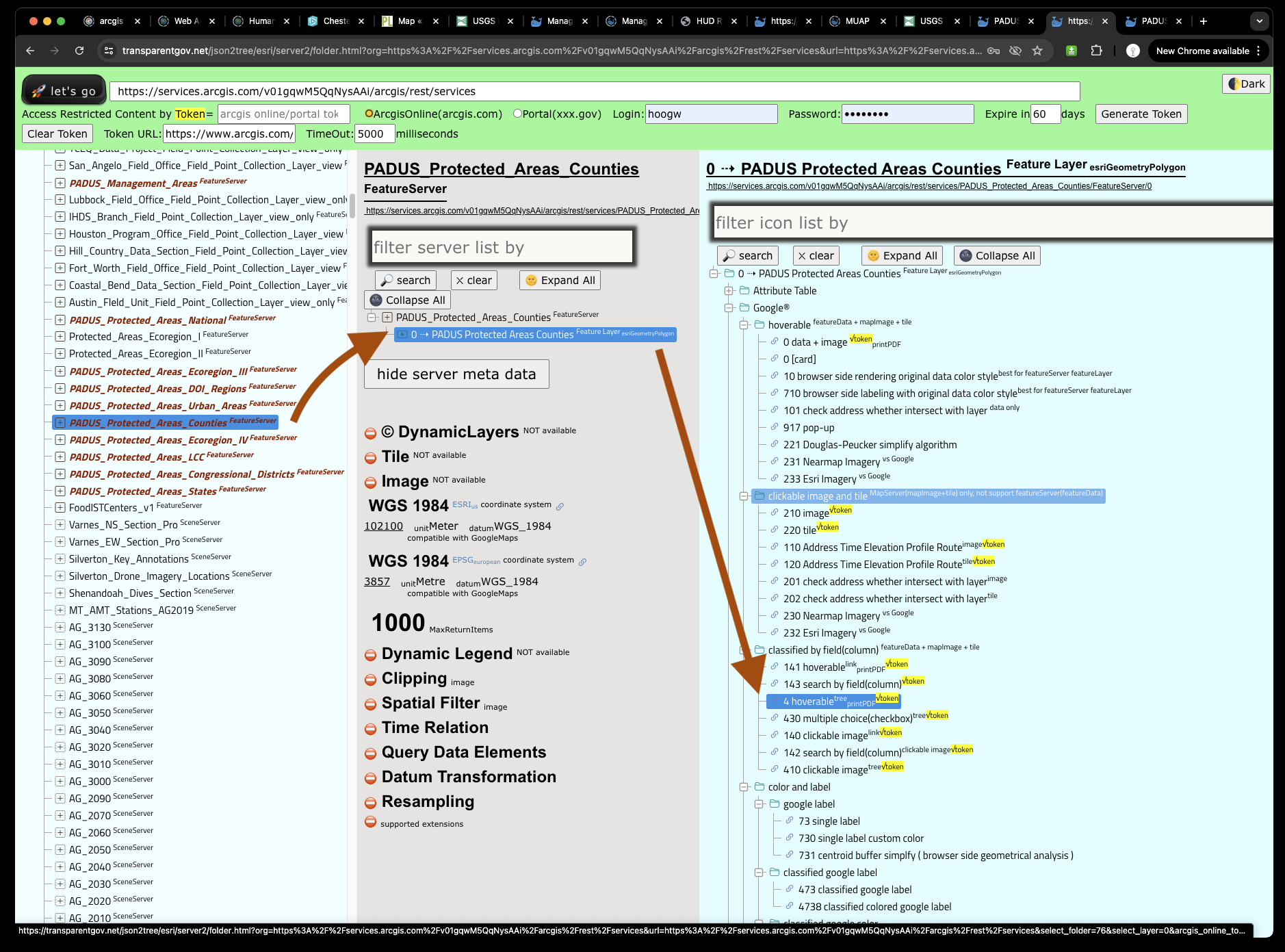
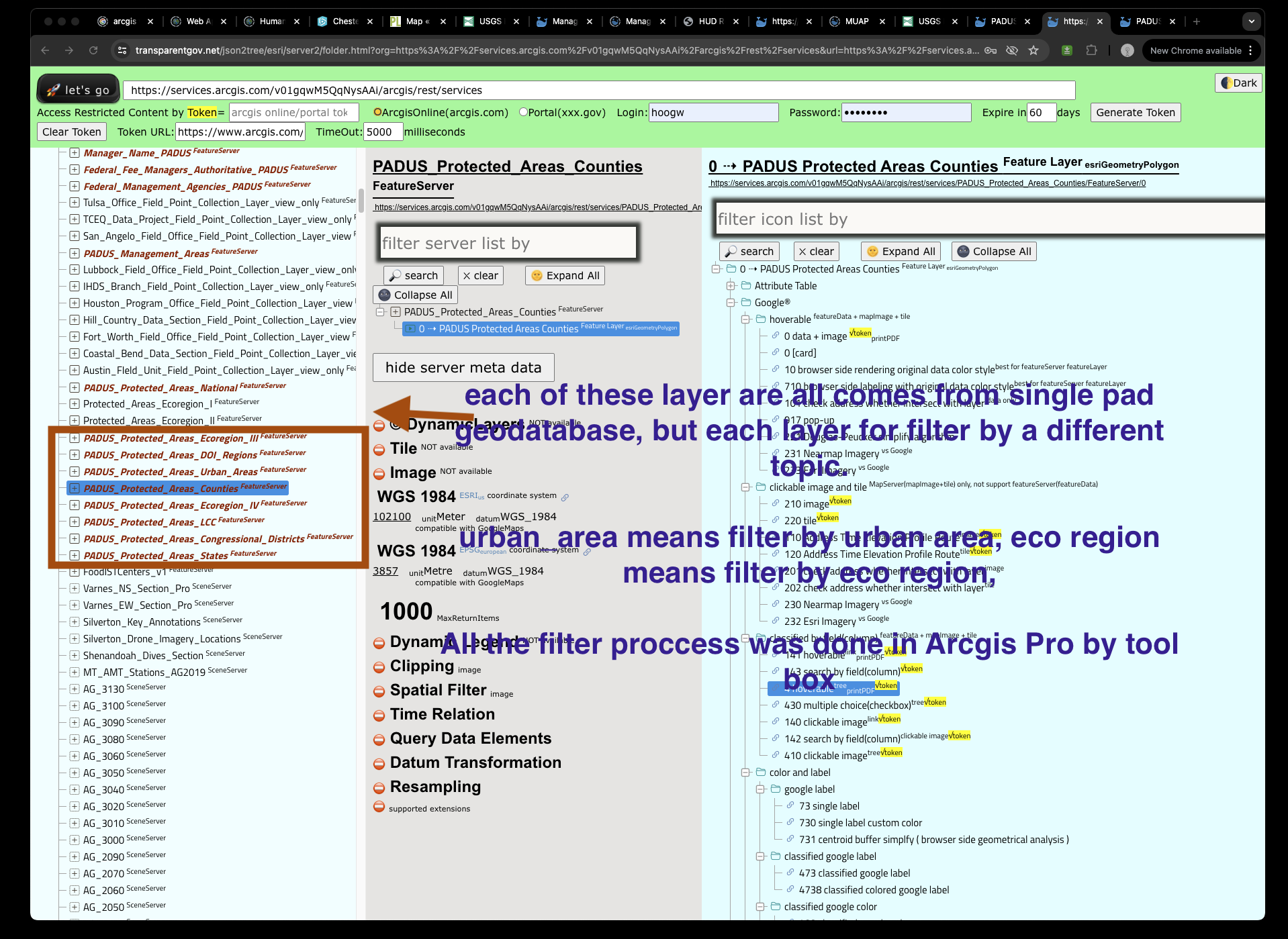
There are too many un-related layers, you only want PAD related layers, so you can filter all layer by key word PAD.
related layer will be highlighted
each of these layer are all comes from single pad geodatabase, but each layer for filter by a different topic.
urban_area means filter by urban area, eco region means filter by eco region,
All the filter proccess was done in Arcgis Pro by tool box