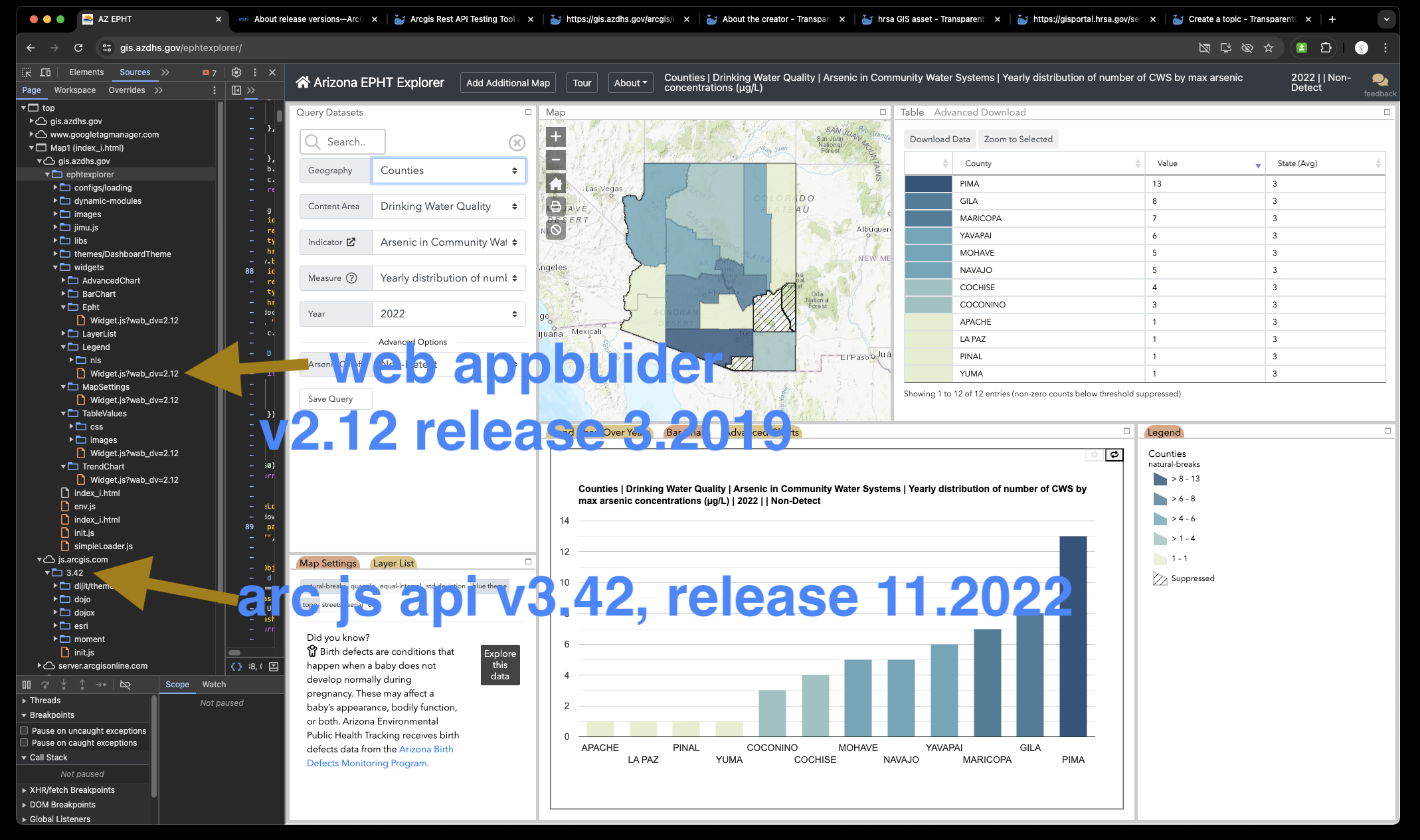
EPHT explorer ( web appbuilder V3.42 ) was created 2019, then web appbuilder version upgrade in 2023.
https://gis.azdhs.gov/ephtexplorer/
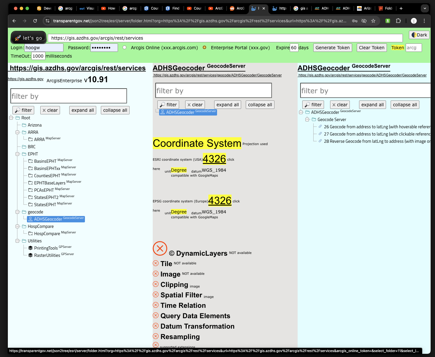
Arcgis enterprise portal REST api endpoint
https://gis.azdhs.gov/arcgis/rest/services
Arcgis enterprise portal REST api endpoint, 3 panel system
https://transparentgov.net/json2tree/esri/server/folder.html?org=https%3A%2F%2Fgis.azdhs.gov%2Farcgis%2Frest%2Fservices&url=https%3A%2F%2Fgis.azdhs.gov%2Farcgis%2Frest%2Fservices&arcgis_online_token=&select_folder=161&select_layer=0
Arcgis online REST api endpoint
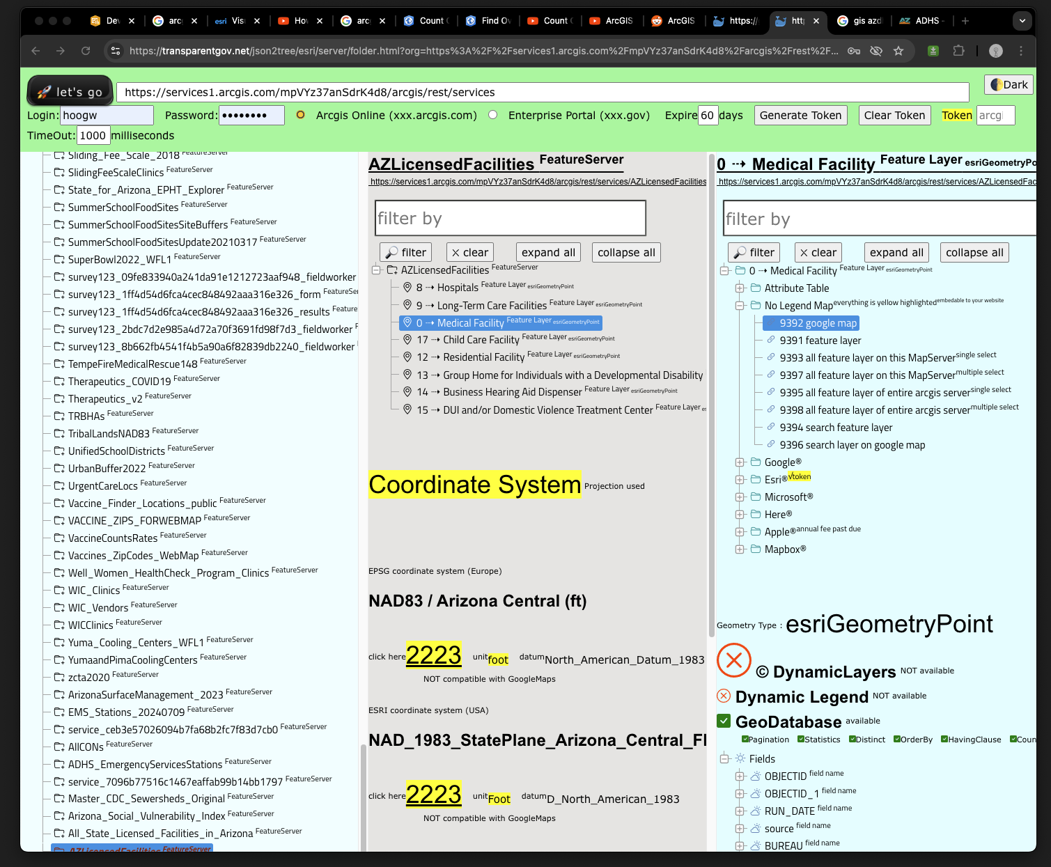
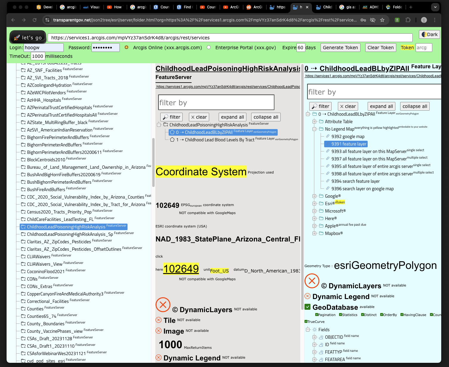
https://services1.arcgis.com/mpVYz37anSdrK4d8/arcgis/rest/services
Arcgis online REST api endpoint, 3 panel system
https://transparentgov.net/json2tree/esri/server/folder.html?org=https%3A%2F%2Fservices1.arcgis.com%2FmpVYz37anSdrK4d8%2Farcgis%2Frest%2Fservices&url=https%3A%2F%2Fservices1.arcgis.com%2FmpVYz37anSdrK4d8%2Farcgis%2Frest%2Fservices&arcgis_online_token=&select_folder=74&select_layer=0
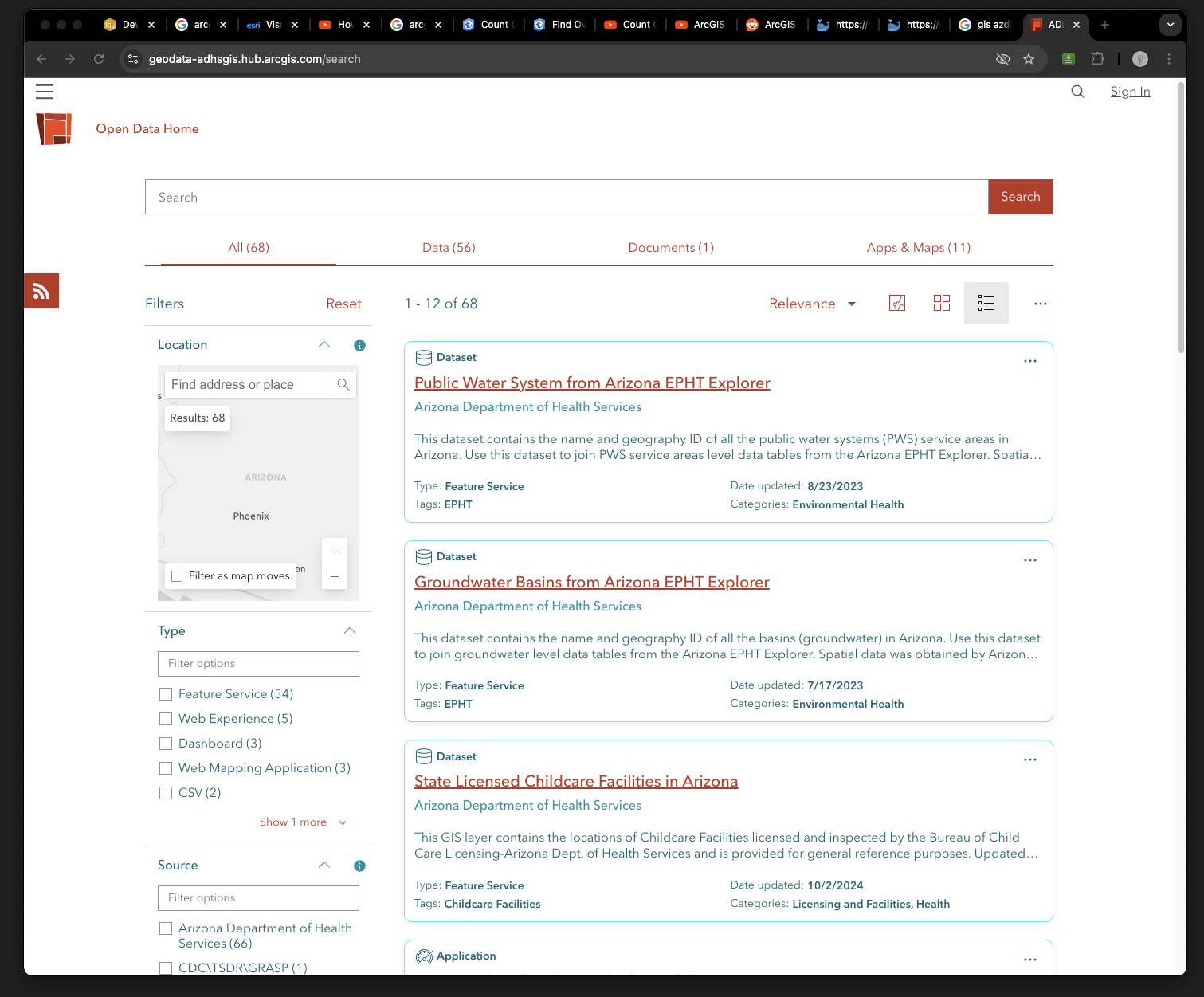
Arcgis online open data
https://geodata-adhsgis.hub.arcgis.com/search
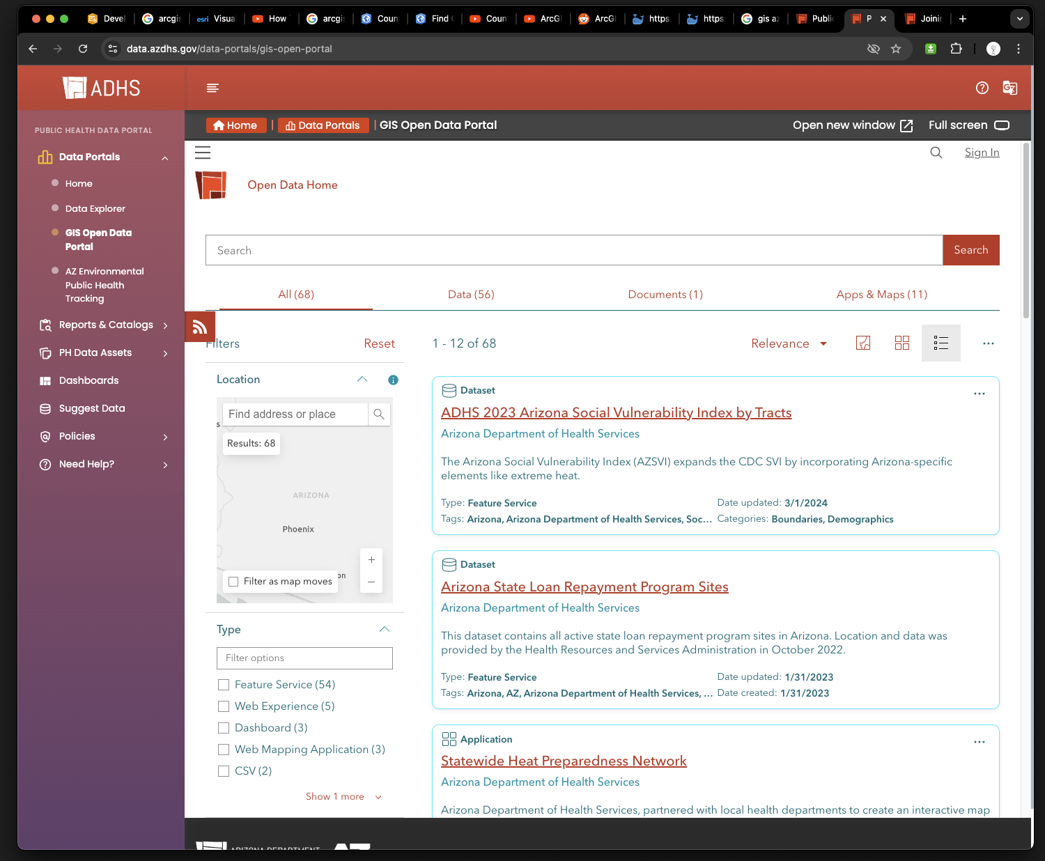
gis open data portal, Not ESRI product, PHP, use iframe embed ESRI's arcgis online open data
https://data.azdhs.gov/data-portals/gis-open-portal
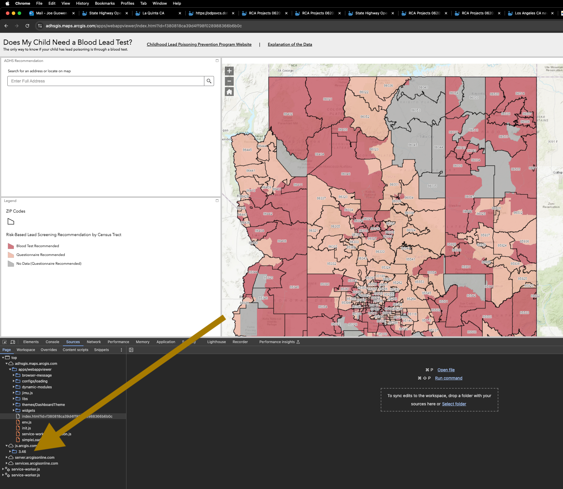
Web appbuilder app, use arcgis js api V3.46
https://adhsgis.maps.arcgis.com/apps/webappviewer/index.html?id=f380818ca39d4ff98f028988366b6b0c
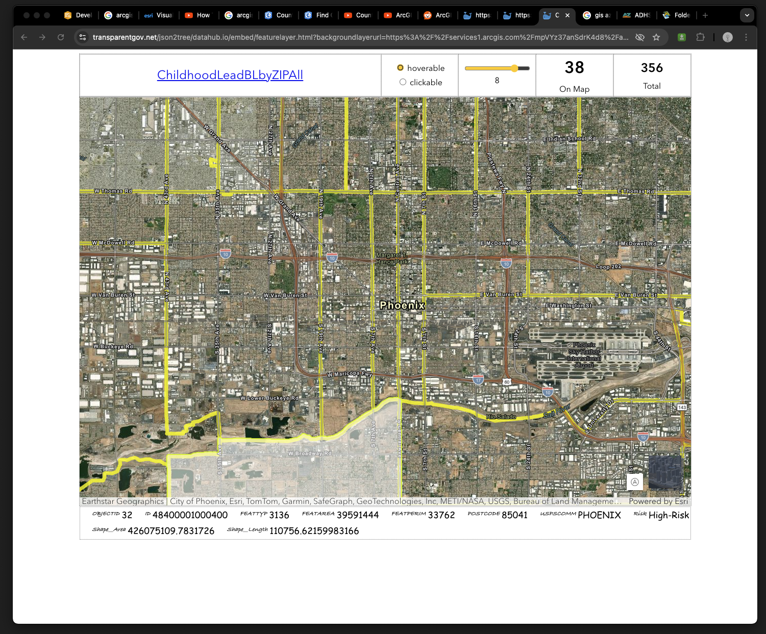
child blood lead layer, hosted on arcgis online
https://transparentgov.net/json2tree/datahub.io/embed/featurelayer.html?backgroundlayerurl=https%3A%2F%2Fservices1.arcgis.com%2FmpVYz37anSdrK4d8%2Farcgis%2Frest%2Fservices%2FChildhoodLeadPoisoningHighRiskAnalysis%2FFeatureServer%2F0&layer=ChildhoodLeadBLbyZIPAll
EPHT explorer ( web appbuilder V3.42 ) was created 2019, then web appbuilder version upgrade in 2023.
https://gis.azdhs.gov/ephtexplorer/
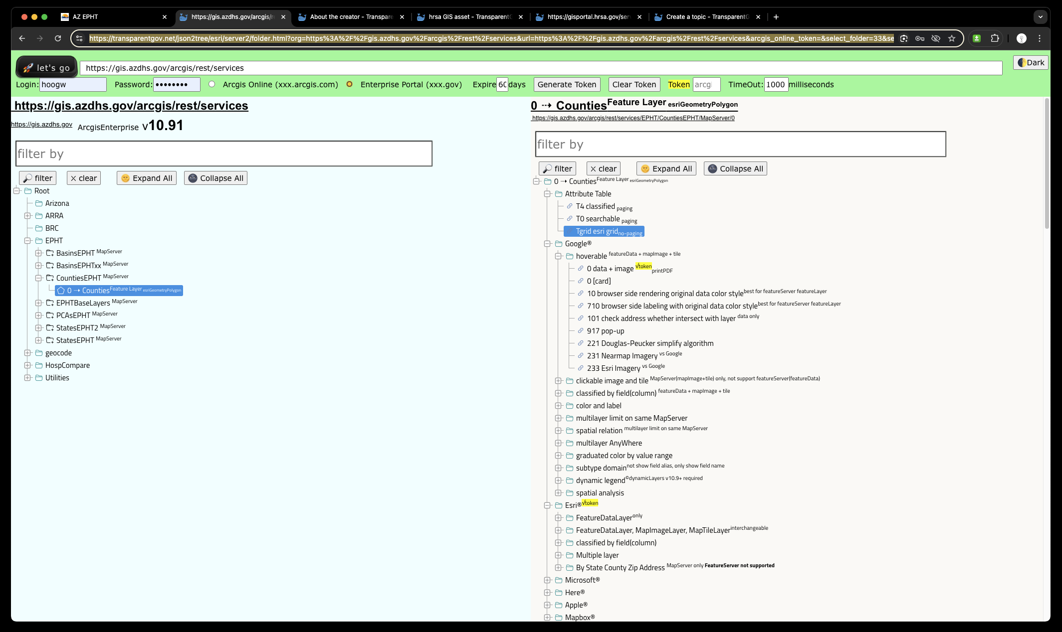
2 panel Arcgis REST endpoint
https://transparentgov.net/json2tree/esri/server2/folder.html?org=https%3A%2F%2Fgis.azdhs.gov%2Farcgis%2Frest%2Fservices&url=https%3A%2F%2Fgis.azdhs.gov%2Farcgis%2Frest%2Fservices&arcgis_online_token=&select_folder=33&select_layer=
Note:
all GIS layer value is empty null, because GIS data is completely seperate from Non-GIS SQL table.
when user click any button, the. app will call web service
https://gis.azdhs.gov/virtualD/getFeatures
to get real value.
https://transparentgov.net/json2tree/arcgis/js3/featureTable.html?&layer_id=0&layer=Countie&url=https://gis.azdhs.gov/arcgis/rest/services/EPHT/CountiesEPHT/MapServer
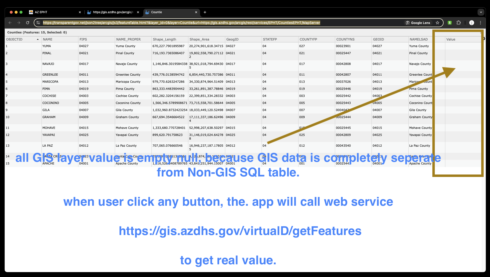
Since AZ only have 15 counties, it works fine.
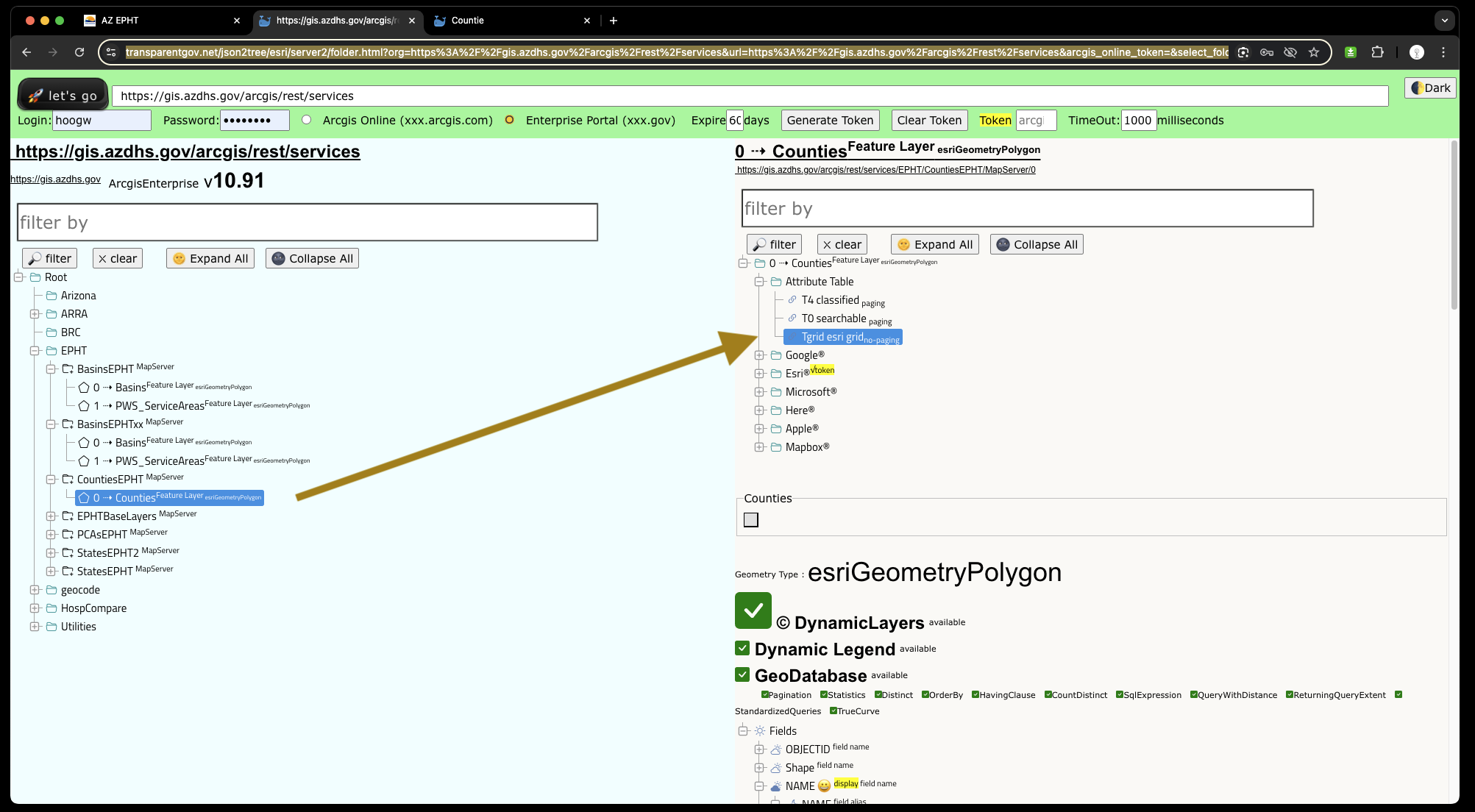
Because gis layer attribute table don't have value, you have to download table data then join with gis layer in ArcPro.
This setup could cause lots of issue.
Good practice is :
In enterprise Geodatabase, spatial SQL table ( layers ), should just access non-gis table then select all value directly from other non-gis table populate into layer spatial SQL table.
Select non-spatial table data populate into spatial table ( layer table )
This integration between non-spatial SQL table with spatial (layer table ) is real time.
https://transparentgov.net/json2tree/esri/server2/folder.html?org=https%3A%2F%2Fgis.azdhs.gov%2Farcgis%2Frest%2Fservices&url=https%3A%2F%2Fgis.azdhs.gov%2Farcgis%2Frest%2Fservices&arcgis_online_token=&select_folder=33&select_layer=
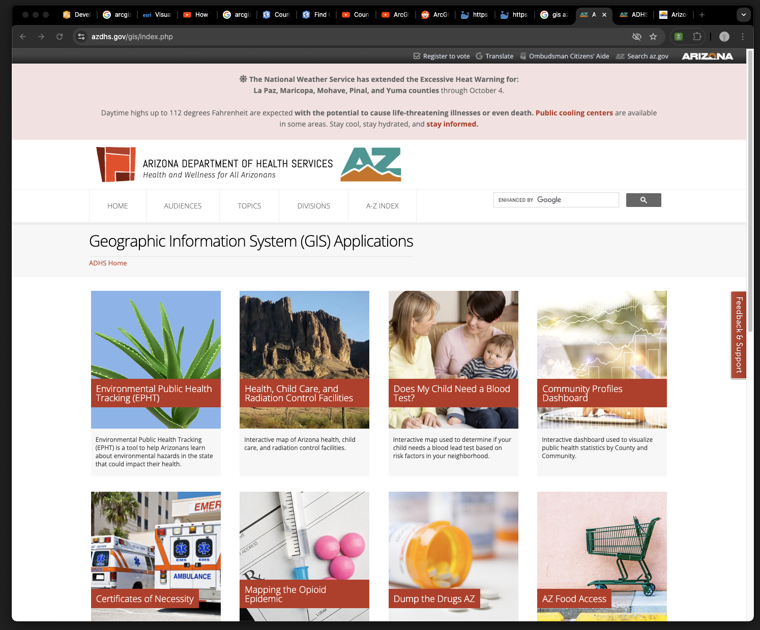
GIS map gallery, made of PHP, not ESRI product.
https://www.azdhs.gov/gis/index.php
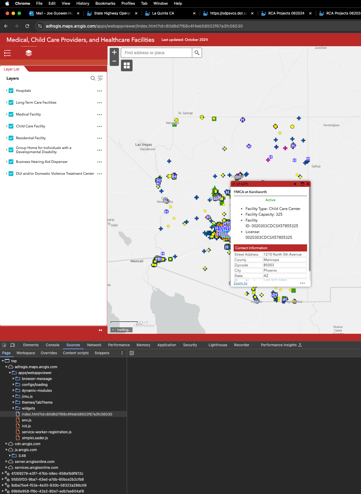
AZ Medical facility, web appbuilder app
https://adhsgis.maps.arcgis.com/apps/webappviewer/index.html?id=80d8d7f68c4f4eb58502f67a3fc56030
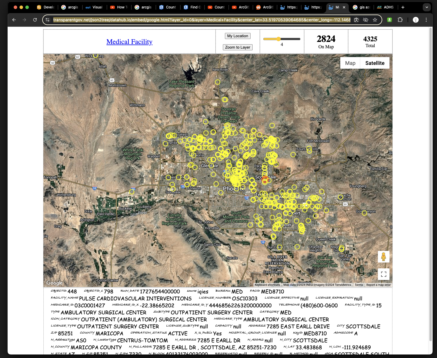
AZ Medical facility, on google map
https://transparentgov.net/json2tree/datahub.io/embed/google.html?layer_id=0&layer=Medical+Facility¢er_lat=33.51970539064685¢er_long=-112.14689596704655¢er_zoom=10&url=https%3A%2F%2Fservices1.arcgis.com%2FmpVYz37anSdrK4d8%2Farcgis%2Frest%2Fservices%2FAZLicensedFacilities%2FFeatureServer&panto=0
AZ Medical facility, gis layer hosted on arcgis online
https://transparentgov.net/json2tree/esri/server/folder.html?org=https%3A%2F%2Fservices1.arcgis.com%2FmpVYz37anSdrK4d8%2Farcgis%2Frest%2Fservices&url=https%3A%2F%2Fservices1.arcgis.com%2FmpVYz37anSdrK4d8%2Farcgis%2Frest%2Fservices&arcgis_online_token=&select_folder=236&select_layer=0