American English, first floor is ground floor,
Europe, first floor is actually means second floor in US.
L0 means ground floor = first floor in US
L1 means first floor above ground floor = second floor in US
L2 = 3rd floor in US
L3 ....
L4
Grey color level means no floor plan, unit not exist, you will see dark gray color without unit outline.
White color with outline means unit.
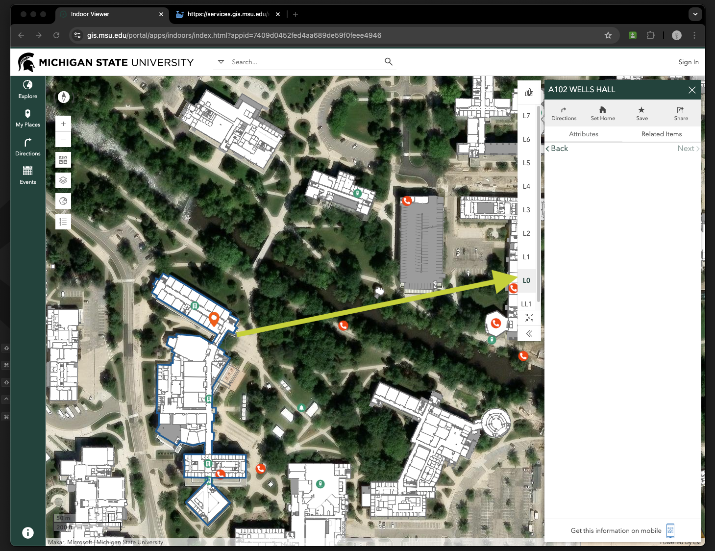
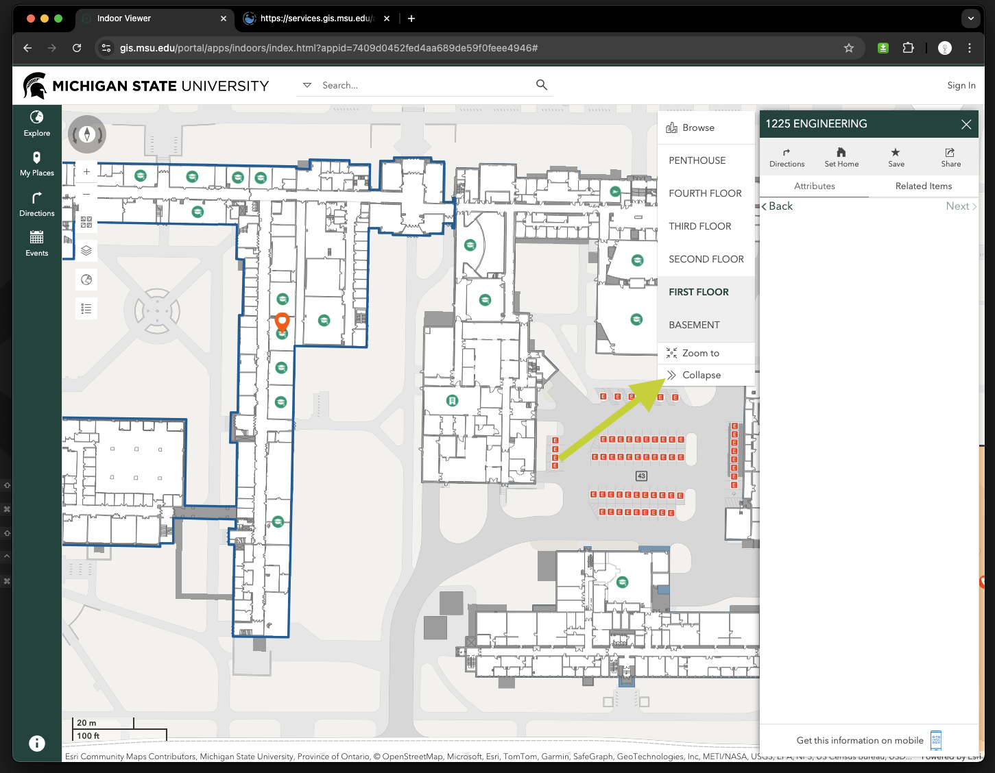
Warning, in arcgis indoor explorer, floor level is attached to each building. When you select floor level it only refer to the only one building, that you selected or highlighted, does not apply to other building.
Step 1, you must select a building first, for example click any building
https://gis.msu.edu/portal/apps/indoors/index.html?appid=7409d0452fed4aa689de59f0feee4946

Step 2, click any level, for example L0 to see ground level floor plan unit, done

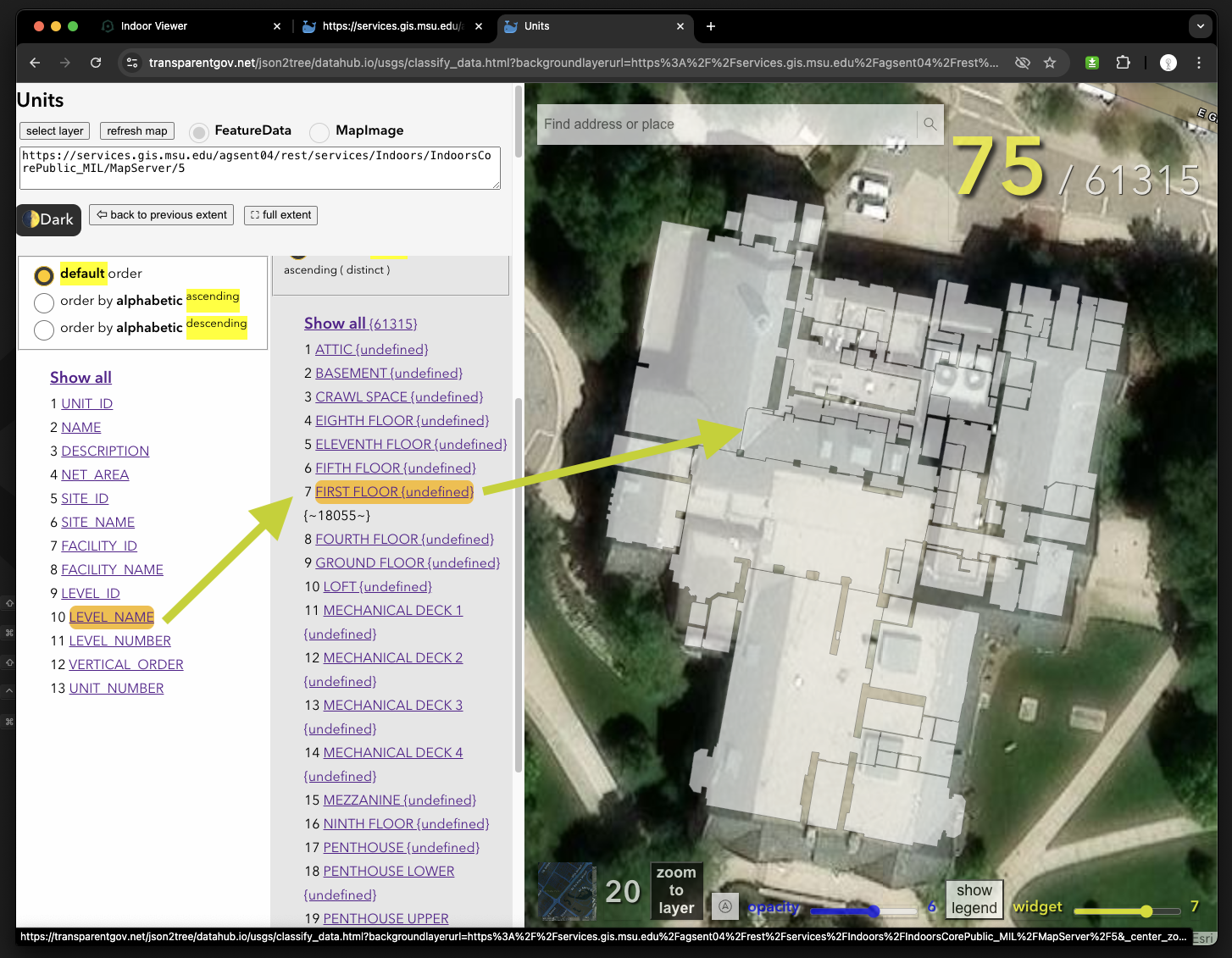
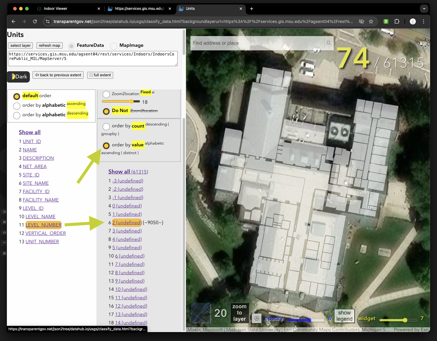
Warning, same data, but in following apps, floor level selection works for all buildings. When you select or click a level name, all building will only show that level you selected. You don't need to select any individual building, floor name or level number works for all building.
https://transparentgov.net/json2tree/datahub.io/usgs/classify_data.html?backgroundlayerurl=https%3A%2F%2Fservices.gis.msu.edu%2Fagsent04%2Frest%2Fservices%2FIndoors%2FIndoorsCorePublic_MIL%2FMapServer%2F5&_center_zoom=20&_center_lat=42.73419365489569&_center_long=-84.48282245764668&layer=Units&select_field=9&select_fieldvalue=-1&distinctorgroupby=groupby&orderbycountorvalue=orderby_value&zoom2feature_yesNo=donot_zoom2feature
Level name

Level number works the same way
