Given a sample layer endpoint, click it.
https://services.arcgis.com/XORNS2fPFySPlBgy/arcgis/rest/services/Campus_Plant_Walk/FeatureServer/0?f=html
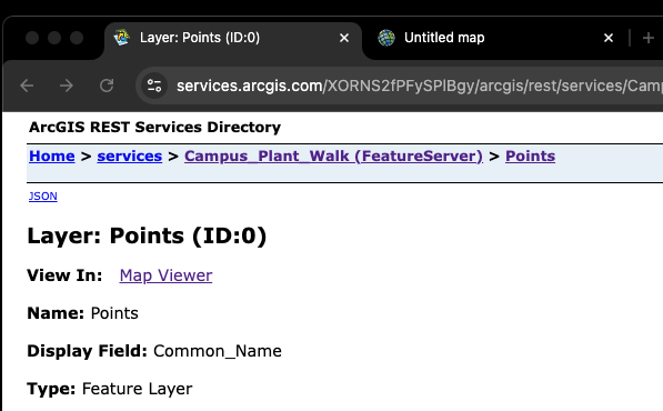
There are 3 options, you will select the method that fit your need. For example, if you only want see 1 layer, then choose option 3 or 2. If you want see multiple layers, choose option 1.
Layer URL format is fixed, it is always like this :
https://xx.xxxx./xx/arcgis/rest/services/feature-server-name/FeatureServer/layer-id
https://xx.xxxx./xx/arcgis/rest/services/map-server-name/MapServer/layer-id
layer-id is always a number from 0 to what ever.
1. Open ESRI's map viewer
has some bugs has not been fixed by ESRI, but you should use this one
https://www.arcgis.com/apps/mapviewer/index.html
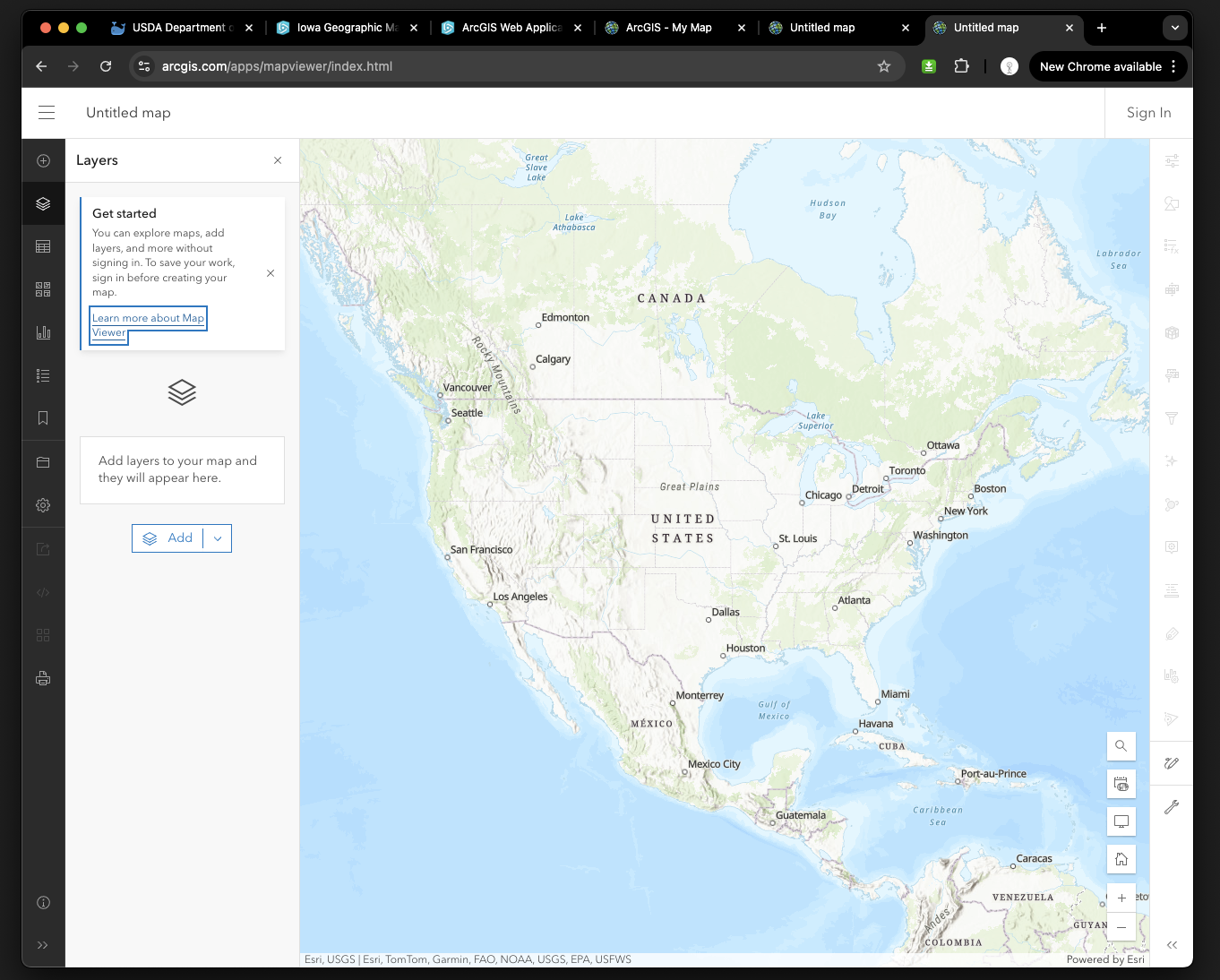
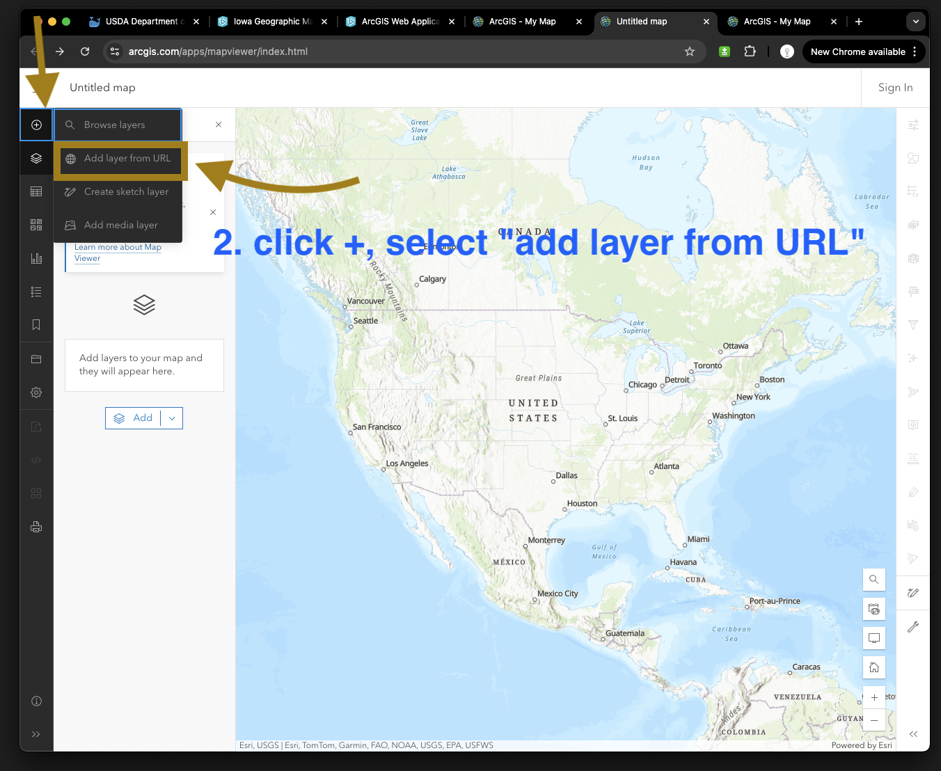
2. Option 1
click +, select "add layer from URL"
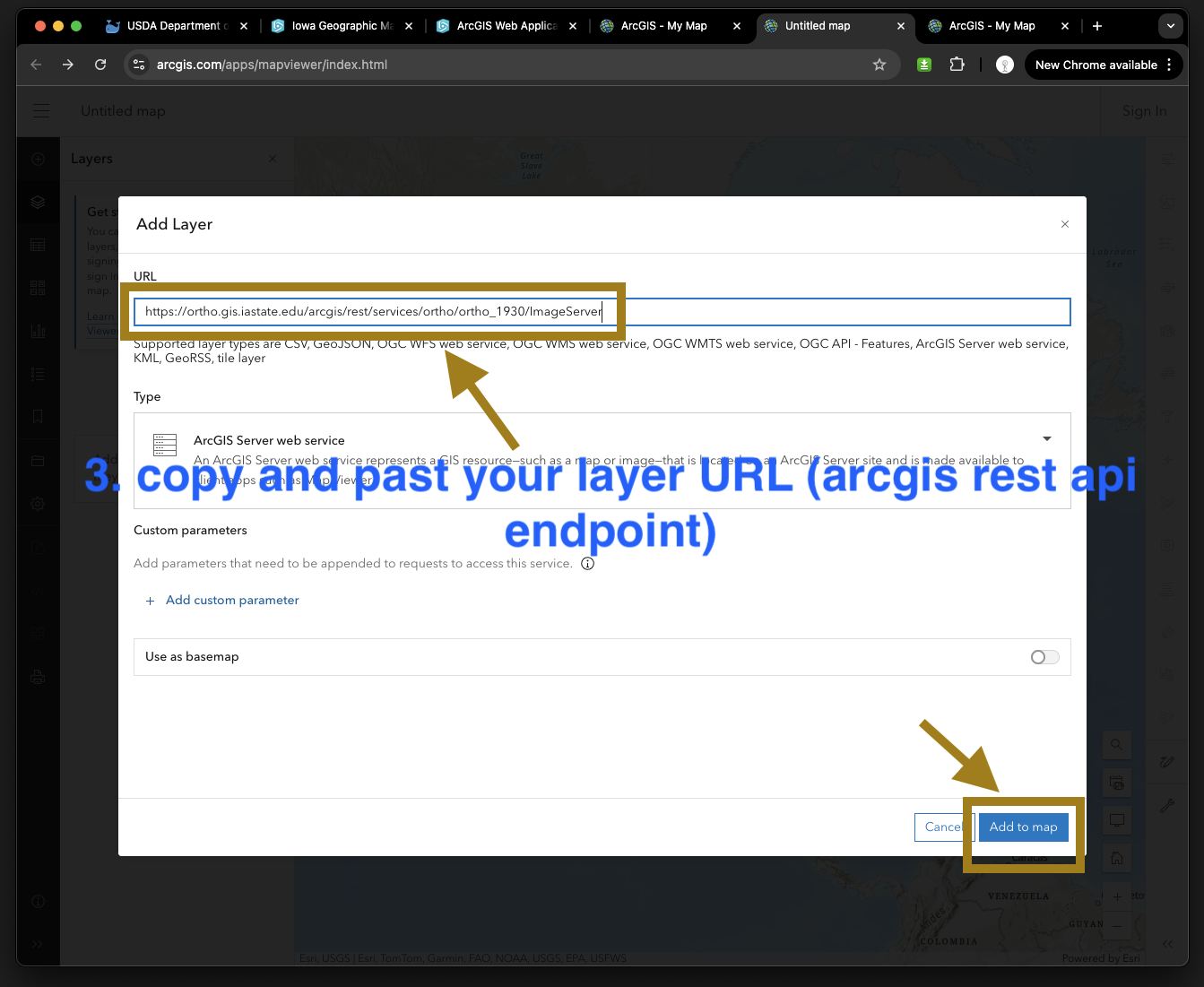
3. copy and past your layer URL (arcgis rest api endpoint), then add to map
4. Option 2,
you can just add ?url=your-layer's-endpoint-url to address bar, then click enter key will to the same job.
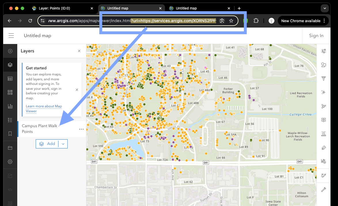
5. Option 3,
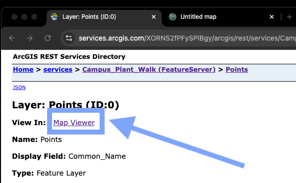
Click Map Viewer will do the same job, if you just want to see 1 layer, not multiple layer.
All ESRI map viewer are for public user to use, no need to sign in arcgis online.
The only difference is after you sign in your arcgis online account, you can save your edited map to your organization's account.
Without sign in to any organization, the save button is disabled grey out, you can't save your map to anywhere.