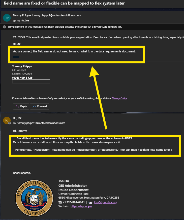
Very Important, field name does not need to match Motorola Standard field name.
They can map your fields properly to the their standard fields.
This save me a lots of effort. Because I get data from Los Angeles County, the raw data have different field name than Motorola's. To transform schema, either use FME (I do not have), or manually (time consuming, specially update once month)
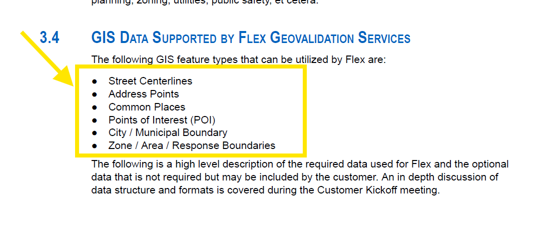
1. there are 6 layers needed
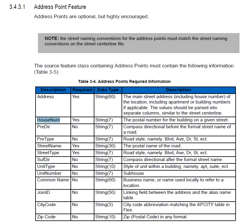
2. Do not need to fill left, right city code, zip code, because Motorola can run their method to automatically fill these fields
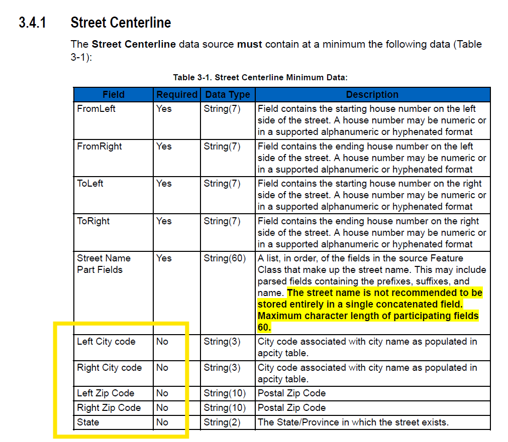
3. Elevation does not means how many meters or feets above sea level. instead, it is a integer number represent the level of road when crossing. For example, ground level is 0. If a bridge cross over from a street on ground, the bridge segment elevation field value will be 1. If a road cross from under ground, then this street segment elevation value will be -1. Freeway intersection crossing could have max elevation level 7.
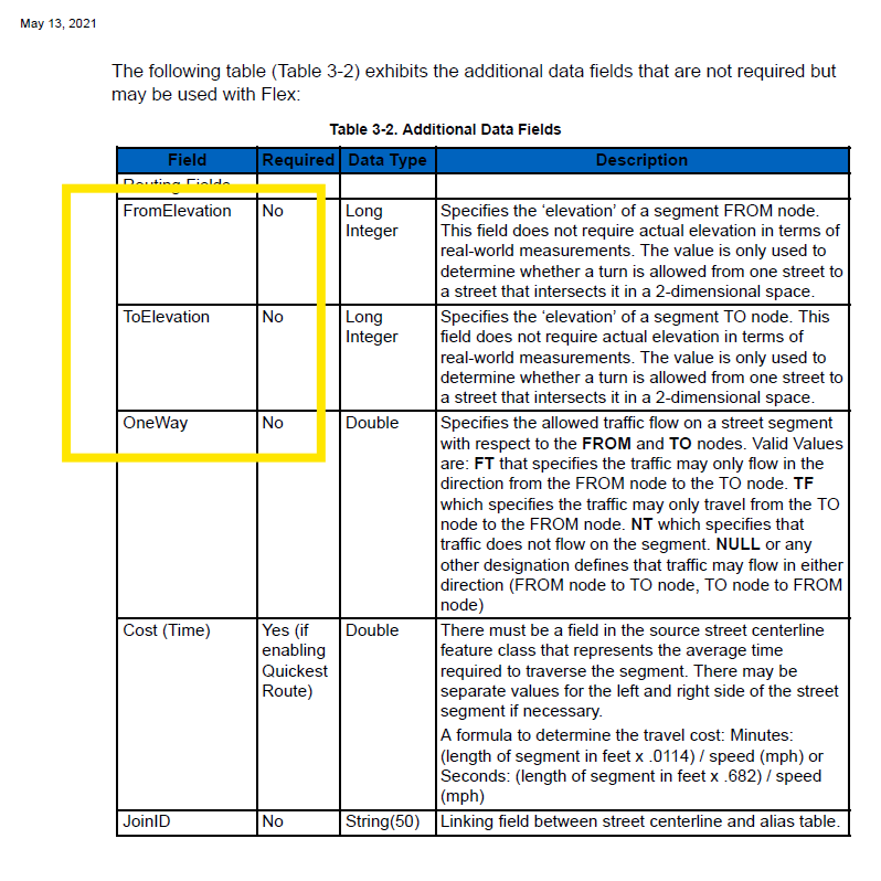
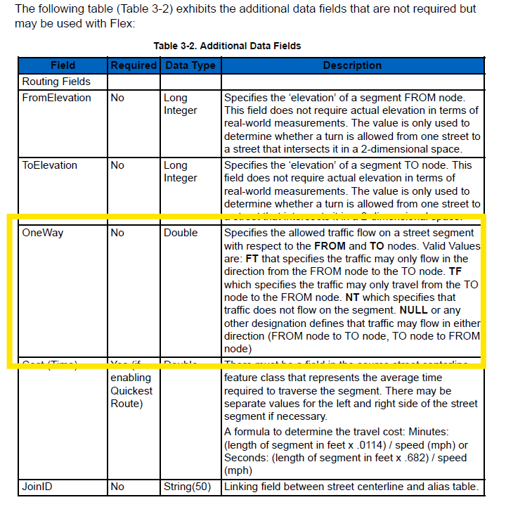
4. One Way is needed
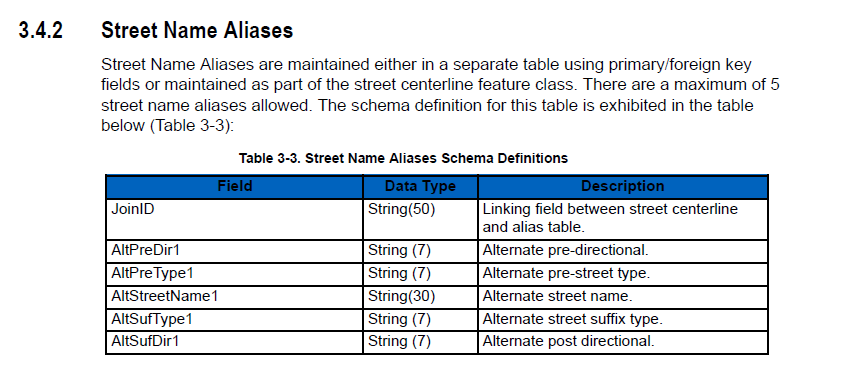
5. Street name alias
6. Address point
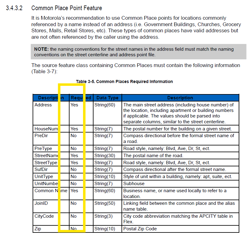
7. Common place point, must have address, as well as common name populated.
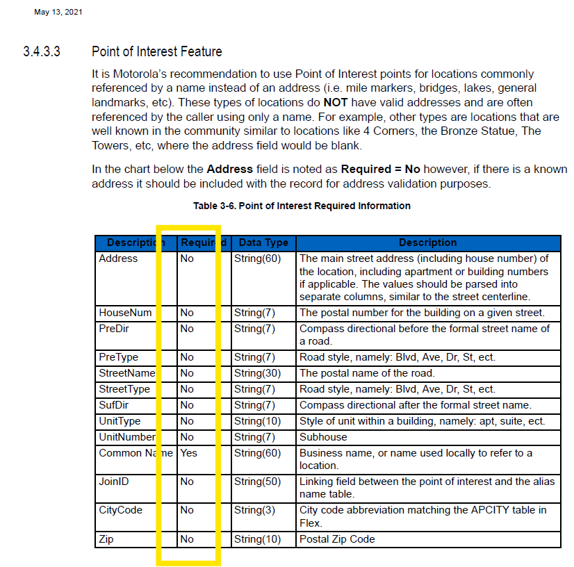
8. point of interest do NOT need address field populated, but must have common name populated
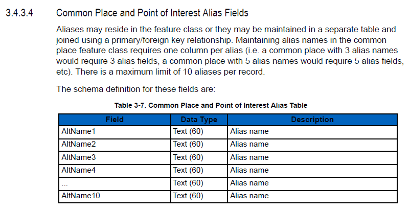
9. alias is used for old name, or previous name or other name
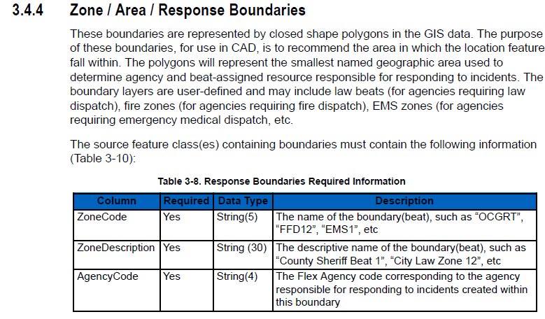
10. Zone should be police beat
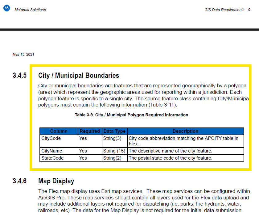
11. city boundary need nearby other cities in the county.