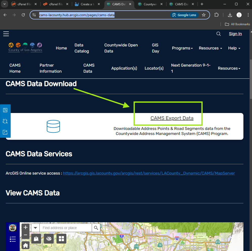
Step 1.
click download
https://cams-lacounty.hub.arcgis.com/pages/cams-data
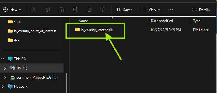
Step 2.
When unzip file, must use xxx.gdb as geodatabase folder name. Otherwise, Qgis would not read this folder.
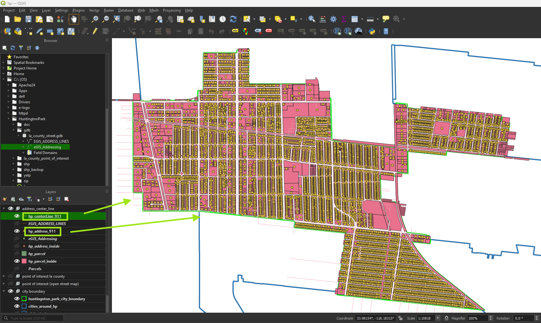
Step 3.
Select feature intersect with city boundary, then export feature
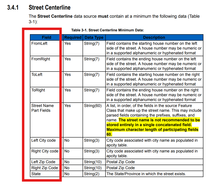
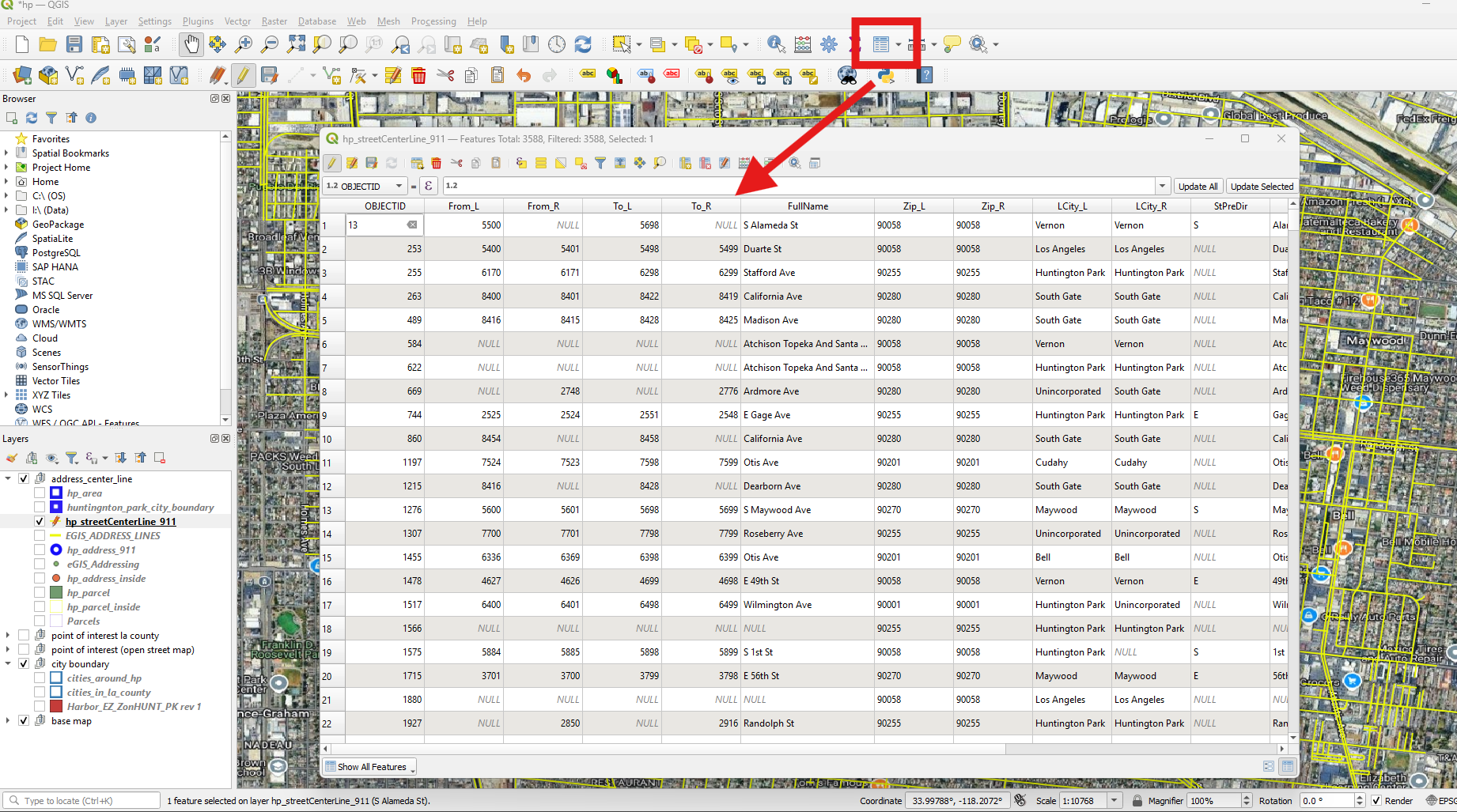
Step 4.
Edit attribute table, follow 911 Standard,
Step 5.
elevation field is not meters from sea level.
Instead it is number of level. 0 means ground, surface. bridge cross over from above will be 1. Railroad pass through underground will be -1.

Step 6.
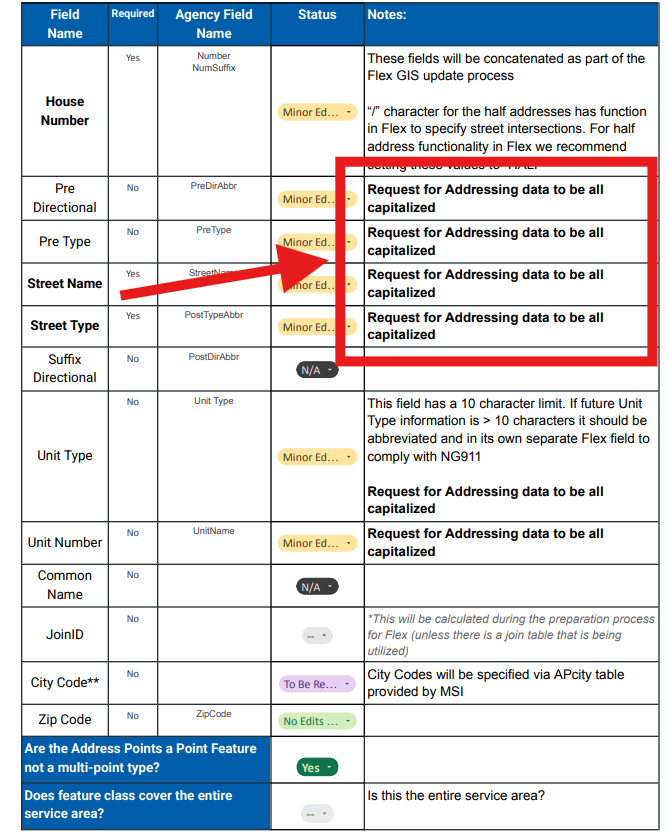
Must convert all fields to upper case, this is required by vendor
Step 7.
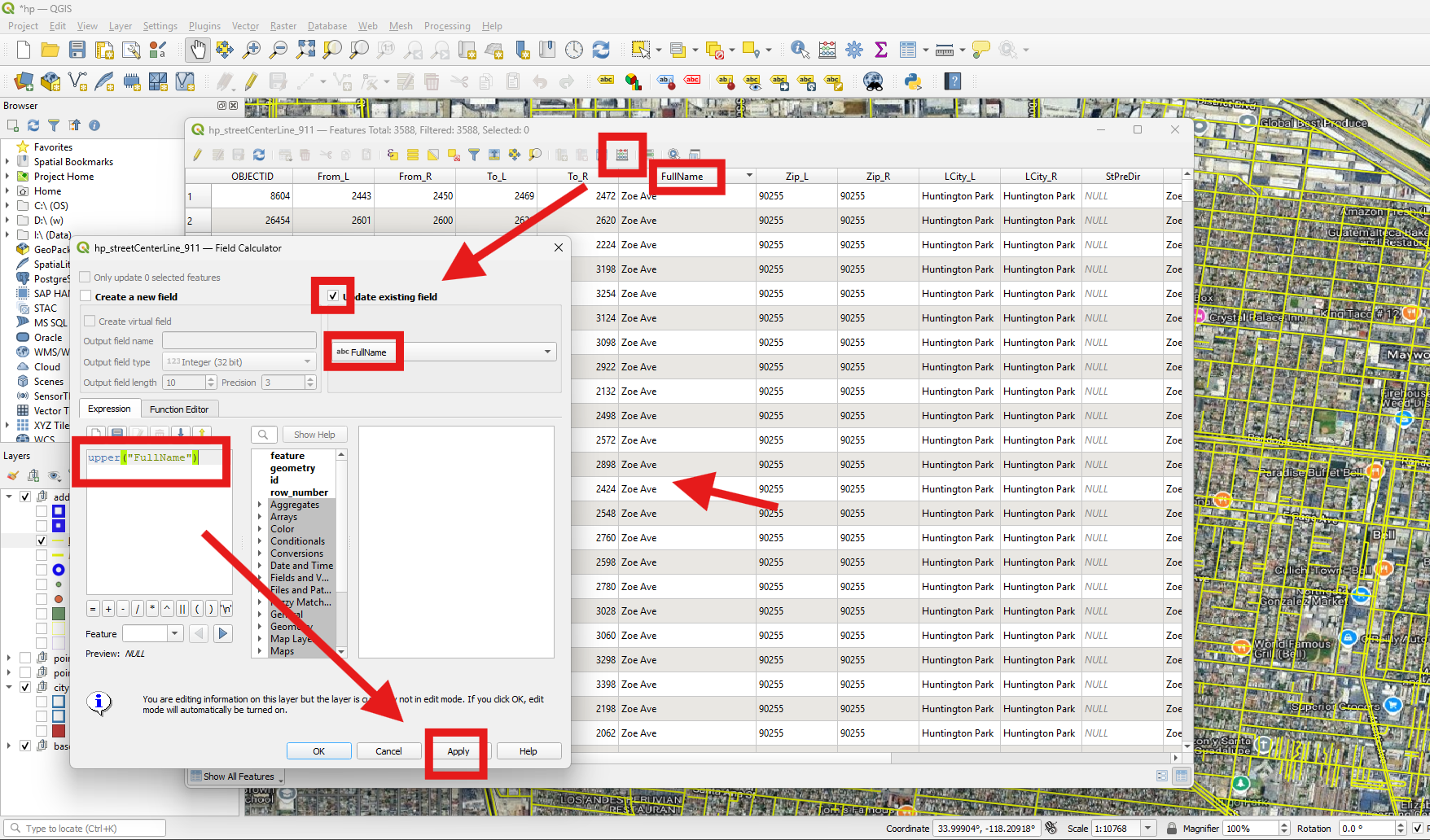
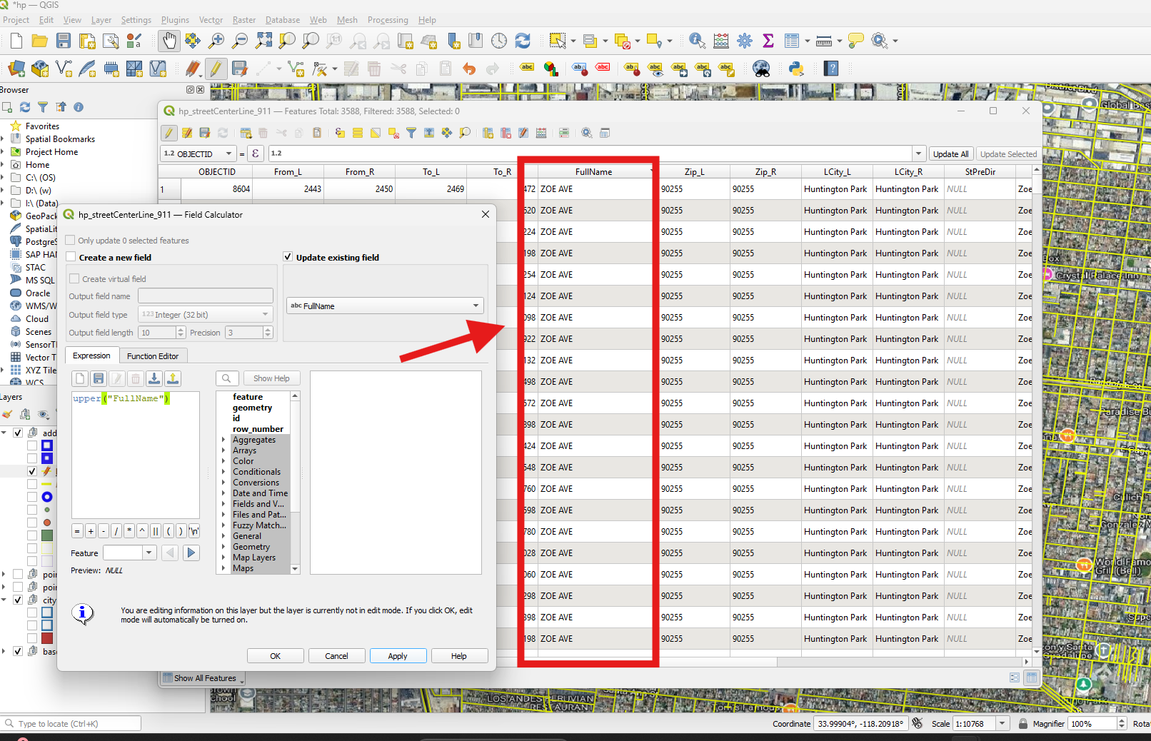
Open attribute table, open field calculator, use upper('field name') function
Step 8.
Do all the fields the same way
Step 9.
Step 10.
Step 11.
Step 12.
Step 13.
Step 14.
Step 15.
Step 16.