1). ARCO in Huntington Park is POI(point of interest)
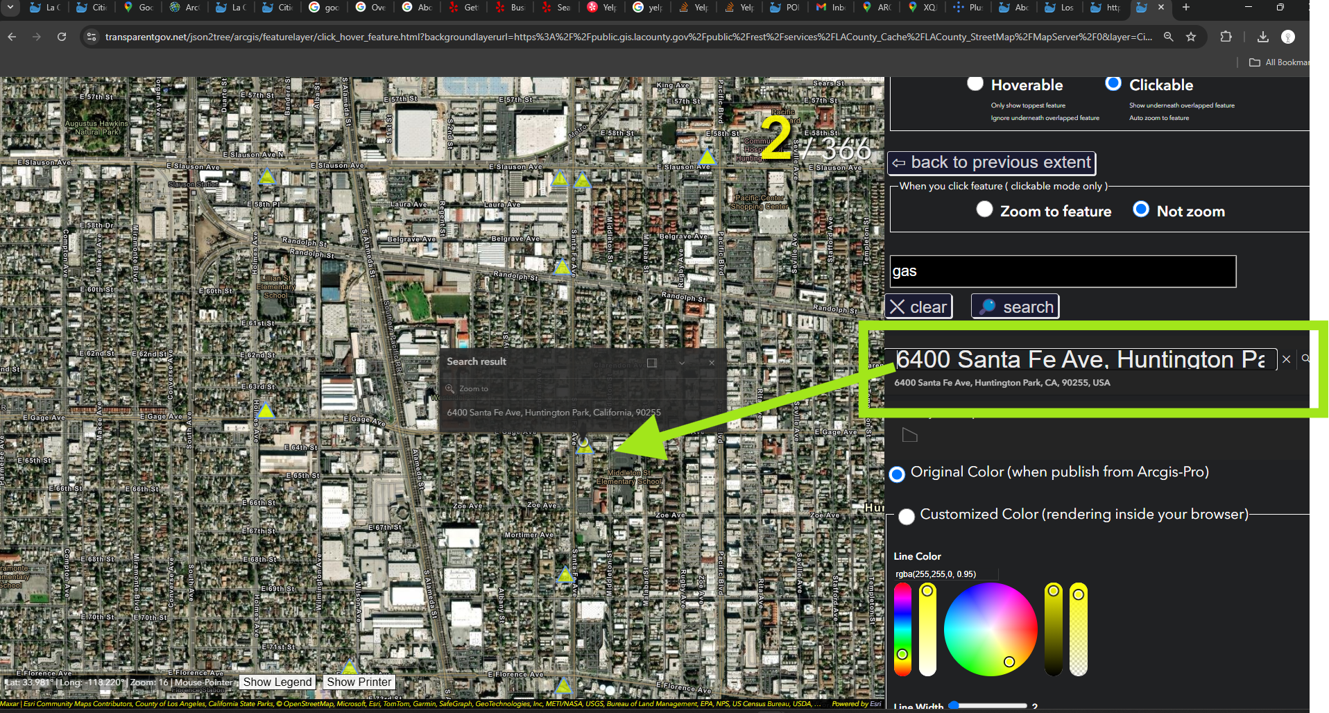
2). 6400 Santa Fe Ave, Huntington Park, CA 90255 is ADDRESS
Obviously POI(point of interest) and Address are 2 very different naming system.
even though both of them meaning the same location( same latitude, same longitude ).
Beside that, there are other naming system
3). XQJC+H2 is google pluscode system
4). 33.98144634492826, -118.23001234186141 is lat-long coordinate system
all 4 naming system means the same location.
You search any of these 4 on google map, you will get same location.
Assuming you are in this ARCO gas station, then you call 911
Police ask you for your location, which naming system would you use ?
Obviously POI is the most easy to remember, easy to communicate, it will be used by most of users.
Except your home address, you propably don't know or remember most of public place address where you went.
At this moment, POI is only thing you know, you remember. POI is only thing you can report to 911 for your location.
Remember: NOT every police department in US can locate you by your cell phone signal !
Now we need a POI database to efficiently convert POI to address, to lat, long on the fly.
Where to get POI database ? Google Map, Yelp business, Government business licensing system, open street map, ESRI, etc.
https://transparentgov.net/json2tree/arcgis/featurelayer/click_hover_feature.html?backgroundlayerurl=https%3A%2F%2Fpublic.gis.lacounty.gov%2Fpublic%2Frest%2Fservices%2FLACounty_Cache%2FLACounty_StreetMap%2FMapServer%2F0&layer=Cities+and+Communities&symbolType=native&_center_lat=33.982778281830775&_center_long=-118.23483475401568&_center_zoom=16&panto=0&poi=gas&clickorhover=click&zoom2feature=not_zoom2feature
1). Search POI for gas
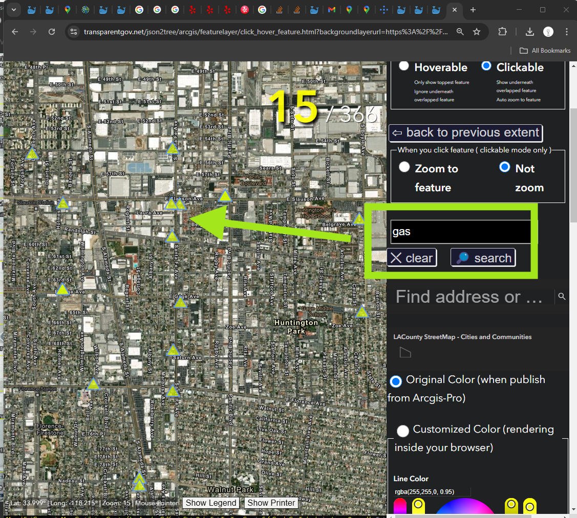
https://transparentgov.net/json2tree/arcgis/featurelayer/click_hover_feature.html?backgroundlayerurl=https%3A%2F%2Fpublic.gis.lacounty.gov%2Fpublic%2Frest%2Fservices%2FLACounty_Cache%2FLACounty_StreetMap%2FMapServer%2F0&layer=Cities+and+Communities&symbolType=native&_center_lat=33.982778281830775&_center_long=-118.23483475401568&_center_zoom=16&panto=0&poi=gas&clickorhover=click&zoom2feature=not_zoom2feature
2). Search address
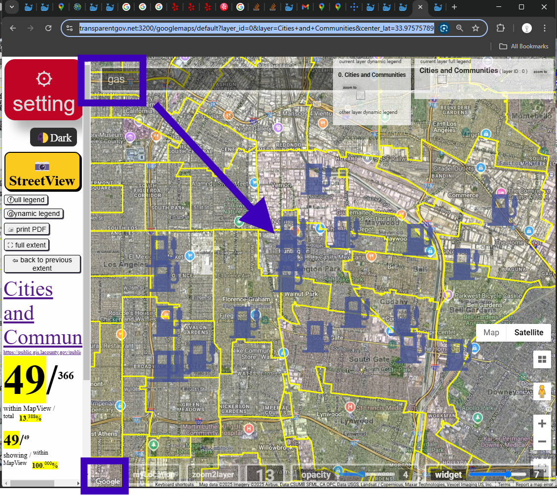
3). Search google map POI
https://transparentgov.net:3200/googlemaps/default?layer_id=0&layer=Cities+and+Communities¢er_lat=33.97769494862001¢er_long=-118.21338596679094¢er_zoom=14&url=https%3A%2F%2Fpublic.gis.lacounty.gov%2Fpublic%2Frest%2Fservices%2FLACounty_Cache%2FLACounty_StreetMap%2FMapServer&overlayType=overlayType_image&panto=0
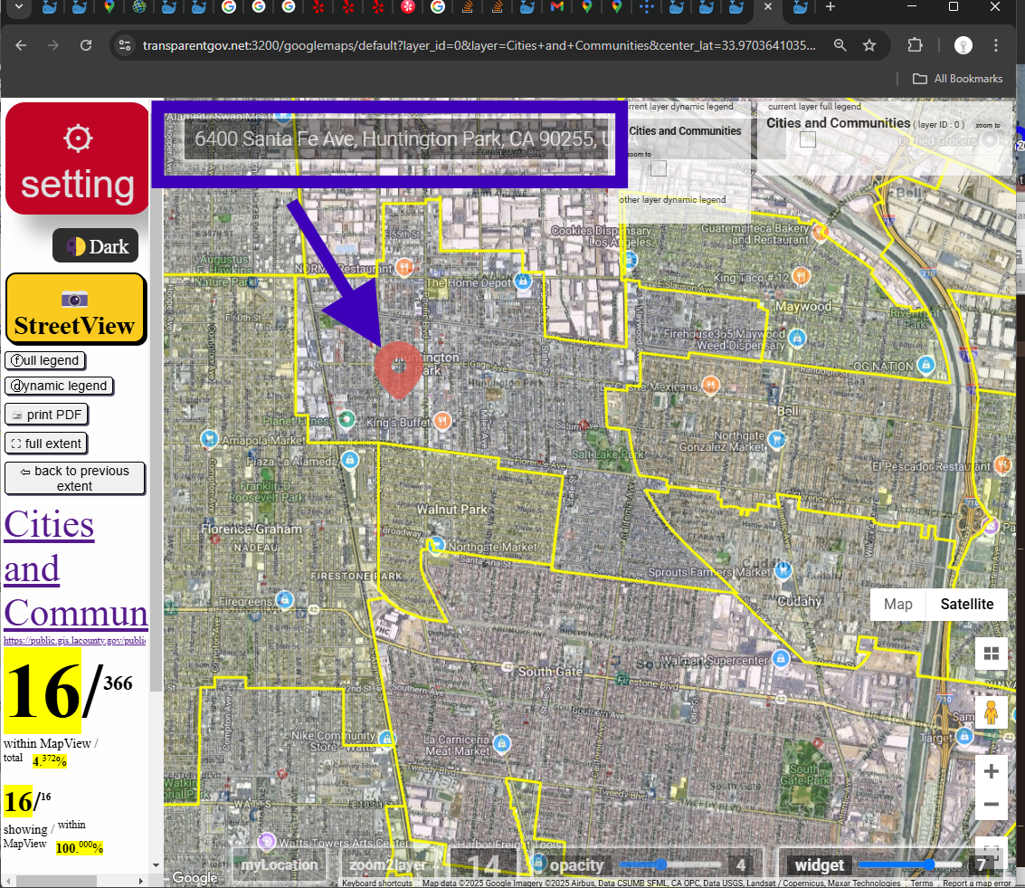
4). Search google map ADDRESS
https://transparentgov.net:3200/googlemaps/default?layer_id=0&layer=Cities+and+Communities¢er_lat=33.97769494862001¢er_long=-118.21338596679094¢er_zoom=14&url=https%3A%2F%2Fpublic.gis.lacounty.gov%2Fpublic%2Frest%2Fservices%2FLACounty_Cache%2FLACounty_StreetMap%2FMapServer&overlayType=overlayType_image&panto=0
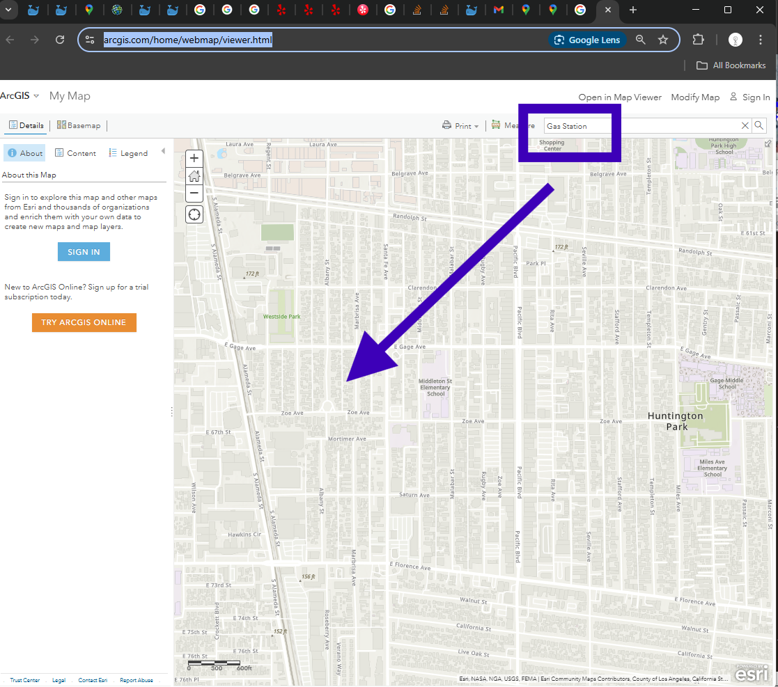
5).Standard ESRI web map viewer don't allow you search POI, if you search gas station, you will see empty result.
https://www.arcgis.com/home/webmap/viewer.html
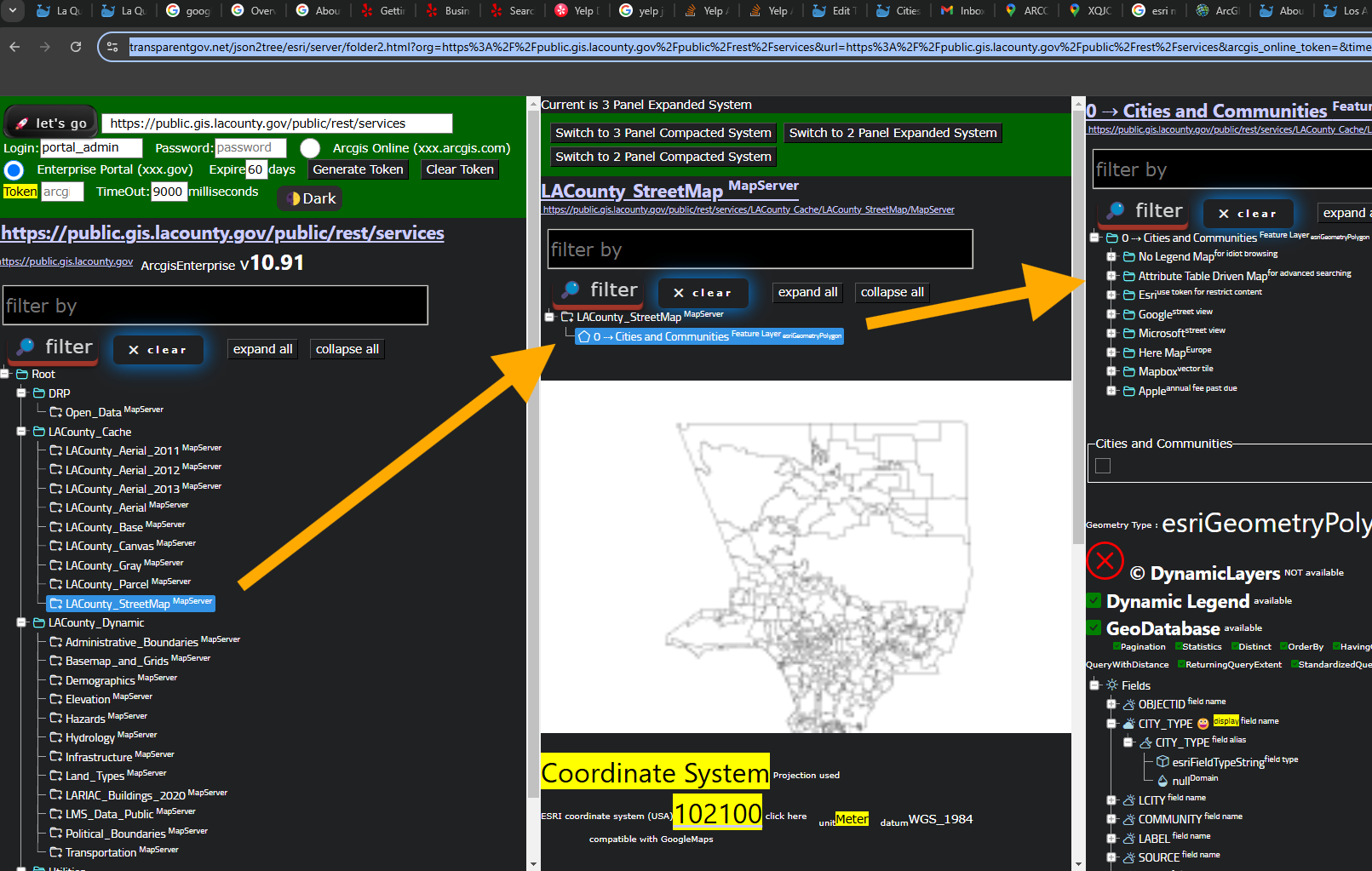
LA county cities layers
https://transparentgov.net/json2tree/esri/server/folder2.html?org=https%3A%2F%2Fpublic.gis.lacounty.gov%2Fpublic%2Frest%2Fservices&url=https%3A%2F%2Fpublic.gis.lacounty.gov%2Fpublic%2Frest%2Fservices&arcgis_online_token=&timeout=9000&select_folder=28&select_layer=0&select_folder_text=LACounty_StreetMap+%3Csup%3EMapServer%3C%2Fsup%3E&select_layer_text=0+%26%23x21E2%3B+Cities+and+Communities+%3Csup%3EFeature+Layer%3Csub%3E+esriGeometryPolygon%3C%2Fsub%3E%3C%2Fsup%3E