Possible one way field value in ESRI network analysis:
"F" : if traffic flow from digitization From to To
"T" : if traffic flow is reverse from digitization From to To
"B": means 2 way streets.
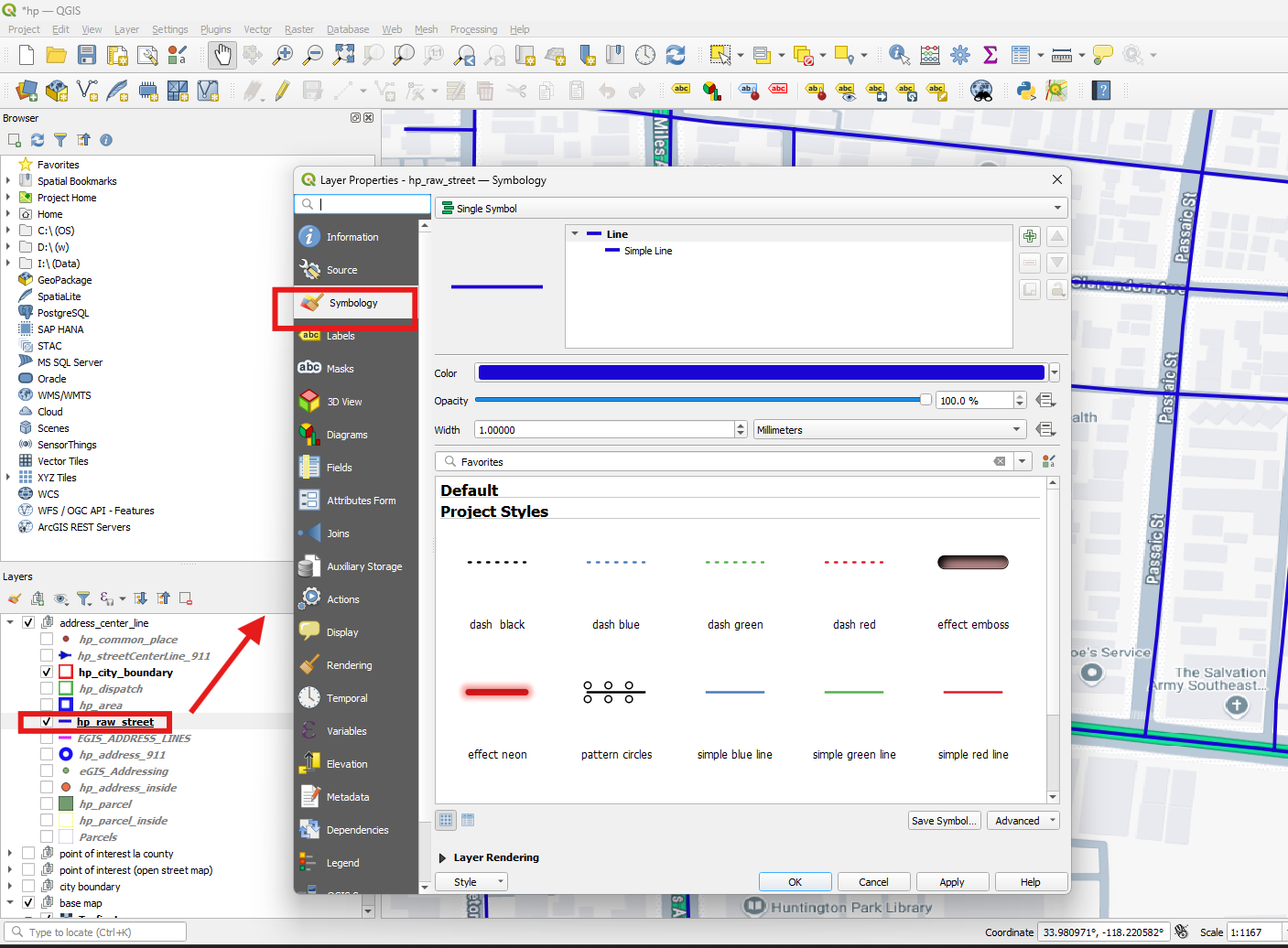
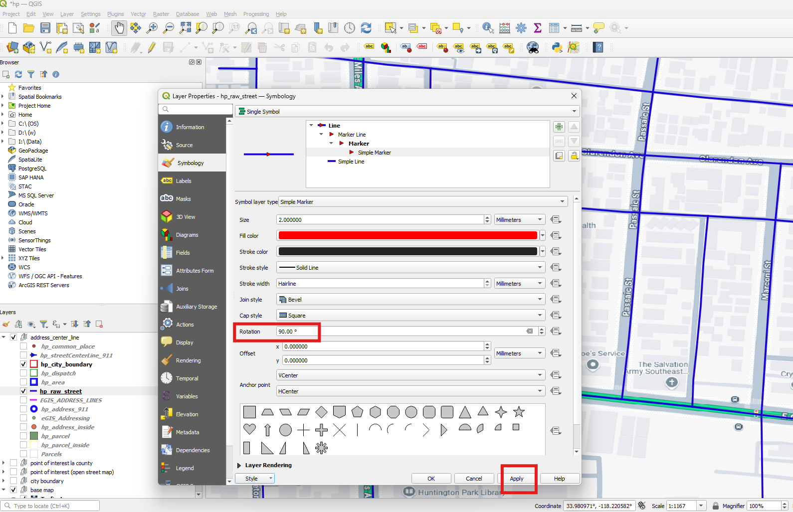
Step 1.
open layer properties, click symbology tab
Step 2.
click plus button.
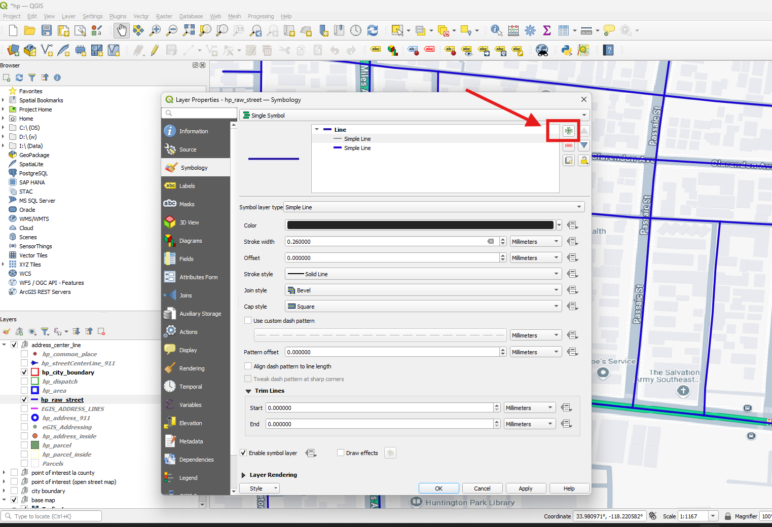
Step 3.
select marker line symbol
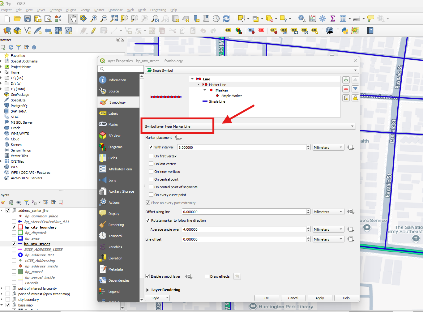
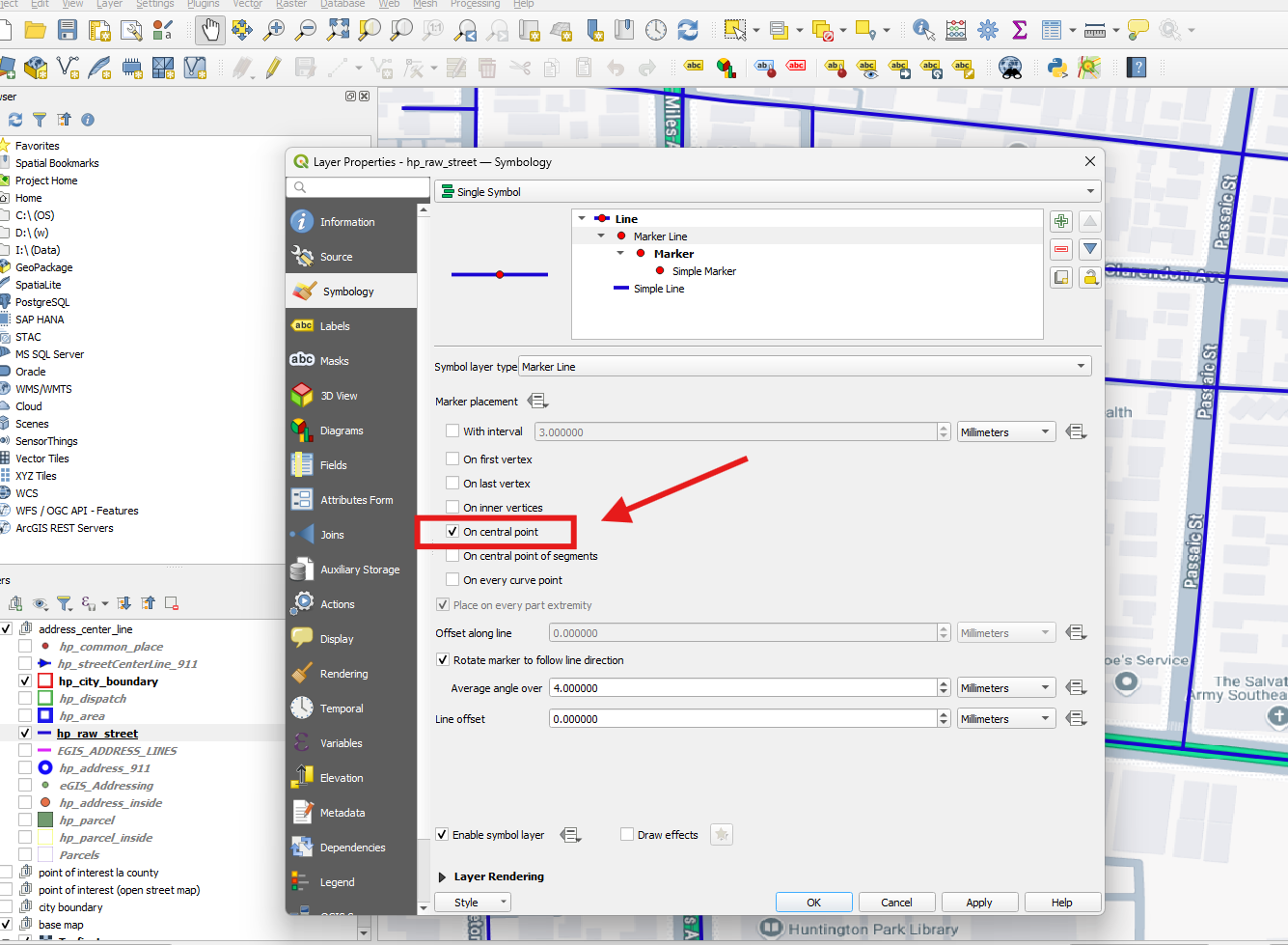
Step 4.
Change the marker line placement to on central point.
Step 5.
click Simple Marker, then click a triangle, let it be triangle.

Step 6.
set the rotation to 90 degrees, means, arrow will point downstream. When you digitizing this line, there is start from point and to destination point. 90 degree means from start to destination. If 270 degree means reverse direction. 270 means arrow point upstream direction.
Step 7.
change size to larger
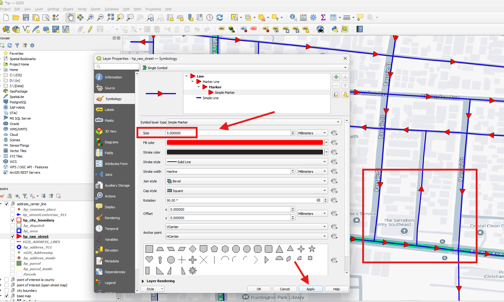
Step 8.
Most of street are 2-way, so initally set all value to "B"
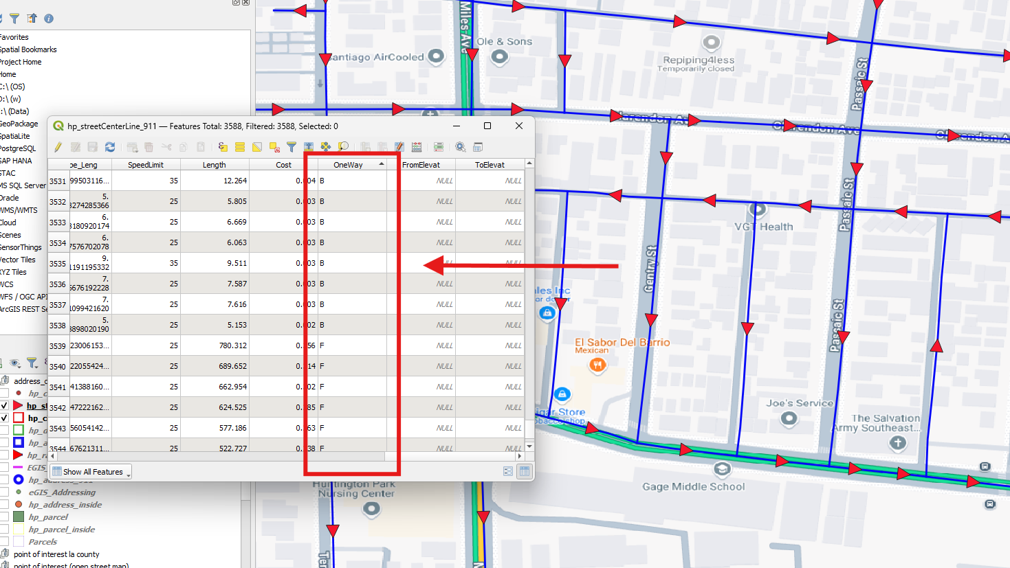
Step 9.
find the one way street, compare whether it traffic flow direction is same as triangle,
if same, asign "F", otherwise, asign "T"
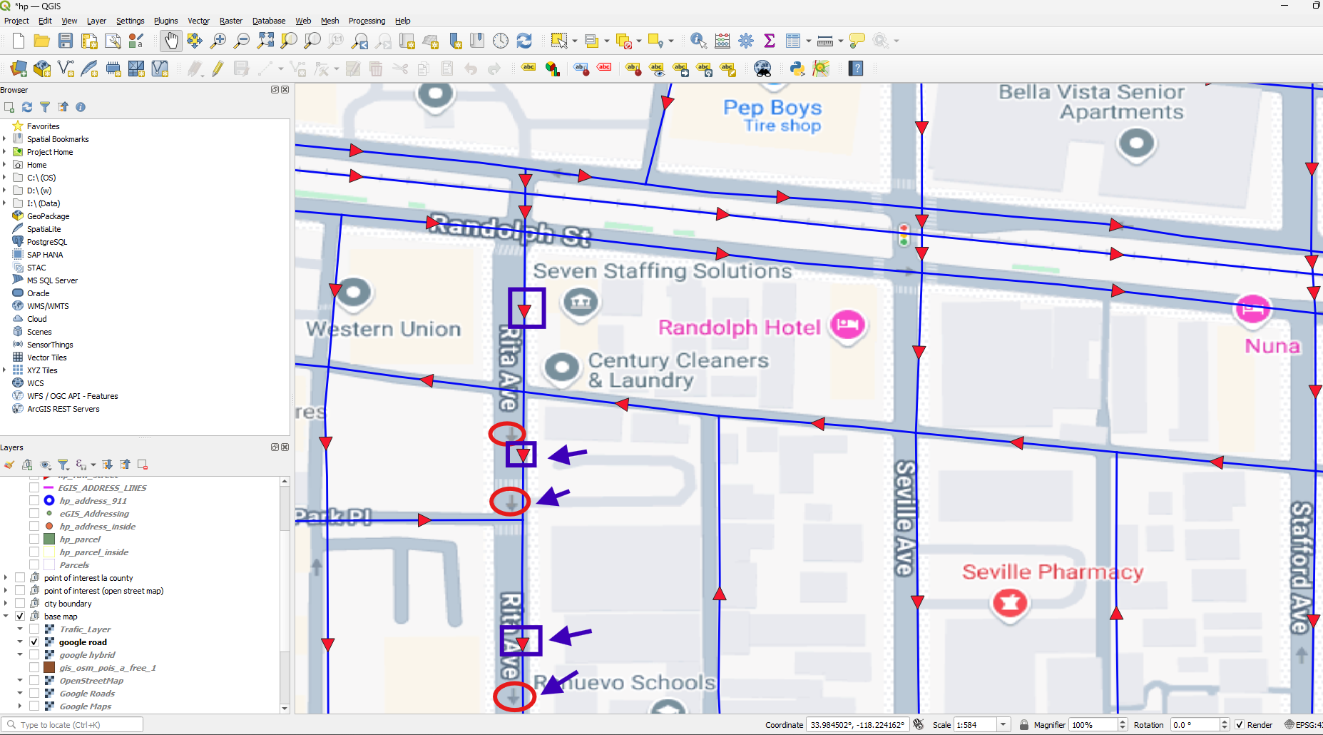
Step 10.
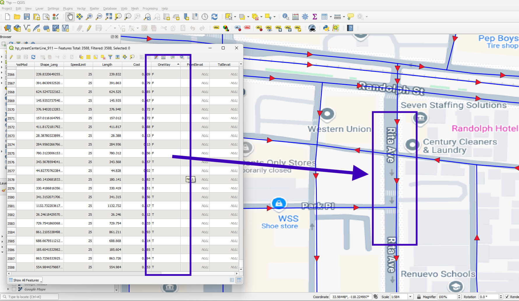
Google map have one way traffic flow direction arrow ( I circle it with red circle)
ESRI street layer have digitization direction, now I set it 90 degree triangle, means downstream. ( I use blue squre to circle it. It is red triangle ).
Now I want you to compare google one way arrow with red triangle.
If they are same direction, asign value "F" for this street segment.
Otherwise, asign "T"
Step 11.
Use same way to compare between google one way direction with esri digitization direction throught all street segment, update one way value.
https://www.northrivergeographic.com/qgis-arrow-in-the-direction-of-line-digitization/