Short Summary
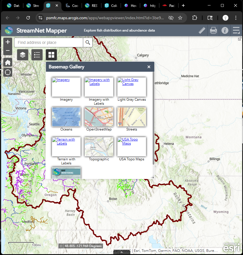
Obviously webapp builder v3.41 has been retired by esri in 2024.
These missing base map icon will no longer available.
More and more function will break down in 2026, more and more function will collapse in 2027 since ESRI discard all old widget system company wide, replace it with new component system.
This is AS-IS condition, since ESRI no longer support 3rd generation based webapp builder a few years ago.
The only choice left with you is get another million $$$ from tax payer to build a new one.
This is a live example how you will end up with if you invest your million $$$ on any of ESRI's build out model (commercial off-the-shelf (COTS) products.)
Developer edition (with custom widget)
3rd generation api based webapp builder (retired 2024)
4th gen based experience builder
ESRI 3rd api based classic story map, ( retired since arcgis online v11.x release)
ESRI 4th api based story map
Esri dashboard app,
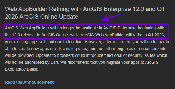
say bye to web app builder in Q1 2026, eneterprise 12.0
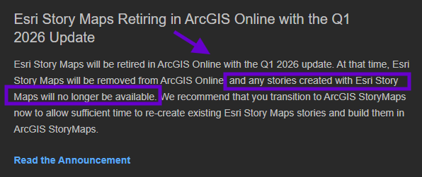
say bye to story map in Q1 2026, eneterprise 12.0
Build-in edition ( no custom widget allowed ), 5 mins click on arcgis online or portal to create a new one.
ESRI is doing widget-component transition for you in 2026. You should be safe since you don't have custom widget.
https://psmfc.maps.arcgis.com/apps/webappviewer/index.html?id=3be91b0a32a9488a901c3885bbfc2b0b
Long Story
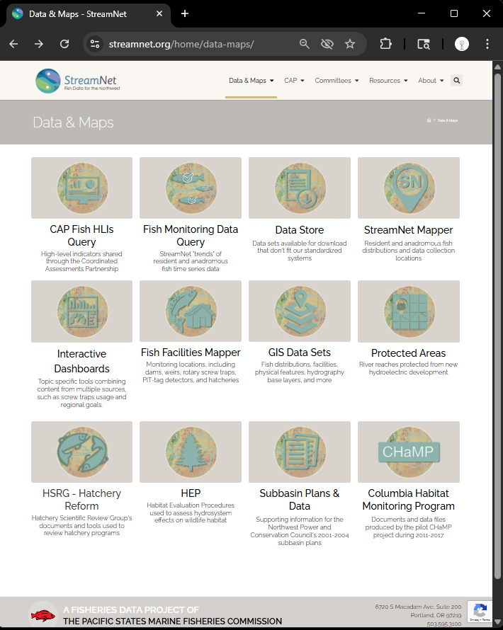
Step 1.
https://www.streamnet.org/home/data-maps/
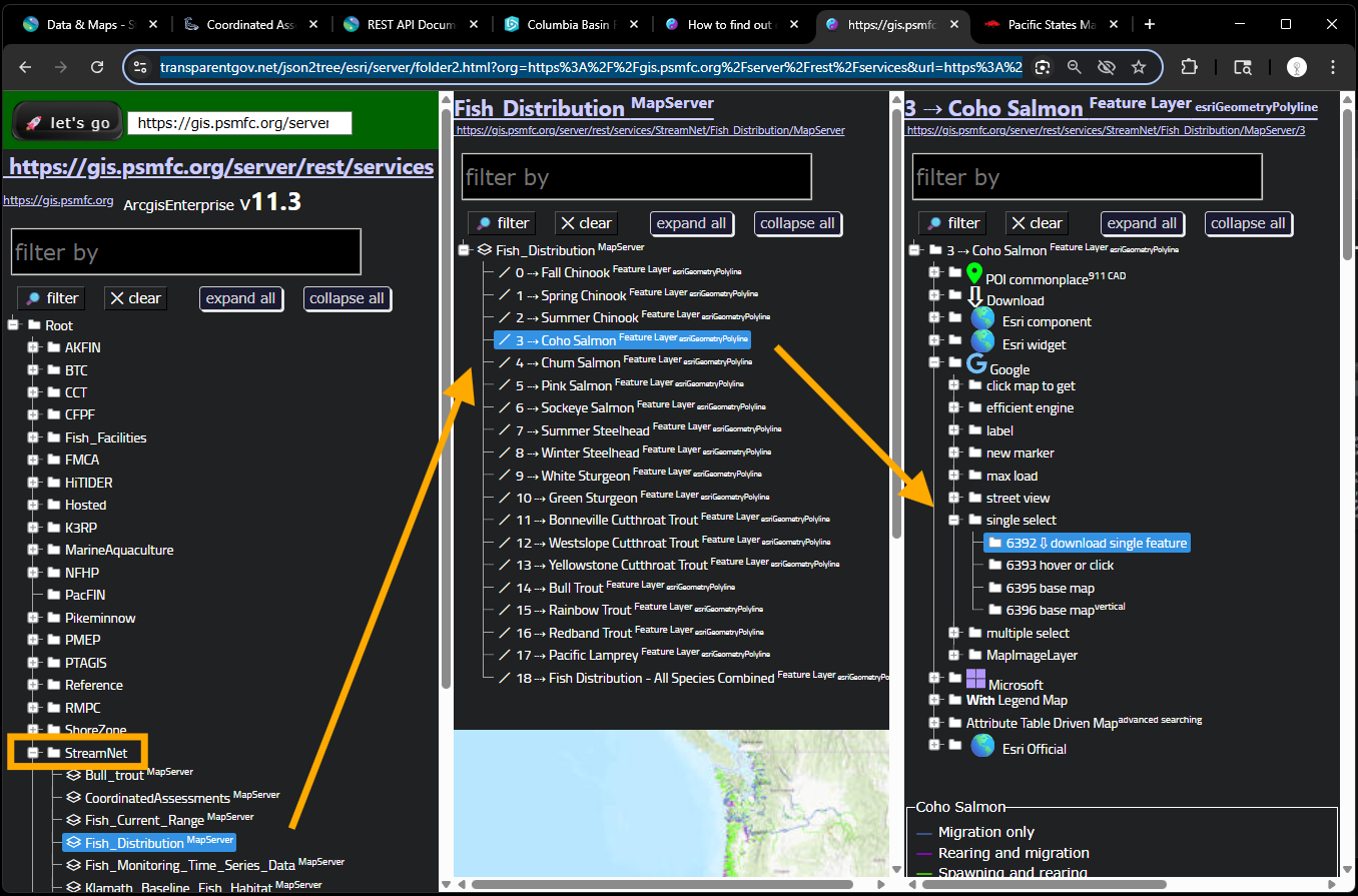
Step 2.
https://transparentgov.net/json2tree/esri/server/folder2.html?org=https%3A%2F%2Fgis.psmfc.org%2Fserver%2Frest%2Fservices&url=https%3A%2F%2Fgis.psmfc.org%2Fserver%2Frest%2Fservices&select_folder=38&select_layer=3&arcgis_online_token=&select_folder_text=Fish_Distribution+%3Csup%3EMapServer%3C%2Fsup%3E&select_layer_text=3+%26%23x21E2%3B+Coho+Salmon+%3Csup%3EFeature+Layer%3Csub%3E+esriGeometryPolyline%3C%2Fsub%3E%3C%2Fsup%3E
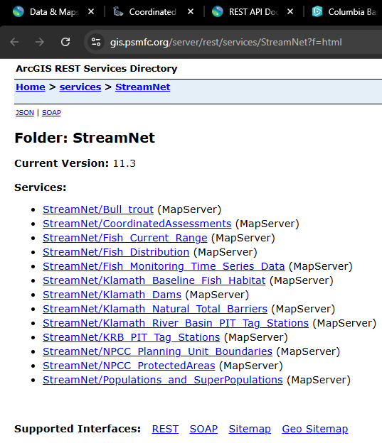
Step 3.
https://gis.psmfc.org/server/rest/services/StreamNet?f=html
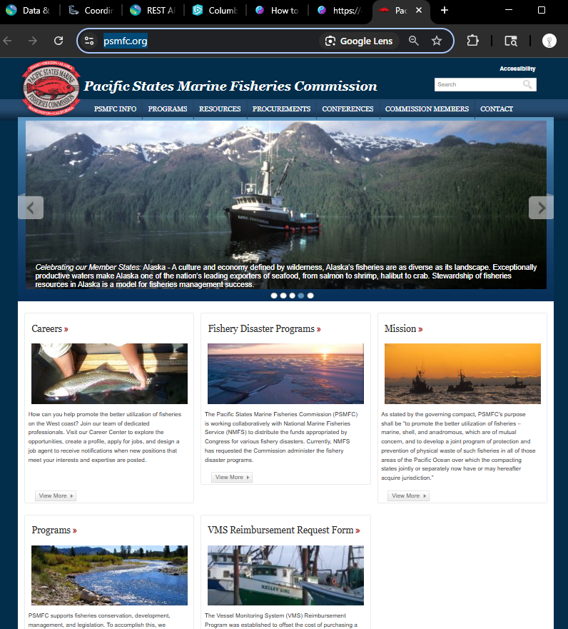
Step 4.
https://www.psmfc.org/
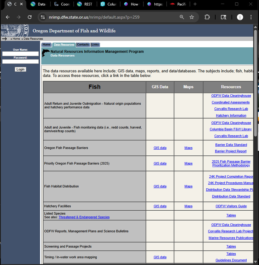
Step 5.
https://nrimp.dfw.state.or.us/nrimp/default.aspx?p=259
Step 6.
Obviously webapp builder v3.41 has been retired by esri in 2024.
These missing base map icon will no longer available.
More and more function will break down in 2026, more and more function will collapse in 2027.
This is AS-IS condition, since ESRI no longer support 3rd generation based webapp builder a few years ago.
The only choice left with you is discard your investment, get another million $$$ from tax payer to build a new one.
This is a live example how you will end up with if you invest your million $$$ on any of ESRI's build out model, such as
3rd generation api based webapp builder
4th gen based experience builder
ESRI story map, Esri dashboard app,
https://psmfc.maps.arcgis.com/apps/webappviewer/index.html?id=3be91b0a32a9488a901c3885bbfc2b0b
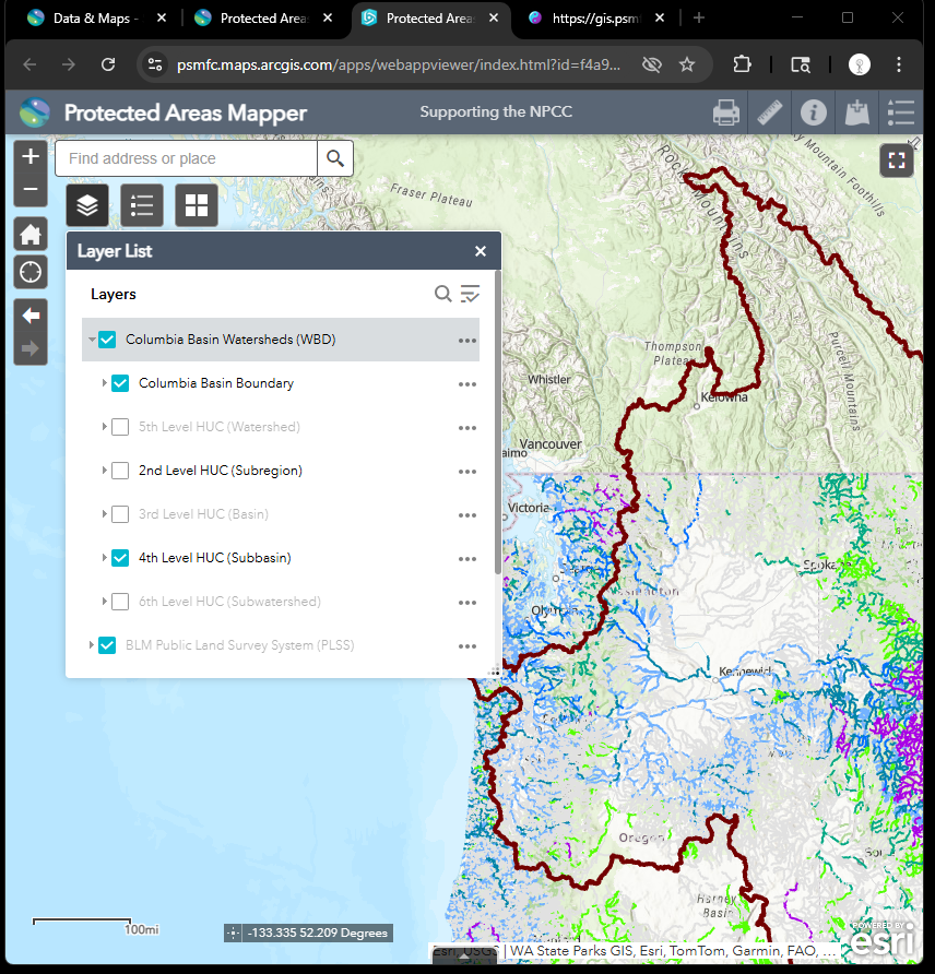
Step 7.
Obviously webapp builder v3.41 has been retired by esri in 2024.
These missing base map icon will no longer available.
More and more function will break down in 2026, more and more function will collapse in 2027.
This is AS-IS condition, since ESRI no longer support 3rd generation based webapp builder a few years ago.
The only choice left with you is discard your investment, get another million $$$ from tax payer to build a new one.
https://psmfc.maps.arcgis.com/apps/webappviewer/index.html?id=f4a9bf13f2014b259d63c8eb03e1f7af
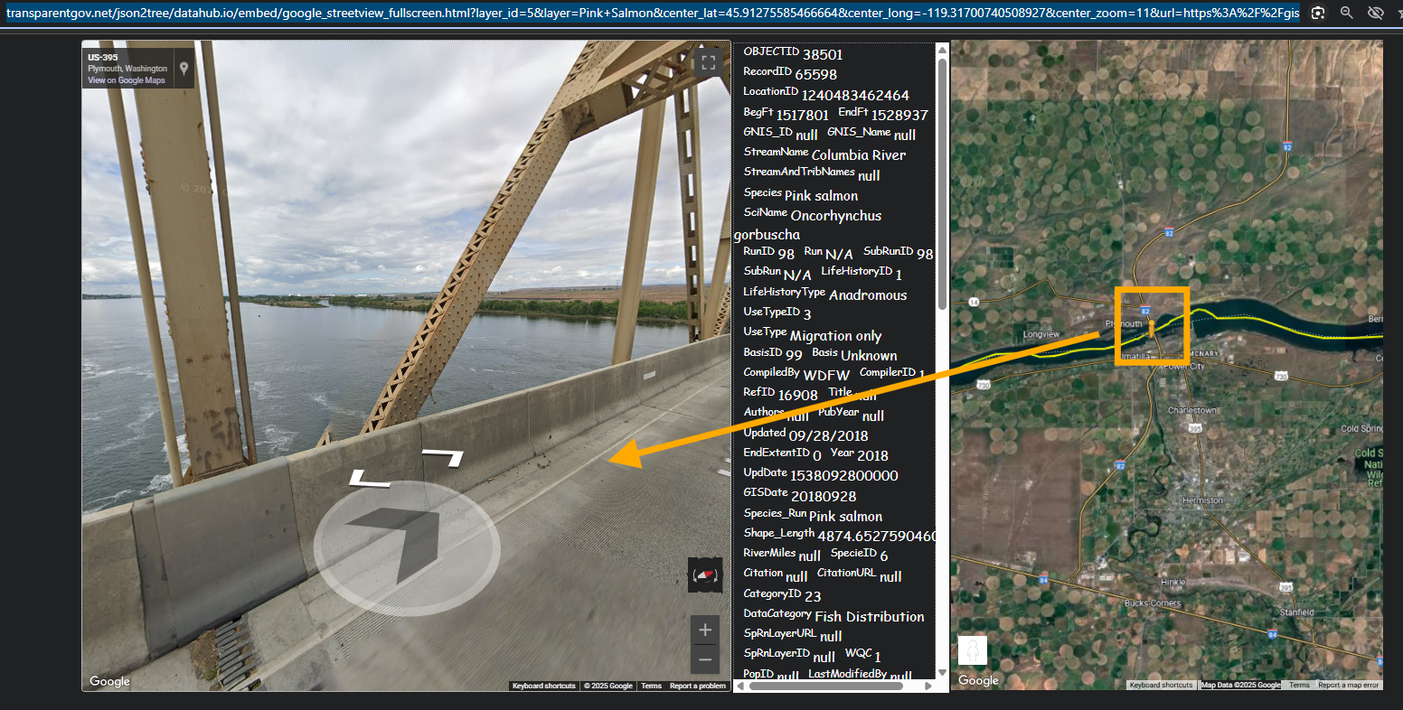
Step 8.
I wrote this model use google map api v3 in 2004, it still runs like a new one in 2025 !
google v3 has not change since 2009 release
Assume I plan to fish pink salmon,
I am looking for a fishing site,
so I can use google street view to inspect where pink salmon lives by each stream.
street view model is 6390, use mouse hove the stream line on map,
the street view is popup so I can check the road condition, environment of that area before I hit the road.
or you can click to hold the pegman, then drag the pegment to where you want to inspect road conditions.
https://transparentgov.net/json2tree/datahub.io/embed/google_streetview_fullscreen.html?layer_id=5&layer=Pink+Salmon¢er_lat=45.91275585466664¢er_long=-119.31700740508927¢er_zoom=11&url=https%3A%2F%2Fgis.psmfc.org%2Fserver%2Frest%2Fservices%2FStreamNet%2FFish_Distribution%2FMapServer&panto=0
Step 9.
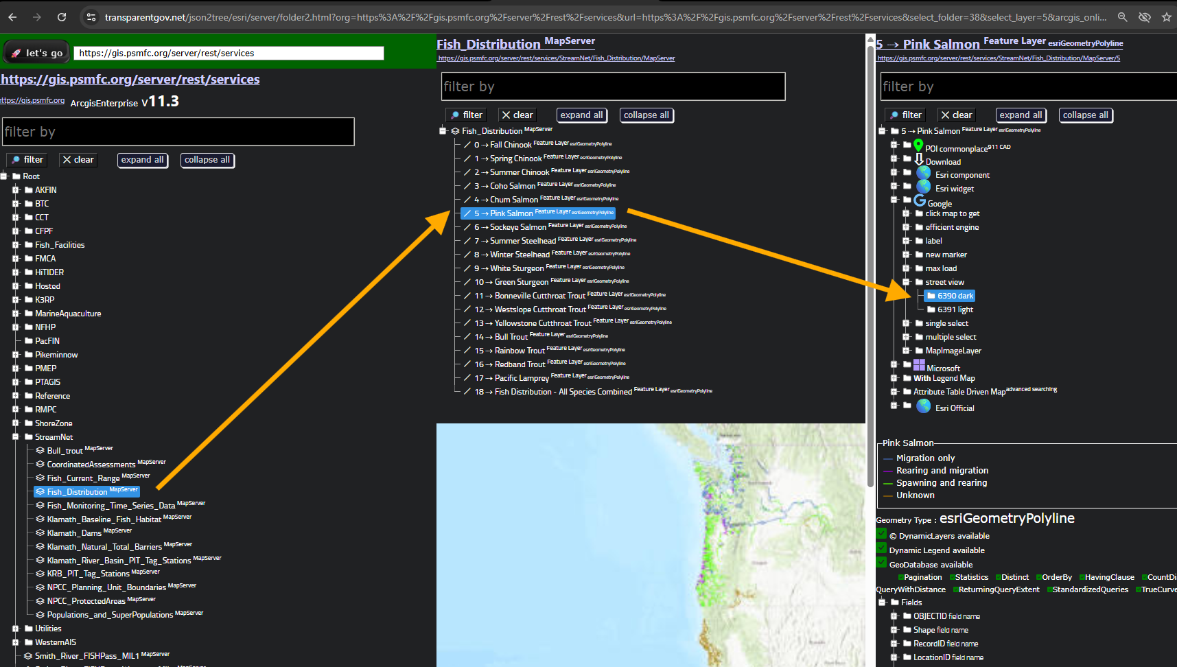
find street view model 6390 here
https://transparentgov.net/json2tree/esri/server/folder2.html?org=https%3A%2F%2Fgis.psmfc.org%2Fserver%2Frest%2Fservices&url=https%3A%2F%2Fgis.psmfc.org%2Fserver%2Frest%2Fservices&select_folder=38&select_layer=5&arcgis_online_token=&select_folder_text=Fish_Distribution+%3Csup%3EMapServer%3C%2Fsup%3E&select_layer_text=5+%26%23x21E2%3B+Pink+Salmon+%3Csup%3EFeature+Layer%3Csub%3E+esriGeometryPolyline%3C%2Fsub%3E%3C%2Fsup%3E