Step 1.
fake street address are not real, it is calculate by ArcPro locator using street center line segment, right-from-house-number, right-to-#, left-from#, left-to#
These unwanted fake street address block the real POI points in suggest popup.
the problem list here
combined address + POI layer act as both address and POI role (911 POI)
Step 2.
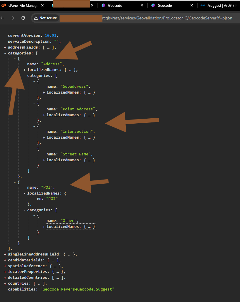
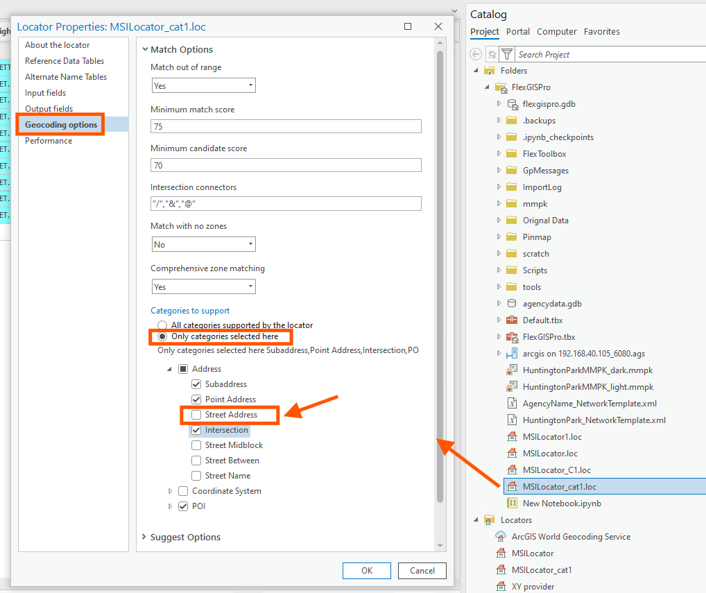
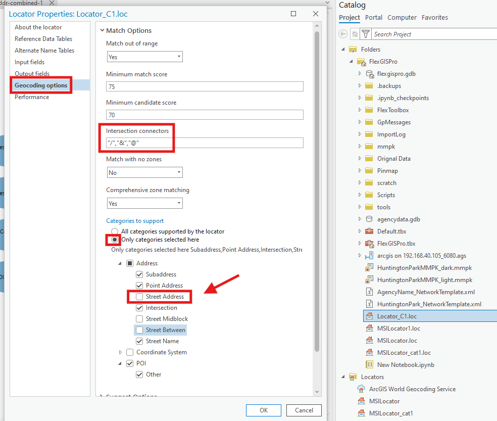
these kind of fake address, esri called them as a category, the category name is 'street address'
the work around is you should uncheck the category name is 'street address', see below
Step 3.
these kind of fake address, esri called them as a category, the category name is 'street address'
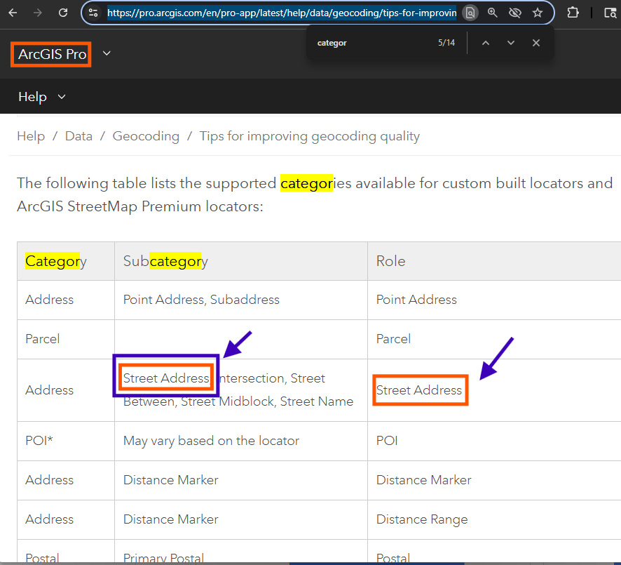
https://pro.arcgis.com/en/pro-app/latest/help/data/geocoding/tips-for-improving-geocoding-quality.htm
blue box and red box are both "street address", but they are meaning different things.
red box, street address ROLE, means street center line layer act as street address ROLE,
blue box, street address (category). means, these fake address calculated by street segment house number range.
Step 4.
blue box and red box are both "street address", but they are meaning different things.
red box, street address ROLE, means street center line layer act as street address ROLE,
Step 5.
blue box and red box are both "street address", but they are meaning different things.
blue box, street address (category). means, these fake address calculated by street segment house number range.
Step 6.
by default, if you do not change anything, ArcPro locator will include fake street address. Otherwise if you remove these fake address category from locator property see previous screen. You can see the difference.
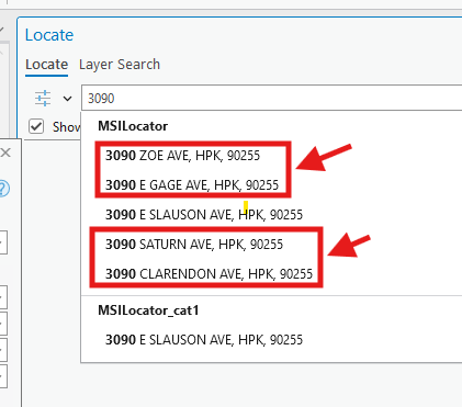
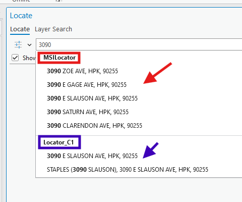
For example, 3090 slauson is real address, all other 3090 xxxxx is all fake. We only have 1 real address start with 3090.
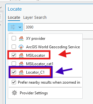
I create 2 locator to compare, MSLocator_cat1 does not show fake address, only show real address. Because I uncheck fake street address category.
The original locator by default, show all red box fake address.
Step 7.
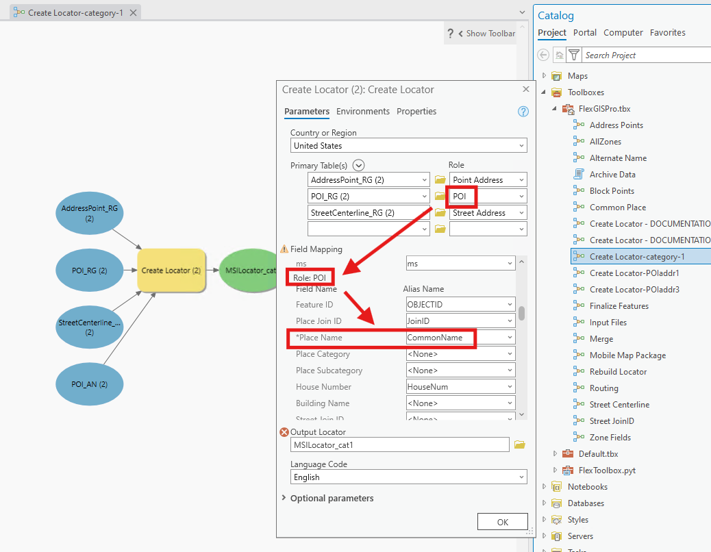
However, it does not show POI business name, so show POI business name, you have to combine POI business name with street address together into single common name field, and use this single field as PLACE name field, when you create a POI role.
Note: street address was used multiple times, but each time has different meaning, depends on context, some times it means street address role, some time it means street address category, some time it means just regular "address", some time it means fake-address.
a picture, better than thousands words.
Step 8.
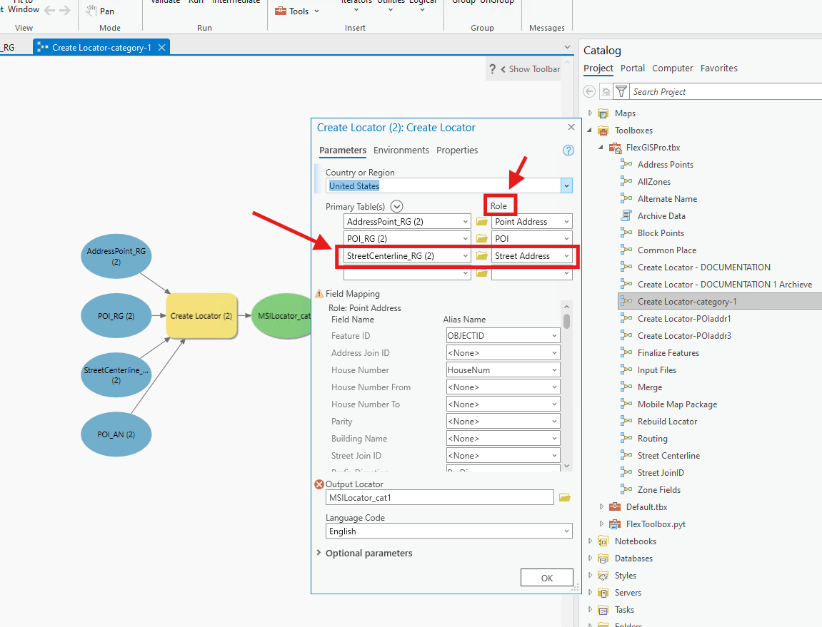
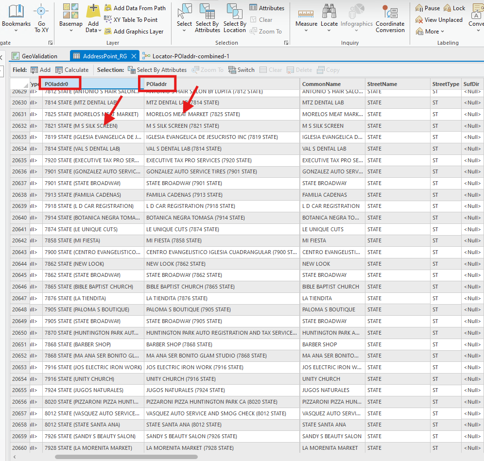
combine POI + address = POIaddr,
POIaddr0 is different style = address + POI
Step 9.
POI role original use POI layer, now you want to change it to this combined layer.
YES, this combined layer use as both Address ROLE and POI role. Yes, both role.
Place Name is required, set as POIaddr ( combined field ),
other field also mapped accordingly
Step 10.
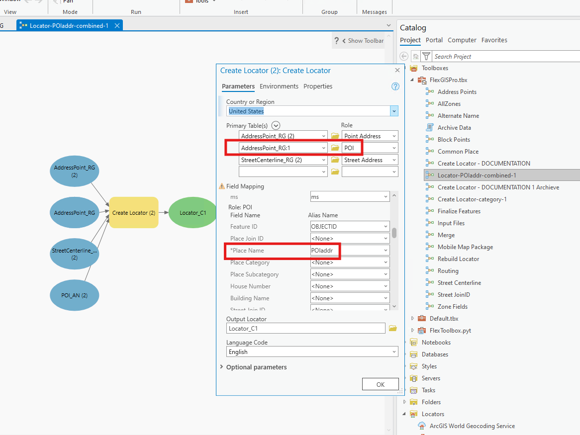
uncheck "street address" category
Step 11.
red box, arrow is original setting
blue box, arrow is I fixed version, named C1
Step 12.
when you search 3090, see the difference.
red box, arrow is original setting, NO POI business shows, lots of fake address
blue box, arrow is I fixed version, named C1, show all POI business, NO- fake-address, only show 1 real address
Step 13.
Step 14.
Step 15.
Step 16.
Step 17.
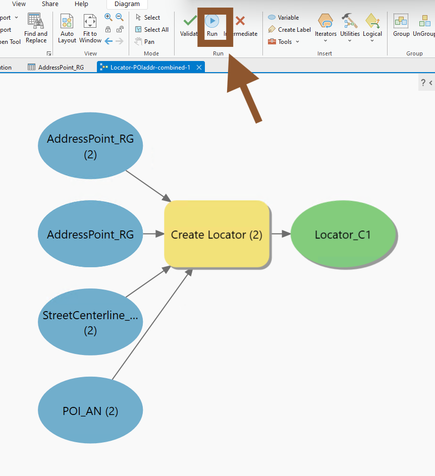
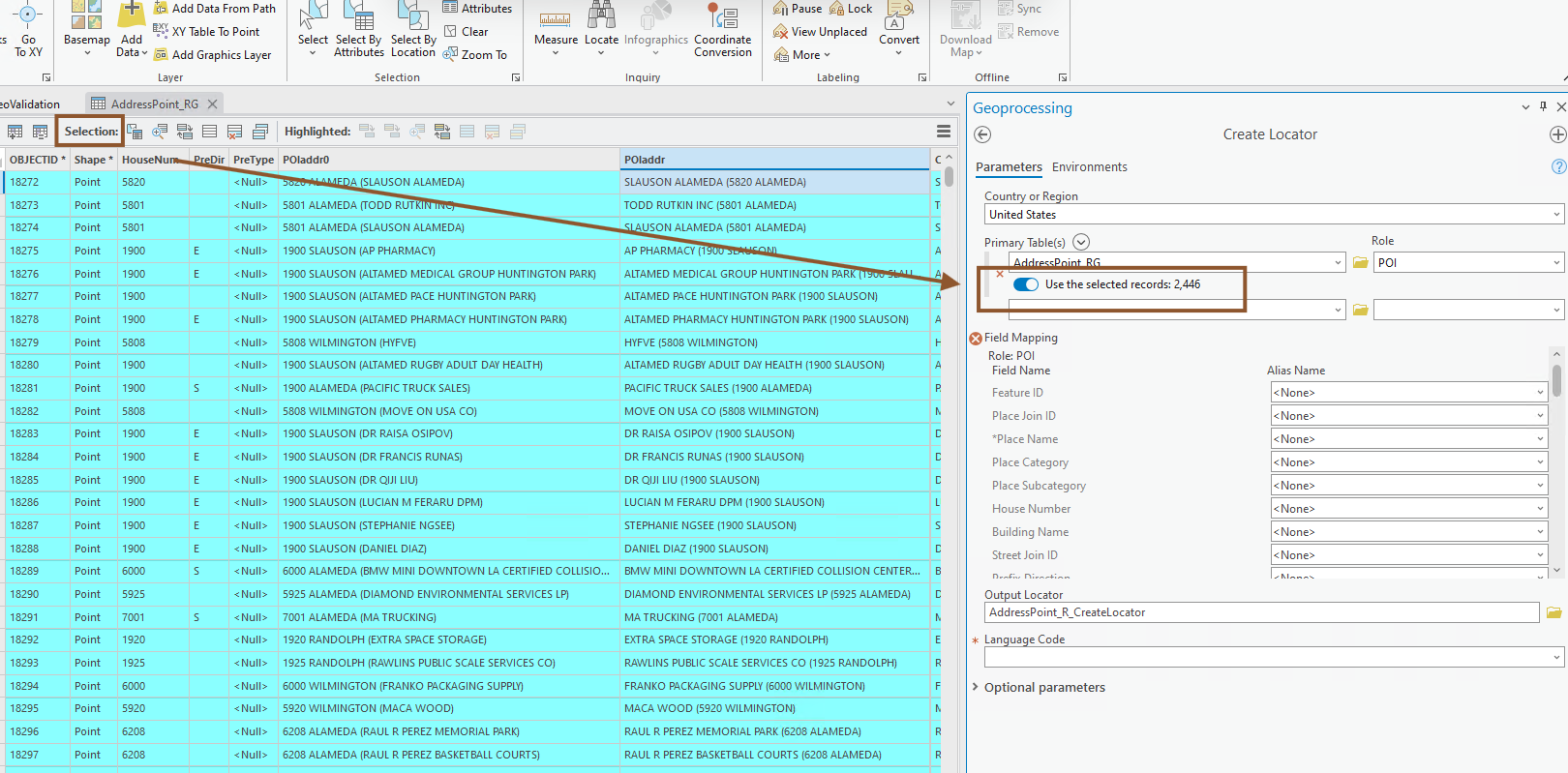
Before you click RUN button, must clear all selection, otherwise, if you select some feature, by default, create locator will use only the selected feature, not the whole layer. ( this is not obviously can be see here, but you can see this logic if you just run geoprocessing, tool, create locator tool )
Because of this is python script tool, there is no user interface button or check box to obviously tell you only use selected feature.
But you have to keep in mind, see next screen user interface version of create locator tool, it obviously tell you, so you would not miss it.
Step 18.
if you select some feature, by default, create locator will use only the selected feature, not the whole layer.
Step 19.
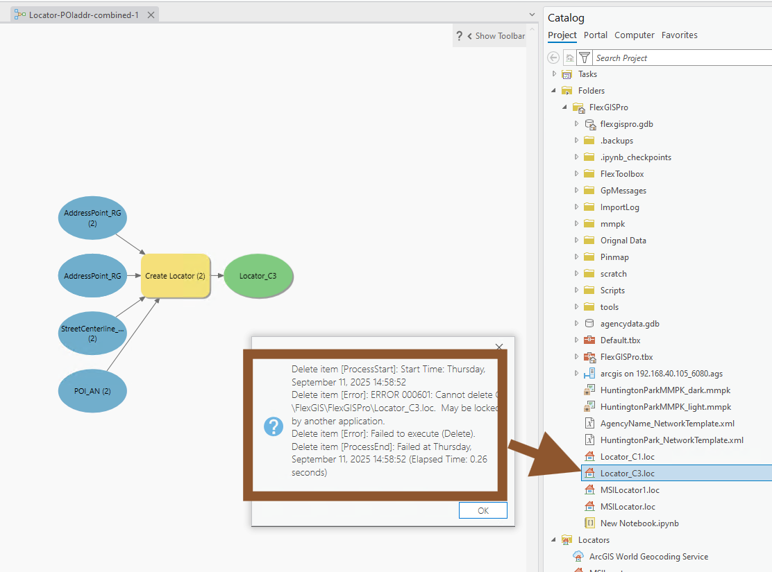
when you try to delete old locator, but you see this error,
the reason is because you publish geocode service with this locator, unless you delete the published geocode service, otherwise, this locator will be locked by arcgis server.
So 1st delete web service, then delete locator in ArcPro, will no more error message.
Or close ArcPro. Just delete xxxx.loc file in ArcPro project folder directly also works the same.
Step 20.
category list is actually dynamically generated at run time