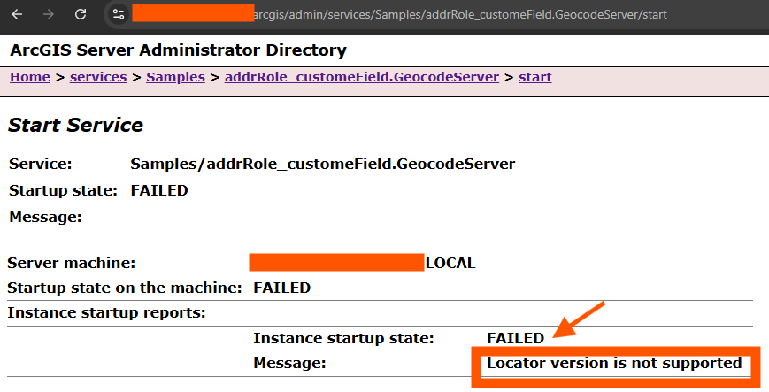
Step 1.
For those who run ArcServer v10.91, your max locator version is 3.3.
If you choose locator v3.5, you will get this error, when you start locator in ArcServer.
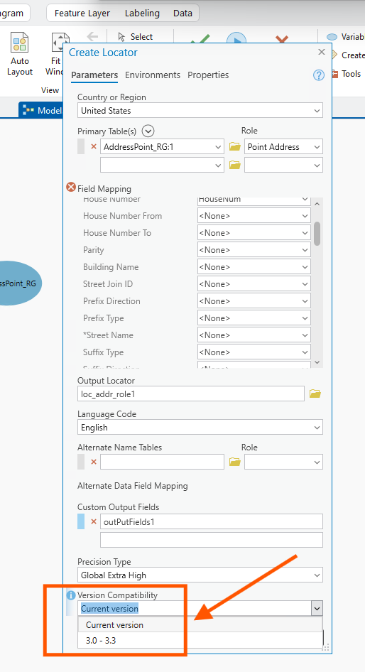
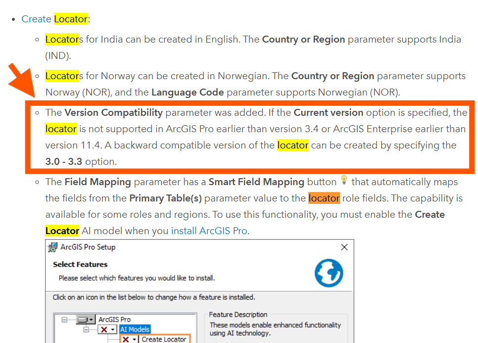
Step 2.
must select 3.0-3.3, if use current version, will cause obove error.
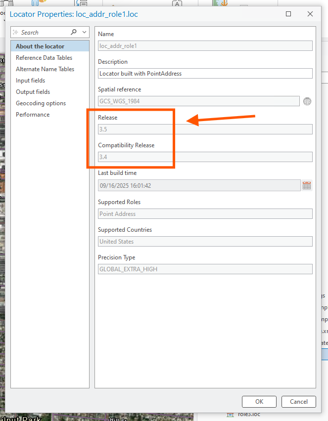
Step 3.
if you see compatibility 3.4 here, it will failed when you publish to arcServer v10.91
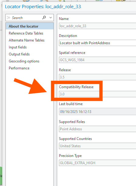
Step 4.
if your see 3.0 here, means ArcServer v10.91 will works fine
Step 5.
https://pro.arcgis.com/en/pro-app/3.4/get-started/whats-new-in-arcgis-pro.htm
Step 6.
has ArcServer v11.4 fixed the problem?
This is 11.4, but not sure their locator version, since locator version can back ward compatible.
but this sample did not fix it
https://transparentgov.net/json2tree/gateway/feature-layer/geocode-suggest-zoom2location.html?backgroundlayerurl=https%3A%2F%2Fgisapps.cityofchicago.org%2Farcgis%2Frest%2Fservices%2FChicago_Addresses%2FGeocodeServer&_center_lat=42.013697580379&_center_long=-87.686125731634&_center_zoom=18&panto=0
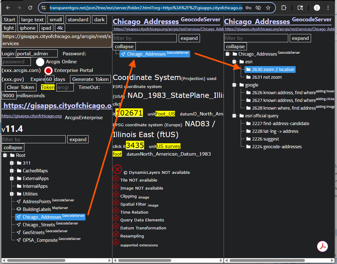
Step 7.
here is their locator
https://transparentgov.net/json2tree/esri/server/folder2.html?org=https%3A%2F%2Fgisapps.cityofchicago.org%2Farcgis%2Frest%2Fservices&url=https%3A%2F%2Fgisapps.cityofchicago.org%2Farcgis%2Frest%2Fservices&arcgis_online_token=&timeout=9000&select_folder=8&select_layer=-1&select_folder_text=Chicago_Addresses+%3Csup%3EGeocodeServer%3C%2Fsup%3E&select_layer_text=Chicago_Addresses+%3Csup%3EGeocodeServer%3C%2Fsup%3E
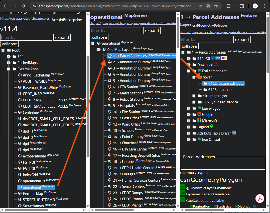
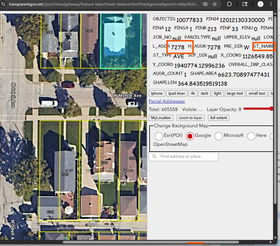
Step 8.
get parcel address for testing
https://transparentgov.net/json2tree/esri/server/folder2.html?org=https%3A%2F%2Fgisapps.cityofchicago.org%2Farcgis%2Frest%2Fservices&url=https%3A%2F%2Fgisapps.cityofchicago.org%2Farcgis%2Frest%2Fservices&arcgis_online_token=&timeout=9000&select_folder=32&select_layer=1&select_folder_text=operational+%3Csup%3EMapServer%3C%2Fsup%3E&select_layer_text=1+%26%23x21E2%3B+Parcel+Addresses+%3Csup%3EFeature+Layer%3Csub%3E+esriGeometryPolygon%3C%2Fsub%3E%3C%2Fsup%3E
Step 9.
get parcel address for testing
https://transparentgov.net//json2tree/gateway/feature-layer/hover-feature.html?backgroundlayerurl=https%3A%2F%2Fgisapps.cityofchicago.org%2Farcgis%2Frest%2Fservices%2FExternalApps%2Foperational%2FMapServer%2F1&layer=Parcel+Addresses&_center_lat=41.99338805894643&_center_long=-87.8105480328067&_center_zoom=20&panto=0
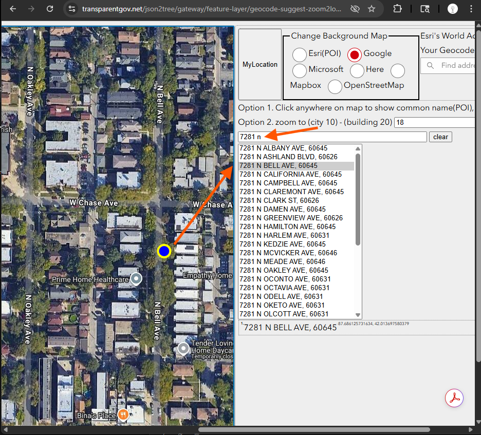
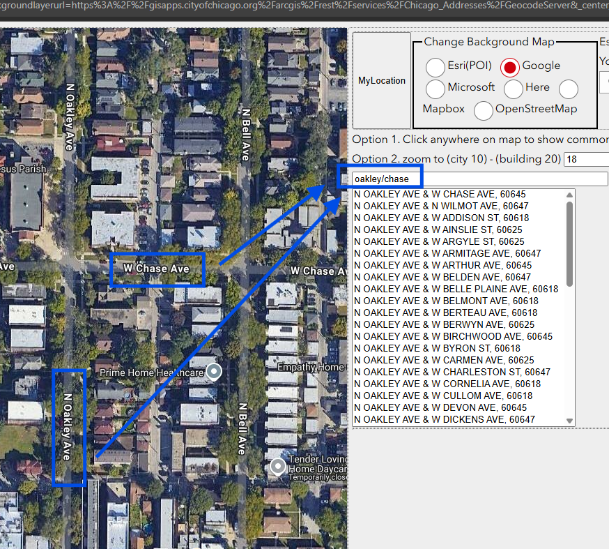
Step 10.
test their cross street, works fine
https://transparentgov.net/json2tree/gateway/feature-layer/geocode-suggest-zoom2location.html?backgroundlayerurl=https%3A%2F%2Fgisapps.cityofchicago.org%2Farcgis%2Frest%2Fservices%2FChicago_Addresses%2FGeocodeServer&_center_lat=42.0136537378701&_center_long=-87.68858799951&_center_zoom=18&panto=0
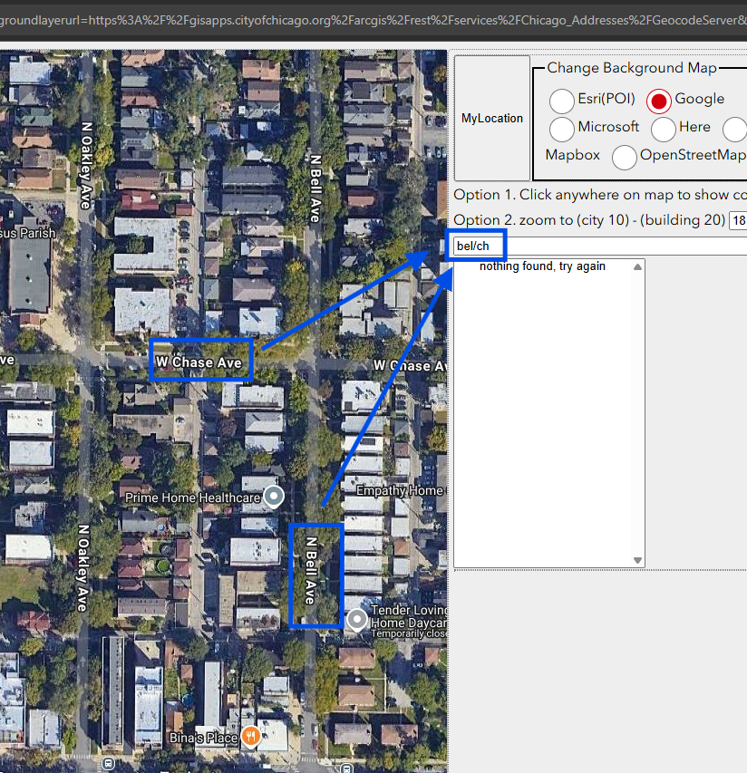
Step 11.
test 3 letter + 2 letter cross street,
failed
by default, esri's setup is not design for 3 + 2 letter.
you have to use your work around to fix it.
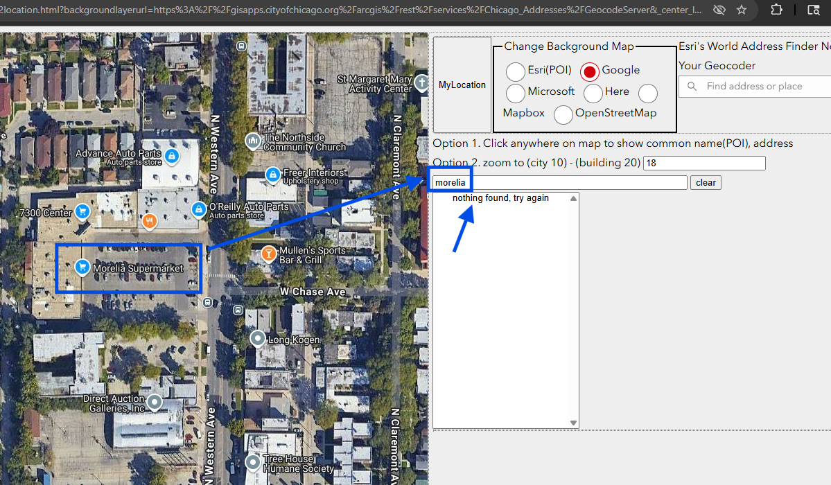
Step 12.
test POI, search a business name,
failed on POI test.
https://transparentgov.net/json2tree/gateway/feature-layer/geocode-suggest-zoom2location.html?backgroundlayerurl=https%3A%2F%2Fgisapps.cityofchicago.org%2Farcgis%2Frest%2Fservices%2FChicago_Addresses%2FGeocodeServer&_center_lat=42.013797222332286&_center_long=-87.69183347241858&_center_zoom=18&panto=0
Step 13.
Step 14.
Step 15.
Step 16.
Step 17.
Step 18.
Step 19.
Step 20.