Step 1.
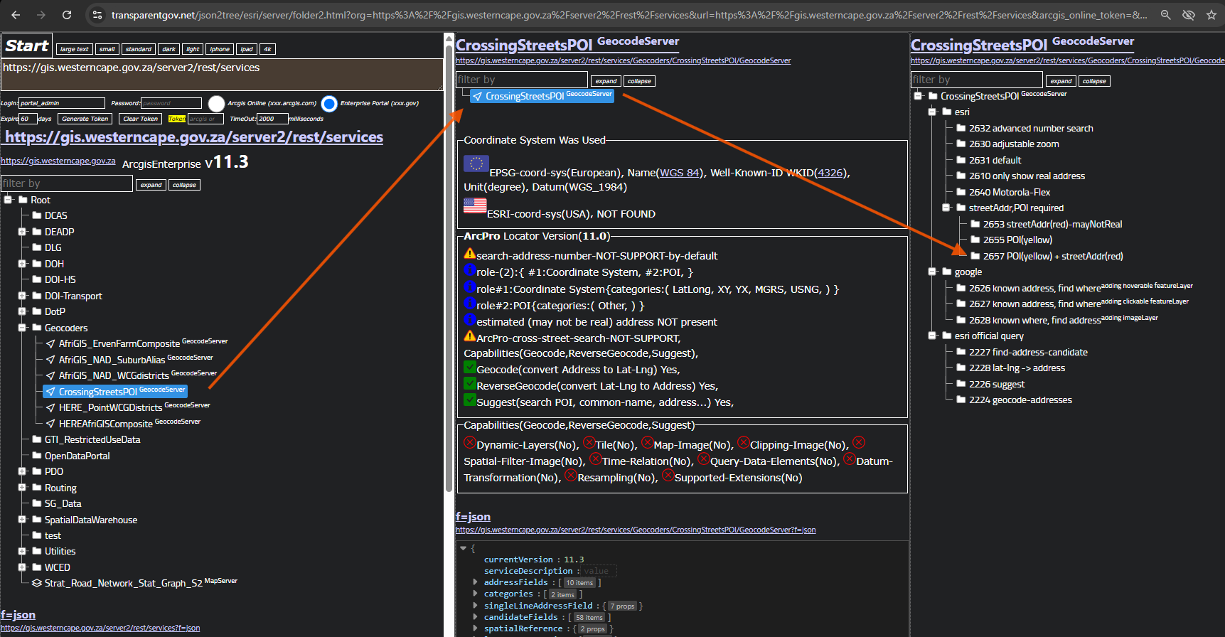
just want to confirm other POI locator, if they can list all business name by just type address number.
https://transparentgov.net/json2tree/esri/server/folder2.html?org=https%3A%2F%2Fgis.westerncape.gov.za%2Fserver2%2Frest%2Fservices&url=https%3A%2F%2Fgis.westerncape.gov.za%2Fserver2%2Frest%2Fservices&arcgis_online_token=&select_folder=76&select_folder_text=CrossingStreetsPOI+%3Csup%3EGeocodeServer%3C%2Fsup%3E&select_layer=-1&select_layer_text=CrossingStreetsPOI+%3Csup%3EGeocodeServer%3C%2Fsup%3E
Step 2.
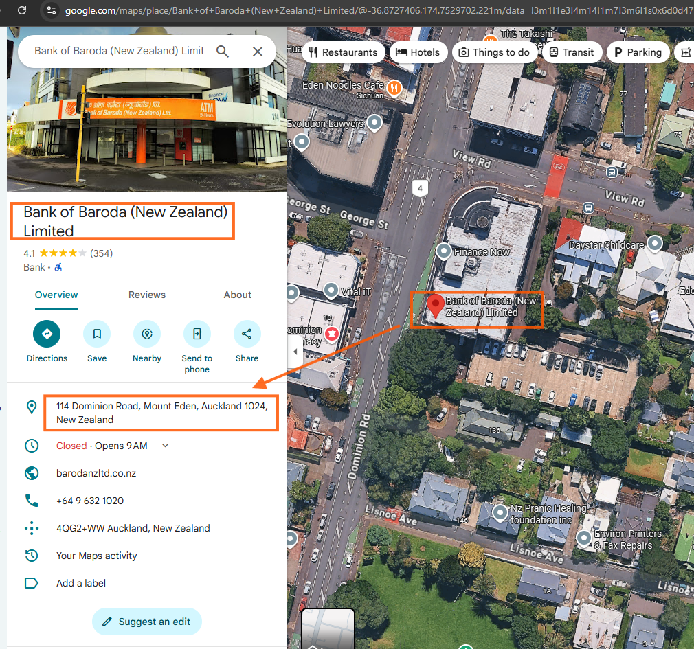
use this POI as sample test
Step 3.
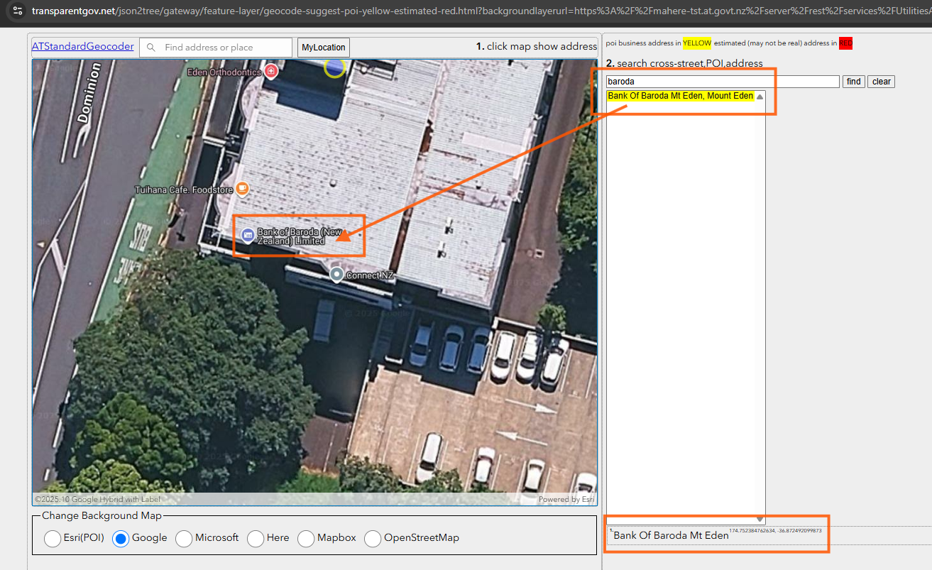
use model 2657, test POI name, business name, works
https://transparentgov.net/json2tree/gateway/feature-layer/geocode-suggest-poi-yellow-estimated-red.html?backgroundlayerurl=https%3A%2F%2Fmahere-tst.at.govt.nz%2Fserver%2Frest%2Fservices%2FUtilitiesAT%2FATStandardGeocoder%2FGeocodeServer&layer=ATStandardGeocoder&_center_lat=33.928799999999995&_center_long=-118.2468&_center_zoom=13&panto=0
Step 4.
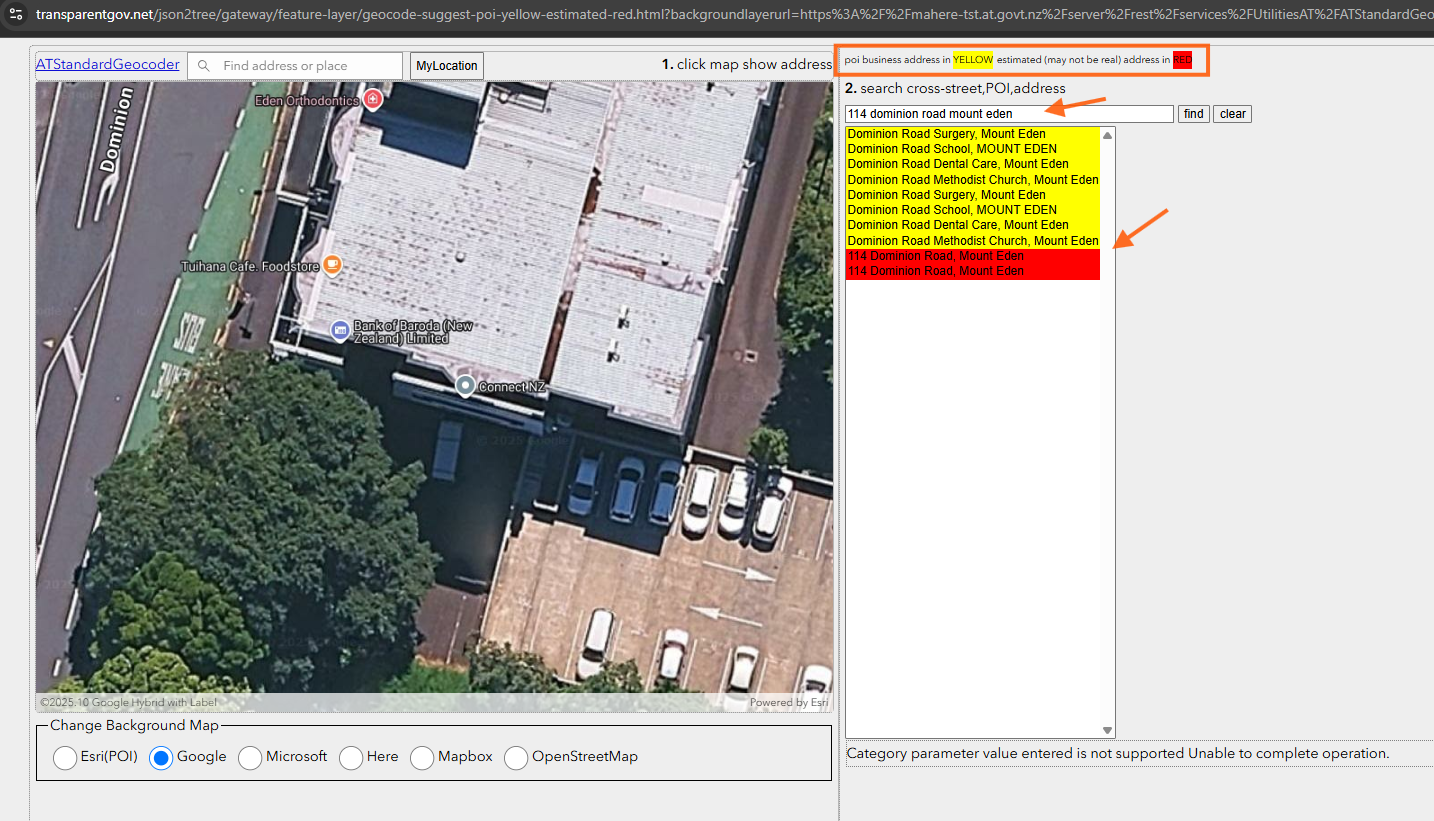
if I type bank's address, it should popup bank name, but it failed to do that.
Seems esri does not bind poi business name with address number by default, unless you make some work around to create link between
https://transparentgov.net/json2tree/gateway/feature-layer/geocode-suggest-poi-yellow-estimated-red.html?backgroundlayerurl=https%3A%2F%2Fmahere-tst.at.govt.nz%2Fserver%2Frest%2Fservices%2FUtilitiesAT%2FATStandardGeocoder%2FGeocodeServer&layer=ATStandardGeocoder&_center_lat=-36.87267276452528&_center_long=174.75236360296358&_center_zoom=21&panto=0
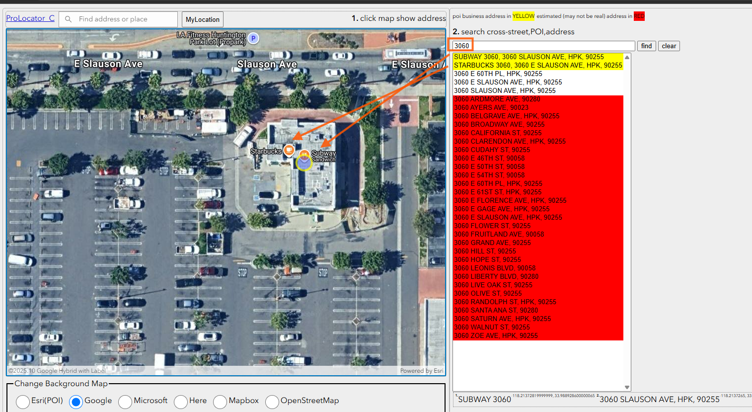
Step 5.
if I add work around in arcPro. I can let you type address number to show all POI associate with that address number.
for example 3060 slauson have 2 POI business, starbuck and subway.
This should be done by ESRI, but hasn't yet. Yellow is POI, red is estimated address, no color address means real physical address.
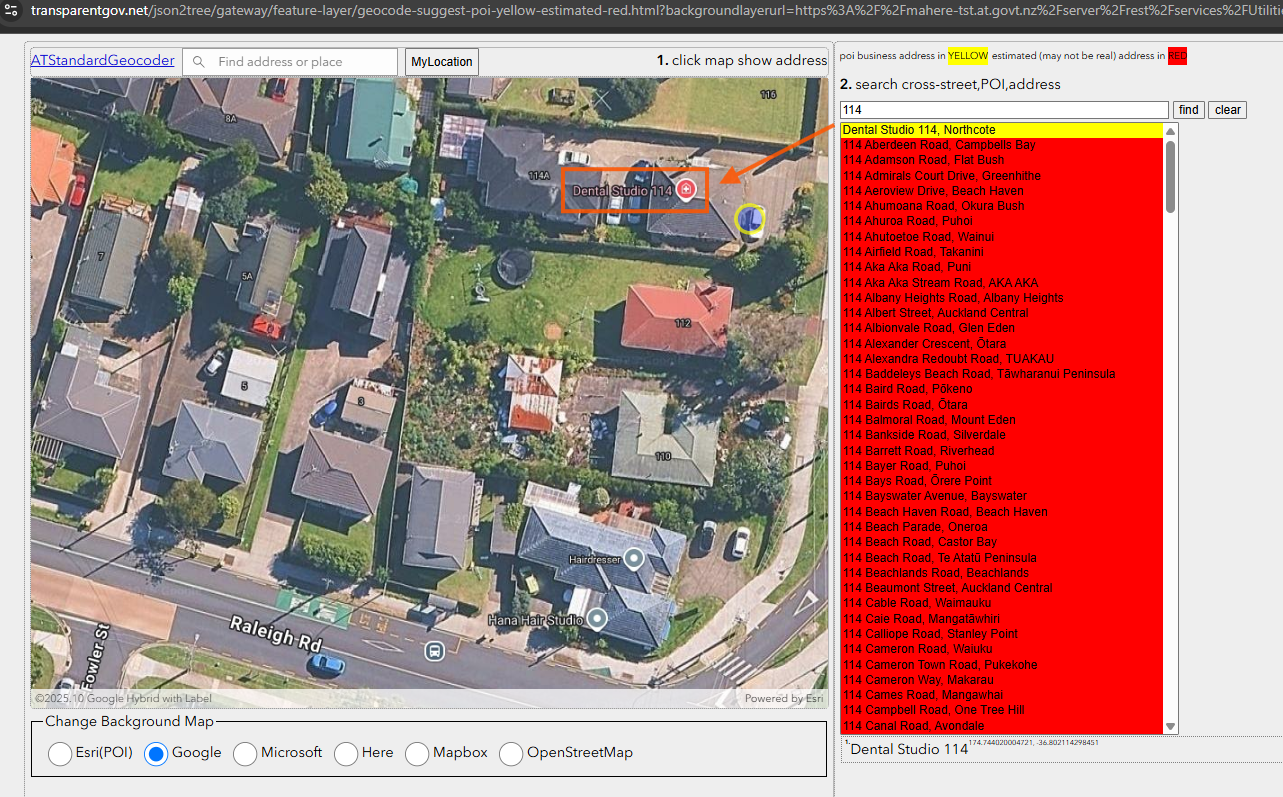
Step 6.
without addtional work around, just type number 114, it does not popup bank name,
it actally popup a business name have 114. This indicate if you add address number at the end of POI name will be the work around to make it works.
https://transparentgov.net/json2tree/gateway/feature-layer/geocode-suggest-poi-yellow-estimated-red.html?backgroundlayerurl=https%3A%2F%2Fmahere-tst.at.govt.nz%2Fserver%2Frest%2Fservices%2FUtilitiesAT%2FATStandardGeocoder%2FGeocodeServer&layer=ATStandardGeocoder&_center_lat=-36.80232190627559&_center_long=174.74354167741947&_center_zoom=20&panto=0
Step 7.
Step 8.
Step 9.
Step 10.
Step 11.
Step 12.
Step 13.
Step 14.
Step 15.
Step 16.
Step 17.
Step 18.
Step 19.
Step 20.