Within city limit, need every business, outside of city limit, do not need every business, but need some of them.
For law enforcement agencies, police, court house, jail, etc. need southern california, some times suspect was transfer to another county another city's police station.
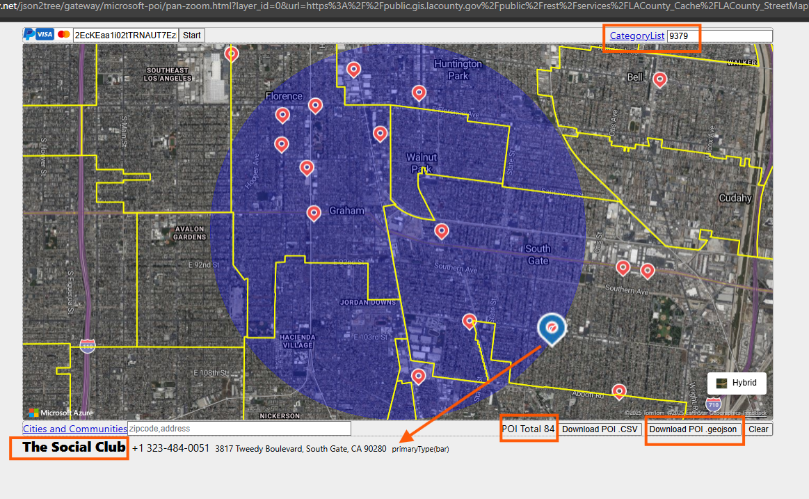
For hospital, night club, inn, motel, need surrouding cities, some times suspect was in nearby city's motel, night club etc.
Step 1.
select night-life model, will only show night club, when you pan and zoom
https://transparentgov.net/json2tree/esri/server/folder2.html?org=https%3A%2F%2Fpublic.gis.lacounty.gov%2Fpublic%2Frest%2Fservices&url=https%3A%2F%2Fpublic.gis.lacounty.gov%2Fpublic%2Frest%2Fservices&arcgis_online_token=&timeout=9000&select_folder=27&select_layer=0&select_folder_text=LACounty_StreetMap+%3Csup%3EMapServer%3C%2Fsup%3E&select_layer_text=0+%26%23x21E2%3B+Cities+and+Communities+%3Csup%3EFeature+Layer%3Csub%3E+esriGeometryPolygon%3C%2Fsub%3E%3C%2Fsup%3E
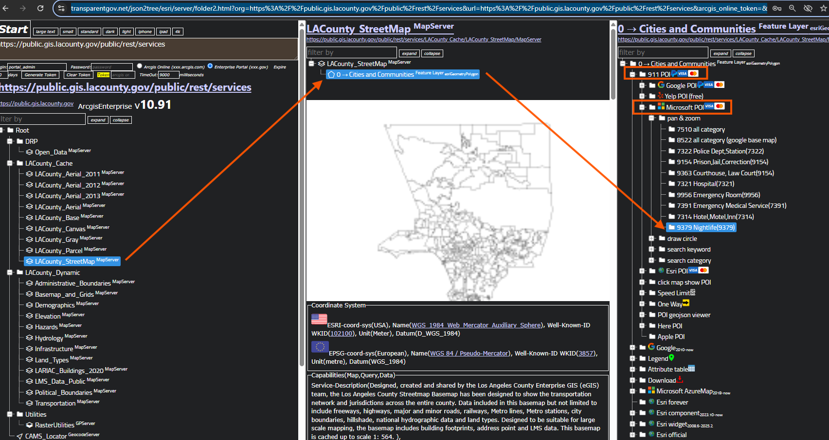
Step 2.
You must use your own microsoft azure map key, then click start button, to load map.
Without key, you will see blank map !
https://transparentgov.net/json2tree/gateway/microsoft-poi/pan-zoom.html?layer_id=0&url=https%3A%2F%2Fpublic.gis.lacounty.gov%2Fpublic%2Frest%2Fservices%2FLACounty_Cache%2FLACounty_StreetMap%2FMapServer&poicategory=9379&layer=Cities+and+Communities
Step 3.
jail, prison
https://transparentgov.net/json2tree/esri/server/folder2.html?org=https%3A%2F%2Fpublic.gis.lacounty.gov%2Fpublic%2Frest%2Fservices&url=https%3A%2F%2Fpublic.gis.lacounty.gov%2Fpublic%2Frest%2Fservices&arcgis_online_token=&timeout=9000&select_folder=27&select_layer=0&select_folder_text=LACounty_StreetMap+%3Csup%3EMapServer%3C%2Fsup%3E&select_layer_text=0+%26%23x21E2%3B+Cities+and+Communities+%3Csup%3EFeature+Layer%3Csub%3E+esriGeometryPolygon%3C%2Fsub%3E%3C%2Fsup%3E
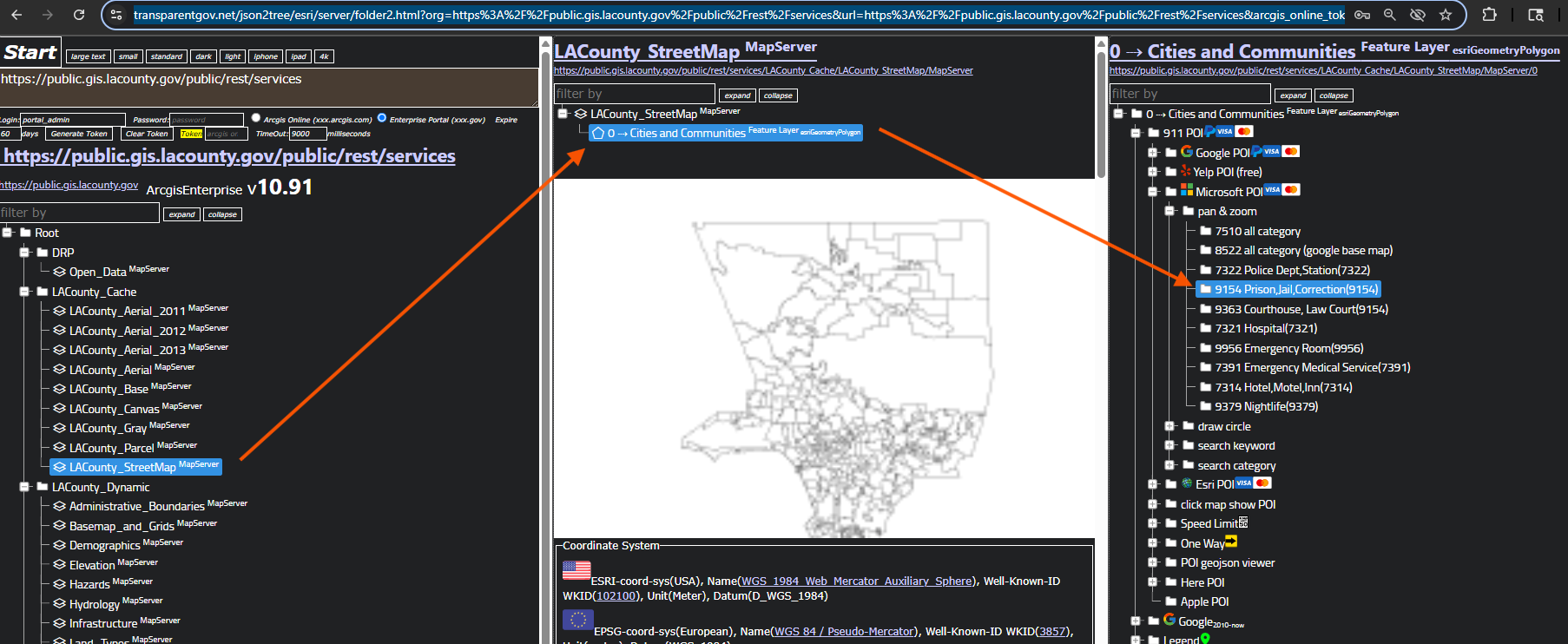
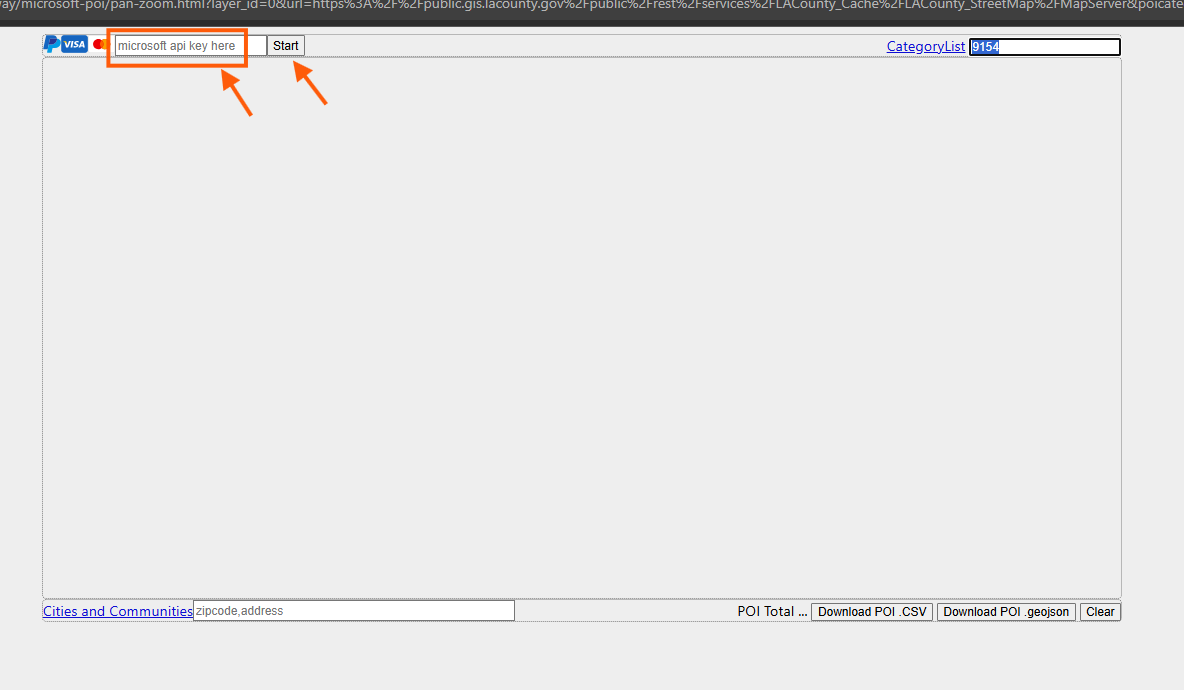
Step 4.
jail, prison
https://transparentgov.net/json2tree/gateway/microsoft-poi/pan-zoom.html?layer_id=0&url=https%3A%2F%2Fpublic.gis.lacounty.gov%2Fpublic%2Frest%2Fservices%2FLACounty_Cache%2FLACounty_StreetMap%2FMapServer&poicategory=9154&layer=Cities+and+Communities
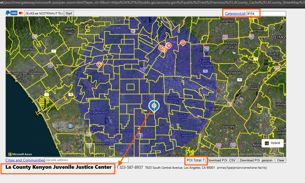
Step 5.
You must use your own microsoft azure map key, then click start button, to load map.
Without key, you will see blank map !
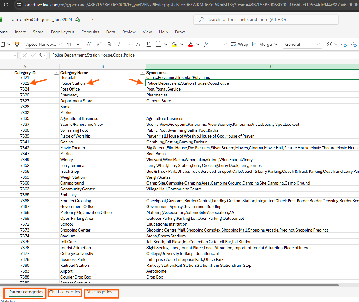
Step 6.
Microsoft POI category list is here
https://transparentgov.net/data/live_data/TomTomPoiCategories_June2024.xlsx
or
https://1drv.ms/x/c/4bb7f53b690630c0/Ec_yaxtVENxPlEyIeqbpsLcBLo6d6KAIKMrf6Km6KmM1Sg?e=ZDVlSb
Step 7.
Step 8.
Step 9.
Step 10.
Step 11.
Step 12.
Step 13.
Step 14.
Step 15.
Step 16.
Step 17.
Step 18.
Step 19.
Step 20.