Step 1.
Only show me police department in socal
https://transparentgov.net/json2tree/gateway/yelp/pan-zoom-marker-label-category.html?layer_id=18&url=https%3A%2F%2Fpublic.gis.lacounty.gov%2Fpublic%2Frest%2Fservices%2FLACounty_Dynamic%2FPolitical_Boundaries%2FMapServer&poicategory=policedepartments&layer=County+Boundaries&panto=0¢er_lat=33.61381416906848¢er_long=-117.84954134581368¢er_zoom=9

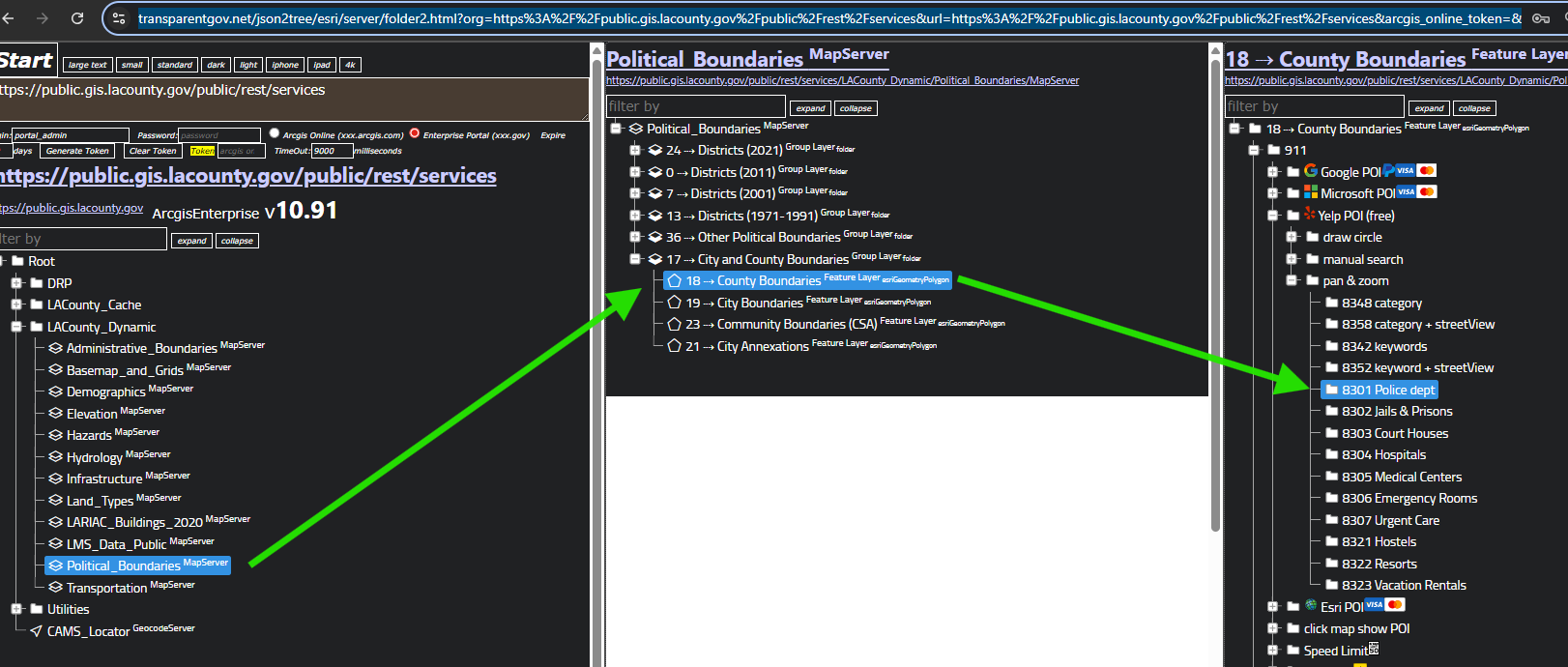
Step 2.
these cat. are frequently used, if you want cat. that is not list here, see next step.
https://transparentgov.net/json2tree/esri/server/folder2.html?org=https%3A%2F%2Fpublic.gis.lacounty.gov%2Fpublic%2Frest%2Fservices&url=https%3A%2F%2Fpublic.gis.lacounty.gov%2Fpublic%2Frest%2Fservices&arcgis_online_token=&timeout=9000&select_folder=17&select_layer=18&select_folder_text=Political_Boundaries+%3Csup%3EMapServer%3C%2Fsup%3E&select_layer_text=18+%26%23x21E2%3B+County+Boundaries+%3Csup%3EFeature+Layer%3Csub%3E+esriGeometryPolygon%3C%2Fsub%3E%3C%2Fsup%3E
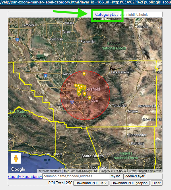
Step 3.
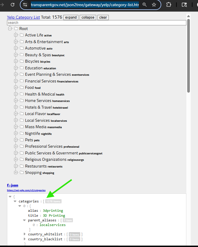
click yelp category list
https://transparentgov.net/json2tree/gateway/yelp/pan-zoom-marker-label-category.html?layer_id=18&url=https%3A%2F%2Fpublic.gis.lacounty.gov%2Fpublic%2Frest%2Fservices%2FLACounty_Dynamic%2FPolitical_Boundaries%2FMapServer&layer=County+Boundaries&panto=0¢er_lat=35.2838614435733¢er_long=-118.90518688516013¢er_zoom=8
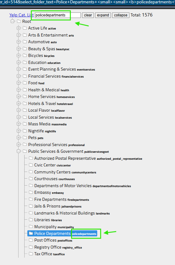
Step 4.
find police, click it,
arrow means cat. alias, it has no space, cat. alias is actually used as parameter in rest api endpoint.
You can copy either alias, or full name, paste in cat. input box in all model,
both alias and full name works because I convert full name to alias behind the scene. In fact, yelp api only use alias, not accepting full name.
https://transparentgov.net/json2tree/gateway/yelp/category-list.html?select_folder_id=514&select_folder_text=Police+Departments+%3Csmall%3E%3Csmall%3E%3Cb%3Epolicedepartments%3C%2Fb%3E%3C%2Fsmall%3E%3C%2Fsmall%3E&select_folder_alias=policedepartments
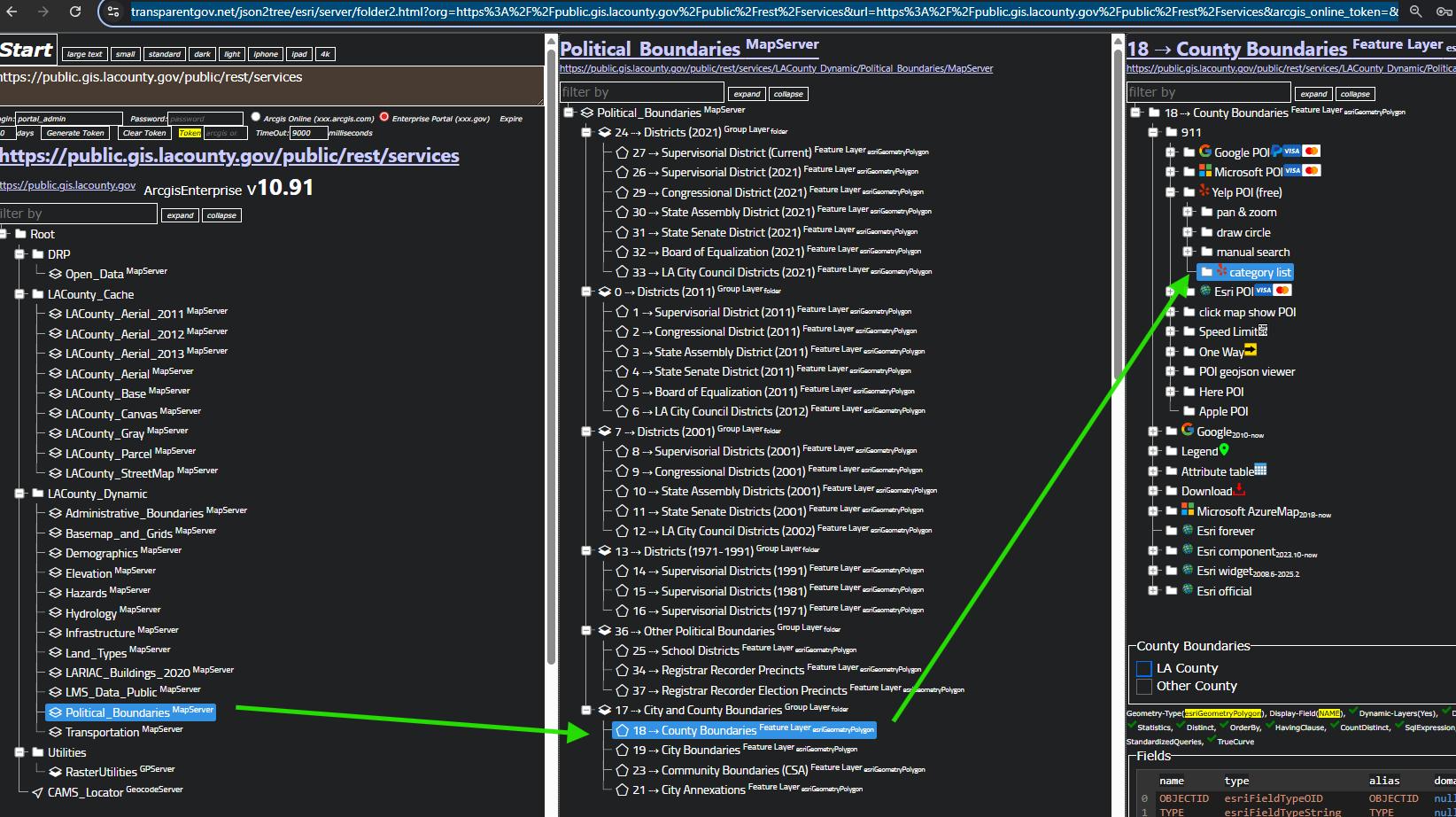
Step 5.
or you can find yelp cat. list here
https://transparentgov.net/json2tree/esri/server/folder2.html?org=https%3A%2F%2Fpublic.gis.lacounty.gov%2Fpublic%2Frest%2Fservices&url=https%3A%2F%2Fpublic.gis.lacounty.gov%2Fpublic%2Frest%2Fservices&arcgis_online_token=&timeout=9000&select_folder=17&select_layer=18&select_folder_text=Political_Boundaries+%3Csup%3EMapServer%3C%2Fsup%3E&select_layer_text=18+%26%23x21E2%3B+County+Boundaries+%3Csup%3EFeature+Layer%3Csub%3E+esriGeometryPolygon%3C%2Fsub%3E%3C%2Fsup%3E
Step 6.
original json file is at bottom, scroll down to find it.
https://transparentgov.net/json2tree/gateway/yelp/category-list.html
Step 7.
Step 8.
Step 9.
Step 10.
Step 11.
Step 12.
Step 13.
Step 14.
Step 15.
Step 16.
Step 17.
Step 18.
Step 19.
Step 20.