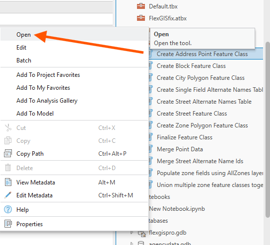
Step 1.
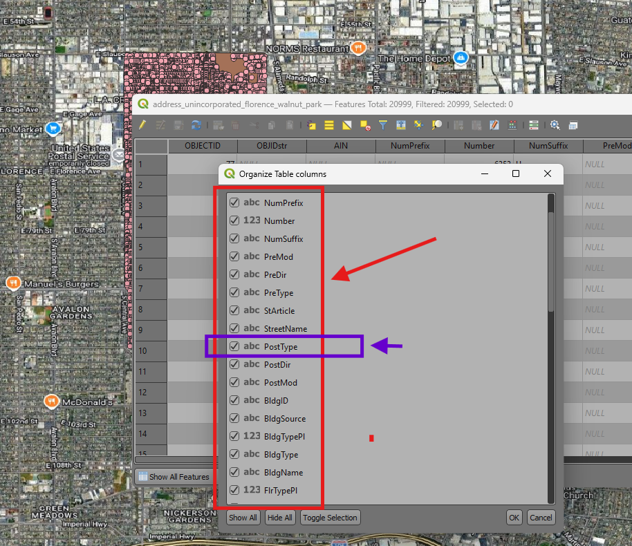
address format, some one call it , schema, or field name, or column name
are very different due to different source.
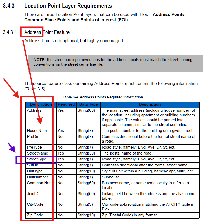
address format used in county CAMS is very different from motorola
For example, county address format, use "PostType"
Motorola format, use "streetType", both means same thing but different language
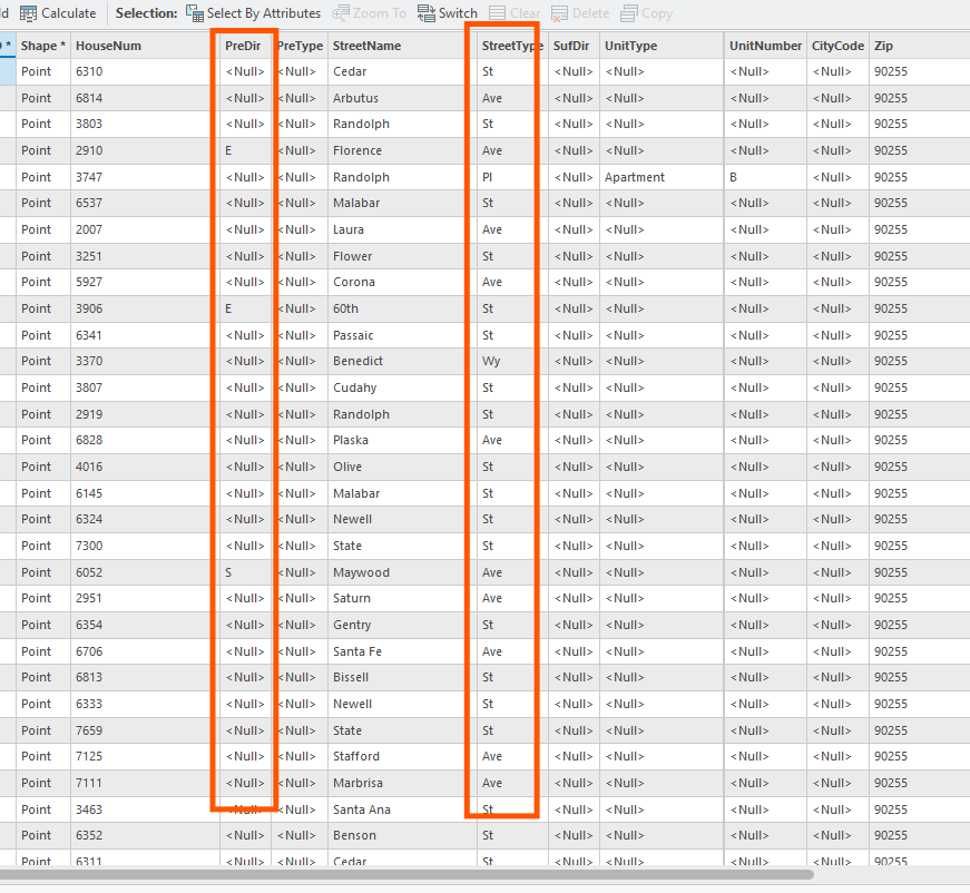
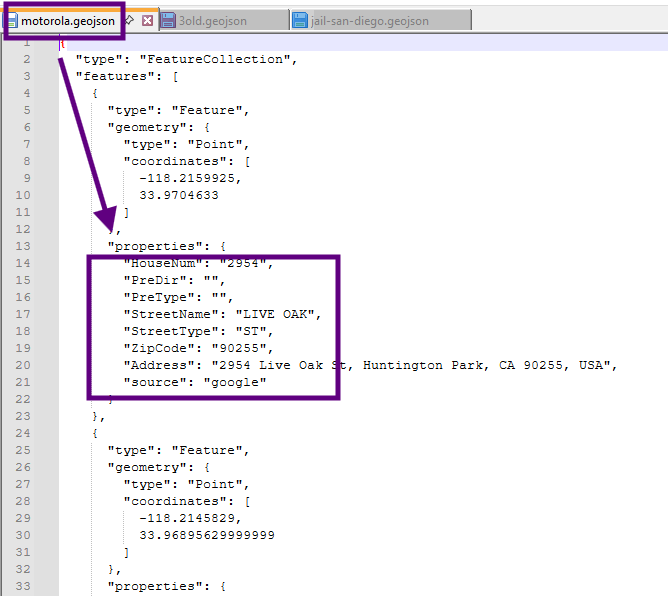
Address format used in motorola system is like this, see red box,
Step 2.
address format used in county CAMS is very different
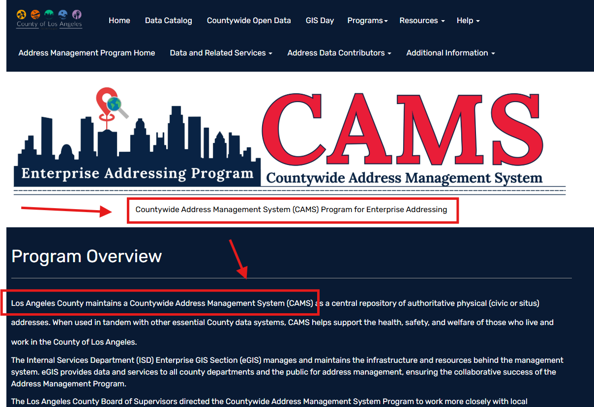
https://cams-lacounty.hub.arcgis.com/
Step 3.
address format used in county CAMS is very different
For example, county address format, use "PostType"
Motorola format, use "streetType", both means same thing but different language
county's address can not be directly use in motorola system.
It have to be convert to motorola format before feed into motorola system.
Step 4.
How to convert from county format to motorola format?
You can manually convert.
But the problem with manually convert is :
It is not efficient to processing so many times.
For example, I collect address for this small area from one source
another piece of area in another day from another source,
another day another set of address
Manually means, each time you need to convert manually, re-type all field name, delete unwanted field,
re-organize order.
If you do address one time, you can manually convert.
If you need to maintain address over times, you need add new address, change address over time,
manually convert is not working, because each time you do with address, you need manually convert.
Step 5.
Does arcgis pro has tool to automatically convert format ?
Not I know, by search field mapping tool, none of them works.
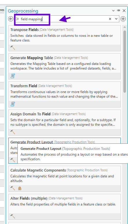
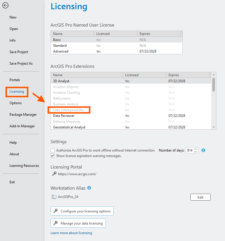
Step 6.
ArcGIS Data Interoperability extension
can do the job, but it is not available on you default licence. see below,
Also the extra cost does not justify the value.
Also the complication of operating interoperabitity extesion is not justify its value.
It is like using canon to shoot mosquito.
https://pro.arcgis.com/en/pro-app/latest/help/data/data-interoperability/what-is-the-data-interoperability-extension.htm
It is grey out means, you do not have this extension, NO license on your default arcgis pro.
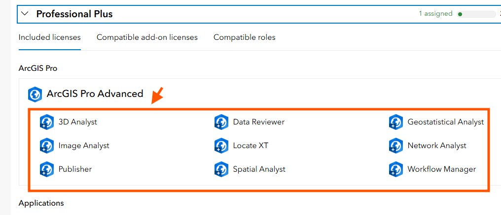
Step 7.
this is what default license had extensions
Step 8.
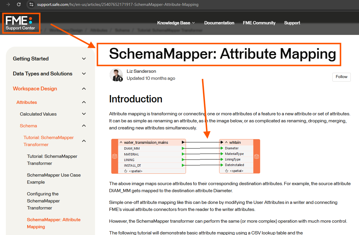
$20k FME can do the job, but its value does not justify the cost.
This simple job does not justify the cost.
Also the overhead complication of operating FME is not justify its value.
It is like using canon to shoot mosquito.
https://support.safe.com/hc/en-us/articles/25407652171917-SchemaMapper-Attribute-Mapping
Step 9.
motorola provide a tool under license, which you can use in Arcgis pro,
Without motorola's license, this tool is not available in Arcgis Pro.
Step 10.
Los angeles county updating entire county address on 1st day of each month.
if some one take down old house, build 2 new house, with 2 new address should be catch on next month release.
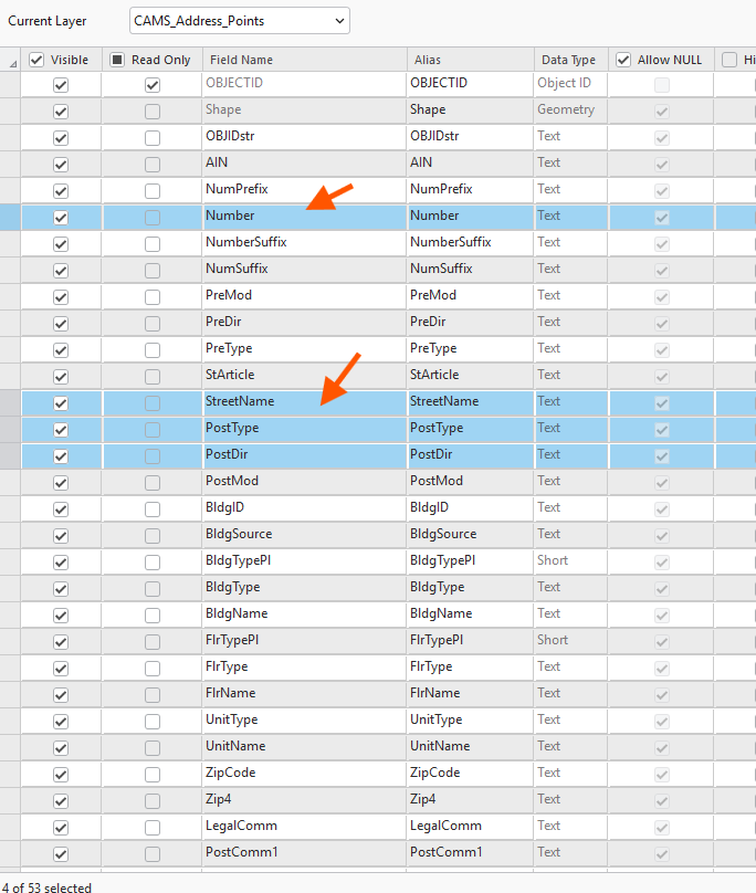
Let's convert year 2026 april county address schema to motorola schema,
this is county's schema, red arrow will be convert to motorola's
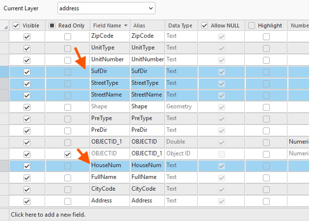
Step 11.
this is motorola schema, red arrow have be convert from county's red arrow
Step 12.
open it
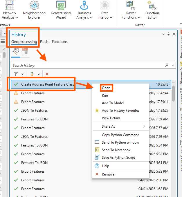
Step 13.
configure field mapping
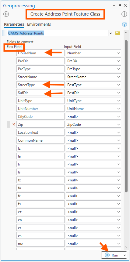
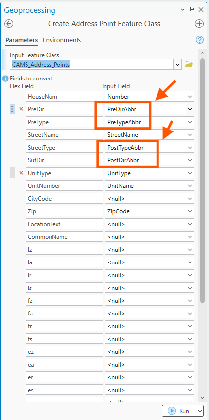
Step 14.
the result have 2 problem,
motorola require abbreviation of pre direction and street type, while county use full word,
I will do it again to fix this
Step 15.
Step 16.
Step 17.
fix by use abbreviation field instead of full word
Step 18.
Step 19.
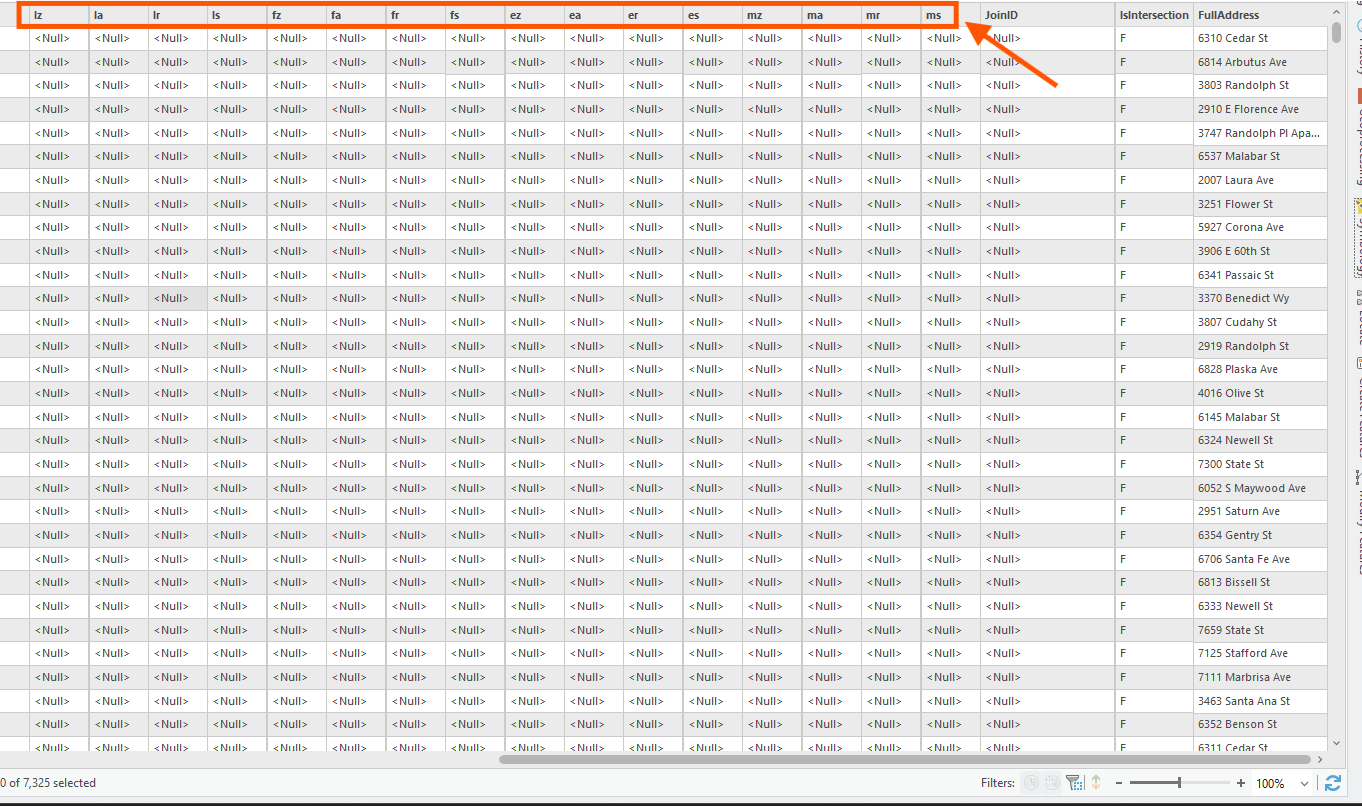
these field is for 911 dispatcher type short cut
L means law, LZ means law zone, means police beat
LA means Law agency, means police response area
LR means law reporting area
LS means law sub zone, means finer grained police beat
F means fire, FZ means fire zone, etc .... same as law
E means evergency, EZ means emergency zone, etc .... same as law
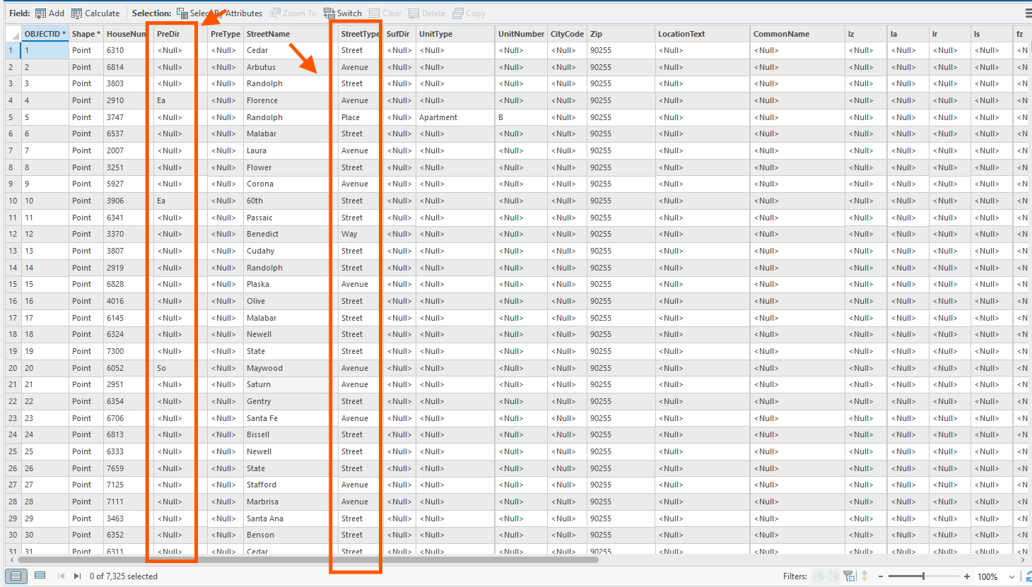
Step 20.
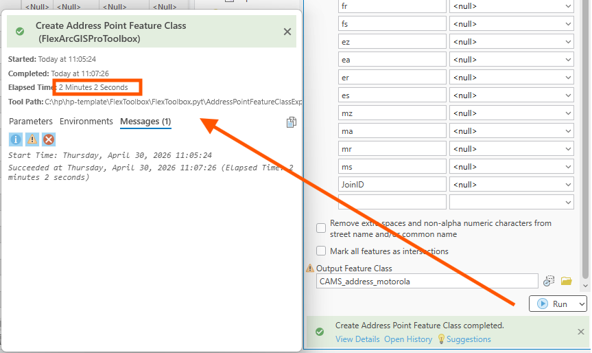
previous problem fixed.
Step 21.
2026-april county address does not have address that I manually fixed since last year, does not have address fix by google map, does not have address fix by apple map since.
While 2025 old address have those fix.
To carry over the fix from last year to this year, I will need the tool to combine 2025 with 2026, not just simply use 2026 to replace 2025.
Arcgis pro lack of special tool, smart enough to figure out which is old address, which is new.
geojson based tool can do this job.
Step 22.
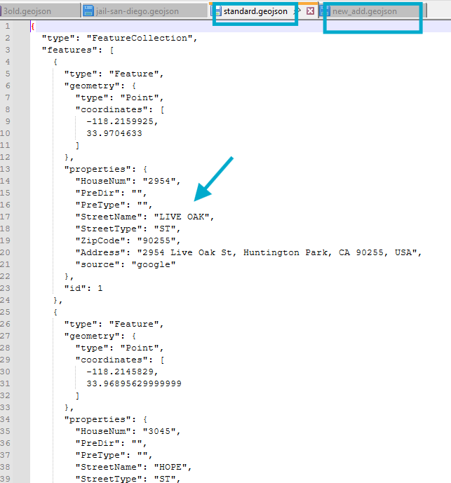
google map, apple map, microsoft collect address has complete different format like this,
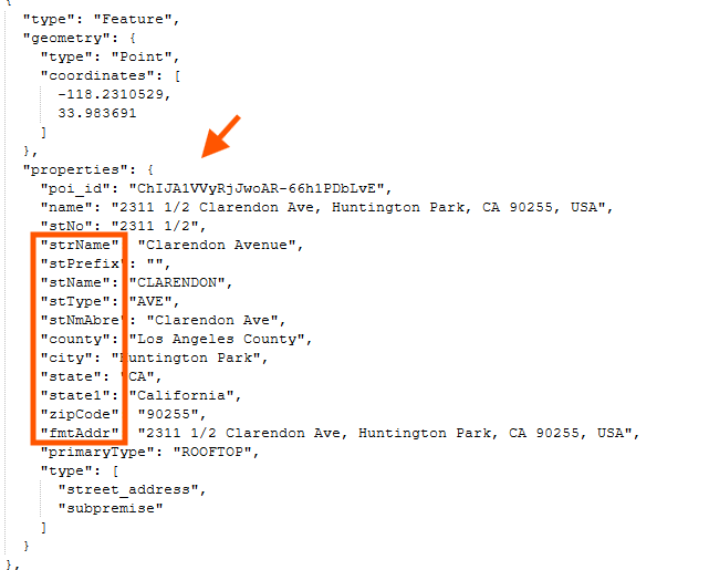
Step 23.
these 3rd party address also need to convert to motorola format before combine into repository.
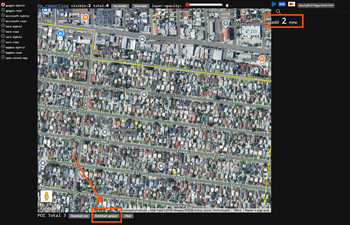
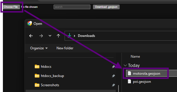
This job will be done when you click download button here
Step 24.
motorola.geojson have address format already converted to motorola style
poi.geojson have original address format.
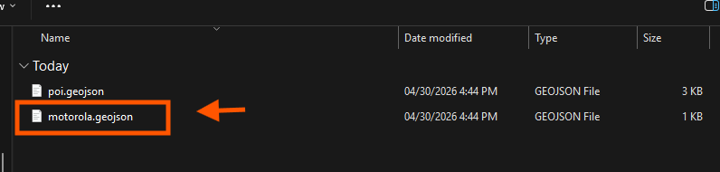
motorola.geojson have address format already converted to motorola style
Step 25.
download address use these model
Step 26.
use combine tool to load motorola.geojson
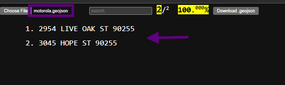
Step 27.
these 2 address is what I download from google map,
now they are already in motorola format,
they are ready to be combine into last year repository.
Step 28.
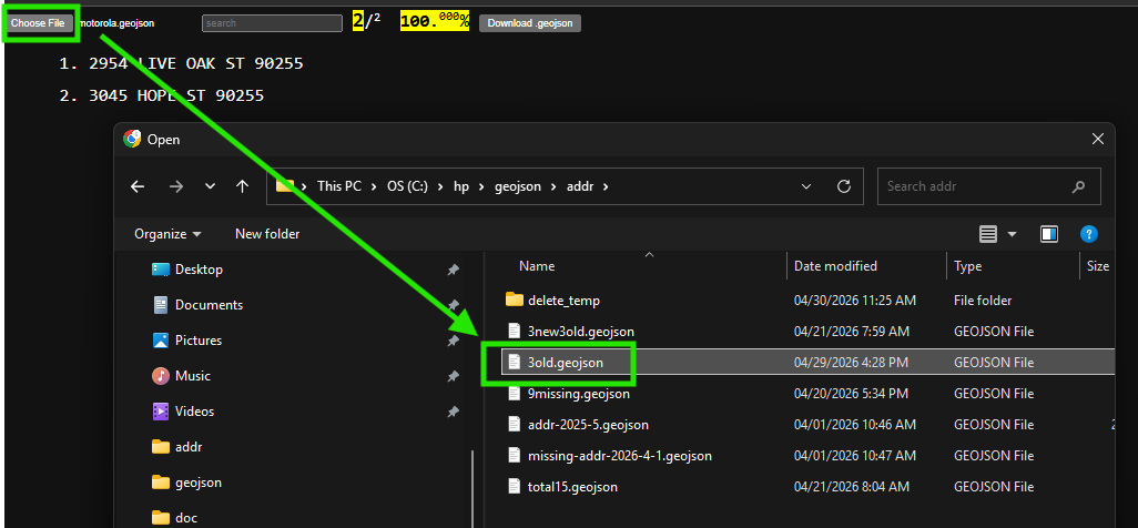
2 new google address combine with 3 old address,
load 3old.geojson file
Step 29.
now you have 5 address, 1-2 are new, 3-5 are old
click download button, to download these 5 address
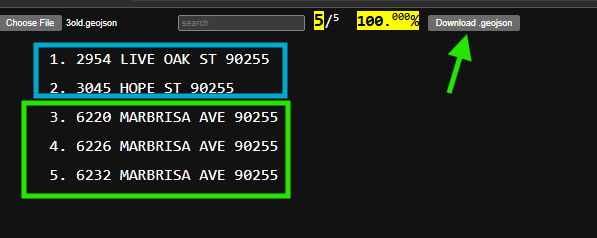
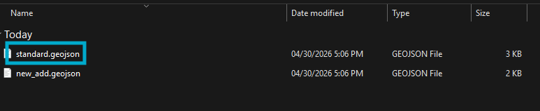
Step 30.
standard.geojson have 5 address combined.
new_add.geojson have what ever you last time load file, the relatively new address , in this case, it have 3 address