Step 1.
to convert number annotation off a Micro station system,

I need to draw a line based off give point and angle.
Arcgis Pro does not have special tool to convert it.
Not all point have house number, only select the point have house number, export to a new layer
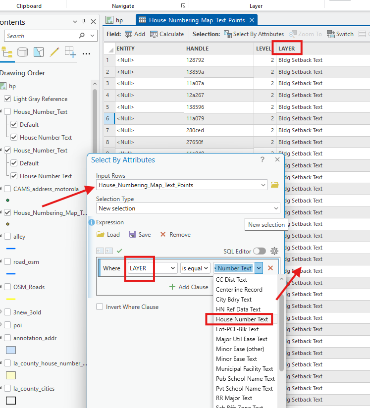
Step 2.
Micro station system use different angle system with geographic lat lng system.
You will have to convert between these 2 system.
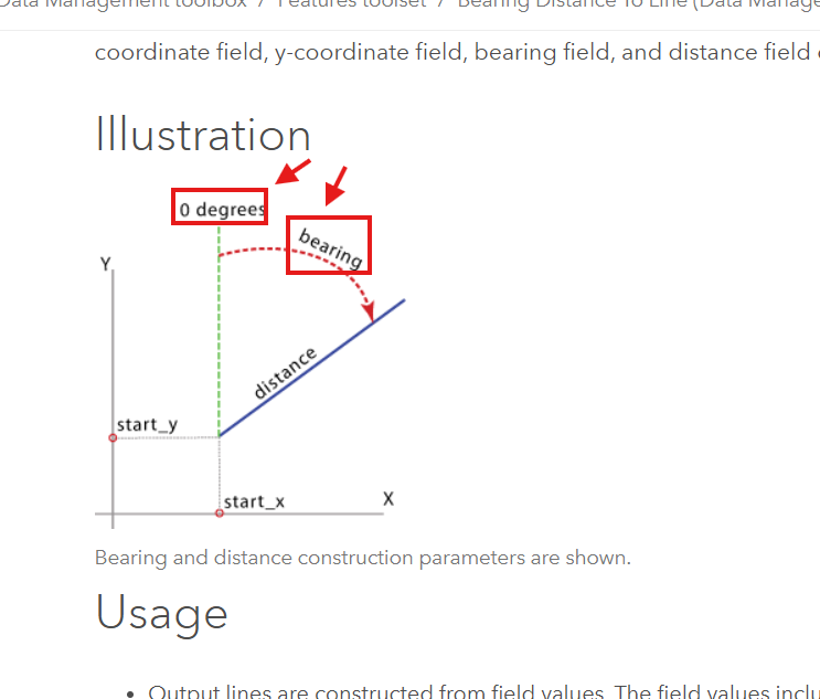
This is geographic lat lng system, what angle means, here they call it bearing instead of angle.
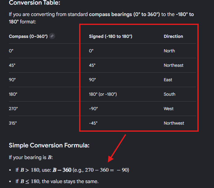
Step 3.
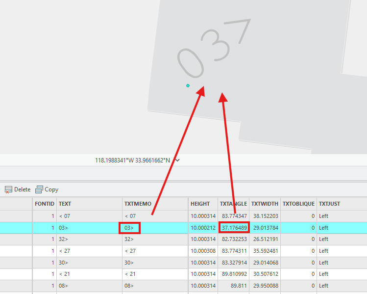
Here is micro station, angle means differently.
text arrow to right : means starting 0 degree from east
37 degree is positive, positive means anti-clock wise turn 37 degree.
convert to bearing is =
east(90) - (+37) = 53
Step 4.
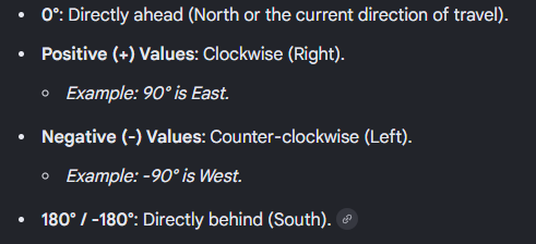
this is how bearing turn base on angle.
Step 5.
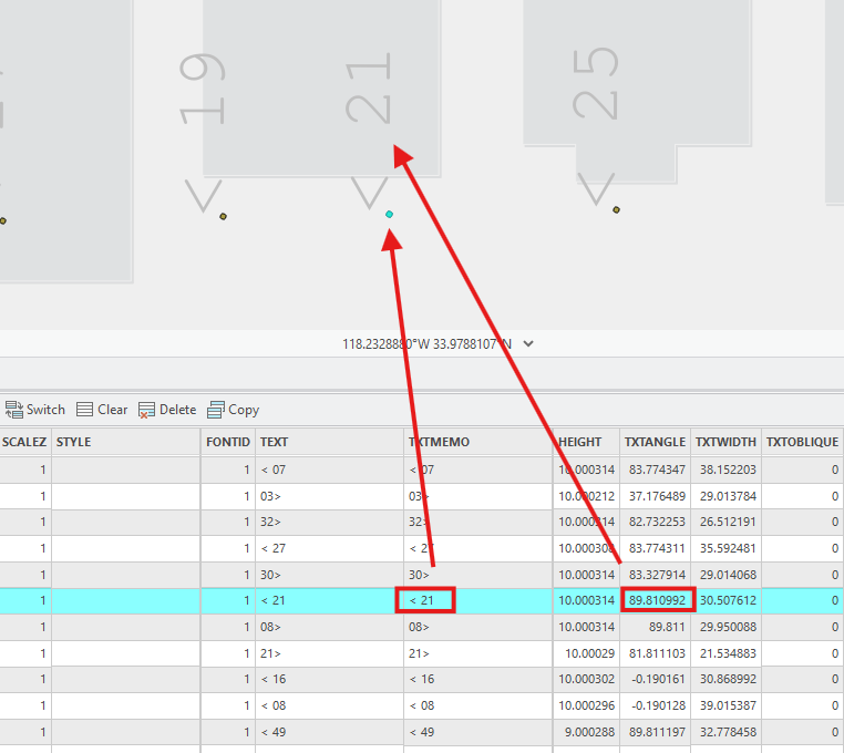
microStation, arrow to left means starting 0 degree from west.
positive 89 degree means,
positive means anti-clock wise,
89 degree means anti-clock wise turn 89 degree from west.
Convert to bearing is = -179
anti-clock use minus sign, clock wise use plus sign
(west) (- 90) - (+89) = -179
For esri's unsigned bearing west (270) - (+89) =181 ( bearing )
Step 6.
Step 7.
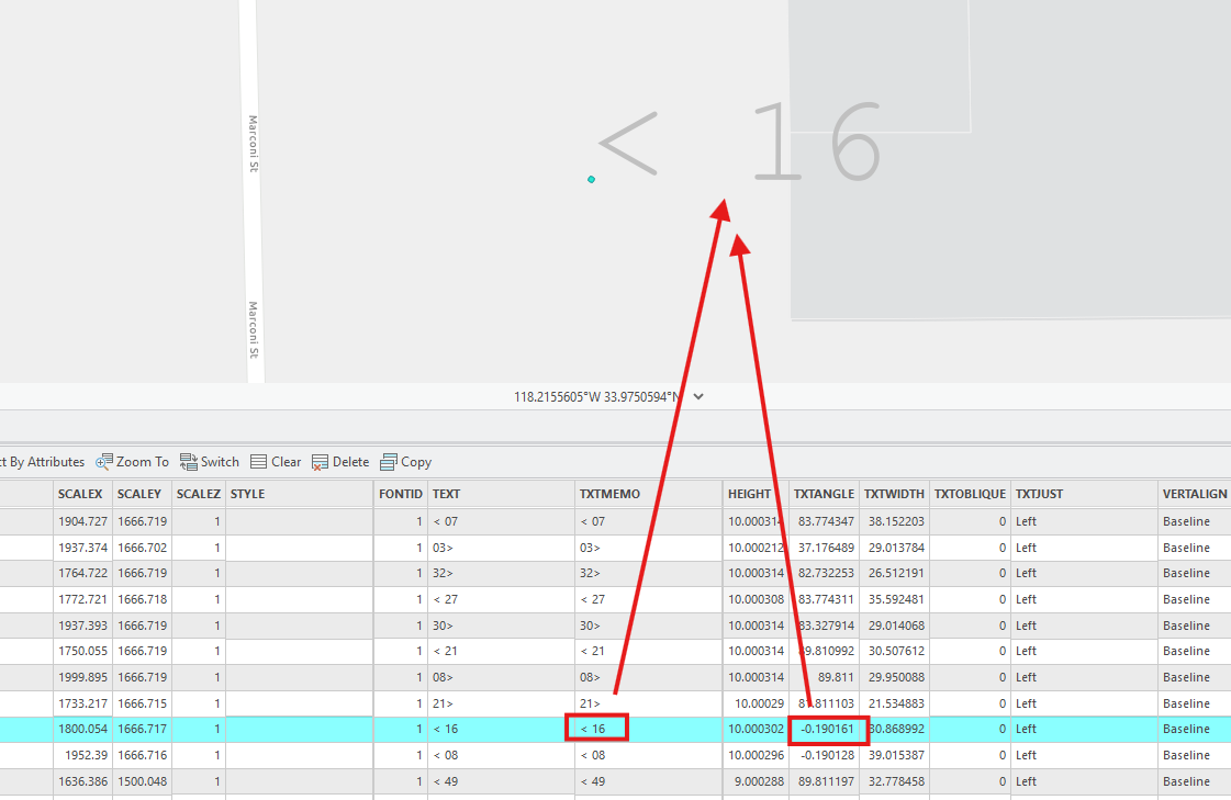
left arrow means west (-90)
negative 0.19 means clock wise turn 0.19 degree
convert to bearing is =
(-90) + ( 0.19 ) = -89.81 ( bearing )
or simple put
no matter clock wise or anti-clock wise, always use minus sign
(-90) - (-0.19) = -89.81 ( bearing )
For esri's unsigned bearing west (270) - (-0.19) = 270.19 ( bearing )
Step 8.
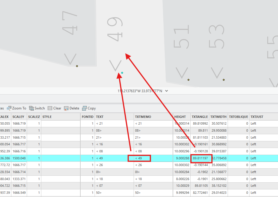
arrow to left means west (-90)
always use minus sign against angle
west (-90) - 89.8 = -179.8 ( bearing )
For esri's unsigned bearing west (270) - 89.8 = 180.2
Step 9.
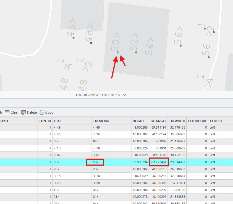
arrow to right means east(90)
always use minus sign against angle
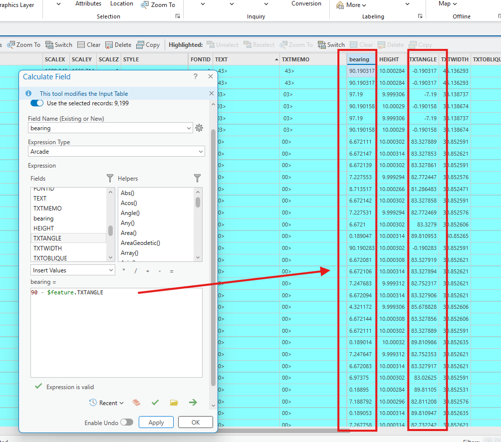
east(90) - 82.7 = 7.3 (bearing)
Step 10.
convert between microStation system and geographic lat lng bearing system
follow 3 rule to calculate bearing:
1). arrow to right means east(90)
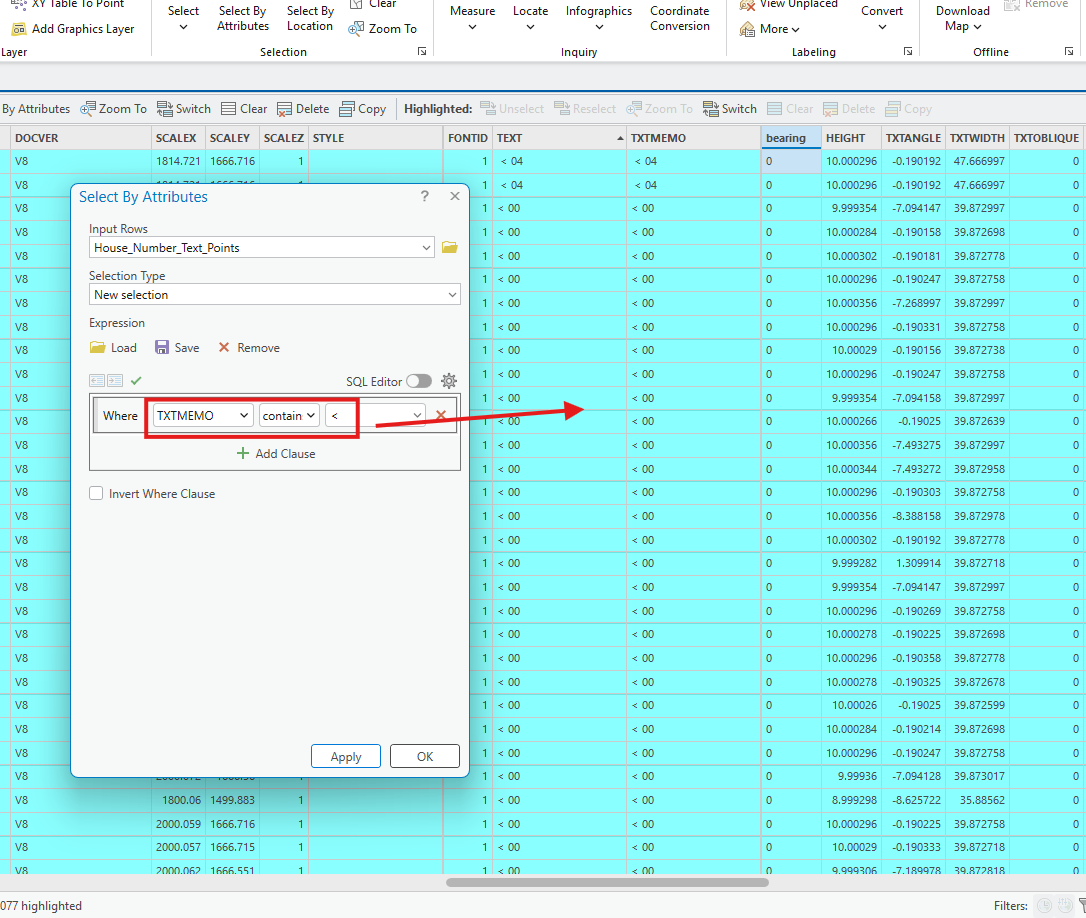
2). arrow to left means west (-90)
3).always use minus sign against angle
Note this bearing system is signed, -180 to +180
Step 11.
esri's bearing is unsigned, 0-360 clock wise turn
Step 12.
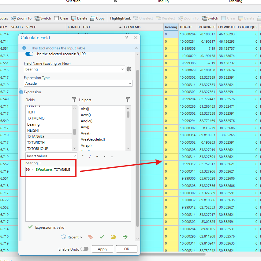
3 rule for esri's bearing need to change to unsigned, 0-360 system.
1). arrow to right means east(90) { no change }
2). arrow to left means west (270) { must change from -90 to 270}
3).always use minus sign against angle { no change }
Step 13.
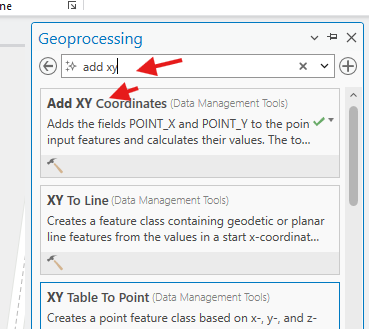
Step 14.
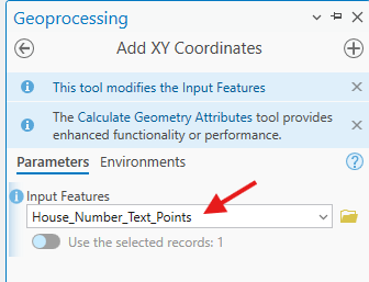
Step 15.
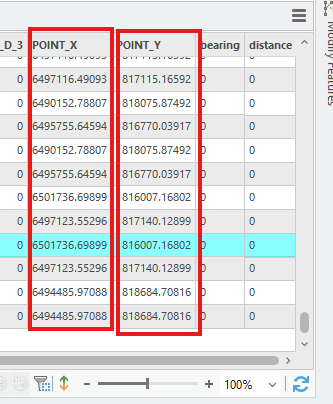
Step 16.
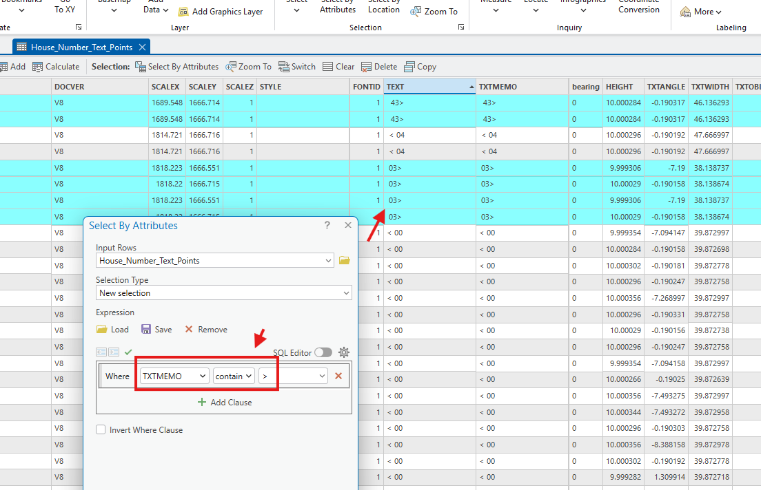
for rule 1). arrow to right means east(90)
select all right arrow
Step 17.
Step 18.
Step 19.
Step 20.
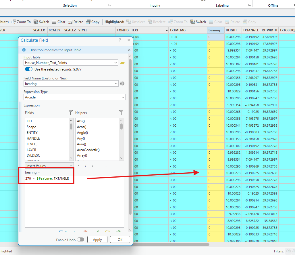
Step 21.
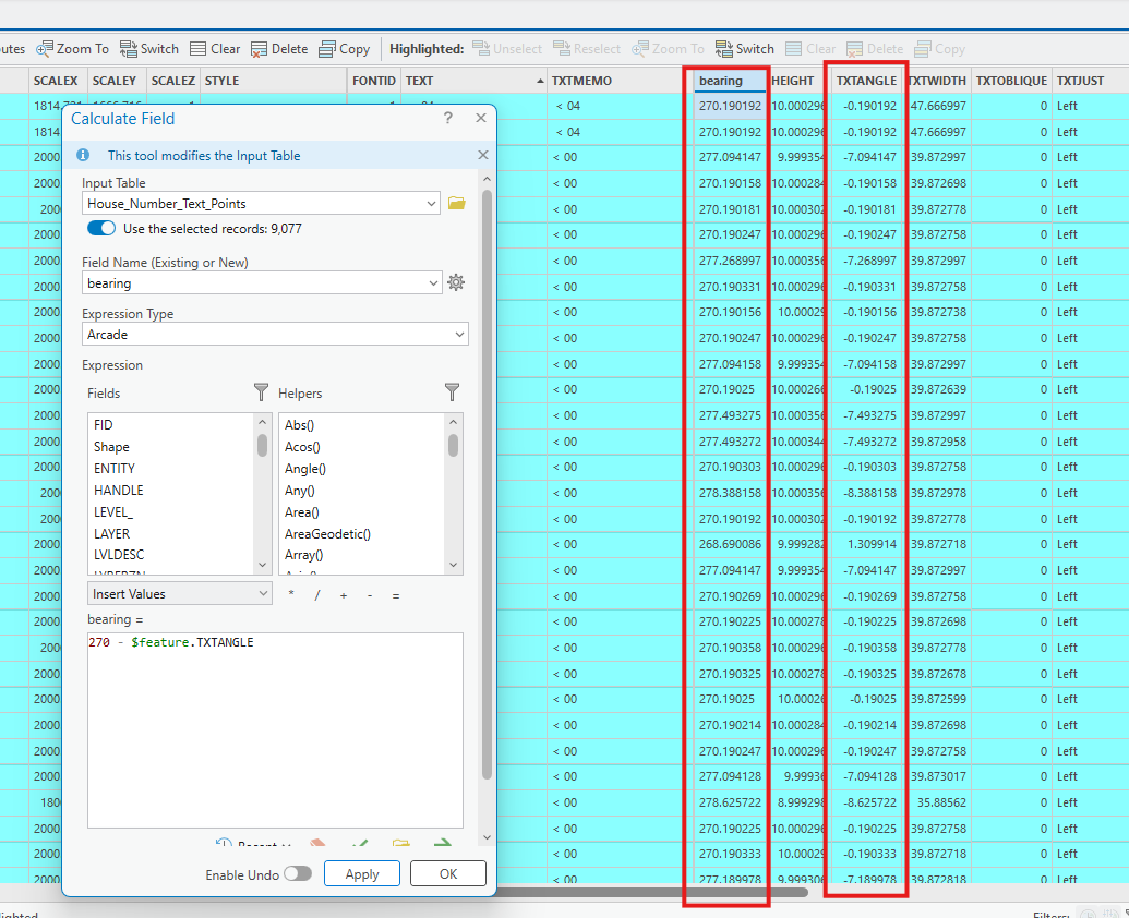
Step 22.
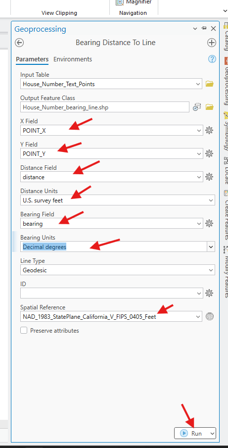
Step 23.
result is
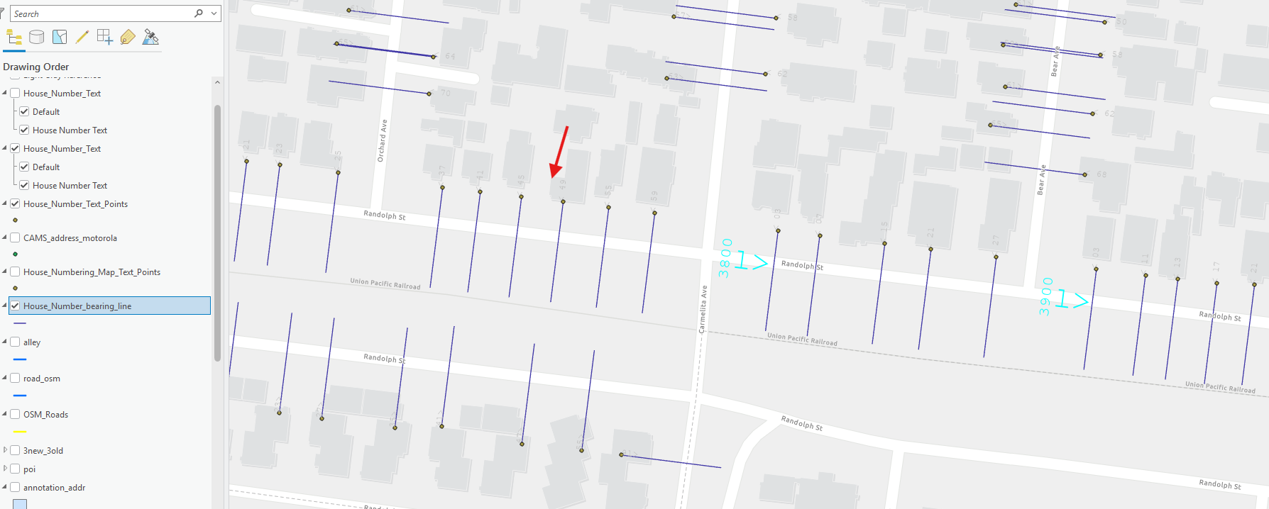
Step 24.
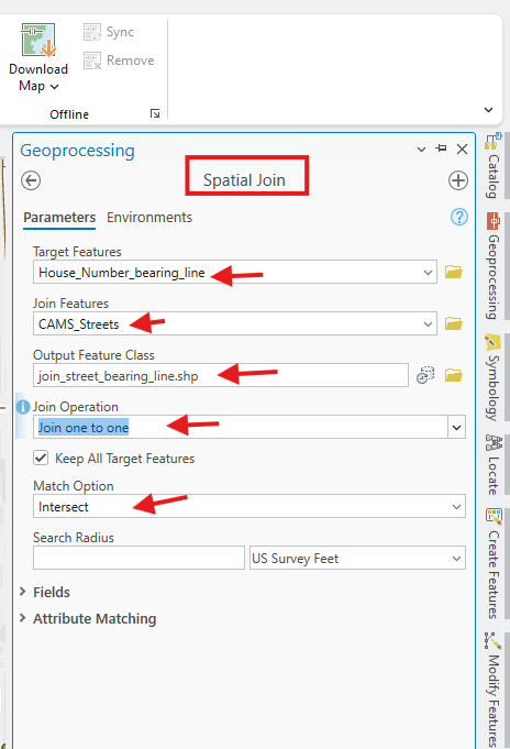
Step 25.
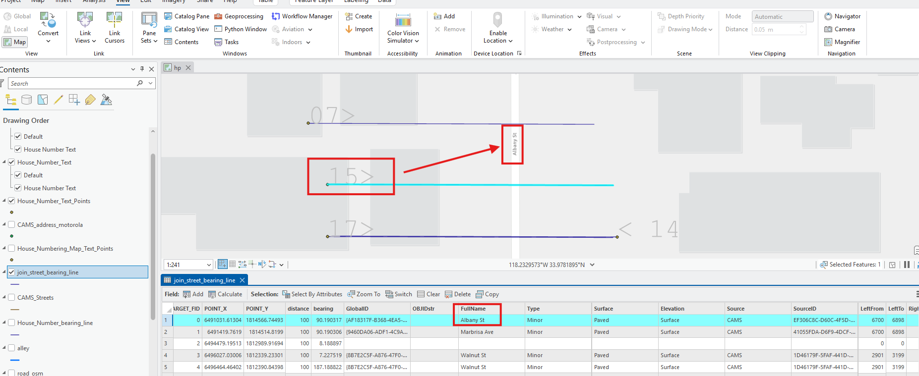
now the number 15 link to street name,
all house number now link to street name,
we know it is
xx15 albany ST
we still missing front 2 digit.
Step 26.
Step 27.
Step 28.
Step 29.