Step 1.
ESRI is a map company.
ESRI's product are "shape" centered.
The subject is polygon, line, point.
Each polygon( line or point) have some data attribute associate with.
Step 2.
On esri's product
You always see "shape" ( or esri called it "feature") first
you see polyon, line, point first.
Shape is subject.
then you click one shape(for example a polygon),
data attribute associated with this polygon show up.
Step 3.
Now I want you to think in diffferent way,
I want you to break this ESRI's traditional concept.
AI would not break tradition, human brain can, because of neutral atom quantum reaction
human brain's atom react in the randomness, uncertainty,
Step 4.
Shape is NOT the center,
Shape is NOT the subject
Shape is only one of attribute like other data attribute.
When you open a dataset, you will not see "Shape"
Instead you see the data attribute.
Only if you want to see the shape,
you can click data attribute,
then shape will show up on google map.
Step 5.
This is completely up-side down from ESRI's traditional concept.
This concept is specally good for POI, address, street range.
For example,
I don't want to see all business points show up on map.
Instead I want to see how many walmart we have,
I am not care where they are, but I want to see what store name we have,
ESRI's product is shape centered.
It show all business point on map, I actually want to look what shop we have, instead of where they are.
I want to see how many pizza shop we have.
Step 6.
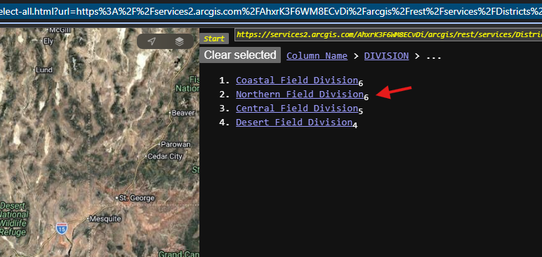
sample,
Data centered style,
not show all polygon on map,
only show all data,
only when you click the data,
the polygon associated with will popup
https://transparentgov.net/json2tree/attribute-driven/apple/classified-select-all.html?url=https%3A%2F%2Fservices2.arcgis.com%2FAhxrK3F6WM8ECvDi%2Farcgis%2Frest%2Fservices%2FDistricts%2FFeatureServer%2F0&layer=Districts&key=DIVISION
Step 7.
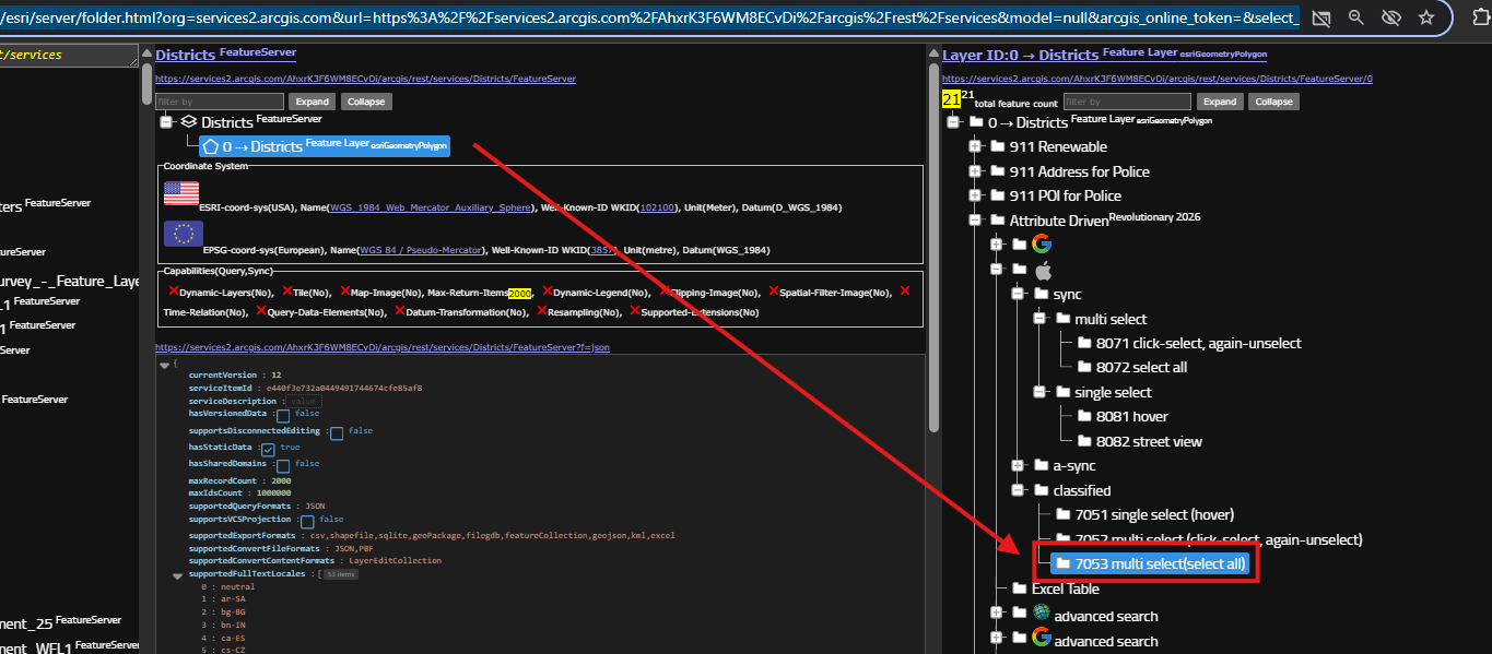
district layer is here, model number is here
https://transparentgov.net/json2tree/esri/server/folder.html?org=services2.arcgis.com&url=https%3A%2F%2Fservices2.arcgis.com%2FAhxrK3F6WM8ECvDi%2Farcgis%2Frest%2Fservices&model=null&arcgis_online_token=&select_folder=205&select_folder_text=Districts+%3Csup%3EFeatureServer%3C%2Fsup%3E&select_layer=0&select_layer_text=0+%26%23x21E2%3B+Districts+%3Csup%3EFeature+Layer%3Csub%3E+esriGeometryPolygon%3C%2Fsub%3E%3C%2Fsup%3E
Step 8.
What inspire me to break through ESRI's tradition concept?
It is POI, Address, street segment.
I found it is not easy to work on POI, address, street with traditional concept.
for example, I want to check street segment range, wether it is over 100,
traditional concept is shape centric,
esri product show all street on map,
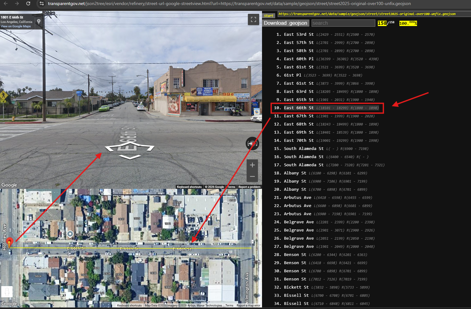
I have to click each segment to check L left, R right range, not easy to do
I want something let me easily check L, R range,
try this, this is street segment,
L, R range show up at one time, on right side.
click one segment,
the shape popup on map.
https://transparentgov.net/json2tree/esri/vendor/refinery/street-url-google-streetview.html?url=https://transparentgov.net/data/sample/geojson/street/street2025-original-over100-unfix.geojson
Step 9.
POI, address, is same idea,
I am not interested where a business is at,
but I want to know what business we have.
for example,
for so-cal law enforcement,
I am not interested in where it is,
But I do want to know law enforcement agency name
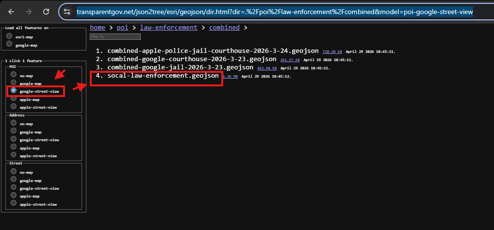
this model is design for that
click file name
https://transparentgov.net/json2tree/esri/geojson/dir.html?dir=.%2Fpoi%2Flaw-enforcement%2Fcombined&model=poi-google-street-view
Step 10.
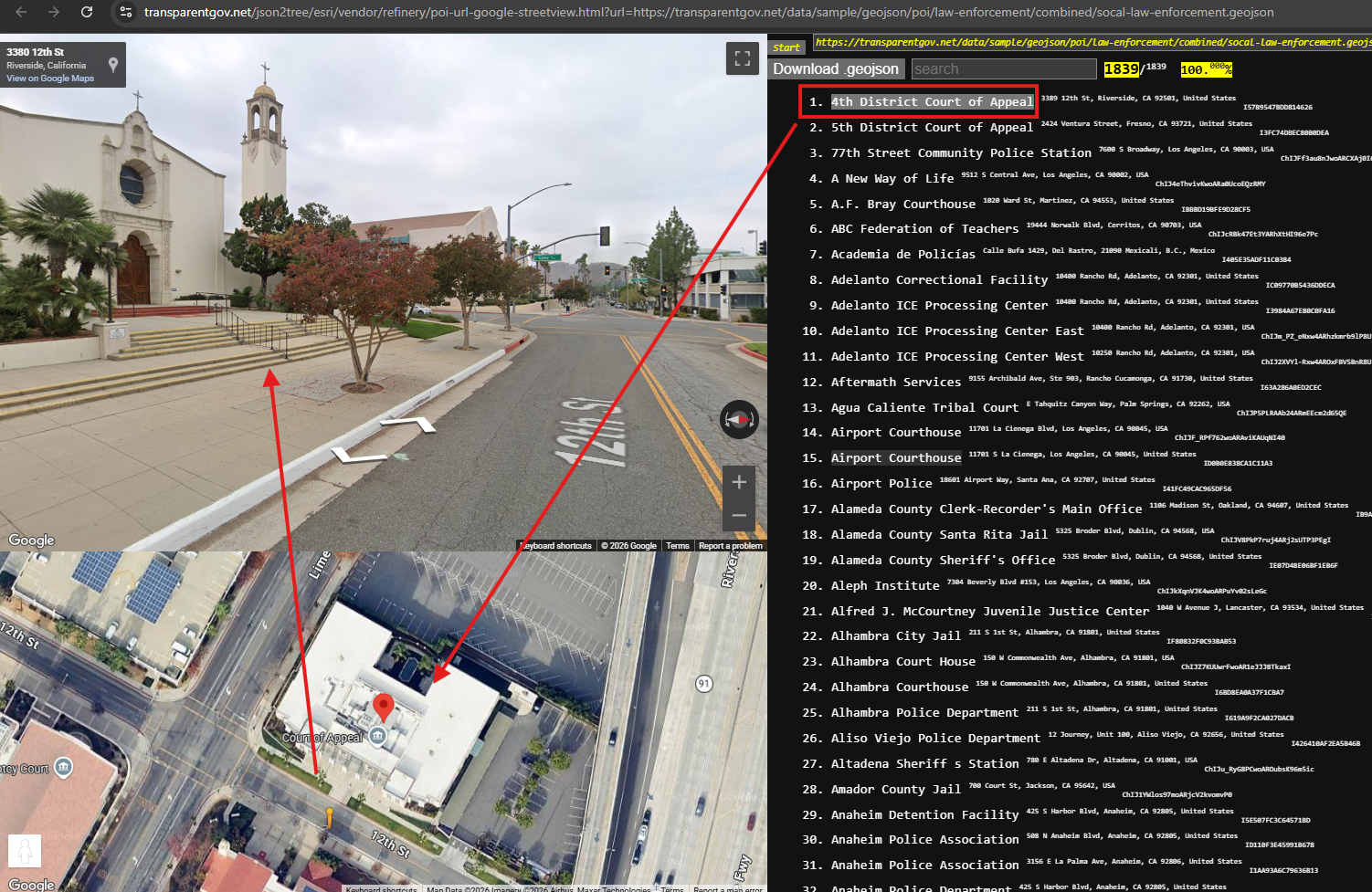
you can now browing law enforcement agency name on right side.
click it, the point shape popup on map,
https://transparentgov.net/json2tree/esri/vendor/refinery/poi-url-google-streetview.html?url=https://transparentgov.net/data/sample/geojson/poi/law-enforcement/combined/socal-law-enforcement.geojson
Step 11.
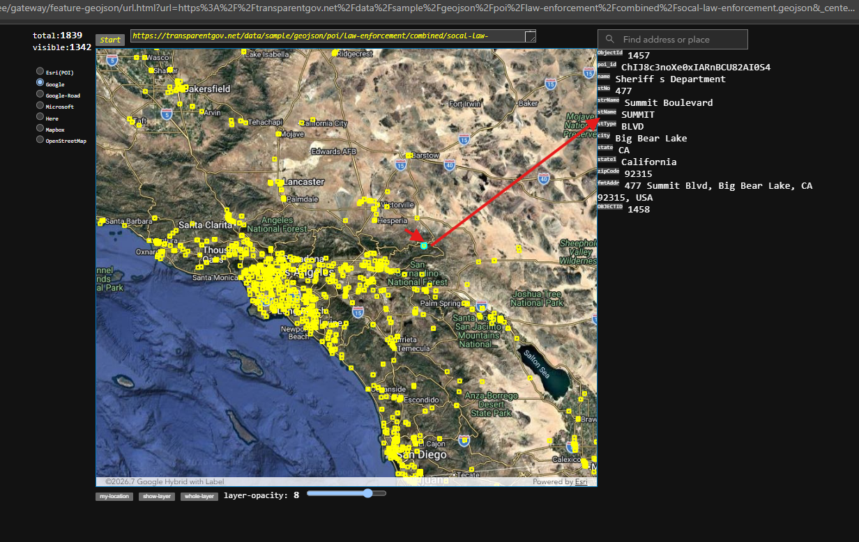
with traditional ESRI's shape centric concept,
Esri's product will show all points on map.
you have to click each point to know agency name.
here is sample with traditional ESRI's shape centric concept.
https://transparentgov.net/json2tree/gateway/feature-geojson/url.html?url=https%3A%2F%2Ftransparentgov.net%2Fdata%2Fsample%2Fgeojson%2Fpoi%2Flaw-enforcement%2Fcombined%2Fsocal-law-enforcement.geojson&_center_lat=34.084410344554215&_center_long=-117.56679190128442&_center_zoom=8&panto=0
Step 12.
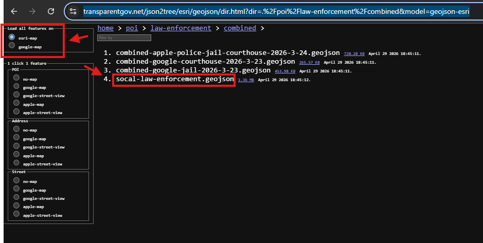
traditional shape centric concept.
https://transparentgov.net/json2tree/esri/geojson/dir.html?dir=.%2Fpoi%2Flaw-enforcement%2Fcombined&model=geojson-esri
Step 13.
traditional shape centric concept is being used by ESRI and all other company for decades.
it is front side of the moon we look at every night.
If the moon have front side, it must have back side, we just don't see it.
same idea,
if shape centric concept is front side,
it must have back side, which is opposite from shape centric.
this revolutionary model is back side of the moon,
we not normally need it.
but when work on POI, address, street etc... we need it.
For all other layer, when you use revolutionary model,
it will give you a completely new angle to look at the same layer.
Step 14.
Step 15.
Step 16.
Step 17.
Step 18.
Step 19.
Step 20.
Step 21.
Step 22.
Step 23.
Step 24.
Step 25.
Step 26.
Step 27.
Step 28.
Step 29.