Step 1.
how to keep street line up to date over the years?
It should like software version update.
windows 11 + patch update2025 = updated 2025 + patch 2026 = updated 2026
Step 2.
Use renewable tool, either build inside Arcgis Pro or outside Arcgis PRO,
you can do the same to update street.
Step 3.
original county maintained street(2025) + street 100 block patch(2026) = updated 2026
Step 4.
updated 2026 + patch(2027) = updated 2027
Step 5.
updated 2027 + patch 1(2028,May) + patch 2(2028,dec) = updated 2028
Step 6.
assume you have a new 2029 county maintained street line.
county is not going to fix 100 block issue.
2 options:
option 1). county 2029 + 100 block patch(2026) + patch(2027) + patch(2028) = updated 2029
need minor inspection for a few error.
option 2).
updated 2028 + county 2029 may work, may not, since county fixing something else, but not fixing 100 block issue. updated 2028 does have 100 block issue fixed, when combine with county 2029, situation is much more complicated than option 1). The renewable tool need to be improved to handle the extra complication.
for example:
in updated 2028 version
main street 2100 - 2200, 2200 - 2300
in 2029 county version
main street 2100 - 2400 ( county is not going to fix 100 issue)
current renewable tool does not have capability to capture 2300 - 2400 change. option 2 will fail
option 1), rebuild from ground (county 2029) cost more time, but will handle this kind of situation.
Step 7.
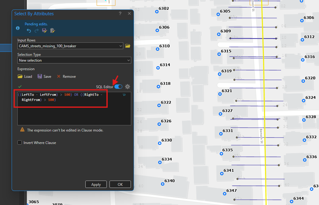
To fix 100 block issue, you will need build a 100 block fix patch.
use this formula to find all street segment block range greater than 100
Step 8.
split segment into smaller segment which have 100 block range.
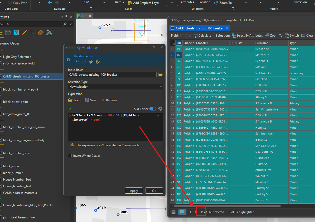
apply this fomula again on patch, to see if anything apply correctly, if anything forget or mistakingly done.
found 35, either typo, or missed, or outside of limit, all these need fix again.
Step 9.
given original county maintained street,
use above formula to extract the problem segment ( range over 100)
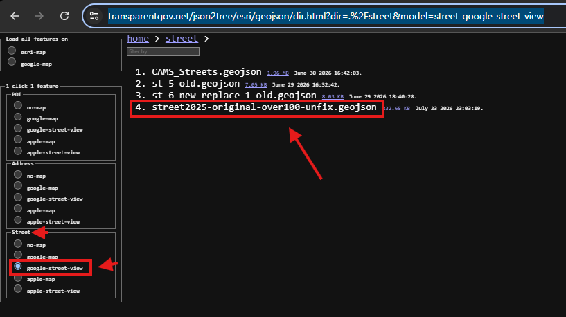
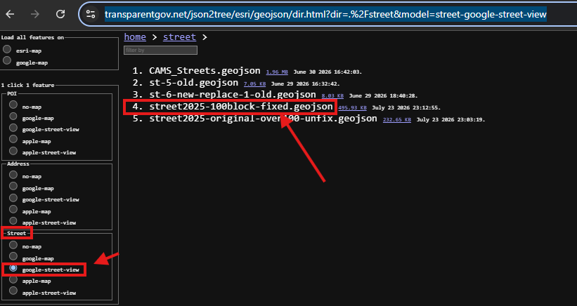
here is unfixed original segment
click file name
https://transparentgov.net/json2tree/esri/geojson/dir.html?dir=.%2Fstreet&model=street-google-street-view
Step 10.
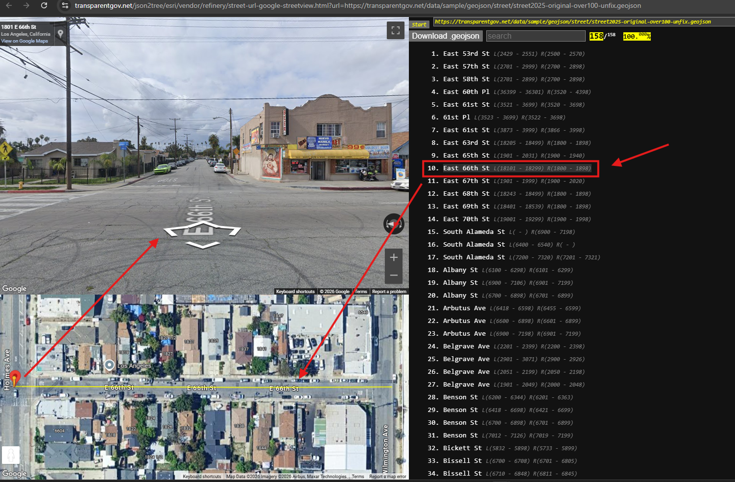
click any street segment,
L means left range
R means right range
these range should be 100, but they are not,
need to split into finer segment with 100 range
street view helps to verify house number.
Step 11.
here is after fix.
This is only patch, not all street.
Later will apply this patch to original data
click file name
https://transparentgov.net/json2tree/esri/geojson/dir.html?dir=.%2Fstreet&model=street-google-street-view
Step 12.
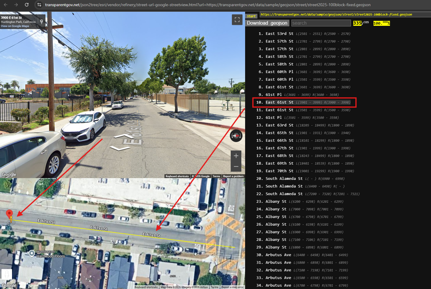
after fix.
the range is 100,
click any segment,
Note: these are revolutionary model, not like traditional ESRI product, shape centric.
The revolutionary model are data centric, shape is only one of attribute.
Why?
Because for Street segment, I am not interested in where it is, how long it is, the shape it is.
I am only interested in the L(left rang) R(right range),
wether it is over 100 or not,
This new model design for that to show you each segment L, R range at one time.
With traditional ESRI product, they show you all the segment on map,
you have to click each segment to see LR range, not easy to look.
https://transparentgov.net/json2tree/esri/vendor/refinery/street-url-google-streetview.html?url=https://transparentgov.net/data/sample/geojson/street/street2025-100block-fixed.geojson
Step 13.
Step 14.
Step 15.
Step 16.
Step 17.
Step 18.
Step 19.
Step 20.
Step 21.
Step 22.
Step 23.
Step 24.
Step 25.
Step 26.
Step 27.
Step 28.
Step 29.