Step 1.
shape file invent since 1993,
file geodatabase invent since 2006,
the biggest difference is,
field name length limit 10 char on shape file
Arcgis Pro, convert file geodatabase to JSON (geojson)
is different from
convert shape file to JSON.
The difference is field name lengh.
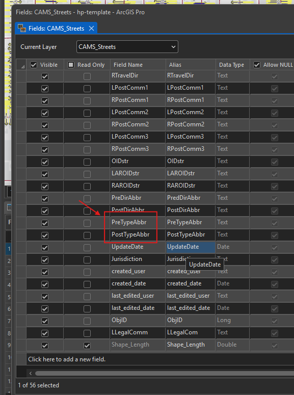
For example if street line in file geodatabase format,
after you convert to JSON, field name remain same lengh. red box
Step 2.
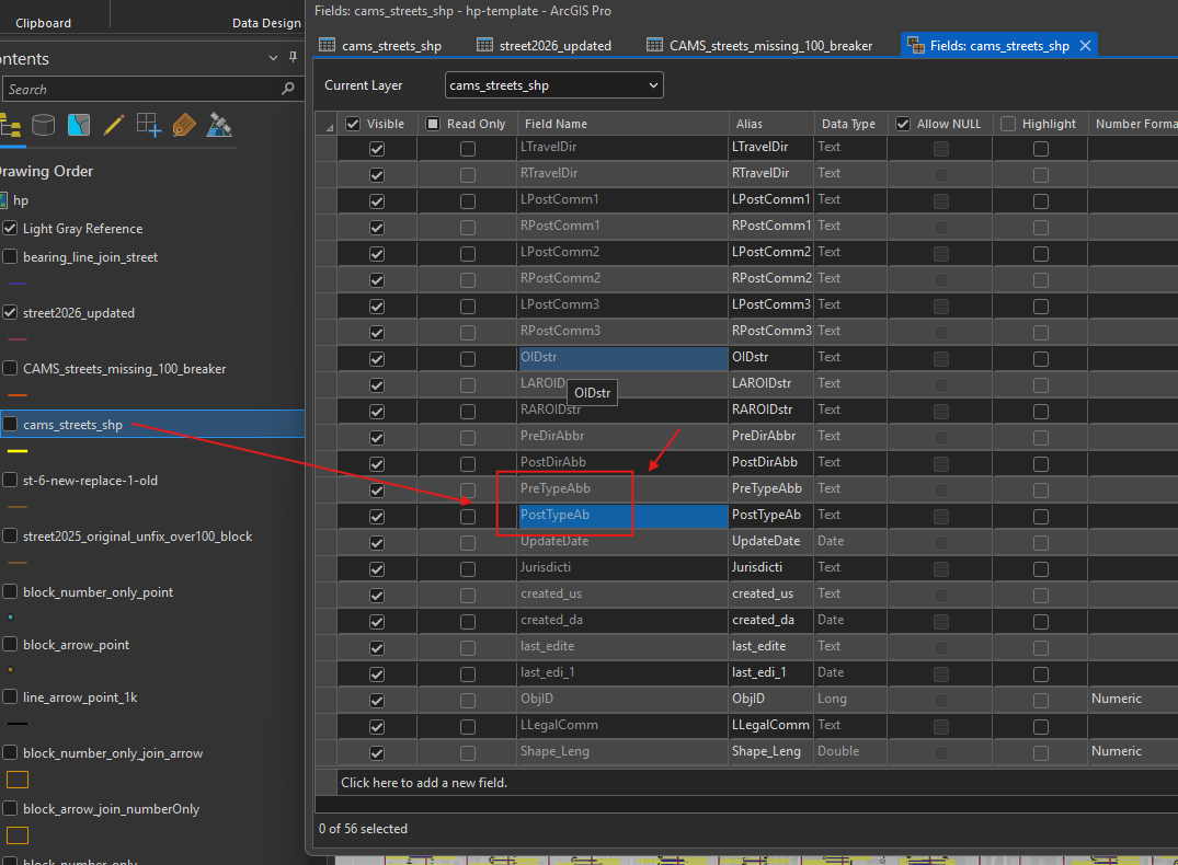
because shape file limit field lengh to 10 char, if over 10, will truncate to 10.
this is same street line in shape file, same field name becomes shorter
Step 3.
people who prefer file geodatabase over shape file is just for remove 10 char limit on field name.
also file geodatabase is like mini folder structure, you can put all layer inside one single file geodatabase,
that is easy to zip, to send over email or download as a single file.
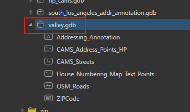
for example, valley.gdb is single file geodatabase, it have 6 layers.
can be zip as single file, email as single file attachment,
If use shape file, 6 file are seperated, but you still can put 6 shape file in a folder,
then zip the folder, email a single zip file.
Step 4.
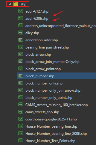
this is shape file,
shp folder is windows folder,
you still can zip whole shp folder, email to other people as single zip file.
shape file can do the same.
Step 5.
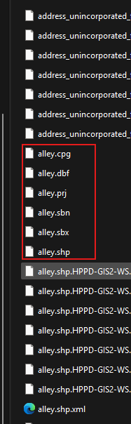
people who prefer shape file
is because shape file is like all other windows file,
how you organize other word, excel file,
is exactly how you organize shape file.
If you want to copy, cut, past a shape file,
you don't have to open Arcgis pro, or other software,
it is windows file, simple copy, cut, delete, past like how you do with pdf file.
Step 6.
For file geodatabase, it is much complicated,
first, you can NOT simple copy past like a PDF file.
You have to have Arcgis Pro to open it,
Inside Arcgis Pro software, you can then copy past.
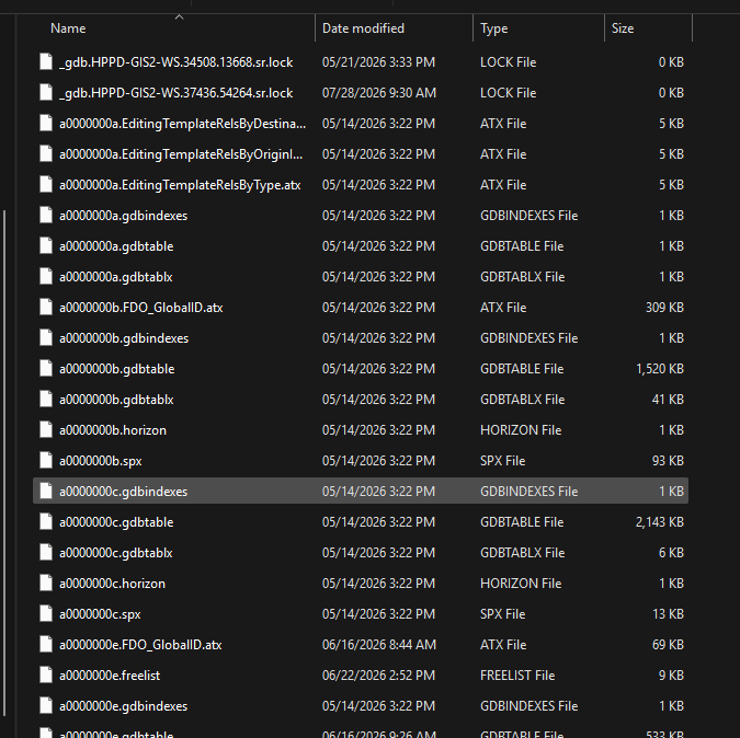
No you see the problem of file geodatabase,
On windows folder, file geodatabase looks like a mess, you can't tell which file is what,
sample file geodatabase folder
Step 7.
simple is best,
If there is no reason you have to use file geodatabase ,
then just keep it simple.
complicated usually means more limititation, easier broken, harder to fix.
keep it simple can let you do MORE
Step 8.
Step 9.
Step 10.
Step 11.
Step 12.
Step 13.
Step 14.
Step 15.
Step 16.
Step 17.
Step 18.
Step 19.
Step 20.
Step 21.
Step 22.
Step 23.
Step 24.
Step 25.
Step 26.
Step 27.
Step 28.
Step 29.