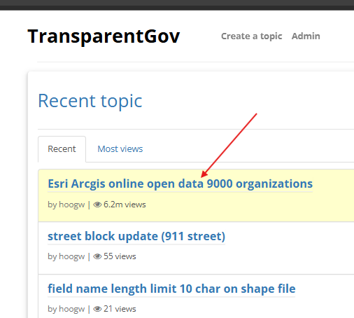
Step 1.
home page, click red arrow
https://transparentgov.net/cleargov1/
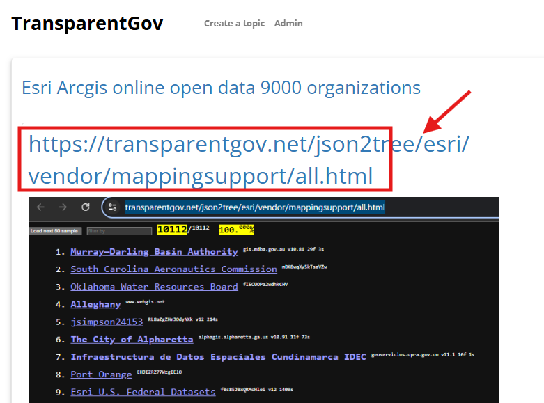
Step 2.
click red arrow
https://transparentgov.net/cleargov1/931/esri-arcgis-online-open-data-9000-organizations
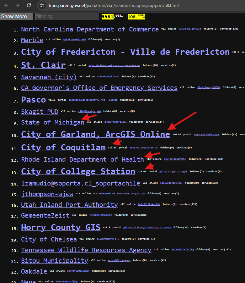
Step 3.
click any organization, any one will works
https://transparentgov.net/json2tree/esri/vendor/mappingsupport/all.html
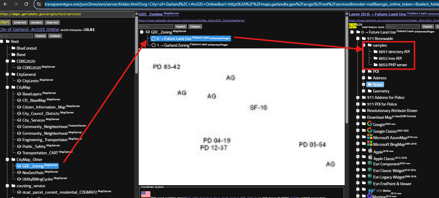
Step 4.
I randomly click one,
click any layers, any one will works
sample will show up
https://transparentgov.net/json2tree/esri/server/folder.html?org=City+of+Garland%2C+ArcGIS+Online&url=https%3A%2F%2Fmaps.garlandtx.gov%2Farcgis%2Frest%2Fservices&model=null&arcgis_online_token=&select_folder=136&select_folder_text=GDC_Zoning+%3Csup%3EMapServer%3C%2Fsup%3E&select_layer=0&select_layer_text=0+%26%23x21E2%3B+Future+Land+Use+%3Csup%3EFeature+Layer%3Csub%3E+esriGeometryPolygon%3C%2Fsub%3E%3C%2Fsup%3E
Step 5.
directory api,
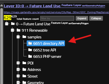
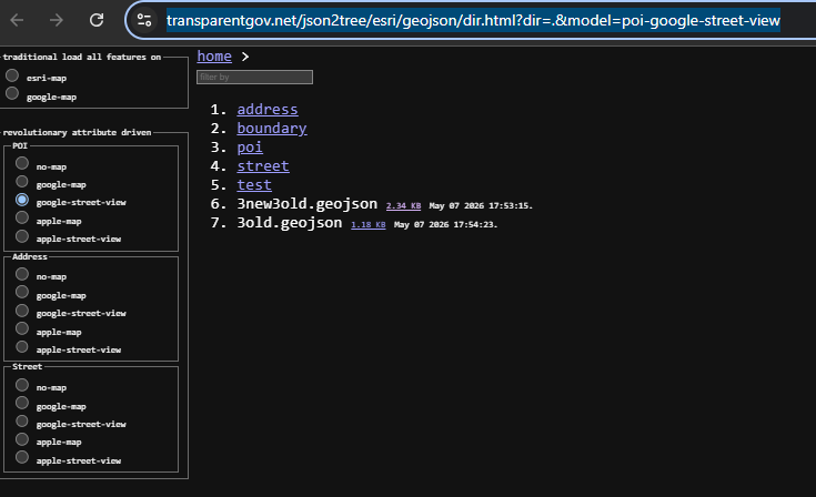
this client (browser) page consume a directory API ( API code wrote in PHP on Apache server)
https://transparentgov.net/json2tree/esri/geojson/dir.html?dir=.&model=poi-google-street-view
it looks like your windows file explorer,
it works the same as your windows file system,
however, this is not windows, it is linux system,
I wrote directory API in PHP runing on top of linux system to let you feels like a windows file explorer.
Step 6.
tree api,
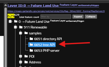
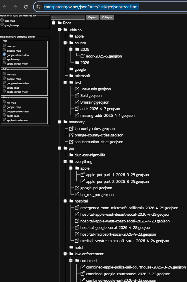
tree api is same as directory api,
php code on top of linux
but it scan all folder, sub-folder, all structure, list all files.
let you look at all file at one time in one page.
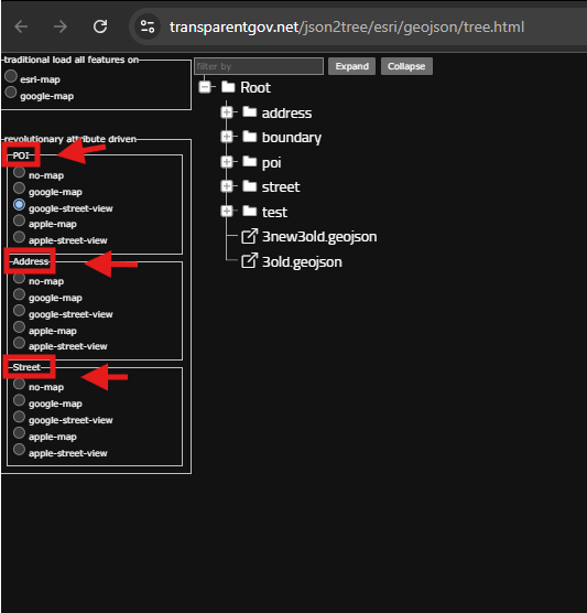
https://transparentgov.net/json2tree/esri/geojson/tree.html
This is NOT looks like your windows file explorer.
Step 7.
I have 3 template, for address, street, POI,
Step 8.
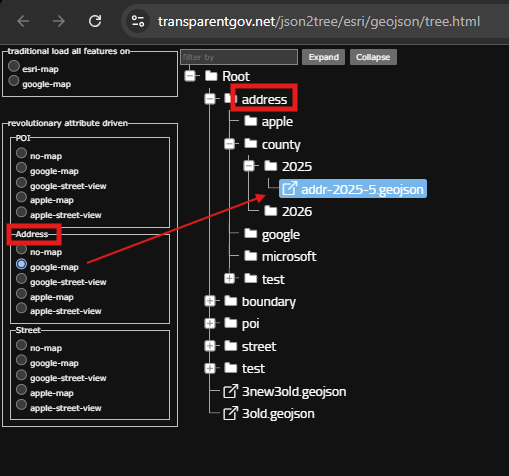
when you click address file
you must select the correct template ( address )
address template, have different style, google street view, apple map, etc...
https://transparentgov.net/json2tree/esri/geojson/tree.html?select_tree=67&select_tree_text=addr-2025-5.geojson&select_type=file&select_path=https%3A%2F%2Ftransparentgov.net%2Fdata%2Fsample%2Fgeojson%2Faddress%2Fcounty%2F2025%2Faddr-2025-5.geojson
Step 9.
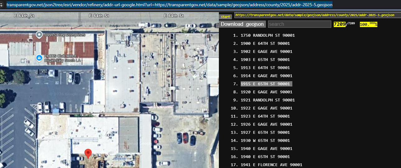
I choose Address template, google map style,
then I click address file, it open a new tab to show google map with address,
hover each address will popup map to show
https://transparentgov.net/json2tree/esri/vendor/refinery/addr-url-google.html?url=https://transparentgov.net/data/sample/geojson/address/county/2025/addr-2025-5.geojson
Step 10.
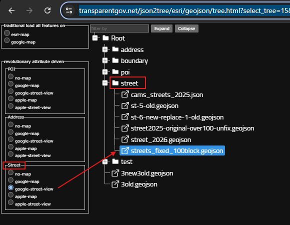
when you click street file, you must select a street template, a map style
https://transparentgov.net/json2tree/esri/geojson/tree.html?select_tree=15&select_tree_text=streets_fixed_100block.geojson&select_type=file&select_path=https%3A%2F%2Ftransparentgov.net%2Fdata%2Fsample%2Fgeojson%2Fstreet%2Fstreets_fixed_100block.geojson
Step 11.
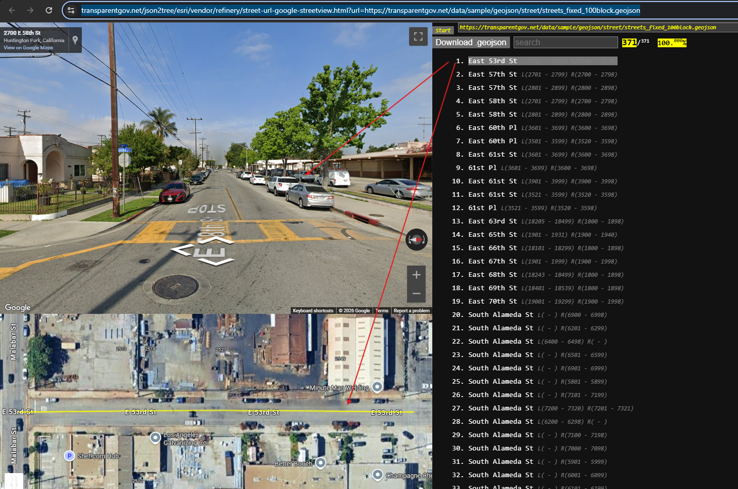
hover any street, it will popup on map
https://transparentgov.net/json2tree/esri/vendor/refinery/street-url-google-streetview.html?url=https://transparentgov.net/data/sample/geojson/street/streets_fixed_100block.geojson
Step 12.
Step 13.
Step 14.
Step 15.
Step 16.
Step 17.
Step 18.
Step 19.
Step 20.
Step 21.
Step 22.
Step 23.
Step 24.
Step 25.
Step 26.
Step 27.
Step 28.
Step 29.