conclusion:
Before convert, original tax parcel address is about 70% accurate. 30% missing address.
After convert text annotation, 99% accuate, 1% wrong or missing.
following operation increase address accuracy from 70% to 99% according my findings.
This method apply to any 88 cities in Los angeles county
Step 1.
This program completed 20 years ago. Data Format is microstation.
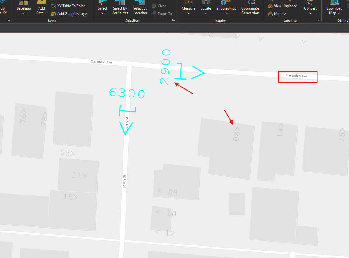
After convert it to ESRI format it looks like this.
2900 means street block range start as 2900, arrow means direction.
08 means this house address is 2908, arrow means street name,
so this address is 2908 clarendon ave
Step 2.
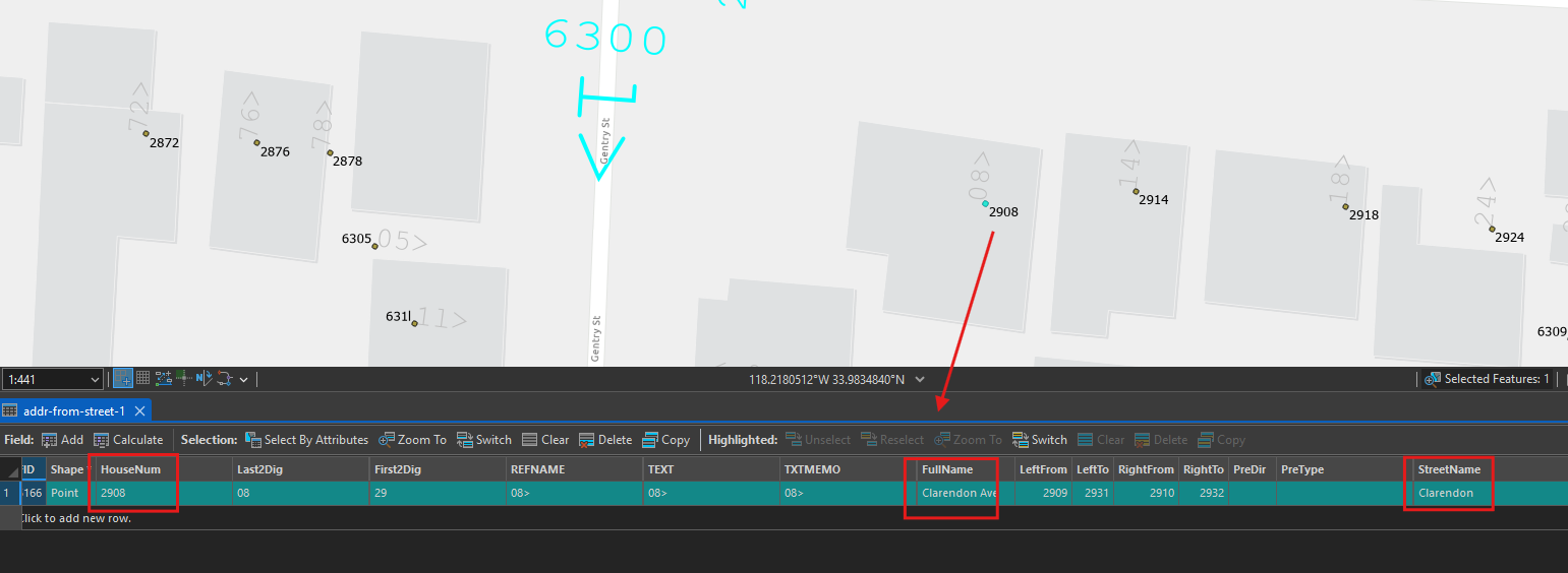
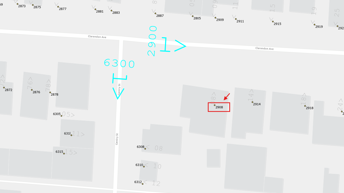
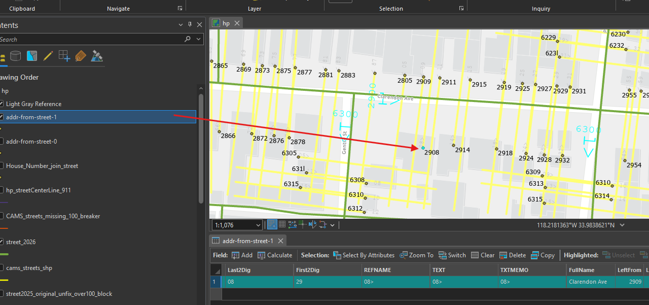
human can tell each house address, but in order for dispatch to understood it, we have to convert text annotation to a real address point, associate with street name accordingly.
Here is what we want
Step 3.
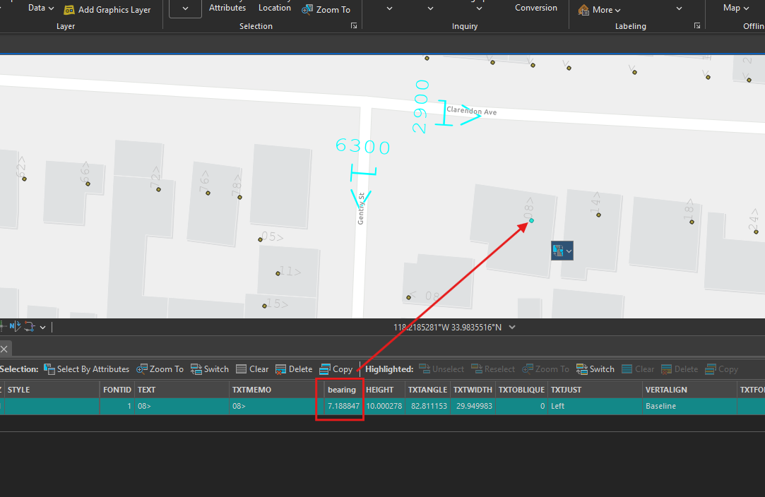
first convert "08" text annotation to point. Bearing angle means the arrow on top of 08, how it turn clockwise from 12 postion. It point to coresponding street.
Step 4.
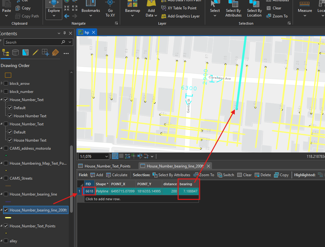
then draw a line from point use the bearing angle as direction. distance use 200 feet. (Yellow line )
the line's FID is same as point, it will be use later to join table as primary key.
Step 5.
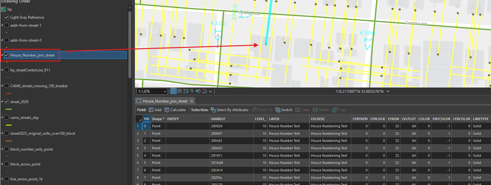
yellow line intersect with street line (red). yellow line spatially join with street by intersect.
yellow line's FID also joint with point FID.
now the point link to yellow line, link to street red line. All the information link together.
Step 6.
finally export to address point
Step 7.
This method requires street block range must be 100. There are 1% of street segment with block range greater than 100. These need manually split it into smaller segment.
Step 8.
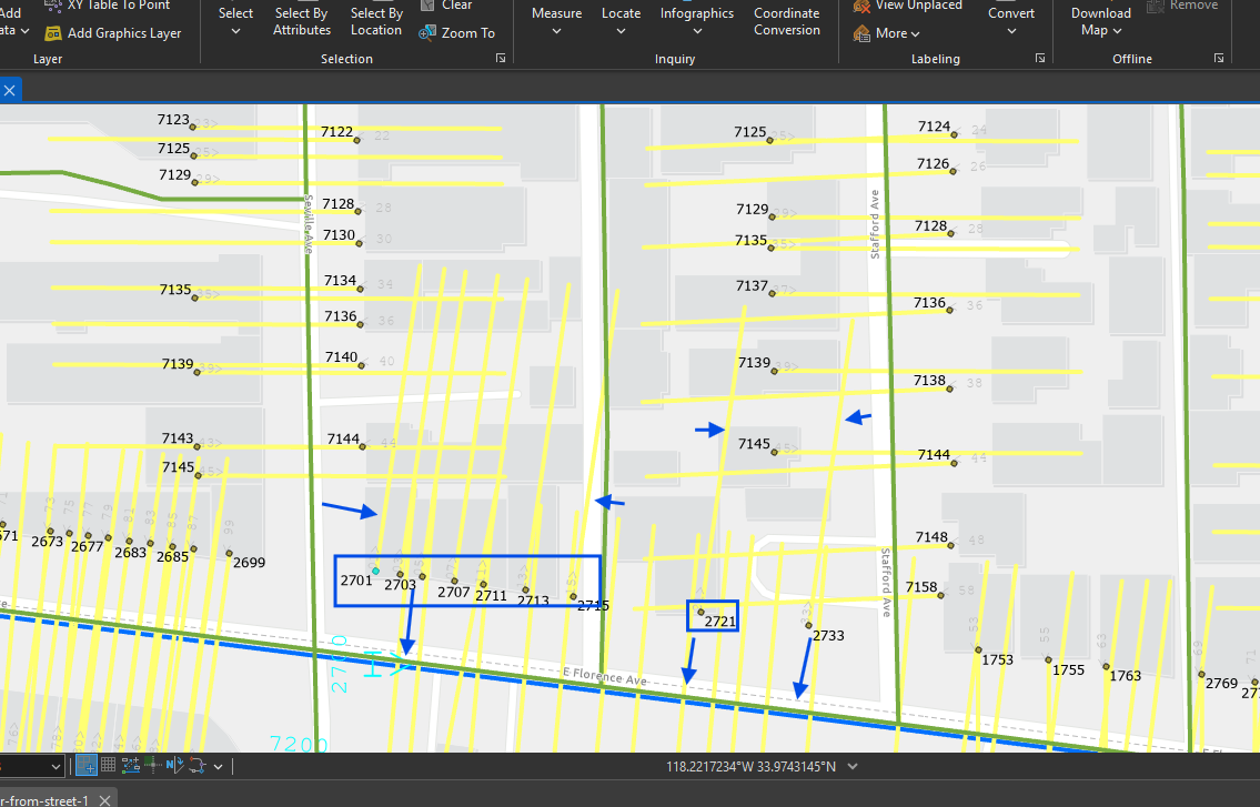
there are 1% of bearing angle isn't correct, yellow line should point to nearest street, but these yellow line point to opposit direction, which is wrong, they should follow blue arrow, these address point need manually fix.
Step 9.
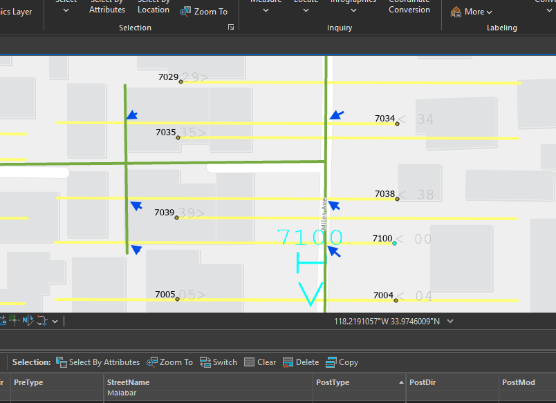
there are 1% of yellow line intersect with 2 street line, failed spatial join, these address point need manually fix.
Step 10.
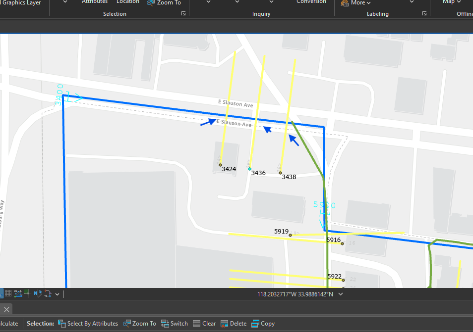
there are less than 1% of yellow line intersect with missing street line, failed spatial join, these address point need manually fix.
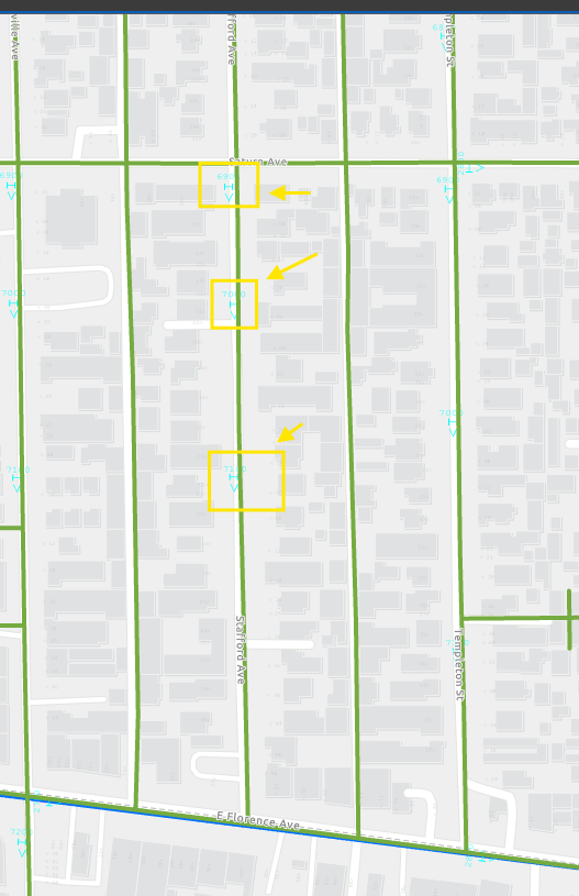
blue line is city limit. red line is street. these 3 yellow line should intersect with red street, not blue city limit.
On the city boundary, there are some red street line missing, cause problem. need manually fix
Step 11.
conclusion:
Before convert, original tax parcel address is about 70% accurate. 30% missing address.
After convert text annotation, 99% accuate, 1% wrong or missing.
Next step is use google street view, USPS, apple map street view to find these 1% and remove it.
Step 12.
Step 13.
Step 14.
Step 15.
Step 16.
Step 17.
Step 18.
Step 19.
Step 20.
Step 21.
Step 22.
Step 23.
Step 24.
Step 25.
Step 26.
Step 27.
Step 28.
Step 29.