Step 1.
given 2 source of address,
1. county tax parcel address 2025, ( 7322 total address )
2. micro-station address survey program. ( 8799 total )
How many address missing ?
micro-station( 8799 total ) - county-address( 7322 total) = missing(?)
why is 3295,
because, micro-station address not include apartment unit.
county address include apartment unit. Some unit missing unit number, make them looks like same address,
7322 have some address that 8799 don't have,
8799 have some address that 7322 don't have.
minus tool deal with all these complications, get result.
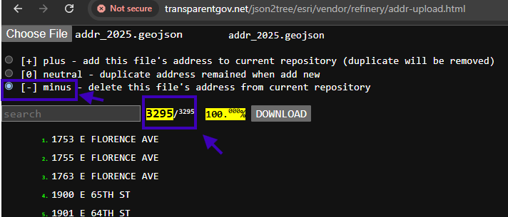
Step 2.
results
https://transparentgov.net/json2tree/esri/vendor/refinery/addr-url.html?url=https://transparentgov.net/data/sample/geojson/address/combine-2025-with-micro-station/micro-station-minus-2025-result/standard.geojson
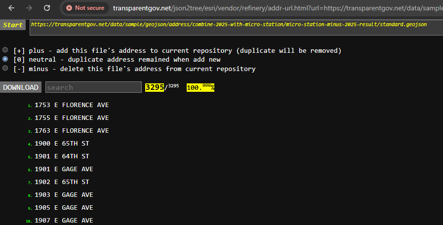
Step 3.
results
https://transparentgov.net/json2tree/esri/geojson/dir.html?dir=.%2Faddress%2Fcombine-2025-with-micro-station%2Fmicro-station-minus-2025-result&model=addr-no-map
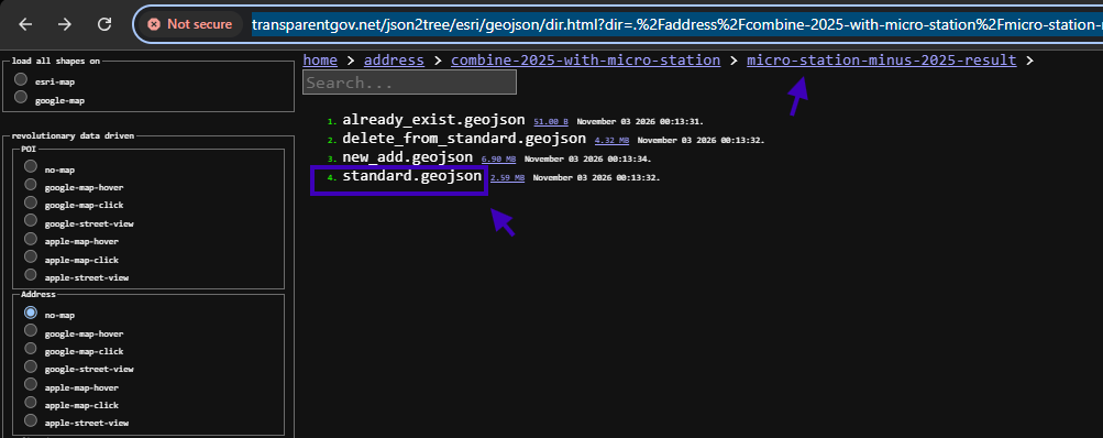
Step 4.
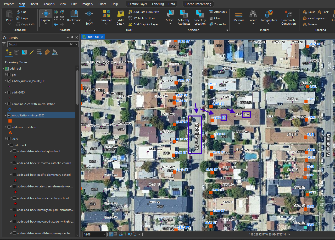
load result into arcgis pro
red square is 3295 result.
accidently found another problem.
county address accidently use AVE for all address on MIDDLETON ST
see blue box.
I have checked county parcel, it is correct, use ST,
only county address use AVE, which is wrong.
Note: the whole MIDDLETON ST address is wrong, around 100 address total wrong.
Step 5.
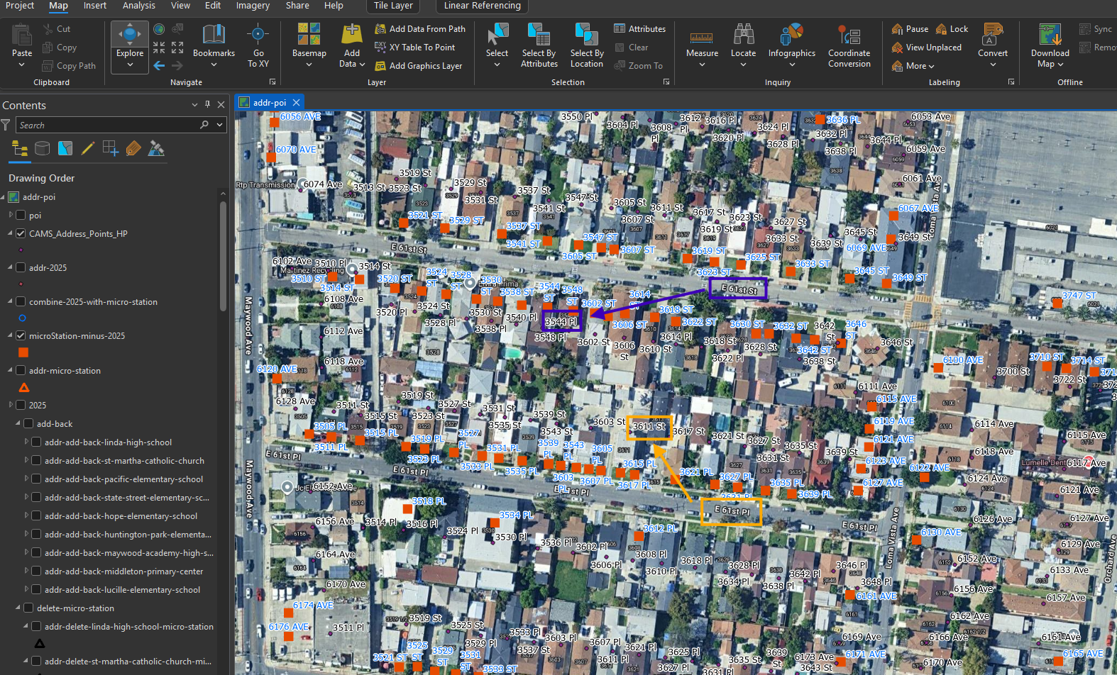
another 100 address error is:
county address accidently use PL for E 61st ST
use ST for E 61st PL
see arrow
Step 6.
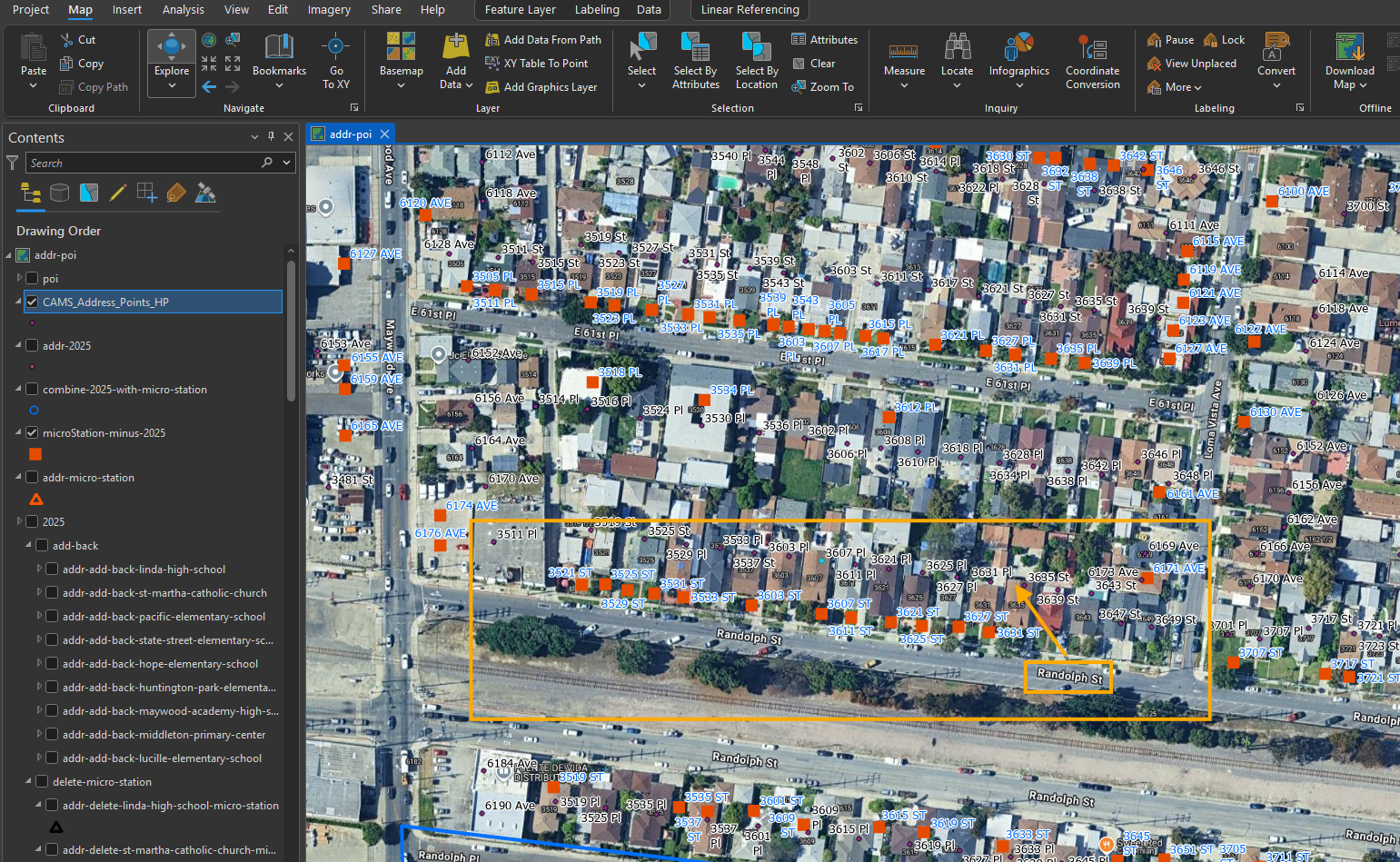
county use PL for these 20 address, which is wrong, should use ST
Randolph ST, not randolph PL
Step 7.
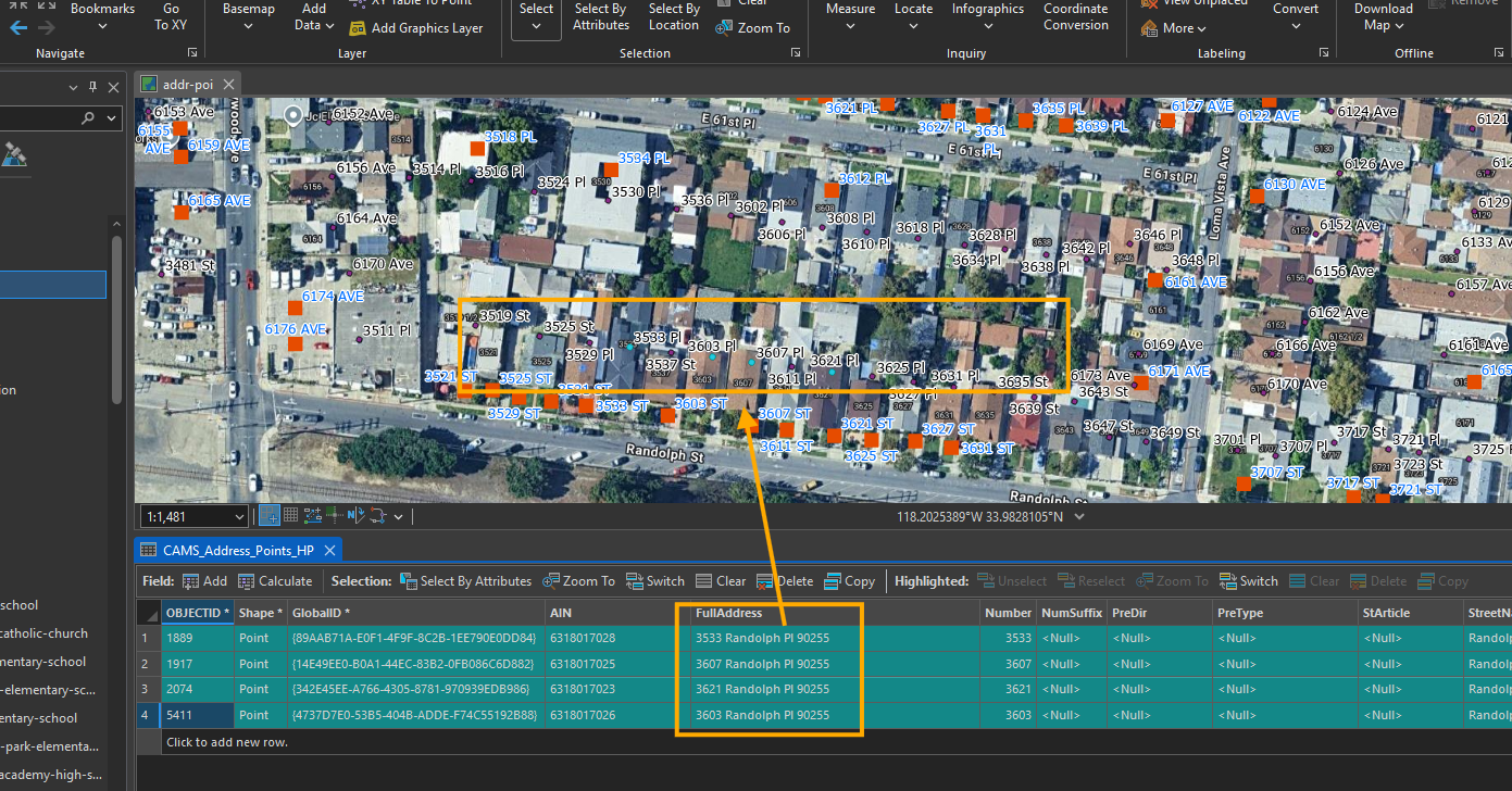
Randolph ST, not randolph PL
red square is from micro-station, which is correct.
Step 8.
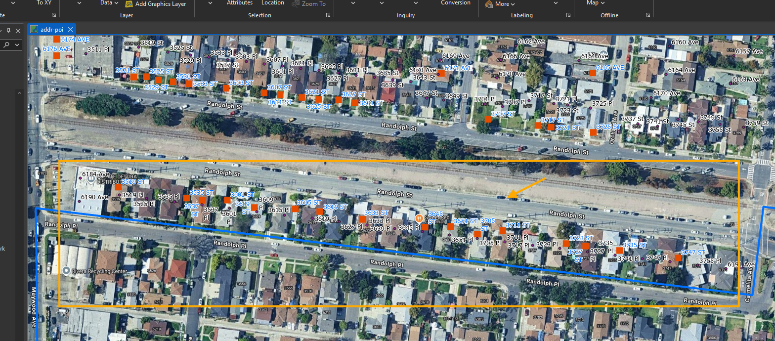
Note, both side of randolph ST is wrong, should not use PL
Step 9.
Step 10.
Step 11.
Step 12.
Step 13.
Step 14.
Step 15.
Step 16.
Step 17.
Step 18.
Step 19.
Step 20.